Meteorologists determine the Creek Fire created two fire tornados

Northeast of Fresno, California earlier this month

Satellite photo showing smoke from fires in California
Satellite photo showing smoke from fires in California at 6:01 p.m. PDT Sept 5, 2020. NASA/Wildfire Today. The Creek Fire

The Creek Fire ran for more than 10 miles and burned 36,000 acres during the first 22 hours after it started at 6 p.m. September 4 northeast of Fresno, California. During that time it created two fire tornados and sent its smoke plume up to 55,000 feet, taller than the tornadic thunderstorms in tornado alley.

An analysis by meteorologists from the National Weather service has revealed that the extreme growth on September 5 generated rare phenomenons — vortices rated at EF2 and EF1, sometimes called fire tornados when they are created by a wildfire.

One was near Mammoth Pool Reservoir and the other was near Huntington Lake. Over 200 people trapped by the fire at Mammoth Pool Reservoir were flown out by courageous National Guard Pilots in helicopters, at times through darkness and smoke.

The NWS personnel rated the vortices based on the effects on trees, including areas where trees were debarked, indicating an EF2 event.

Below is an excerpt from an article by Matthew Cappucci  in the Washington Post.

Jerald Meadows, the warning coordination meteorologist at the Hanford office, said both tornadoes shared common features. “The main contributing factor was the debarking of all the pine trees up with the Mammoth Pool tornado,” Meadows said. “They both uprooted trees to the root balls and snapped large pines. But the [EF1 tornado] did not have any signs of true debarking. We’re probably talking the difference between 100 and 110 miles per hour.”

The Mammoth Pool tornado, which touched down inside the Wagner Campground, snapped several two-foot-diameter trees about 20 to 30 feet above the ground; it was rated as having winds of 115 to 125 mph. The Huntington Lake fire tornado had winds of 90 to 107 mph, and the NWS noted that it was “the result of unprecedented fire activity.”

The article reports that the NWS personnel on duty while the tornados were occurring had concerns about activating their severe weather warning system.

“A tornado warning was considered but not issued,” said [Jerald Meadows, the warning coordination meteorologist at the Hanford Office], who feared that disseminating such an alert might leave people unnecessarily conflicted about deciding whether to shelter or evacuate.

“A tornado warning for a fire opens up a can of worms,” he said. “We want to make sure we’re messaging properly, and we were talking to fire crews letting them know of the circulations we were seeing.”

Before the onslaught of fire tornadoes that has been a hallmark of 2020′s blazes, some National Weather Service offices have had internal discussions and concluded that they would not issue tornado warnings for wildfire-related twisters. While the National Weather Service hasn’t issued specific policy guidance to its 122 forecast offices on how to handle fire tornadoes, Meadows suspects considerable research will be needed to reach a resolution.


This article was edited September 26 to clarify the locations of the fire tornados at Mammoth Pool Reservoir and Huntington Lake.

Thanks and a tip of the hat go out to Tom.

Southern California Hotshot has been missing since Sept. 20

September 25, 2020  |  2:07 p.m. PDT

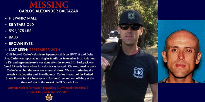
Carlos Alexander Baltazar

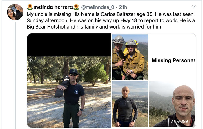
Authorities in Southern California are searching for Carlos Alexander Baltazar, a member of the Big Bear Interagency Hotshot crew. The San Bernardino County Sheriff’s office said he was reported missing by his family September 24. His car was found abandoned on Highway 18 near Delta Avenue by the California Highway Patrol on September 20, about 75 yards from his backpack.

The Sheriff’s office said Mr. Baltazar was was off duty when he abandoned his vehicle and was not in the area of the El Dorado Fire.

Carlos Alexander Baltazar


Anyone with information about Mr. Baltazar’s location should contact San Bernardino County Sheriff Dispatch at 760-956-5001.

Another member of the Big Bear Hotshots, Charlie Morton, became missing September 17, 2020 while working on the El Dorado Fire in San Bernardino County and was found deceased the next day. No cause of death has been released. A memorial service was held for Mr. Morton Friday morning, September 25.

August Complex of fires in Northern California has burned 846,000 acres

It is the largest fire in California’s history — by far

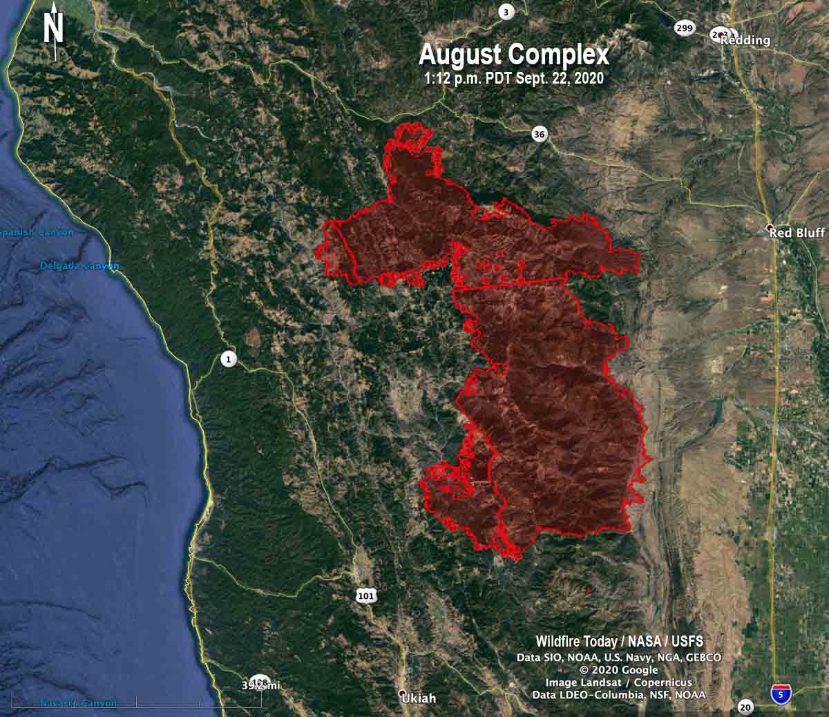
Map of the August Complex of fires
Map of the August Complex of fires. The red dots represent heat detected by a satellite at 1:12 p.m. PDT Sept. 22, 2020.

Four wildfires burning in California are so extraordinarily large that it takes two or more of the largest and highest qualified Incident Management Teams (IMT) to organize and supervise the suppression of each these monster fires.

One of those, the 846,898-acre (that is not a typo) August Complex in Northern California has three Type 1 teams– CAL FIRE 5, Great Basin 2, and Alaska 1. This monster of a fire is 63 miles long (north to south) and at its widest point is 32 miles, east to west. The blaze is divided into three zones, West, North, and South Zones. The fire is the result of 37 fires that started on August 17, burning together on the Mendocino National Forest 32 miles southwest of Redding.

One firefighter, Diane Jones from a fire department in Texas, was killed in a vehicle accident August 31. Twenty-one residences have been destroyed.

One individual with COVID-19 symptoms and two other people who had contact with the individual are in isolation until they can be cleared by testing.

Resources assigned to the fire include 70 hand crews, 388 fire engines, and 35 helicopters for a total of 4,290 personnel — a figure that includes 125 California National Guard personnel.

Some lists of the largest fires in the recorded history of California circulating this year have listed complexes, multiple individual fires managed under one organization, high on the list. But a group of fires arbitrarily lumped under one IMT should not, for historical purposes, be ranked.

However, the August Complex is comprised of multiple fires that burned together and became one, so in my mind it legitimately belongs on the list as the largest in the recorded history of the state. The next three on the list at Wikipedia are all multiple-fire complexes; they should at least have asterisks explaining they are not single fires. But even if the multiple-fire complexes are included, the August Complex is still about 388,000 acres larger than number two on the list, the 2018 Mendocino Complex which consisted of two fires, River and Ranch.

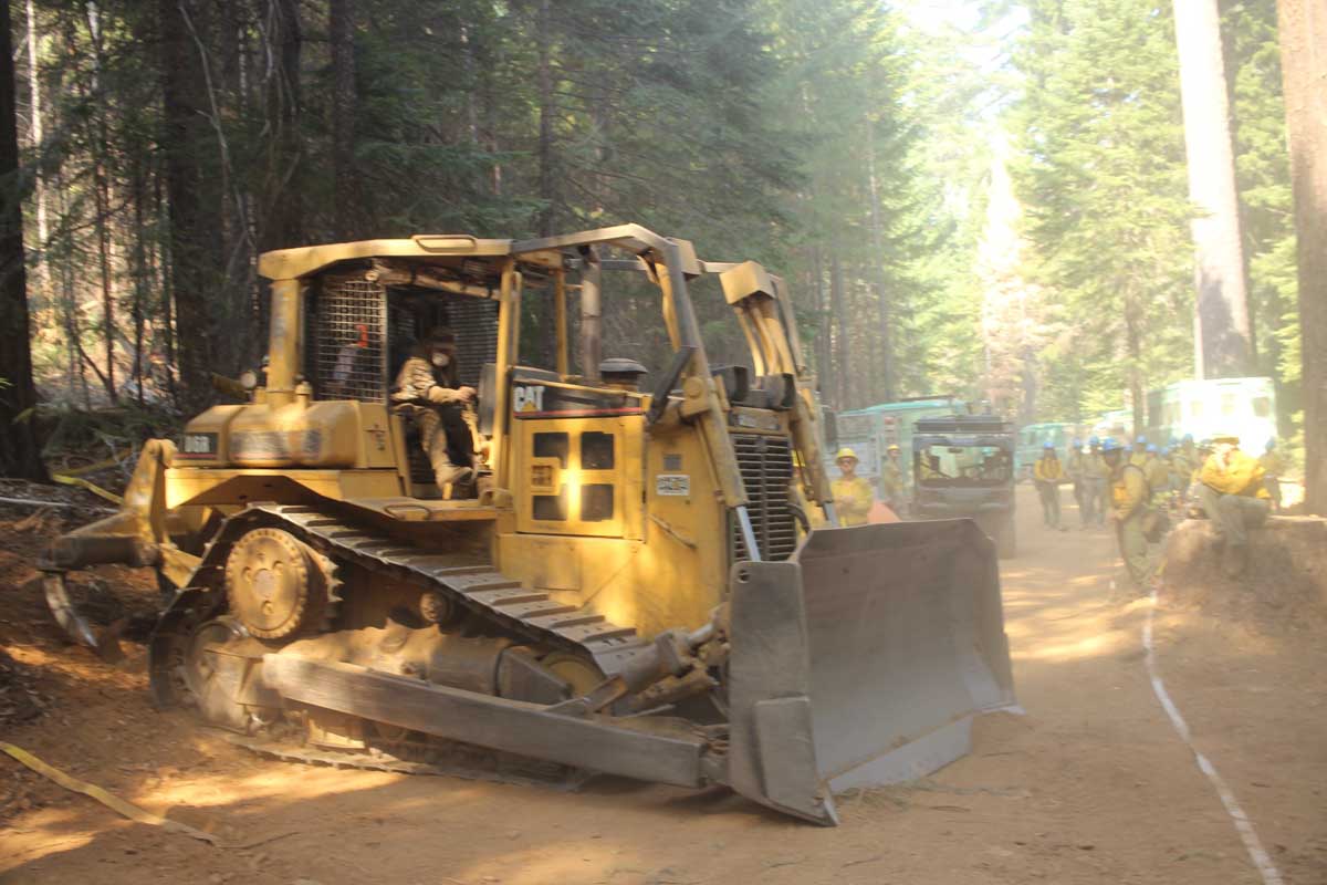
bulldozer August Complex fire
Bulldozer on the 26 Road, north flank of the August Complex, Sept. 21, 2020. USFS photo by Mike McMillan.
firefighter August Complex fire
Lassen Hotshot, conducting a firing operation on the August Complex of fires, Sept. 21, 2020. USFS photo by Mike McMillan.

Name released for forestry technician killed September 17 on Southern California fire

Charlie Morton was a Squad Boss on the Big Bear Hotshots

The U.S. Forest Service has released the name of the forestry technician who died September 17, 2020 in Southern California. Charlie Morton, a Squad Boss on the Big Bear Hotshots passed away on the El Dorado Fire .

Below is an excerpt from a message sent to all Forest Service employees by Chief Vicki Christiansen September 21 at 5:35 p.m.


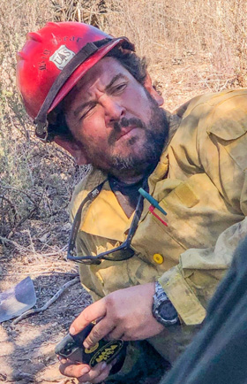
Charlie Morton
Charlie Morton, USFS photo.

“Local efforts to support the firefighter fatality that occurred last Thursday, September 17th have progressed and we are now able to share more information with you. Tragically, Charlie Morton, Squad Boss on the Big Bear Interagency Hotshot Crew, died during suppression activities on the El Dorado Fire on the San Bernardino National Forest in California. The Big Bear Hotshots are local to the San Bernardino National Forest.

“Charlie joined the San Bernardino National Forest in 2007 and worked on both the Front Country and Mountaintop Ranger Districts, for the Mill Creek Interagency Hotshots, Engine 31, Engine 19, and the Big Bear Interagency Hotshots. His family has asked us to share, “Charlie is survived by his wife and daughter, his parents, two brothers, cousins, and friends. He’s loved and will be missed. May he rest easy in heaven.

“The loss of an employee in the line of duty is one of the hardest things we face in our Forest Service family. Certainly, this is true for me as your Chief. Our hearts go out to Charlie’s coworkers, friends and loved ones. Charlie was a well-respected firefighter and leader who was always there for his squad and his crew at the toughest times. We will keep the Big Bear Hotshots and the San Bernardino National Forest employees and community in our thoughts and prayers.

“Now more than ever we are reminded of the truly honorable work and sacrifices made by our wildland fire employees. They commit themselves each day, for weeks and months on end, to protecting lives and supporting communities around the country, in service to their fellow Americans. Our nation owes them all a debt of gratitude.

“We are still learning about the circumstances surrounding Charlie’s passing. We will provide information on plans for services and expressions of condolence as soon as they become available. But for now, I extend my deepest sympathies to Charlie’s coworkers, friends and loved ones. Again, they will remain in our thoughts and prayers.”


Investigators found that the El Dorado Fire was started by a smoke-generating pyrotechnic device at a gender reveal party.

Send cards and condolences to the Morton family here:
P.O. Box 63564
Irvine, CA 92602.

For FedEx or UPS:
c/o ‘Support for Charlie’
1 League # 63564
Irvine, CA 92602.

We send out our sincere condolences for Mr. Morton’s family, friends, and co-workers.

CAL FIRE’s map of structures damaged or destroyed on the North Complex of fires

East of Lake Oroville in California

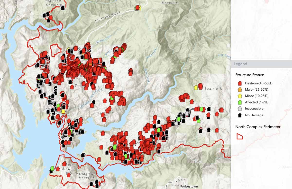
North Complex, preliminary map of structures assessed for fire damage
North Complex. A portion of the  preliminary map of structures assessed for fire damage. CAL FIRE.

CAL FIRE has a zoomable map showing the status of structures that have been evaluated for damage during the North Fire.

“The damage inspection is still ongoing and subject to change,” CAL FIRE writes on the map’s page. “The points shown in this map are being updated regularly. Data is subject to change as information is gathered and verified. The icons on the map indicate the current known status of the structure. If your structure is not identified by an icon, it has not yet been identified. Addresses may be entered into search bar to find a specific location.”

CAL FIRE reports that 1,393 structures have been destroyed in the blaze.

Bobcat Fire continues spreading to the north, burns structures in Juniper Hills

More evacuation warnings issued

Updated September 19  |  9:00 a.m. PDT

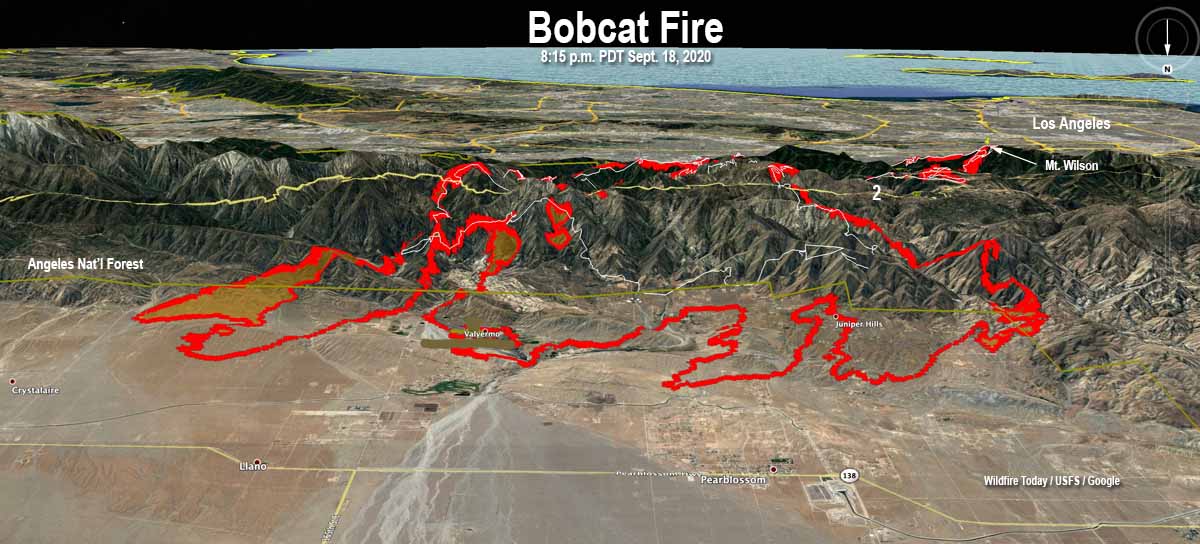
Bobcat Fire map
3-D map of the Bobcat Fire, current at 8:15 p.m. PDT Sept. 18, 2020. The white line was the perimeter about 24 hours earlier. Looking south.

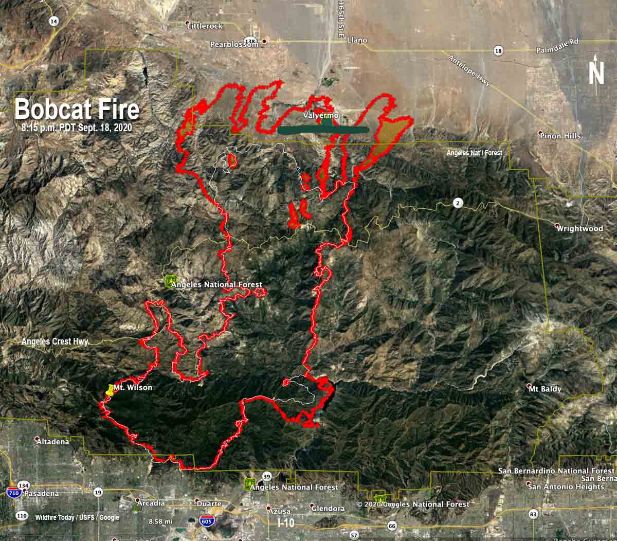
Friday afternoon strong winds gusting up to 35 mph pushed the Bobcat Fire north down-slope out of the Angeles National Forest into the Antelope Valley foothill communities of Juniper Hills and Valyermo. Structures burned, but no details have been released.

The Incident Management Team reports that the perimeter now envelops 91,017 acres.

Bobcat Fire map
Map of the Bobcat Fire, current at 8:15 p.m. PDT Sept. 18, 2020. The white line was the perimeter about 24 hours earlier.
Bobcat Fire burned car
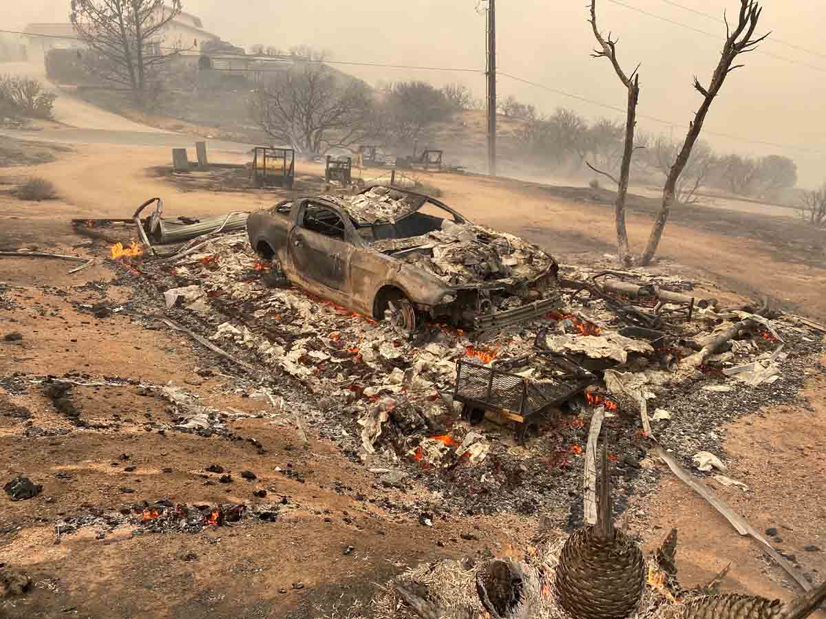
Bobcat Fire in Juniper Hills, CA. Sept. 18, 2020. Photo by Jeff Zimmerman.
Bobcat Fire C-130 air tanker
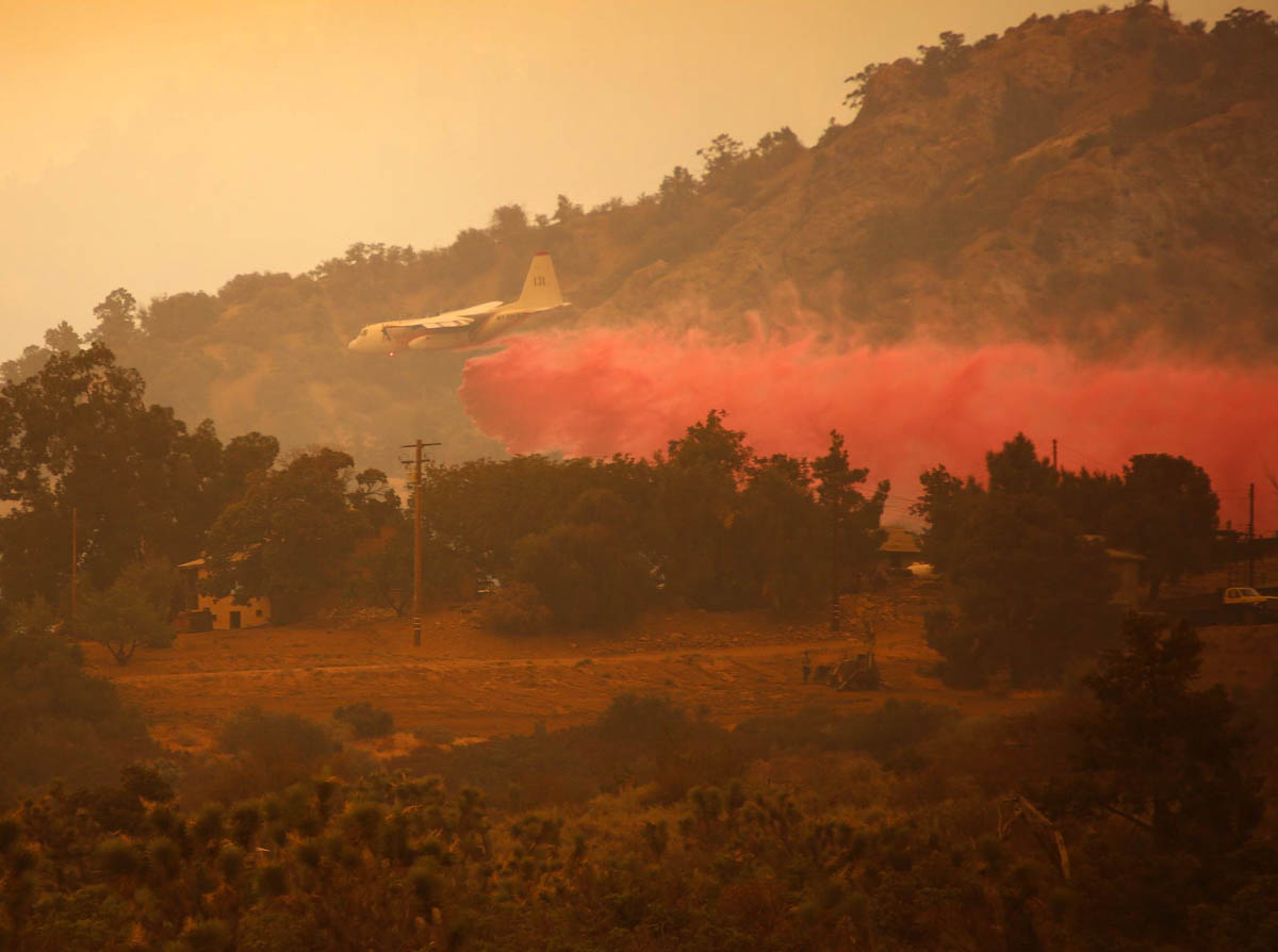
Air Tanker 131, a C-130, (N130FF) drops on the Bobcat Fire Sept. 18, 2020. InciWeb.
Bobcat Fire
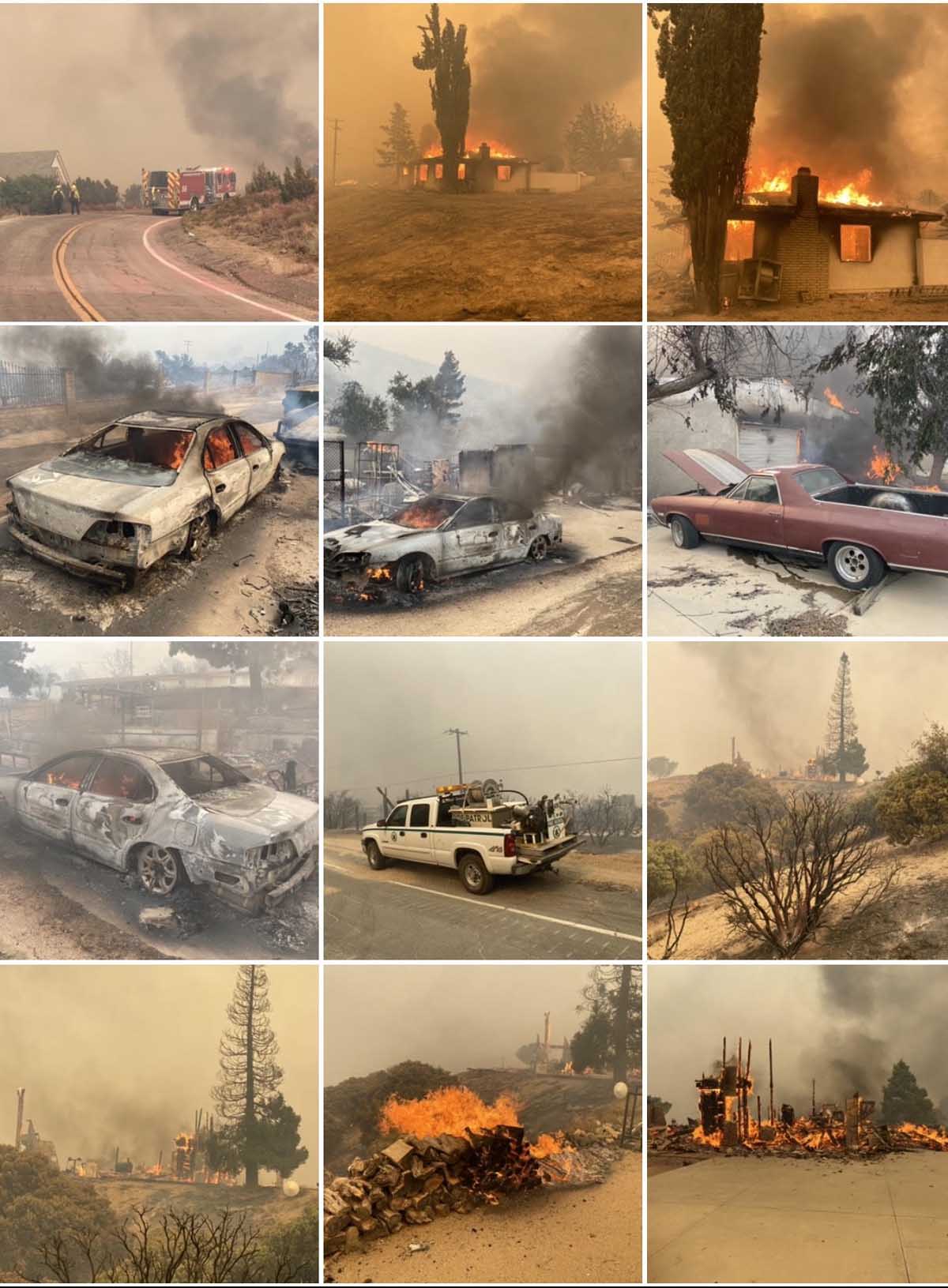
Bobcat Fire, Antelope Valley, Sept. 18, 2020. Photos by Jeff Zimmerman.

Updated  September 18, 2020  |  7:06 p.m. MDT

Bobcat Fire Antelope Valley
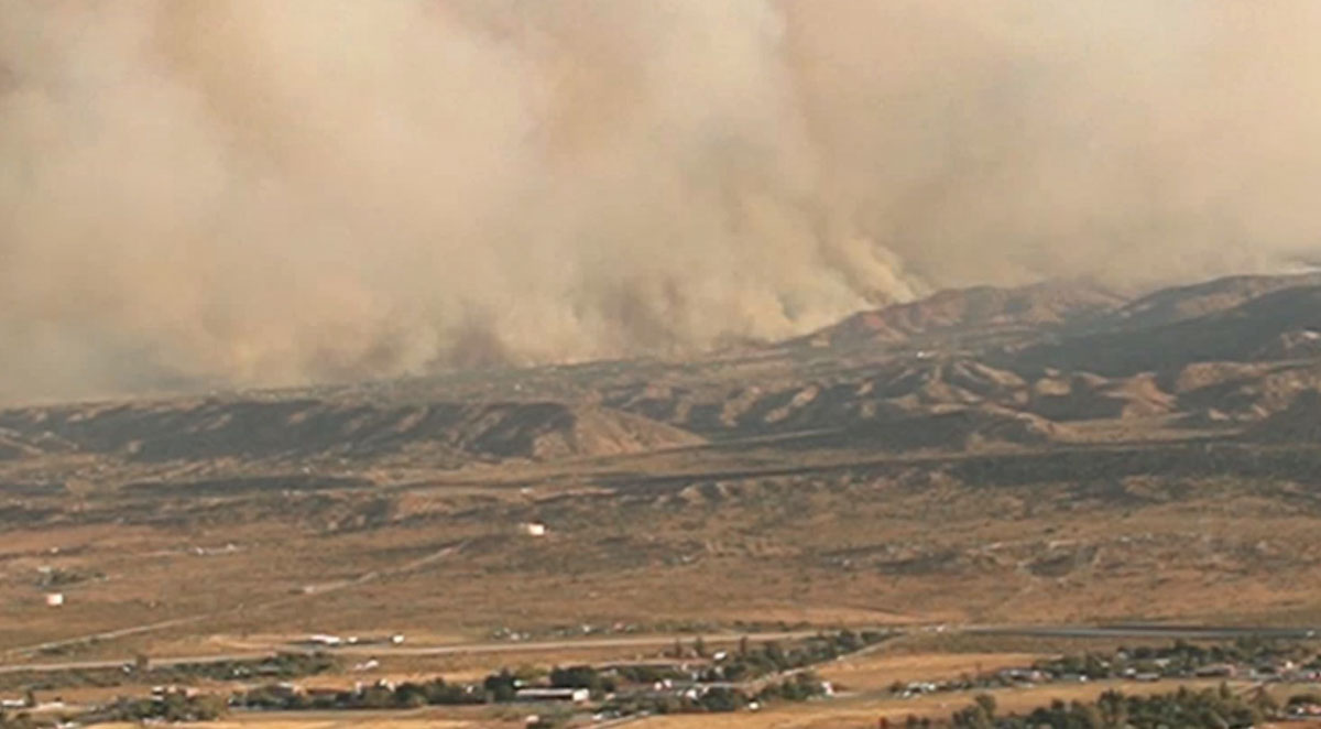
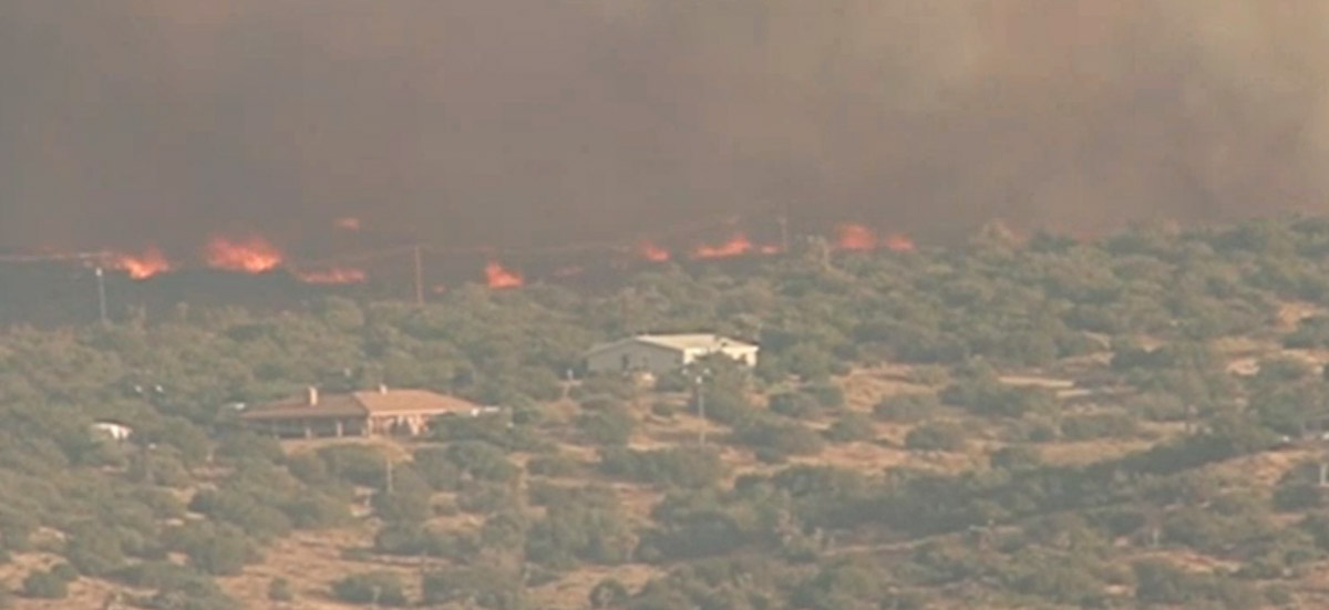
North end of the Bobcat Fire spreads into the Antelope Valley, at 6:19 p.m. PDT Sept 18, 2020. NBC4 Los Angeles.

The Bobcat Fire is being pushed northeast into the Antelope Valley by strong winds out of the southwest — 10 mph hour gusting to 35 mph, with 90 degree temperatures and 9 percent relative humidity.

The incident management team had constructed contingency control lines with dozers to prevent the fire from getting into the valley, but the strong winds pushed the flames across the lines. An additional 60 fire engines were called in Friday to augment the forces already on scene.

The LA County Sheriff has issued new evacuation orders and/or warnings for the north and east sides of the fire.

Many of the 10 air tankers were reloading with retardant at the San Bernardino Airport, but late in the afternoon the air tanker base there was running very low on retardant, and directed that the tankers go to alternative bases for their next load. They were expecting that by the time the load after that was needed, the temporary shortage would be mitigated.

Bobcat Fire Antelope Valley
North end of the Bobcat Fire spreads into the Antelope Valley, at 6:19 p.m. PDT Sept 18, 2020. NBC4 Los Angeles.

Updated September 18, 2020  |  4:45 p.m. PDT

Map of the Bobcat Fire
Map of the Bobcat Fire. The red line was the perimeter at 8:18 p.m. PDT Sept. 17. The red dots represent heat detected by a satellite at 1:36 p.m. PDT Sept. 18, 2020.

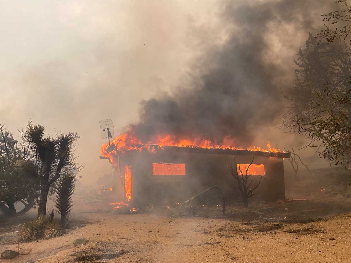
Friday afternoon the northern end of the Bobcat Fire pushed down into the foothills at Juniper Hill and Valyermo. Some structures in the area were destroyed and more evacuation orders were issued. The LA County Sheriff has the latest evacuation information.

Firefighters had to briefly shelter in Fire Station 79 on Valyermo Road as the fire moved through the area. There was a report that a pumphouse at the station burned when the fire spread across the road.

Juniper hills structure burns in Bobcat Fire, September 18, 2020
Juniper hills structure burns in Bobcat Fire, September 18, 2020. Photo by Jeff Zimmerman.

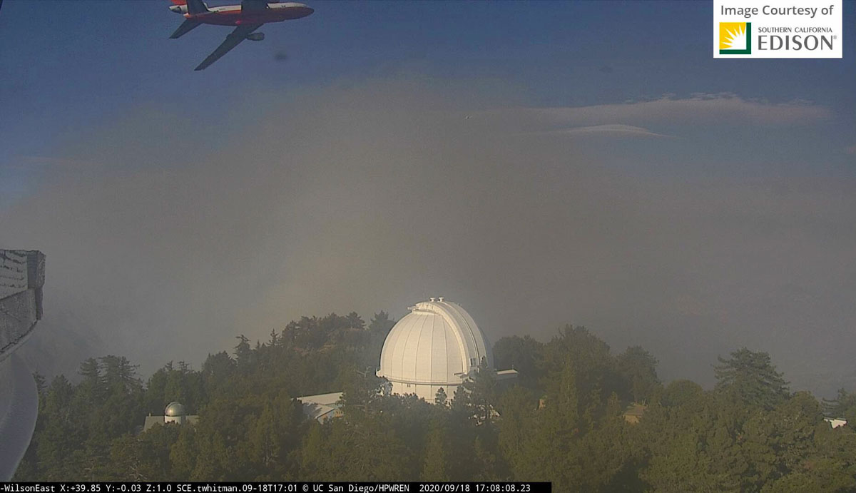
While the fire burns into the desert floor, it is also pushing west, again threatening Mt. Wilson Observatory where approximately six large air tankers are working to slow the spread.

A helicopter is igniting a burning operation, or “strategic aerial firing”, on the eastern perimeter to strengthen containment lines and slow the spread to the east.

There are reports that the community of Big Pines at the intersection of Big Pines Highway and Angeles Crest Highway/2 is threatened.

DC-10 air tanker near Mt. Wilson on the Bobcat Fire at 5:08 p.m. PDT Sept 18, 2020.

September 18, 2020  |  8:33 a.m. PDT

Map of the Bobcat Fire
3-D map of the Bobcat Fire, looking south. The red line was the perimeter at 8:18 p.m. PDT Sept. 17, 2020.

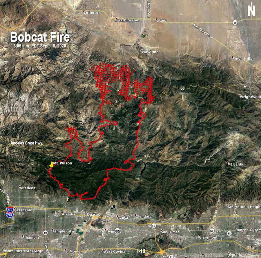
The Bobcat Fire in the Angeles National Forest north of Arcadia continued its spread north on Thursday, advancing north of Highway 2.

From the Incident Management Team:

“The Bobcat Fire had very active fire growth in the north end of the perimeter where it reached Juniper Hills and the communities around it, additional aviation assets were requested. Due to the increased fire activity and spread, evacuation orders were expanded to include the northern foothill communities. As the top end of the fire heads northwest and northeast, crews and aviation assets continued to work to keep the fire south of Pearblossom.

“On the west end of the fire, firefighters will be scouting for additional opportunities to build both indirect and direct fire lines to protect the area around Chilao. Fire activity remained active around Mt. Wilson with crews and equipment working very hard to protect infrastructure. To the east, downslope winds activated eastward fire movement near the San Gabriel Reservoir.”

An evacuation warning was issued Thursday night for residents in the unincorporated community of Wrightwood approximately 10 miles east of the fire.

The blaze was mapped overnight at 60,557 acres.

Map of the Bobcat Fire
Map of the Bobcat Fire. The red line was the perimeter at 8:18 p.m. PDT Sept. 17. The red dots represent heat detected by a satellite at 3:06 a.m. PDT Sept. 18, 2020.