New Mexico prescribed fire escapes, burns into Colorado

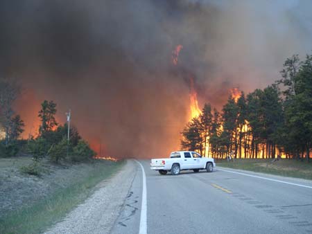
A prescribed fire ignited on May 21, 50 miles west of Raton, New Mexico, planned to be 600 acres, escaped on May 23 when it was too windy to fly air tankers and has now burned 3,800 acres. It has crossed the state line and scorched about 40 acres in Colorado. The name of the fire is H12. The prescribed fire was on the Vermejo Park Ranch a few miles south of the Colorado border.

Today they are transitioning from Kyle Sahd’s Type 3 incident management team to Pruett Small’s Type 2 team. In New Mexico the fire is in the jurisdiction of the Cimarron District, New Mexico State Forestry.

Update on Michigan fires, May 20

Meridian Boundary fire near Grayling Michigan
DNRE photo

Firefighters are still working to control the Meridian Boundary fire in Crawford County in northern lower Michigan which has consumed 8,790 acres and burned 12 homes, damaged two others, and destroyed or damaged another 39 outbuildings. The fire is 65% contained with a fire line around 95% of the perimeter. There have been no reported injuries.  The evacuation order is still in effect but an update on that status will be issued later today.

The fire started when a resident with a burning permit was burning leaves on a day when Red Flag warnings had been issued for some areas in northern Michigan.

The Range 9 fire that started on Camp Grayling military base was controlled at 1,040 acres Tuesday night (map of the fire). It started when a controlled burn, called a “controlled pre-burn” on the base, escaped. Camp Grayling frequently conducts these burns, executed by military personnel with little or no formal National Wildfire Coordinating Group wildfire training, in order to reduce the threat caused by fires started on their firing ranges. If a fire occurs down range while a unit is training, they must stop training until the fire is controlled, thus wasting valuable range time. It is believed that four privately owned summer cottages were destroyed when the fire burned outside the base.

A map of the Meridian Boundary fire southeast of Grayling is below. Click on it to see a larger version.
Continue reading “Update on Michigan fires, May 20”

Fire in northern Michigan caused by escaped controlled burn on military base

According to a spokeswoman from the Michigan Department of Military and Veterans Affairs, the Range 9 fire was caused by a “controlled pre-burn” which got out of control on Camp Grayling. Major Dawn Dancer said the Department of Natural Resources and Environment was aware of the controlled burn “and ok’d it”. After igniting the burn at noon on May 18, a day with Red Flag warnings in the area, the wind increased at around 2:30 to 3:00 p.m. and the burn got out of control. After it burned about 1,200 acres, most of them on the military base, the fire was controlled by 9 p.m. the same day. It is believed that four privately owned summer cottages outside the base were destroyed.

Another fire that started on the same day in northern Michigan, the Meridian Boundary fire, is still uncontrolled and has burned about 7,520 acres.

We have never heard of a “controlled pre-burn”, but judging from the context in information provided by the military, a “pre-burn” appears to be a prescribed burn, or controlled burn. The personnel at Camp Grayling conduct an average of 20 pre-burns each year at Camp Grayling. So far this year they have successfully completed eight pre-burns for a total of 9,000 acres.

Here is a map of the Range 9 fire that started on Camp Grayling.

Map range 9 fire Camp Grayling
Click to see a larger version

Cerro Grande fire, 10 years ago today

On May 10, 2000, a fire that began as a prescribed fire in Bandalier National Monument burned into Los Alamos, New Mexico. In its most extreme state on May 10, the Cerro Grande Prescribed Fire was carried by very high winds, with embers blowing a mile or more across the fire lines to the north, south, and east, entering Los Alamos Canyon towards Los Alamos, New Mexico. The towns of Los Alamos and White Rock were in the fire’s path and more than 18,000 residents were evacuated.

By the end of the day on May 10, the fire had burned 18,000 acres, destroyed 235 homes, and damaged many other structures. The fire also spread towards the Los Alamos National Laboratory, and although fires spotted onto the facility’s lands, all major structures were secured and no releases of radiation occurred.

The Cerro Grande Fire was the largest, most destructive wildfire that New Mexico has ever known. The fire swept across 47,000 forested acres in Bandelier National Monument, the Santa Fe National Forest, Los Alamos National Laboratory, Los Alamos County, and the Santa Clara and San Ildefonso Indian Reservations, causing about $1billion in property damage. Over 280 homes were destroyed or damaged and 40 Laboratory structures burned.

The fire had a major effect on prescribed fire operations nationwide. For more info.

Burning near Los Alamos

We have not heard very much about prescribed fires or fire use fires at Bandelier National Monument since the disastrous Cerro Grande fire of 2000, which began as a prescribed fire then escaped and burned 235 homes in Los Alamos, New Mexico. This interesting article from Fire Engineering describes a fire use fire at Bandelier and has quotes from Dick Bahr and Tom Nichols, who both work for the National Park Service in Boise. Here is an excerpt.

=================================================
By STACI MATLOCK

Last July, people in Los Alamos and Santa Fe looked toward Bandelier National Monument and saw smoke in the air.

Rather than stomp the lightning-caused San Miguel Fire out quickly, Bandelier National Monument let it burn, a counterintuitive move for an agency that only nine years prior had set the blaze destined to became one of the most destructive fires in recent memory. But it was an example of just how much fire management has changed in the last few decades.

Bandelier’s superintendent, Jason Lott, let the San Miguel Fire burn because the weather conditions were right. Fire resources were available if the park’s fire staff needed help, and the fire occurred in an area park staff had already mapped out as needing treatment to reduce flammable forest material. The San Miguel Wildland Fire burned 1,635 acres in the park and Santa Fe National Forest. It left behind patches of burned and unburned vegetation, exactly what forest ecologists like to see. Bandelier’s fire staff only tamped down the fire when it threatened cultural resources or entered risky areas. “Our goal is to allow lightning-ignited fires to burn naturally within fire-adapted ecosystems when we can do so safely, effectively and efficiently,” said Lott at the time.

In centuries past, nature took care of periodically cleaning house in Bandelier and other southwestern forests, sending fire through every 10 to 25 years to kill weak trees and reduce plant debris on the forest floor. Archaeologists and anthropologists have found evidence of ancient native people setting fires to stimulate grass growth.

Then, after the 1871 fire in Peshtigo, Wis., that killed more than 1,000 people, and the Great Fire of 1910 that burned more than 3 million acres in Washington, Montana and Idaho and killed 78 firefighters, wildfire became an enemy to be stopped. From the early to mid-1900s, fire suppression, grazing and logging interrupted the cycle. Western forests became dense and overgrown. “We’ve changed the landscape so that it doesn’t necessarily function as it traditionally did,” said Richard Bahr, lead fire ecologist for the National Park Service in Boise, Idaho.

Bahr said land managers began letting fires burn out naturally again after the 1960s. They were easier to control because the climate was moister and cooler through the 1980s.

Then three factors combined to make forest fires more complicated and more expensive to fight, Bahr said: millions of acres of overgrown forests, more people living in them and a drier, warmer climate.

Tom Nichols, chief of fire and aviation for the National Park Service in Boise, said there are three parts to forest fire management — prescribed burns, suppression of fires and letting the fire burn out on its own as in the case of San Miguel.

Salt Lake Tribune, on the Mill Flat fire

Mill Flat Fire
Mill Flat Fire. Photo from the report.

The Salt Lake Tribune has an article about the Mill Flat fire that was managed as a “fire use” fire for almost a month, then escaped, ran out of the Dixie National Forest, and burned six homes in New Harmony, Utah on August 29, 2009. Wildfire Today reported on the release of the official review of the incident on April 5.

Here is an excerpt from the Tribune article:

Cedar City » A crew monitoring a wildfire in Washington County last summer waited too long to summon help, according to a review of the Mill Flat Fire made public recently by the U.S. Forest Service.

But that was just one problem in how the fire was handled.

The wildfire, sparked by lightning in a wilderness area in July 2009, crested a ridge and raced down two canyons into the residential community of New Harmony on Aug. 29. That night the fire destroyed three houses, heavily damaged three others and burned seven other outbuildings and corrals, leaving residents frustrated and angry the fire was not suppressed earlier.

Former town clerk Valene Scobel did not lose property, but was evacuated along with 150 residents that night.

“They let it burn way too long and it got out of hand,” said Scobel. “They mishandled it big time.”

The Forest Service report says fire managers acted reasonably, given their experience and training, and made public safety a priority. Lessons learned from decisions made during the fire should be used to improve future performance, it said.

But after letting the fire burn for weeks to clear out old growth, the fire crew had become “complacent.” A more aggressive containment approach should have been launched much sooner, the report said.

“Personnel new to the incident viewed the same situation with a much greater sense of urgency and recommended additional resources and more aggressive approach,” the document says. “Fire managers thought they had more time before the fire reached New Harmony.”

The fire stated in wilderness area on July 25, and was allowed to burn because it met criteria in the Forest Service’s land management plan for the area. The agency hoped the fire would eventually help re-establish aspen forests. A model projecting how much the fire could potentially spread in four weeks was completed in the early stages but was not updated after the fire grew significantly in August.

“Other fire behavior prediction tools may have shown a greater potential for the fire reaching New Harmony, but were not used,” says the review, adding that a fire behavior analyst was not assigned to the fire.

The report was also critical of the condition of a fuel break established before the fire erupted along the Forest Service boundary with New Harmony. The fuel break was not capable of stopping the fire because of its location, design and vegetation growth. Despite that, once the fire reached the two canyons into town, the inadequate fuel break was the only option to stop the blaze.

Communication between fire managers and the residents of New Harmony was another issue.

“Some state partners did not feel fully engaged in the fire’s management,” the report says. “Some [fire officials] did not speak up when they had concerns.”

Residents also expressed frustration. Some said they “were made to feel silly” by fire officials for being concerned and felt they were fed “propaganda” about the benefits of the fire.