Fish Fire grows rapidly south of Sundance, WY

A Type 1 Incident Management Team will assume command Wednesday

Updated 8:28 a.m. MDT August 3, 2022
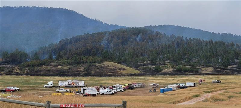
Incident Command Post on the Fish Fire,
Incident Command Post on the Fish Fire, Wednesday August 2, 2022. IMT photo.

The Fish Fire south of Sundance, Wyoming slowed Tuesday night as the winds decreased and the relative humidity rose to 75 percent.

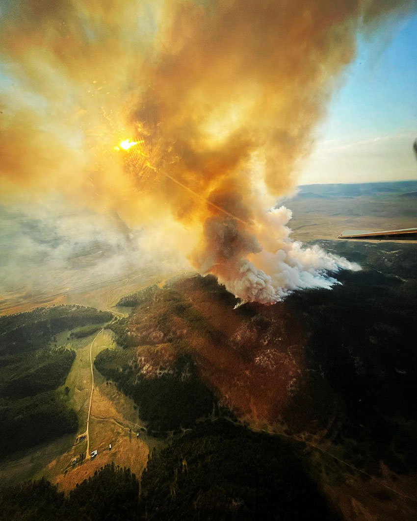
Fish Fire, August 2, 2022
Fish Fire, August 2, 2022. IMT photo.

The updated forecast for Wednesday predicts mostly sunny skies with a high near 84 with a 6 to 13 mph east wind becoming west or southwest after 11 a.m. Winds could gust as high as 22 mph as the relative humidity drops to 25 percent.
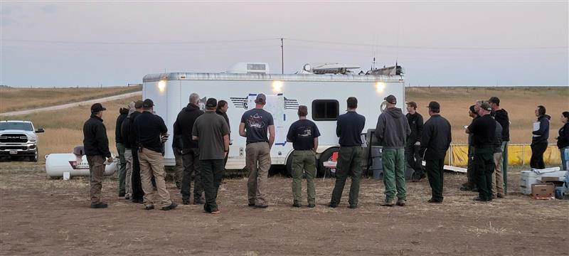
briefing Fish Fire
Briefing on the Fish Fire, Wednesday August 3, 2022. IMT photo.

Since it started Sunday July 31 at 11:30 a.m. it has burned 6,476 acres on private and National Forest lands.
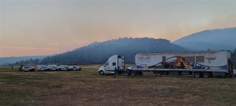
Incident Command Post on the Fish Fire,
Incident Command Post on the Fish Fire, Wednesday August 3, 2022. IMT photo.

The Rocky Mountain Complex Incident Management Team 1 will assume command of the fire Wednesday morning.


5:30 p.m. MDT August 2, 2022
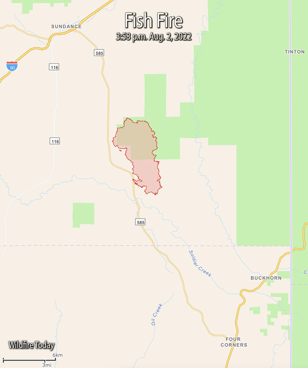
Fish Fire map, 3:58 p.m. Aug 2, 2022.
Fish Fire vicinity map, 3:58 p.m. Aug 2, 2022.

The Fish Fire eight miles south of Sundance, Wyoming was much more active Tuesday than in previous days. At 3:58 p.m. it was mapped at 6,476 acres, about eight times larger than it was Monday evening.

To see all of the articles on Wildfire Today about the Fish Fire, including the most current, click HERE.

Monday afternoon and into the evening it was pushed by winds out of the north and northwest gusting to 30 mph. That caused it to spread rapidly throughout the night and by 4 p.m. Tuesday it had grown about 2 miles to the east and four miles south. It spread east across Canyon Springs Road and south across Cold Springs Road. At that time it was still east of Highway 585.
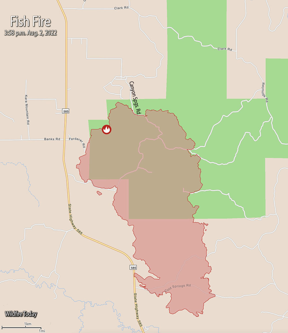
Fish Fire map, 3:58 p.m. Aug 2, 2022
Fish Fire map, 3:58 p.m. Aug 2, 2022.

On Tuesday after 9 a.m. there was a 100 percent cloud cover over the area. In the afternoon winds were out of the northwest at 10 to 15 gusting at 28 to 34 mph while the temperature was 88. The relative humidity rose from 20 percent at 6:30 a.m. to 38 percent at 5 p.m. The forecast for Wednesday calls for mostly sunny skies, 84 degrees, 22 percent RH, and winds from the southwest at 5 to 10 mph.

Evacuation information may be posted on the Crook County Emergency Management Facebook Page, or, Weston County Emergency Management’s Facebook page.

Kim Hemenway, a spokesperson for the fire, said a Type 1 Incident Management Team will arrive Tuesday night and assume command from the Type 3 Team at 6 a.m. Wednesday.

Approximately 250 personnel are assigned.


The article was edited at 7:22 p.m. MDT August 3, 2022 to reflect that the Incident Management Team said their reference to a “Critical Incident Management Team” should have been “COMPLEX Incident Management Team.”

Fish Fire near Sundance, Wyoming prompts evacuations

Another fire, the Carter Fire, has burned more than 10,000 acres near Scotts Bluff, Nebraska

Updated 8:46 p.m. MDT August 1, 2022

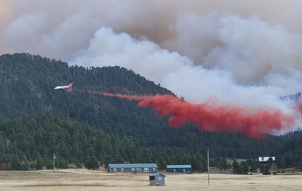
Tanker 40, a BAe-146, drops near the Fish Fire
Tanker 40, a BAe-146, drops near the Fish Fire south of Sundance, WY, August 1, 2022. USFS photo.

Fish Fire

The Fish Fire eight miles south-southeast of Sundance, Wyoming spread to the east Monday threatening the Canyon Springs subdivision. Crews are working in the area to provide protection to the structures. Monday afternoon it had burned about 750 acres.

To see all of the articles on Wildfire Today about the Fish Fire, including the most current, click HERE.

Residences from Canyon Springs Road to the south end of the fire and east of Wyoming Highway 585 are still under evacuation.

The fire started on private land and was human-caused.

A Wyoming Type 3 incident management team is expected to arrive and in-brief Monday at 6 p.m.

The smoke from the fire is blowing east into South Dakota toward Lead and Rapid City .

It is a fairly big air show for that part of the country. We checked a flight tracking app late in the afternoon Monday and spotted four large air tankers at the fire or at the Rapid City Tanker Base 63 miles to the  southeast — two BAe-146s and two RJ85s. Tanker 168, an RJ85, flew up from Abilene, dropped, and headed to Rapid City. There are also two Type 1 helicopters and a Type 3 helicopter assisting firefighters.

The state of Colorado’s PC12 multi-mission aircraft is also on scene for mapping and intelligence support. It found that at noon the fire had burned 527 acres.

Monday afternoon the Four Corners weather station south of the fire recorded 88 degrees, 13 percent relative humidity, and 10 to 20 mph winds gusting out of the west and northwest up to 32 mph. The forecast for the fire on Tuesday predicts 87 degrees, 21 percent RH, and 10 to 15 mph south winds shifting to the west in the afternoon gusting up to 20 mph.

Carter Canyon Fire

The Carter Canyon Fire seven miles southwest of Scotts Bluff, Nebraska has grown to 15,592 acres. The blaze destroyed three homes and damaged several more in the Carter Canyon community that was evacuated Sunday.

The temperature at the fire reached 102 degrees Monday with 16 percent RH and winds gusting at 10 to 15 mph. The National Weather Service forecasts temperatures around or in excess of 100 degrees over the next six days.

Large air tankers have also been assisting firefighters on the Carter Canyon Fire.


Updated at 9:54 a.m. MDT August 1, 2022

Fish Fire, July 31, 2022
Fish Fire, July 31, 2022. Photo by Scott McDermid, Air Attack.

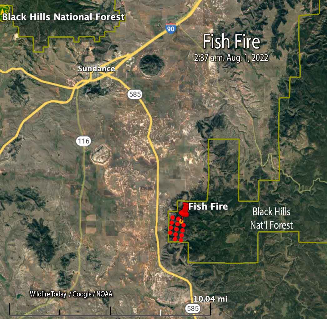
The map below shows heat detected by a satellite as it passed over the Fish Fire at 2:37 a.m. Monday.

Fish Fire map, 2:37 a.m. MDT Aug. 1, 2022 Wyoming
The red dots on the map represent heat detected by a satellite on the Fish Fire at 2:37 a.m. MDT Aug. 1, 2022.

We will update this article as more information becomes available.


10:20 p.m. MDT July 31, 2022

map location fish fire wyoming
Map showing the location of the Fish Fire at 12:43 p.m. MDT July 31, 2022.

The Fish Fire 8 miles south-southeast of Sundance, Wyoming is prompting evacuations south of the city. Evacuation orders are in effect from south of Canyon Springs Road to the south end of the fire, and east of Wyoming Highway 585.

Since it was reported at about 11:30 Sunday morning it burned approximately 500 acres on the Black Hills National Forest by 7 p.m., according to fire officials. Air tankers and at least one Type 1 helicopter are assisting firefighters.

A Wyoming Type 3 incident management team is expected to arrive on Monday.

Fish Fire, July 31, 2022
Fish Fire, July 31, 2022, by @LordBaumeister.

Another fire in the Northern Great Plains has been burning since 6:30 p.m. on July 30 seven miles southwest of Scotts Bluff, Nebraska. The Carter Canyon Fire has grown to approximately 13,000 acres, with part of it being within the Cedar Canyon Wildlife Management Area south of Carter Canyon.

Single engine air tankers as well as large air tankers have been working on these fires, flying out of Rapid City and Rocky Mountain Metropolitan Airport (Jeffco) near Denver. An air attack aircraft flew over from Cody, Wyoming to assist with the Fish Fire on Sunday.

Carter Canyon Fire 12:41 p.m. MDT July 31, 2022
The symbols represent heat detected by satellites on the Carter Canyon Fire as late as 12:41 p.m. MDT July 31, 2022. Parts of the fire are in light vegetation such as grass that cools quickly after burning rapidly and can be missed by the twice daily satellite overflights.

California: San Gabriel Complex of Fires near Los Angeles

(UPDATED at 6:10 a.m. PDT June 22, 2016)

San Gabriel Complex Mt Wilson
The area of the San Gabriel Complex as seen from Mt. Wilson at 6:05 a.m. PDT June 22, 2016. The fires are on the right side of the picture on the far side of the ridge. Very little smoke is rising above the inversion. UCLA photo. Click to enlarge.

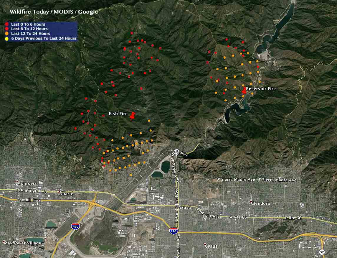
The activity on the Fish and Reservoir Fires that comprise the San Gabriel Complex near Los Angeles has lessened over the last 24 hours. The Fish Fire is still generating heat near the top of the fire and on the southwest side.

The combined acreage for the two fires is now 4,900 acres according to the U.S. Forest Service — 1,200 acres for the Reservoir Fire and 3,700 acres for the Fish Fire. Approximately 1,040 personnel are currently committed to these fires.

The mandatory evacuations for parts of the city of Duarte and in the national monument still remain in effect.

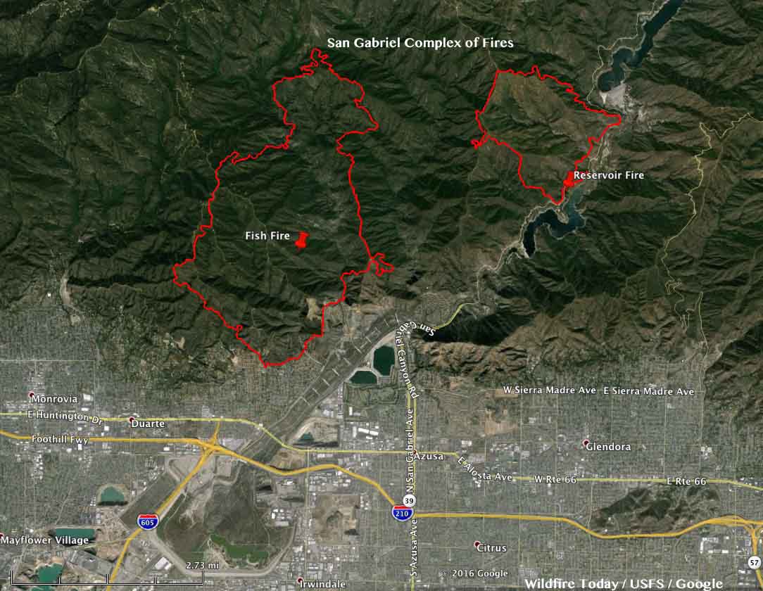
In spite of predictions otherwise, the two fires have still not merged and are over a mile apart.

Tuesday night firefighters continued structure protection along the south perimeter above Duarte. On Wednesday hand crews will hold and improve the fire perimeter, patrol along Highway 39, and seek opportunities to build indirect dozer lines along the Red Box Road.

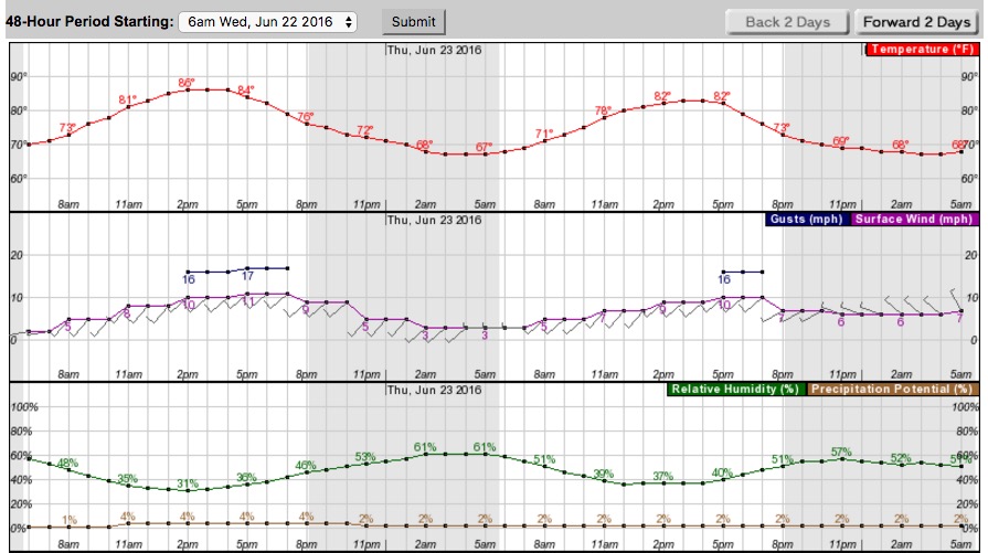
weather forecast San Gabriel Complex fires
Weather forecast for the area of the San Gabriel Complex of Fires, generated at 6:30 a.m. PDT June 22, 2016. NWS.

With the exception of the wind, which could be an issue, the weather forecast for Wednesday favors firefighters, with moderate temperatures and relative humidity. However the wind will be out of the southwest at 8 to 11 mph with gusts up to 17 mph.

Map San Gabriel Complex
Map of the San Gabriel Complex at 3 a.m. PDT June 22, 2016. Click to enlarge.

****

(UPDATE at 9:232a.m. PDT, June 21, 2016)

At a 9 a.m. press conference fire officials at the Fish and Reservoir Fires said the expected nighttime downslope winds that intensified after 4 a.m. caused an increase in fire activity, pushing the Fish Fire down the steep slopes above Duarte, California. With the assistance of at least one water-dropping night-flying helicopter firefighters were able to prevent the loss of any structures.

After a Chief with Los Angeles County Fire Department said they put out the fire at the base of the slopes behind the residences early Tuesday morning, he said there is no containment in that area or any other area on the fire. He also said he does not foresee any relaxation of the evacuation order in the near future.

Fire officials expect the two fires to merge. The incident is now known as the San Gabriel Complex.

****

(UPDATE at 7:54 a.m. PDT June 21, 2016)

Map Fish Reservoir Fires
Map showing heat detected on the Fish and Reservoir Fires at 3:23 a.m. PDT June 21, 2016. Click to enlarge.

The Fish and Reservoir Fires near Glendora, Azuza, and Duarte in southern California have not grown together. According to satellite heat-sensing data they were still about 1.3 miles apart at 3:23 Monday morning.

The U.S. Forest Service reports that the size estimates of the fires are 3,000 acres for the Fish Fire and 2,400 acres for the Reservoir Fire.

A Type 2 incident management team with Mike Wakoski as Incident Commander is assigned to both fires. They had an inbriefing scheduled for 8 p.m. on Monday.

****

(UPDATE at 9:40 p.m. PDT June 20, 2016)

The U.S. Forest Service reports the Fish Fire has burned 3,000 acres and the Reservoir fire, 1,500 acres. LA County reports that as of 8:30 p.m. the two fires had not merged… yet. They were still 1.5 miles apart. But at that time the Fish Fire was 2,000 acres.

****

(Originally published at 4:45 p.m. PDT June 20, 2016. Updated at 5:33 p.m. PDT June 20, 2016)

Map Fish and Reservoir Fires
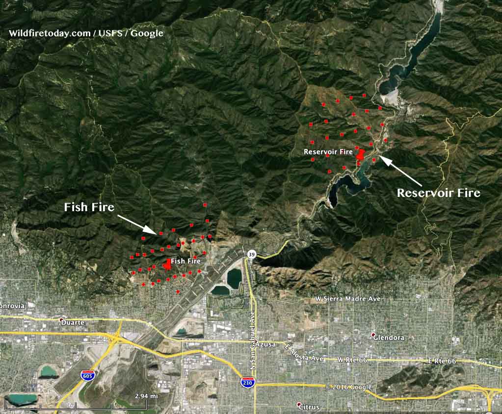
Map showing heat detected on the Fish and Reservoir Fires at 1:21 p.m. PDT June 20, 2016. Click to enlarge.

Two wildfires started today near Los Angeles and both got off to a roaring start. The map above shows the location of the fires at 1:21 PDT on Monday,  about two to three hours after they started. They have grown substantially since then.

Reservoir Fire
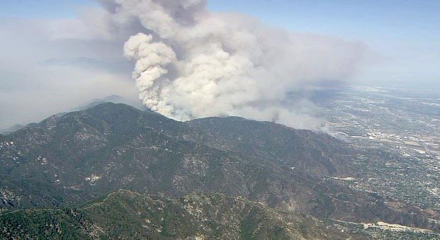
Reservoir and/or Fish Fire. Screen capture from KABC at 5:11 p.m. PDT 6-20-2016.

The Reservoir Fire ignited at about 11 a.m. after a vehicle accident on Highway 39 near Morris Reservoir on the steep slopes above Glendora, California. Within about three hours it had burned 1,200 acres and required the evacuation of San Gabriel Canyon recreation area. At 5:30 p.m. it was estimated at 1,500 acres.

Continue reading “California: San Gabriel Complex of Fires near Los Angeles”

Photos of the Reservoir and Fish Fires near Los Angeles

These are photos from the Reservoir and Fish Fires near Los Angeles on June 30, 2016.

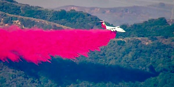
BAe-146 drop
A BAe-146 drops on one of the fires near Los Angeles, June 20, ,2016. Screen grab from ABC7 video.
DC-10 drop fire
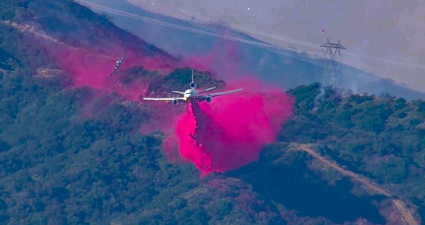
A DC-10 drops on one of the fires near Los Angeles, June 20, ,2016. Screen grab from ABC7 video.

And these photos:

And then this:

****

Our main article about the Fish and Reservoir Fires has more details about these blazes.