Hennessey Fire spreads south toward Vacaville

The LNU Complex of fires has burned tens of thousands of acres in Napa and Solano Counties in northern California

August 19, 2020  |  7:35 p.m. PDT

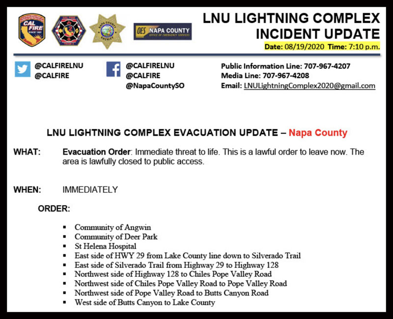
More evacuations have been ordered for the Hennessey and LNU Complex in northern California, this time in Napa County, including the St Helena Hospital and the communities of Angwin and Deer Park.


August 19, 2020  |  6:36 p.m. PDT

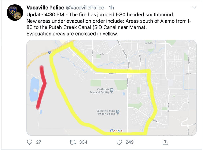
Fire jumps I-80

The Hennessey Fire has crossed Interstate 80 near Vacaville, California, prompting more evacuations. At about 5:15 p.m. @CAFireScanner reported that ground units said they had about 80 acres south of the Interstate and they would not be able to catch it without support from aviation.


August 19, 2020  |  12:58 p.m. PDT

LNU Complex fires Northern California evacuations Napa County

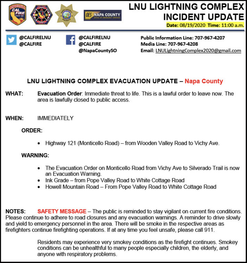
Official evacuation information for the LNU Complex of fires north of Vacaville is provided by @CALFIRELNU. Follow them on Twitter.

map fire Hennessey LNU Complex 1145 pm PDT August 18, 2020
Map of the fires in the LNU Complex in northern California. The data is from a privately owned aircraft and mapping system operated by Tenax Aerospace under an exclusive use contract with the U.S. Forest Service. The flight was at 11:45 p.m. PDT August 18, 2020. After the information was collected the fires spread substantially to the south and southeast. The red arrows were added by Wildfire Today indicating the direction of additional spread after the flight. There is high confidence in the accuracy of this mapping data, much more than heat data collected by satellites.

The map above of the fires in the LNU Complex in northern California is from a fixed wing mapping flight at 11:45 p.m. MDT August 18. After the flight the fires spread substantially to the south and southeast. The red arrows were added by Wildfire Today indicating the direction of additional spread after the flight. This is considered accurate data, much better than information collected by an orbiting satellite passing by hundreds of miles above the Earth. The limitation is that it is just a snapshot of one moment in time while the fires are spreading very rapidly, in some cases, into populated areas. This data is usually only available once a day in the middle of the night.

The mapping flight determined that at 11:45 p.m. Tuesday the size of the multiple fires in the Complex combined (Gamble, 15-10, Hennessey, and others) was 51,223 acres.

Continue reading “Hennessey Fire spreads south toward Vacaville”

Several large fires burning north of Napa, CA in Lake Berryessa area

Hennessey, Gamble, and 15-10 Fires

August 18, 2020  |  4:46 p.m. PDT

 LNU Complex Hennessey Gamble 15-10 fire
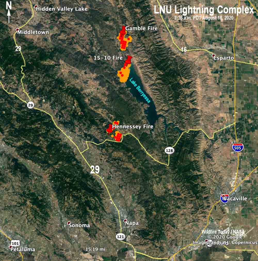
Map of the LNU Complex of fires at 2:36 a.m. PDT August 18, 2020.

Hennessey Fire

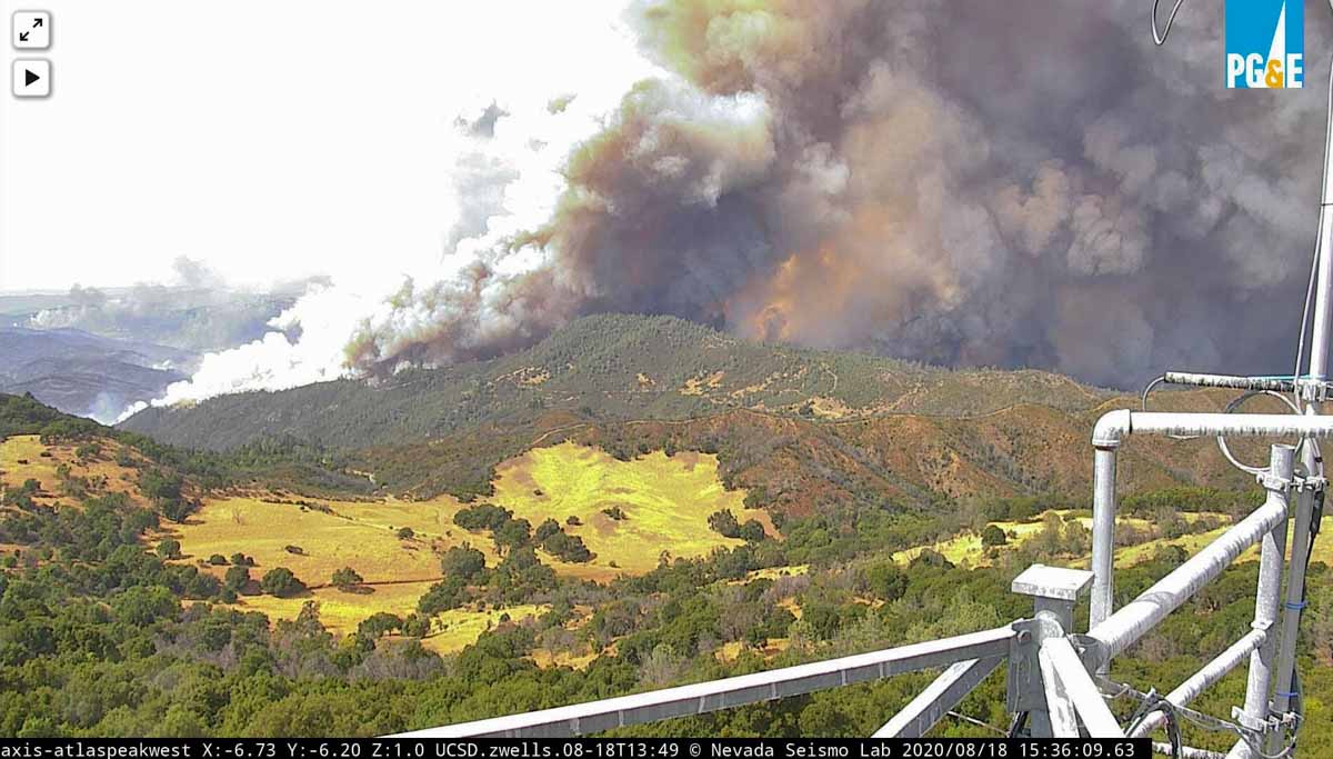
At least three large wildfires are spreading rapidly in northern California north of Napa. The Hennessey Fire is about 12 air miles north of Napa near the intersection of Highway 128 and Chiles Pope Valley Road. The last size provided by CAL FIRE (which could be many hours old) was 2,700 acres but it has grown substantially since then. Approximately 205 structures are threatened and evacuation orders are in place. At around 4 p.m. Tuesday there was a report that it had crossed to the south side of Highway 128 and was burning toward Atlas Peak. Three structures have been destroyed. Tuesday afternoon it was creating a large pyrocumulus cloud, indicating extreme fire behavior. An AlertWildfire camera captured the early hours of the fire including when a passing thunderstorm caused a rapid 180-degree shift in the wind direction and the spread of the fire.

(To see all of the articles on Wildfire Today about the lightning-caused wildfires in California, including the most recent, click HERE.)

Hennessey Fire August 18, 2020

15-10 Fire

There are two large fires near Lake Berryessa. The 15-10 Fire (the name will probably change) is along Berryessa Knoxville Road near the northwest shore of the lake. Tuesday at 2:36 a.m. it had burned approximately 1,000 acres according to sensors on a satellite, but it is very active Tuesday afternoon.

Gamble Fire

At 2:36 a.m. the south edge of the Gamble Fire was two miles north of the 15-10 Fire. At that time it had also burned approximately 1,000 acres according to sensors on a satellite, and it too was very active.

Evacuations are occurring for the 15-10 and Gamble Fires. With both fires burning along the Berryessa Knoxville Road, evacuation is complicated.

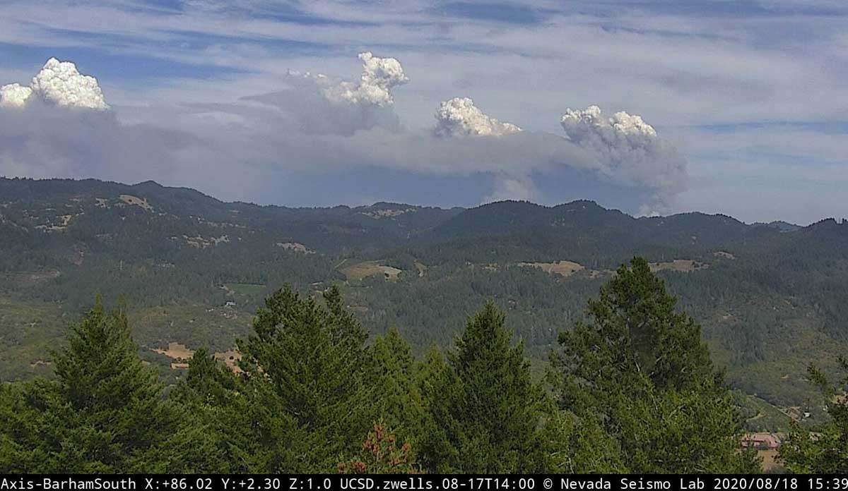
The photo below with four pyrocumulus clouds forming above the rapidly spreading fires is very impressive.

LNU Lightning Complex of fires
LNU Lightning Complex of fires August 18, 2020
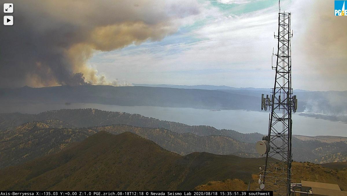
LNU Lightning Complex of fires
LNU Lightning Complex of fires near Berryessa Lake, August 18, 2020