California wildfires — update on the four largest

The LNU Lightning Complex has grown to 302,388 acres

August 21, 2020  |  7:17 p.m. PDT

LNU Lightning Complex map

Firefighters in northern California are struggling for the sixth day with the aftermath of 10,800 lightning strikes that hit the area during a 72-hour period that began Sunday. Since there was not much rain with the lightning, over 300 fires started. Most of the blazes are under control, but still remaining are over 450,000 acres on active fires, and in some areas, the remains of structures that were destroyed. CAL FIRE spokesperson Jeremy Rahn described the situation as a “historic lightning siege.”

(To see all of the articles on Wildfire Today about the lightning-caused wildfires in California, including the most recent, click HERE.)

At least four people have died; a pilot whose helicopter crashed while dropping water on a fire near Coalinga, a PG&E worker, and two other civilians.

The fires are so numerous that three groups of fires have been formed, called “complexes”. This simplifies the organization and reduces confusion and duplication of personnel.

According to CAL FIRE more than 50,000 residents in California have evacuated because of the fires. On the four largest fires and complexes, CAL FIRE reports that 540 structures have burned, a number that includes residences, commercial, and outbuildings.

All non-essential personnel at Travis Air Force Base south of Vacaville were told Wednesday night to evacuate. They were ordered to not exit through the Main or Hospital Gates, but to instead use the North and South Gates.

The 50 patients that were at the 151-bed St. Helena Hospital northeast of St. Helena were ordered to evacuate.

Shortages of aircraft and firefighters are hampering the suppression of the fires. The dry, windy, and very hot weather conditions which are expected to continue through the weekend make control of any vegetation fire difficult even when an adequate number of resources are available.

The largest of the complexes is the LNU Lighting Complex. As of Thursday it had burned 215,000 acres in Napa, Lake, Yolo, Solano, and Sonoma Counties. The Hennessey Fire within the complex stretches for 45 miles north to south. It spread into the outskirts of Vacaville and crossed Interstate 80 between the city and Fairfield. As of Thursday night firefighters had been able to limit the burned area south of the Interstate.

Two other complexes are in the South Bay area, and the River Fire is south of Salinas.

The information below is updated when the data is provided by CAL FIRE.

LNU Lightning Complex

  • Updated August 21, 2020 at 7:14 p.m. PDT, Aug. 21
  • Location: North Bay
  • Counties: Napa, Lake, Yolo, Solano, Sonoma
  • Administrative Unit: CAL FIRE Sonoma-Lake-Napa
  • Acres: 302,388. The largest fire in the complex is the Hennessey Fire, 256,102. The Walbridge Fire west of Healdsburg is 43,286.
  • Structures destroyed: 480
  • Personnel assigned: 1,059 (an increase of 472)
  • Evacuation information:  CAL FIRE LNU Twitter page
  • Notes: Fires that merged to become the Hennessey Fire include Gamble, Green, Spanish, 5-10, Morgan, and Markley Fires. At 3 p.m. August 21 @CAFireScanner reported, after monitoring radio traffic, that approximately 15 air tankers are working in the North Bay area; seven S-2Ts, a BAe-146, three or four military MAFFS, and three very large air tankers, two DC-10s and one 747.

SCU Lightning Complex

  • Updated August 21, 2020 at 7:11 p.m. PDT, Aug. 21
  • Location: South Bay
  • Counties: Santa Clara, Alameda, Stanislaus, Contra Costa, San Joaquin
  • Administrative Unit: CAL FIRE Santa Clara
  • Acres: 274,968
  • Structures destroyed: 5
  • Personnel assigned: 1,179
  • Evacuation information:  CAL FIRE SCU Twitter page
  • Notes: comprised of approximately 20 separate fires broken into three zones; the Canyon Zone, the Calaveras Zone, and the Deer Zone.
SCU Lightning Complex and CZU August Lightning Complex map

CZU August Lightning

  • Updated August 21, 2020 at 4:07 p.m. PDT, Aug. 21
  • Location: South Bay
  • Counties: San Mateo, Santa Cruz
  • Administrative Unit: CAL FIRE San Mateo-Santa Cruz
  • Acres: 50,000 (from live briefing at 6:30 a.m. Aug. 21, and a video briefing at about 8:30 a.m. Aug. 21)
  • Structures destroyed: 50
  • Personnel assigned: 1,026
  • Evacuation information: CAL FIRE CZU Twitter page
  • Notes: Multiple large fires in southern San Mateo County and Northern Santa Cruz County merged and continue to actively burn throughout the day due to low relative humidities, inaccessible terrain, and limited resources, according to the Incident Management Team. Approximately 64,600 people have been evacuated.

River Fire

  • Updated August 21, 2020 at 6:30 a.m. PDT, Aug, 21
  • Location: Five miles south of Salinas, near Pine Canyon Rd. and River Rd.
  • Counties: Monterey
  • Administrative Unit: CAL FIRE San Benito-Monterey
  • Acres: 39,464
  • Structures destroyed: 10
  • Personnel assigned: 696
  • Evacuation information: CAL FIRE San Benito-Monterey Twitter page
  • Notes: The River Fire has not been as active as the other fires.
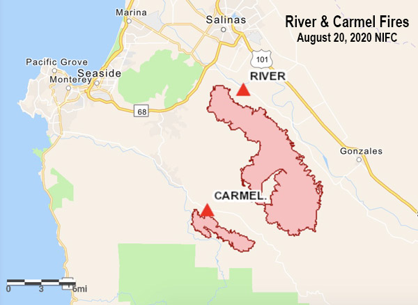
River Fire map
River Fire map

CAL FIRE’s video briefing about statewide fires, and the LNU Complex of fires

LNU Complex of fires -- briefing
LNU Complex of fires — briefing. ABC10.

At a briefing Wednesday the first minute and a half was about the statewide wildfire situation, then they moved on to details about the LNU Complex of fires in Napa, Lake, and Solano Counties of California.

(To see all of the articles on Wildfire Today about the lightning-caused wildfires in California, including the most recent, click HERE.)

Hennessey Fire spreads south toward Vacaville

The LNU Complex of fires has burned tens of thousands of acres in Napa and Solano Counties in northern California

August 19, 2020  |  7:35 p.m. PDT

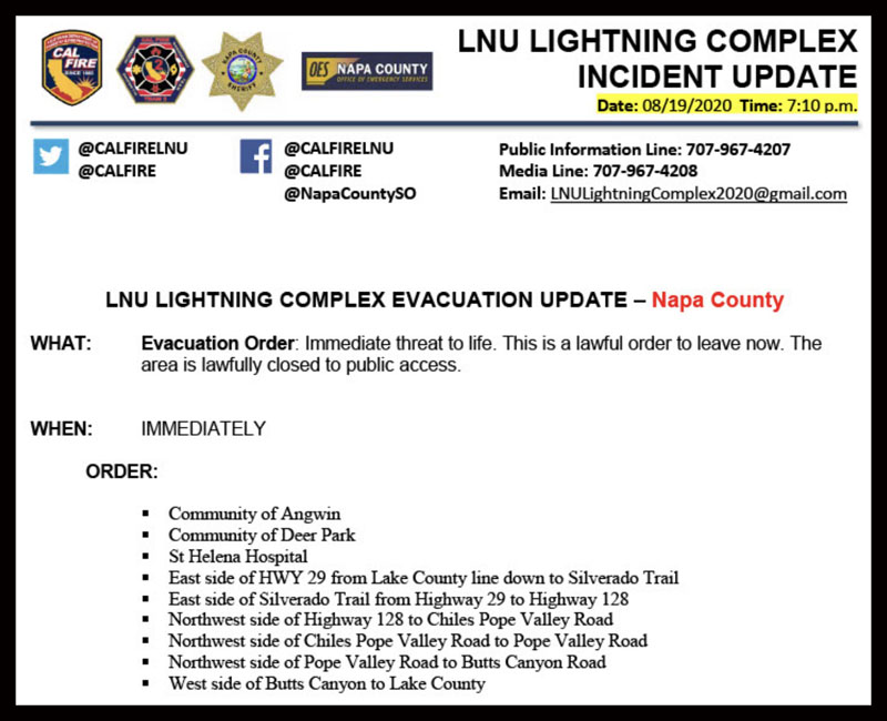
More evacuations have been ordered for the Hennessey and LNU Complex in northern California, this time in Napa County, including the St Helena Hospital and the communities of Angwin and Deer Park.


August 19, 2020  |  6:36 p.m. PDT

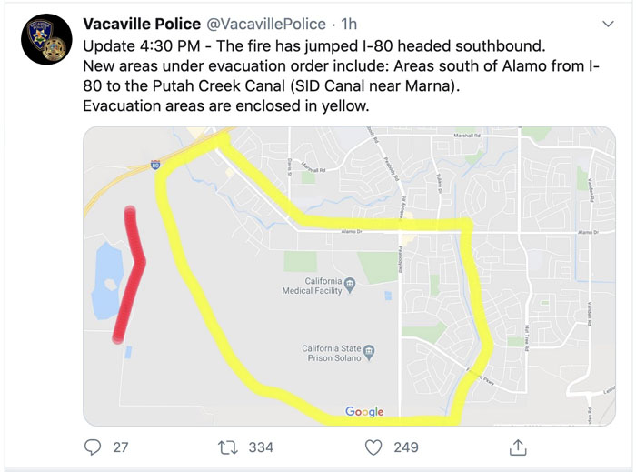
Fire jumps I-80

The Hennessey Fire has crossed Interstate 80 near Vacaville, California, prompting more evacuations. At about 5:15 p.m. @CAFireScanner reported that ground units said they had about 80 acres south of the Interstate and they would not be able to catch it without support from aviation.


August 19, 2020  |  12:58 p.m. PDT

LNU Complex fires Northern California evacuations Napa County

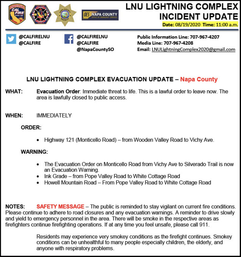
Official evacuation information for the LNU Complex of fires north of Vacaville is provided by @CALFIRELNU. Follow them on Twitter.

map fire Hennessey LNU Complex 1145 pm PDT August 18, 2020
Map of the fires in the LNU Complex in northern California. The data is from a privately owned aircraft and mapping system operated by Tenax Aerospace under an exclusive use contract with the U.S. Forest Service. The flight was at 11:45 p.m. PDT August 18, 2020. After the information was collected the fires spread substantially to the south and southeast. The red arrows were added by Wildfire Today indicating the direction of additional spread after the flight. There is high confidence in the accuracy of this mapping data, much more than heat data collected by satellites.

The map above of the fires in the LNU Complex in northern California is from a fixed wing mapping flight at 11:45 p.m. MDT August 18. After the flight the fires spread substantially to the south and southeast. The red arrows were added by Wildfire Today indicating the direction of additional spread after the flight. This is considered accurate data, much better than information collected by an orbiting satellite passing by hundreds of miles above the Earth. The limitation is that it is just a snapshot of one moment in time while the fires are spreading very rapidly, in some cases, into populated areas. This data is usually only available once a day in the middle of the night.

The mapping flight determined that at 11:45 p.m. Tuesday the size of the multiple fires in the Complex combined (Gamble, 15-10, Hennessey, and others) was 51,223 acres.

Continue reading “Hennessey Fire spreads south toward Vacaville”

Several large fires burning north of Napa, CA in Lake Berryessa area

Hennessey, Gamble, and 15-10 Fires

August 18, 2020  |  4:46 p.m. PDT

 LNU Complex Hennessey Gamble 15-10 fire
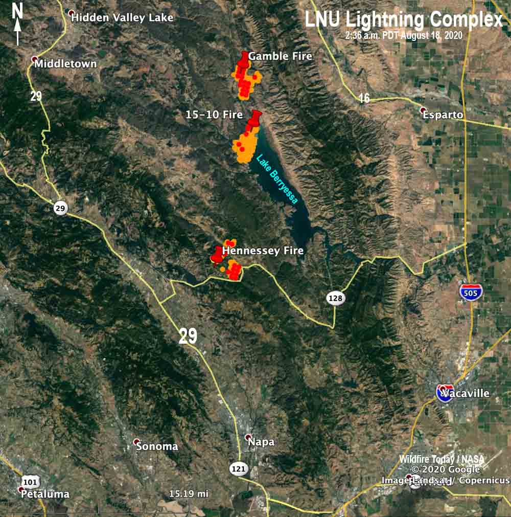
Map of the LNU Complex of fires at 2:36 a.m. PDT August 18, 2020.

Hennessey Fire

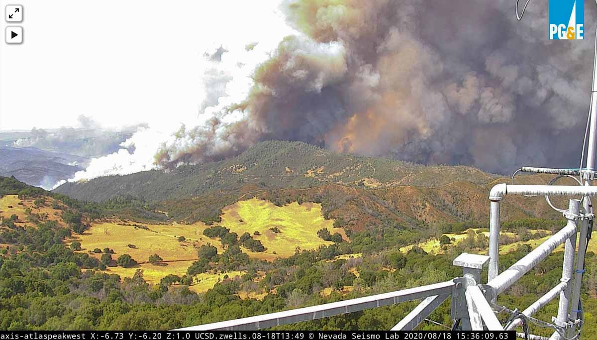
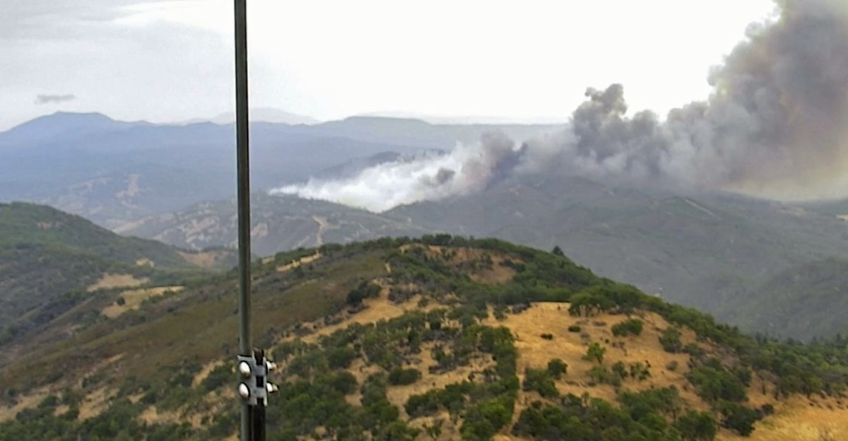
At least three large wildfires are spreading rapidly in northern California north of Napa. The Hennessey Fire is about 12 air miles north of Napa near the intersection of Highway 128 and Chiles Pope Valley Road. The last size provided by CAL FIRE (which could be many hours old) was 2,700 acres but it has grown substantially since then. Approximately 205 structures are threatened and evacuation orders are in place. At around 4 p.m. Tuesday there was a report that it had crossed to the south side of Highway 128 and was burning toward Atlas Peak. Three structures have been destroyed. Tuesday afternoon it was creating a large pyrocumulus cloud, indicating extreme fire behavior. An AlertWildfire camera captured the early hours of the fire including when a passing thunderstorm caused a rapid 180-degree shift in the wind direction and the spread of the fire.

(To see all of the articles on Wildfire Today about the lightning-caused wildfires in California, including the most recent, click HERE.)

Hennessey Fire August 18, 2020

15-10 Fire

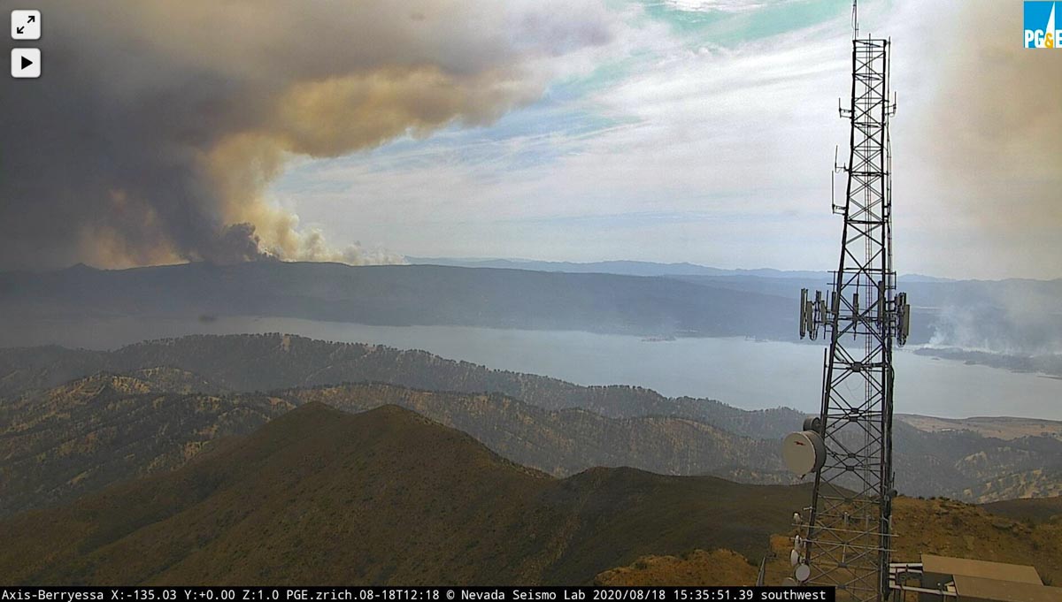
There are two large fires near Lake Berryessa. The 15-10 Fire (the name will probably change) is along Berryessa Knoxville Road near the northwest shore of the lake. Tuesday at 2:36 a.m. it had burned approximately 1,000 acres according to sensors on a satellite, but it is very active Tuesday afternoon.

Gamble Fire

At 2:36 a.m. the south edge of the Gamble Fire was two miles north of the 15-10 Fire. At that time it had also burned approximately 1,000 acres according to sensors on a satellite, and it too was very active.

Evacuations are occurring for the 15-10 and Gamble Fires. With both fires burning along the Berryessa Knoxville Road, evacuation is complicated.

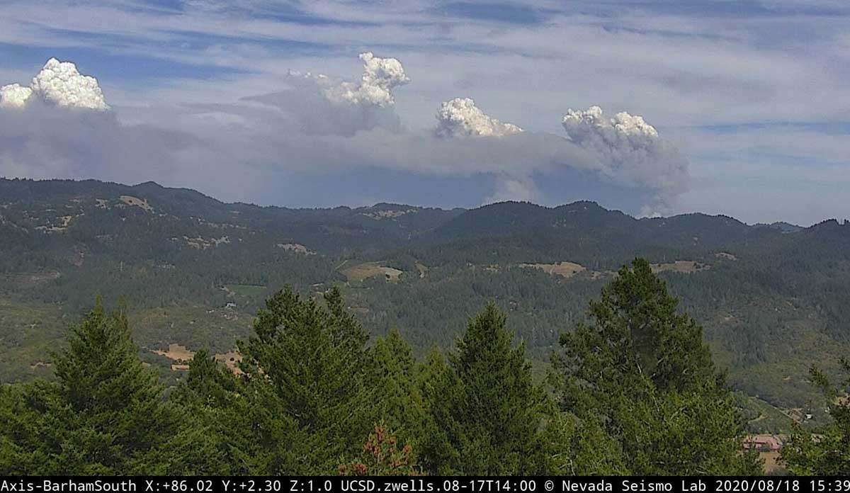
The photo below with four pyrocumulus clouds forming above the rapidly spreading fires is very impressive.

LNU Lightning Complex of fires
LNU Lightning Complex of fires August 18, 2020
LNU Lightning Complex of fires
LNU Lightning Complex of fires near Berryessa Lake, August 18, 2020

Time-lapse camera records moment a passing thunderstorm changes spread direction of Hennessey Fire

Napa County, California

August 18, 2020 | 2:25 p.m. PDT

Hennessey Fire 13 miles north of Napa, California, August 17, 2020. Screenshot from the video below. This shows the smoke after the wind shift.

A time-lapse camera at Atlas Peak in Napa County, California recorded the moment a wind shift caused by a passing thunderstorm August 17, 2020 suddenly changed the direction the Hennessey Fire was spreading.

If firefighters find themselves in a situation where thunderstorms could influence the wind direction on a fire, they should ensure they are in a safe location. A passing thunderstorm changed the wind direction on the Yarnell Hill Fire June 30, 2013 entrapping and killing 19 firefighters.

(To see all of the articles on Wildfire Today about the lightning-caused wildfires in California, including the most recent, click HERE.)

As of August 18 the Hennessey Fire has burned 2,700 acres; 205 structures are threatened and evacuation orders are in place. Three structures have been destroyed.

Anyone having trouble viewing the video can see it a YouTube.

Thanks go out to @bbdd333 who made the raw video footage available to us.