Congress takes another tentative step toward developing a wildland fire bill

The Senators hope the public will give them input on the proposal.

Five U.S. Senators are supporting a concept for a bill, or as they call it, a “discussion draft”, that would affect wildland firefighting. The document is being floated as a trial balloon to solicit input. If the draft ever becomes a proposed bill, it will no doubt look different in its final form, with some provisions added and others removed.

“In an effort to move the discussion forward, we are asking for feedback on a diverse set of ideas to tackle the challenges of catastrophic wildfires,” said Maria Cantwell (D-Wash.), the panel’s top Democrat. “While not perfect, we are working to drive the discussion toward consensus and a 21st century management strategy.”

Fire Funding

Named the “Wildfire Budgeting, Response, and Forest Management Act of 2016”, it would begin by fixing the inadequate funding of suppressing wildfires, ending the cumbersome practice of having to borrow funds from non-fire accounts to pay for suppression costs. This issue has been cussed and discussed ad infinitum for years with broad bipartisan support, but Congress has failed to take any meaningful action on the problem.

The Holy Grail

One issue that we have written about many times and called the “Holy Grail of Firefighter Safety”, is addressed. Our concept is to provide two pieces of real time information to the management team or supervisors on a wildfire: the location of the fire and the location of firefighters.

The discussion draft addresses the fire’s location by requiring that Federal and State wildland firefighting agencies develop, by March 1, 2018, “protocols and plans for the use of unmanned aircraft systems (UAS) … to detect spot fires, assess fire behavior, develop tactical and strategic firefighting plans, position crews, and enhance firefighters’ safety”. And it mentions an “ortho rectified map”. Sadly, it does not specifically require that a system be implemented that will provide the information in real or near-real time, but if you’re going to hit every item on that list, it pretty much has to be real time data, or close to it.

The other half of the Holy Grail, the location of firefighters, is also covered. By March 1, 2018 the Departments of Interior and Agriculture “shall jointly develop and operate a tracking system to remotely locate the positions of fire crews assigned to Federal Type 1 Wildland Fire Incident Management Teams”. Their locations would be depicted on an ortho rectified map developed by the UAS.

Unified system for carding firefighting aircraft

There would be a single system, by March 1, 2018, “for providing credentials to all Federal and State-certified aircraft, personnel (including pilots and maintenance personnel), and firefighting support equipment for fires on Federal land and for firefighting operations conducted by, or in cooperation with, Federal agencies”. Until that system is up and running, all Federal and State wildland firefighting agencies would accept the standards of each other.

Miscellaneous

Other provisions would ease some environmental regulations for certain hazard fuel reduction projects, require an inventory of 452,000 acres of young-growth timber stands on Alaska’s Tongass National Forest, and make any money left over from fire suppression funds at the end of the year available for hazard fuel reduction projects. (If you’re thinking inventorying half a million acres of the Tongass NF has nothing to do with wildland fire, you are correct.)

Supporters

If this discussion draft morphs into actual legislation, more Senators will publicly support it, but for now the list includes Senator Lisa Murkowski (R-AK), Senator Maria Cantwell (D-WA), Senator Ron ‎Wyden (D-OR), Senator Michael Crapo (R-ID), and Senator James Risch (R-ID).

A previous trial balloon

In July of 2015 the Democratic Staff of the U.S. Senate Committee on Energy and Natural Resources prepared a list of concepts, called a White Paper, that also was a hopeful step toward an actual bill. It had one important provision that is lacking in this latest discussion draft. It would have revised or repealed Public Law 107-203 that was passed in 2002 as a reaction to the ThirtyMile Fire the previous year. That law resulted in a crew boss on the fire being charged with 11 felonies, including four counts of manslaughter. Since then firefighters that witness accidents have been advised to lawyer-up and reveal as little as possible about what they know, reducing the opportunities for learning lessons — possibly resulting in more firefighter fatalities down the road. This law has also led to accident investigations and fatality reports that do not identify the causes, squandering learning opportunities.

The revision or repeal of Public Law 107-203 is very important.

You can read the entire Discussion Draft HERE.

If you have an opinion about what is, or is not in this discussion draft, contact your Senators and/or put your thoughts in a comment below.

One company’s solution to tracking firefighting resources in real time

Firefighting agencies that are uncomfortable sending wildland firefighters into dangerous areas without knowing in real time exactly where they are in relation to the flaming front of the fire now have more choices about how to avoid this dangerous practice that has contributed to the deaths of more than two dozen firefighters.

This video by the Southern Rockies Fire Science Network describes a collaborative project between the City of Boulder, Colorado and PAR Government to work toward what we have called the Holy Grail of Firefighter Safety — knowing the real time location of personnel and the fire.

This and the efforts of other companies along the same lines are making it more difficult for firefighting agencies to find excuses for their failure to implement solutions similar to this. I’m looking at YOU, U.S. Forest Service, National Park Service, Bureau of Land Management, Bureau of Indian Affairs, and Fish and Wildlife Service — as well as the state fire organizations that employ large numbers of wildland firefighters. Leadership is needed NOW to develop standards so that the tracking systems deployed are interoperable.

Articles on Wildfire Today tagged “holy grail“.

Thanks and a tip of the hat go out to Daniel.

Colorado to evaluate devices for tracking firefighters

Wildfire Today has unabashedly advocated the the use of devices that would make wildfire supervisors aware in near-real-time the location of their firefighting resources. Our thinking is, if that and the location of the fire were known on the Yarnell Hill and Esperanza Fires the lives of 24 firefighters might have been saved. (See tag for “Holy Grail of Wildland Firefighting Safety”).

In 2014 the governor of Colorado signed legislation creating the Center of Excellence for Advanced Technology Aerial Firefighting (CoE), whose mission statement says they will:

…research, test, and evaluate existing and new technologies that support sustainable, effective, and efficient aerial firefighting techniques.

Apparently the organization interprets that mission very broadly since they have started a study to evaluate the effectiveness and practicality of small GPS-enabled devices that can communicate with firefighters on the ground and keep track of their location via satellites.

In 2012 the U.S. Forest Service bought 6,000 devices like this. We have not heard much about how that acquisition turned out.

Below is information about the new Colorado project provided by the (CoE).

****

“In the interest of improving communications for, and safety of, wildland firefighters, the Center of Excellence (CoE) is evaluating the use of satellite-based messenger devices by Division of Fire Prevention and Control (DFPC) firefighters and cooperators. These devices can enable firefighters to send messages and they also track the location of personnel without using cellular or conventional radio networks. To date, the primary users of these devices have been the civilian outdoor community; however, military and civil government agencies have begun experimenting with integrating these devices into their operations. Early results show that satellite messengers can be effective at supplementing existing radio and cellular communication networks.

Device Overview

Two types of devices are being evaluated by the CoE. The first is the lower-cost SPOT Gen3, which can send one-way messages over the Globalstar satellite network. Since SPOT Gen3’s have sending capability only, it is not possible to obtain delivery confirmations for successful messages. To increase the probability that messages are successfully delivered, the SPOT sends multiple copies of the same message.

The SPOT Gen3 device can send the following types of messages:Spot3

  • An SOS message that triggers a search and rescue response
  • A “Help” message that delivers a preset distress message and the device’s location to designated contacts
  • A customized message with preset content that is input into the SPOT website prior to a trip
  • A message stating that the device user is “OK,” which is sent to designated contacts
  • Tracking points sent at preset intervals that show the device’s current location

The second device that the CoE is evaluating is the DeLorme inReach. Two models of the inReach are being evaluated—the basic model and a premium model that includes GPS mapping and navigation. The inReach can send two-way messages over the Iridium satellite network, which provides delivery confirmations for successful messages. In addition, text messages can be sent to firefighters in the field.

The DeLorme InReach device can send the following types of messages:De Lorme InReach

  • An SOS message that triggers a search and rescue response, though in this case the search and rescue coordination center can customize the response based on a text message conversation with the device user
  • Preset or customized messages sent via a virtual keyboard, or the inReach device can pair with Apple or Android smartphones and allow users to control all features of the device, including text input through their smartphones
  • Tracking information at preset intervals

The SPOT Gen3 device retails for $149.99, the DeLorme inReach base model (inReach SE) for $299.99, and the premium model (inReach Explorer) for $379.99. Satellite service subscriptions comprise a substantial portion of the cost of operating these devices, with cost primarily governed by how frequently tracking points can be sent by the device. Service for the SPOT device must be bought on an annual basis, while service for the DeLorme devices can be purchased on either an annual or a month-to-month basis. If the DeLorme devices are used for 8 months or less each year, the month-to-month plan will be the most cost-effective option.

Summary of Device and Service Costs:

SPOT (annual) DeLorme Contract (annual) DeLorme Month-to-Month (plus $24.95 annual fee)
Device Cost $149.99 $299.99/$379.99 $299.99/$379.99
Base Option
  • $150
  • Location every 10 minutes
  • User must push tracking button every day
  • Predefined messages
  • $300
  • Location every 10 minutes
  • 40 texts/month
  • $34.95/month
  • Location every 10 minutes
  • 40 texts/month
Mid-Range Option
  • $200
  • Location every 5 minutes
  • Predefined messages
  • $600
  • Location every 10 minutes
  • Unlimited texting
  • $64.95/month
  • Location every 10 minutes
  • Unlimited texting
Premium Option
  • $300
  • Location every 2.5 minutes
  • Predefined messages
  • $960
  • Location every 2 minutes
  • Unlimited texting
  • $99.95/month
  • Location every 2 minutes
  • Unlimited texting

The following chart represents the cost of buying and operating a device for two years, assuming that the DeLorme devices are on the month-to-month plan and are used for 6 months each year:

personnel tracker chart

An enterprise plan is also available for the DeLorme devices. This plan charges for each byte of data used by the device rather than by the various texting and tracking features. As a result, a direct comparison to the consumer plans is difficult, but superior value may be found if usage is carefully monitored. Real-world testing of this plan is being conducted by the CoE to gain insight into its value.

Both the SPOT and DeLorme devices may be used by DFPC wildland fire personnel during fire assignments and remote project work. Using either device, personnel in need of emergency medical assistance or personnel lost in the wildland will be able to summon search and rescue assistance. Additionally, personnel will have the ability to send messages with other content to supervisors or incident commanders, though this functionality is limited with the SPOT device. Finally, the location of personnel can be tracked in near real-time using either the companion websites for the devices or using the Colorado Wildfire Information Management System (CO-WIMS).”

Legislation introduced to acquire system to track location of state firefighters in Washington

Photo above: 19 white hearses brought the Granite Mountain Hotshots back to Prescott, Arizona, July 7, 2013. They were killed after being overrun by the Yarnell Hill Fire. Photo by Bill Gabbert.

A bill introduced in the Washington state legislature would provide for state employed firefighters a system that would track their location. Knowing where firefighters are while working on a rapidly spreading fire is crucial to ensuring their safety, and is half of what we have called Holy Grail of Firefighter Safety. The other half is knowing the real time location of the fire relative to the personnel. If a Division Supervisor, Operations Section Chief, or Safety Officer is monitoring this information they could potentially warn firefighters that their present position is in danger when the fire begins to spread in their direction. A system like this might have saved 24 lives on the 2013 Yarnell Hill and 2006 Esperanza Fires. In both cases the firefighters and their supervisors did not have a clear understanding of where the fire and the firefighters were.

In a January 18 article about how to reduce the number of fatalities on wildland fires, we wrote:

When you think about it, it’s crazy that we sometimes send firefighters into a dangerous environment without knowing these two very basic things.

Below is a section from House Bill 2924 as introduced in the Washington State Legislature on January 27, 2016, sponsored by six lawmakers:

…Require all fire suppression equipment and personnel in its employ or direction to be outfitted with an electronic monitoring device that utilizes global positioning system technology to protect the safety of wildland firefighters…

The Seattle Times wrote about the proposed legislation. Here is an excerpt:

…DNR has done some early research on GPS, according to Bob Johnson, the agency’s wildfire-division manager. Setting up a system could cost $1.5 million, Johnson told lawmakers.

“Improving safety for our firefighters is paramount and we’d view this technology … as a viable supplement to existing safety measures,” wrote Mary Verner, DNR’s deputy supervisor for resource protection. “Though, it, like many technologies, does have its limitations.”

Challenges, benefits

GPS locaters are used by various departments and agencies around the country, according to Triplett.

But there aren’t yet national standards for GPS systems, so when firefighters come from different agencies or another state to fight large blazes, they may not have equipment that works together, according to Triplett.

Steve Pollock, chief regional fire coordinator for the Texas A&M Fire Service, said it took about three years to develop that agency’s GPS system. When it goes live in July, it will be able to track more than 200 bulldozers, fire engines and coordinating vehicles, he said…

There needs to be leadership, nationally, to develop standards for firefighter tracking systems so that the devices used by different agencies are compatible and interoperable. This should be the duty of the National Wildfire Coordinating Group, National Association of State Foresters, U.S. Forest Service, National Park Service, and Bureau of Land Management.

If individual state and local organizations spend millions on stand-alone systems that can’t be used outside their jurisdictions it will be FUBAR. Leadership is needed. Today.

Colorado’s Multi Mission aircraft enhance firefighter safety

Colorado MMA
One of the two Multi Mission Aircraft owned by the Colorado Division of Fire Prevention and Control. CDFPC photo.

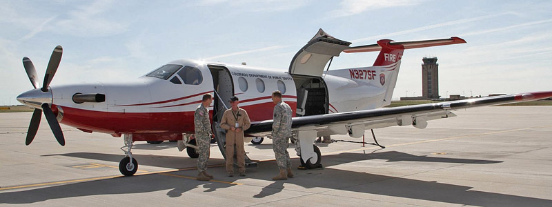
The two Multi Mission Aircraft (MMA) recently purchased by the Colorado Division of Fire Prevention and Control could be significant progress toward what we have called the Holy Grail of Firefighter Safety — knowing the real time location of a wildfire and firefighters.

The Pilatus PC-12 single-engine aircraft have sensors on board combined with communications and software capabilities that can provide a version of the Holy Grail to office-bound fire managers as well as firefighters on the ground.

Operating well above firefighting air tankers and helicopters, the MMAs have two cameras, color and infrared. The color camera provides video similar to that used by news helicopters orbiting over a wildfire in California. The heat-detecting infrared sensor can map the location of large fires and can find small ones that can be difficult or impossible to spot from the air using just human eyesight. The cameras can be used to monitor the locations of firefighters on the ground, however their identities or resource designators would not be automatically provided.

The suite of communications and software, called Colorado Wildfire Information Management System (CO-WIMS), transmits the data from the sensors in a usable form to a network where it can be accessed by authorized personnel in offices, fire apparatus, and firefighters on the ground with hand held devices.

Half of the Holy Grail appears to be provided with the MMAs — the real time or near-real time location of the fire. The other half, knowing the location of firefighters, can be determined to a certain extent, but only if the equipment operator devotes a significant amount of their time using the cameras to follow personnel and equipment on the ground. On a small fire this could be done while still maintaining the big picture of the spread of the fire, but on large incidents with hundreds or thousands of resources, it would be impossible. However, if a crew reported that they were in a dangerous situation (think Yarnell Hill Fire, where 19 firefighters died), perhaps the operator could use the infrared and visual sensors to locate them and relay that information to resources on the ground or in the air that could provide assistance.

The wildland firefighting agencies still need to adopt hardware and communications systems that can track every piece of apparatus, crew, and any resource operating alone on the fireline. That information could then be accessed on a display that could be monitored, at a minimum, by a Safety Officer, and others as needed; eventually by fire supervisors with hand held devices.

Some of the air attack aircraft under federal contract either have or will have video capabilities similar to that on Colorado’s MMAs, but a system needs to be utilized by the U.S. Forest Service and other agencies that can make it usable to firefighters on the ground. Colorado has provided a template proving it can be done.

The CO-WIMS being used now by Colorado to provide real time intelligence is a huge step forward. While the state is far from developing a comprehensive organization for responding to and managing wildland fires, they deserve kudos for what they have already implemented with the MMAs and CO-WIMS.

It’s kind of like a homeless person being given a pair of $500 shoes. It’s a nice addition to their wardrobe, but there is still more that needs to be done.

More information: A .pdf version of a DCFPC presentation about the MMA and CO-WIMS at the October 21-23, 2015 Colorado State Fire Chiefs Fire Leadership Conference.

The following videos demonstrate some of the intelligence gathering capabilities of the MMA:

Continue reading “Colorado’s Multi Mission aircraft enhance firefighter safety”

USFWS employee receives award for suggestion to track firefighters with transmitter collars

Barton Rye award
FWS Branch Chief John Segar presents National Safety Award to Barton Rye Credit: Josh O’Connor, USFWS

Tallahasee, Florida – On May 7, the U.S. Fish and Wildlife Service (FWS) presented its second annual National Fire Safety Award to Barton (Bart) Rye, Prescribed Fire/Fuels Technician from St Marks National Wildlife Refuge for a simple suggestion that helped direct a lost firefighter to safety during a prescribed fire.

The Award, presented by John Segar, FWS Chief, Branch of Fire Management from the National Interagency Fire Center, recognizes Rye for his innovative use of Global Positioning System (GPS) technology to more easily map, track and monitor the location of multiple firefighters, vehicles, and aircraft during large burns on the 70,000-acre refuge.

Rye suggested that his fire crew on foot and all-terrain vehicles (ATVs) carry GPS transmitter collars, like those worn by his hunting dogs, so that up to ten resources could be tracked in real-time by a Burn Boss on a single hand-held receiver. ATVs and dozers on southeastern forests commonly become high-centered on hard-to-spot stumps in heavy vegetation where they cannot be readily seen by others, risking the loss of life and/or equipment during fires.

transmitter collar

The refuge first tested the use of the collars last spring. When a firefighter unfamiliar with southeastern terrain walked into a sawgrass pond while igniting a burn and becoming disoriented in knee-deep water with grass over his head, the GPS device allowed the Burn Boss to verbally direct the firefighter out of harm’s way. In February, a helicopter working a 3800-acre burn carried a collar to allow immediate location of the aircraft in case of an accident.

transmitter collar

“Bart’s initiative added a level of safety that wasn’t there before and may very well lead to national implementation,” said Segar. “This system is off-the-shelf and simple to operate.”

The Refuge purchased two hand-held receivers — one each for a Burn Boss and Firing Boss — and a transmitting collar for each prescribed fire crew member. A single transmitter and hand-held receiver together cost about $500.

St. Marks National Wildlife Refuge along Florida’s Gulf Coast conducts 40-50 prescribed burns annually, averaging 300-400 acres each, to reduce the risk of wildfire and maintain fire-resilient landscapes.

firefighter tracking
Map showing the tracks of three firefighters on a prescribed fire, in green, red, and blue.

(All photos were provided by the FWS.)
(Note from Bill: The Garmin website has information about one of their tracking systems.)