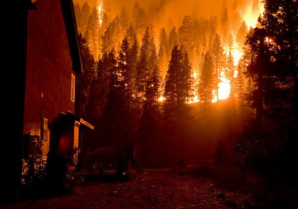
Wildfire news, October 6, 2012

Idaho Governor has recommendations on how to reduce damage from wildfires

The Governor of Idaho, C.L. “Butch” Otter, in an opinion article published under his name, has some recommendations about how to reduce the adverse impacts from wildfires. They include more roads, grazing, and logging.

Smoke from Idaho’s Mustang Fire had elevated levels of radiation

The Idaho Department of Environmental Quality tested the air quality near the Mustang Fire and said that even though they found “definitely elevated” levels of radiation, it did not pose a risk to human health. The air samples were obtained in the nearby town of North Fork. As Wildfire Today told you on September 21, the fire burned through four former mining sites that had traces of radioactive uranium and thorium.

The Chicago Tribune reports:

…Paul Ritter, health physicist with the state environmental agency, said in the area of the mining sites, smoke from the fire showed amounts of radiation roughly equivalent to emissions from a fire in 2000 that charred parts of Los Alamos National Laboratory, the nuclear weapons design facility in New Mexico.

“The readings are definitely elevated but not out of line with what has been measured in fires before. It is not a risk,” he said.

Americans are exposed to an estimated 310 millirems of radiation a year from natural sources, including some rocks and soils, according to the U.S. Nuclear Regulatory Commission.

An analysis of air samples in North Fork showed residents would have been exposed to 0.5 millirems of radiation in a 30-day period. That compares to a dose of 5 millirems delivered by a round-trip transcontinental flight, Ritter said.

Utah students influence legislation about wildfires

Some high school students in Utah who were interested in the effects of climate change talked to state Representative Kraig Powell, who, according to a report in Power Engineering:

…has opened a bill file for legislation that would examine how climate change is expected to drive more and bigger wildfires and to begin planning for future wildfire fighting and suppression costs.

In early meetings with Powell, [the students] shared some of what they had learned about wildfire in Utah. For instance, they told how the state already has seen 400,000 acres burned this year with suppression costs of $47.1 million — part of a trend prompted by record hot and dry periods.

They also told how rehabilitating burned areas often costs more than fighting the wildfire itself. Their example? The 2007 Milford Flat fire which racked up a $5 million bill for suppression, while rehabilitating the scarred forest and range cost $17 million.

That’s what led to the concept for the bill, which is currently being drafted by the Legislature’s lawyers.

“I’ve been learning a lot,” Powell said. “It’s not a simple science.”

Meth production may have caused brush fire

Michigan State Police are investigating a small wildfire that may have originated from an attempt to cook meth in Marquette Township.

Firefighter on Idaho fire survives pneumonia and septic shock

Having medical personnel on a fire with the ability to administer IVs may have prevented a death on the Halstead Fire near Stanley, Idaho in September.

The firefighters at the incident base were sleeping in cold, damp, conditions. At times the temperature was as low as 12 degrees at night and inversions caused the area to be smoked in.

The firefighter was diagnosed with septic shock which has a death rate of over 60 percent. The initial treatment by a medic may have saved his life. Congratulations to the medic for the treatment provided, and to the Incident Management Team for having a Medical Unit on scene with the ability to administer IVs.

Here are some excerpts from the Facilitated Learning Analysis:

============================================================

On September 13, 2012, “Jim”, a firefighter from the Halstead fire, near Stanley, Idaho, was transported via ambulance to a hospital in Ketchum, Idaho. The next morning he was transported by life flight to Twin Falls, Idaho. He was diagnosed with pneumonia and sepsis [blood poisoning], and was suffering from septic shock. He stayed in the ICU for two days and remained in the hospital for three additional days.

[…]

In the days leading up to the incident, the Medical Unit on the fire reported having 30 to 40 cough and cold symptom related cases a day; roughly 10 to 15 percent of the people in camp.

[…after being treated at the fire and while being transported to the hospital…]

The next morning the attending physician elected to transport Jim via life flight to a larger medical facility in Twin Falls. Jim had been diagnosed with pneumonia and sepsis, and was suffering from septic shock. In layman’s terms that means he had fluid in his lungs and was suffering from blood poisoning, and the blood poisoning sent his body into shock. The doctor’s assessment was that the blood poisoning was caused by the pneumonia.

The next morning CRWB(t) saw Jim just after he had a “central line” put in his neck. A centralline is used to administer medication or fluids, obtain blood tests (specifically the “mixed venous oxygen saturation”), and directly obtain cardiovascular measurements such as the central venous pressure. CRWB(t) saw quite a bit of blood on Jim and saw his demeanor and became very concerned. He asked one of the hospital staff how Jim was doing and the person replied by asking CRWB(t) how old he was. CRWB(t) said “27” and the person said, “If this had happened to you, you would be dead right now.” CRWB(t) did not leave Jim’s side from that moment until Jim’s mom came to look after him.

According to WebMD (www.webmd.com), permanent organ damage can occur in people who survive sepsis, the death rate for sepsis is 20%, and the death rate from septic shock is over 60%.


Fire allegedly set by firefighter burns 430 acres in Idaho

BAe-146 on Karney Fire
A BAe-146 air tanker makes a drop on the Karney Fire northeast of Boise. (Inciweb photo)

The Karney fire that according to Boise County Sheriffs office officials was allegedly set by an 18-year old volunteer firefighter, has burned 430 acres 6 miles northeast of Boise, Idaho. The fire is about a mile west of the community of Robie Creek and is being managed by a Type 2 incident management team led by Incident Commander Mike Wilde.

More information about the Karney Fire.

Strong winds hit Mustang Fire in Idaho

Mustang Fire, Old Alta Ranger Station. Photo by J. Hibbard/USFS
On the Mustang Fire, the old Alta Ranger Station is covered in fire shelter wrap. Photo by J. Hibbard/USFS

Red Flag warnings brought stronger winds and low humidities to one of the megafires in Idaho, but as of 4 p.m. on Monday, the winds have not been quite as powerful as predicted in the Red Flag Warning that covered Sunday and Monday.

Mustang Complex

On the Mustang Complex the winds did not hit until 6 p.m. on Sunday. At the Squaw Creek weather station on the east side of the fire they averaged 10 to 13 mph with gusts of 18 to 27 for about six hours, then slowed until they increased at 2 p.m. on Monday, blowing at 11 mph with gusts to 21 along with a RH of 13%. But at the Pinyon Peak weather station farther west the winds have been consistently strong, averaging around 20 mph with gusts in the 30s and 40s.

There were some areas of growth in the northwest corner of the fire in a wilderness area.Additional activity was near the Gattin Ranch, but with support from helicopter water drops firefighters were able to defend the community. The anticipated fire growth along the Highway 93 corridor only occurred in the southeastern corner of the fire near North Fork, where the fire progressed down Donnelly Gulch towards the Salmon River.

Firefighters on the fire are not using any air tankers, but say the helicopters are sufficient for thier needs. They recorded 38 hours of time on the ships Sunday.

Evacuation orders are still in effect for the Highway 93 corridor.

Trinity Ridge

Strong winds have not occurred on this fire. Over the last 24 hours they have been averaging from 1 to 5 mph with some gusts at 12 to 20. But the RH Monday afternoon has been in the single digits at a nearby weather station.

The fire is showing very little heat detected by satellites, however there are two areas on the east side with heat near the perimeter that could be problematic.

Halstead Fire

This fire has also been spared from the strong winds mentioned in the Red Flag Warning for Sunday and Monday. Fire managers were thinking that if the fire made it through the Red Flag Warning with no significant growth then it would be pretty much over. However on Sunday there was additional growth on the north side amounting to over 600 acres. The fire did not use any helicopter time on Sunday, in fact they loaned two Type 1 helicopters to other fires, the Mustang Complex and a new fire near Boise.

Kari Greer photos from the Trinity Ridge Fire

Trinity Ridge fire, cabin, August 24, 2012, photo by Kari Greer for USFS
Trinity Ridge fire, August 24, 2012, photo by Kari Greer for USFS

Kari Greer is at it again… taking great photos for the U.S. Forest Service at a wildfire. These were all shot in mid to late August at the Trinity Ridge Fire in Idaho. You can see the another 600 or so HERE. Excellent job, Kari. And again we congratulate the USFS for their wisdom to arrange to have a great photographer document some of the major fires we are experiencing.

Trinity Ridge fire, August 17, 2012, photo by Kari Greer for USFS
Trinity Ridge fire, August 18, 2012, photo by Kari Greer for USFS

Continue reading “Kari Greer photos from the Trinity Ridge Fire”

Idaho’s three megafires

Halstead fire
Halstead fire as seen from Yankee Fork Rd near SunBeam, August 30, 2012, Photo by Crig Daughtry

There are currently three uncontained wildfires that are larger than 100,000 acres. For purposes of this discussion, we will call 100,000 the minimum size for a megafire.

All three of these fires are in Idaho, and two are on the Salmon-Challis National Forest. Those two are the Mustang Complex and the Halstead Fire and are under the direction of Jim Loach’s Area Command Team. The third fire is the Trinity Ridge Fire on the Boise National Forest.

map of Mustang, Halstead, Trinity fires
Map showing the location of the Halstead, Mustang, and Trinity fires, September 5, 2012. (click to enlarge)

Here are some stats we compiled from InciWeb and the National Situation Report about these three megafires:

Megafire stats - September 5, 2012

The cost to date for these three fires totals over $73,000,000. They are tieing up 2,653 firefighting personnel. We don’t know what the weather and fuel conditions were when the fires were first reported, or what the commitment was to an aggressive initial attack strategy. Maybe there was no chance in hell of catching them early. But if initial attack had been successful on these three fires, over $71,000,000 could have been saved and 2,653 firefighting personnel could be doing something else. In some cases a significant investment in initial attack resources, both ground and air, can save large sums of taxpayer dollars later.

It is not likely that any of these fires are going to be contained or controlled anytime soon. Now that we are into the month of September, I imagine the Incident Management Teams are looking carefully at the fire and weather history of the area, hoping to have a weather related fire season ending event in the near future.

Predicted containment dates on large fires, especially megafires, are frequently picked out of the air (or some other more intimate location) and are relatively meaningless if they are farther out than a few days. In this case, the predicted containment dates for the three fires range from September 30 to October 16. In case you’re wondering which year, they all selected 2012.  Whew!

The IMTeam on the Mustang Complex dashed hopes for a quick containment with this statement on their InciWeb page:

Containment [of 16%] will not change in the near term future due to current point protection strategies.

Abandoning containment for point protection may or may not be temporary, and is usually due to extreme weather and/or fire behavior, extreme topography, a shortage of firefighting resources, management direction to be less aggressive in suppressing the spread of the fire, or a combination of some of these.