Stagecoach Fire continues to burn in Kern County, California

August 6, 2020 | 7:28 a.m. PDT
Map of the Stagecoach Fire
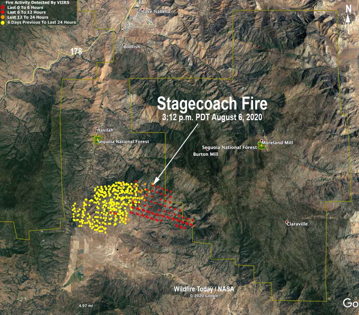
Map of the Stagecoach Fire showing heat detected by a satellite as late as 3:12 a.m. PDT August 6, 2020.

The Stagecoach Fire 21 miles east of Bakersfield was very active Wednesday, putting up a large column of smoke as it spread into more rugged terrain primarily to the east and southeast. The fire is 9 miles south of the town of Lake Isabella.
Stagecoach Fire
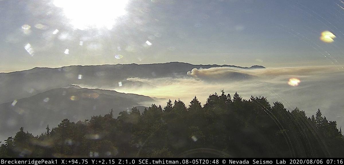
Stagecoach Fire, from Breckenridge, at 7:16 am PDT Aug 6, 2020.

Wednesday at 7 p.m. fire officials with Kern County said it had burned 4,250 acres. Heat detected by satellites at 3:12 a.m. Thursday shows the fire could have grown by another 2,000 acres during the night (see map above). The unconfirmed satellite data indicates the Stagecoach Fire has moved into the Sequoia National Forest after burning on private property and land protected by the Bureau of Land Management.

Evacuations are in effect.

Stagecoach Fire
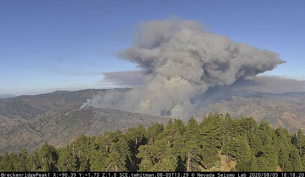
Stagecoach Fire as seen from Breckenridge, looking east at 6:18 pm PDT August 5, 2020.

As of Wednesday morning the Stagecoach Fire south of Lake Isabella in Kern County California had burned 4,100 acres, a spokesperson for CAL FIRE said. During the afternoon the intensity increased, sending up a large smoke column.

At least two homes have been destroyed as the fire continues to spread to the east.
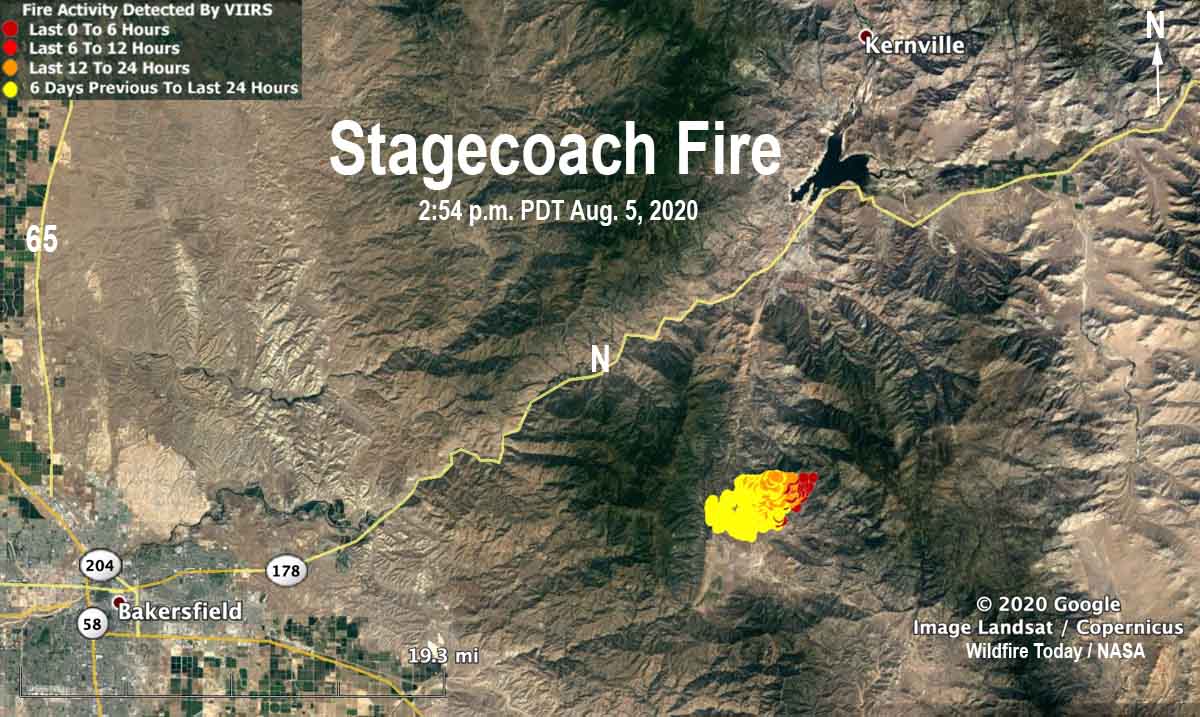
Map of the Stagecoach Fire
Map of the Stagecoach Fire showing heat detected by a satellite as late as 2:54 p.m. PDT August 5, 2020.

Not much information about the fire is being released by Kern County.

To see all articles on Wildfire Today about the Stagecoach Fire, including the most recent, click here.
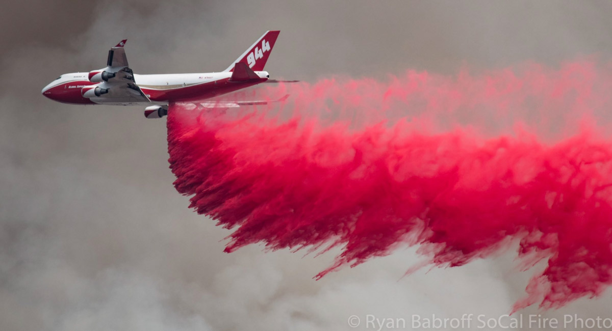
Air Tanker 944, a 747, drops on the Stagecoach Fire
Air Tanker 944, a 747, drops on the Stagecoach Fire August 4, 2020. Photo by @SoCalFirePhoto.
CAL FIRE Dozer 1743 on the Stagecoach Fire
CAL FIRE Dozer 1743 on the Stagecoach Fire. CAL FIRE photo.
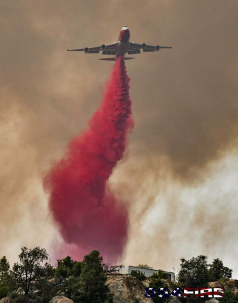
Air Tanker 944, a 747, drops on the Stagecoach Fire
Air Tanker 944, a 747, drops on the Stagecoach Fire August 4, 2020. Photo by @564fire.

Stagecoach Fire burns thousands of acres south of Lake Isabella, CA

Evacuations are in effect

August 4, 2020 | updated at 9 p.m. PDT

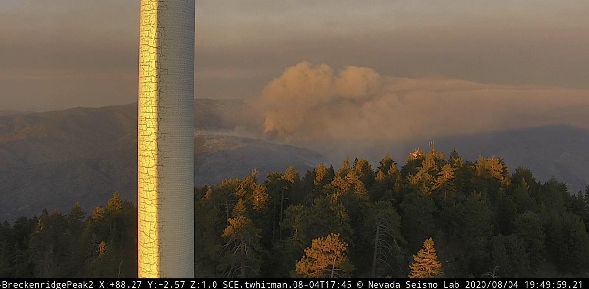
Stagecoach Fire
Stagecoach Fire, looking east from Breckenridge Peak at 7:49 p.m. PDT August 4, 2020.

Not much information is available about the Stagecoach Fire that was reported at 3:29 p.m. August 3 South of Havilah, California in Kern County off Stagecoach Drive and Old Ox Road. Tuesday morning Kern County Fire Department said it had burned 2,500 acres, and updated the size to 3,500 acres at 8 p.m. The fire is spreading primarily to the east and northeast.

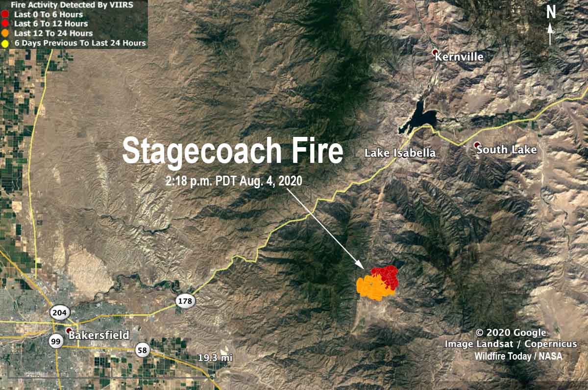
The Stagecoach Fire is burning on private property and land protected by the Bureau of Land Management between two large parcels of the Sequoia National Forest. It is 12 miles south of Lake Isabella and 22 miles east of Bakersfield. (See the map below.)

To see all articles on Wildfire Today about the Stagecoach Fire, including the most recent, click here.
Map of the Stagecoach Fire
Map of the Stagecoach Fire showing heat detected by a satellite as late as 2:18 p.m. PDT August 4, 2020.

Soon after it started Kern County said structures were threatened.

At 8 p.m. PDT we checked FlightRadar24 and saw that at least two air tankers were working the fire, a DC-10 and a BAe-146.

Below is an excerpt from an article at ABC23 in Bakersfield:

…One of the first homes to burn in the fire was a total loss. On Monday, 23ABC spoke with the home’s owners as they evacuated the area. Still emotional after losing their property, they thought fire crews should have done more.

“They said the road’s too narrow. We’re not going down there. We’re not defending that,” the homeowner said. “So they’re up in all the neighbor’s houses and everything. And the fire is going everywhere else, but it’s going straight up in our house and that’s it.”

Resources assigned to the Stagecoach Fire include 21 fire engines, 3 water tenders, 3 helicopters, 7 hand crews, 3 dozers, and a variable number of air tankers (up to 4 at one point), for a total of 242 personnel.

Refuge Fire burns 2,500 acres in Kern County, California

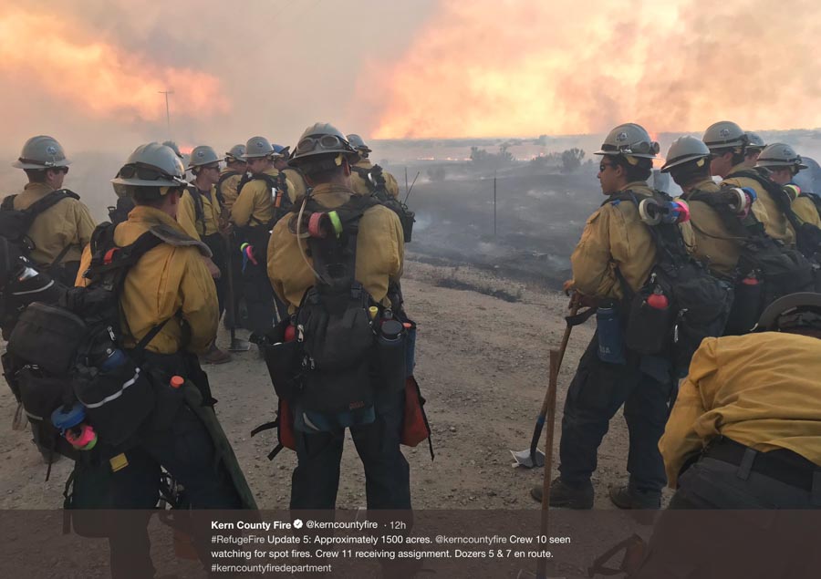
Refuge Fire

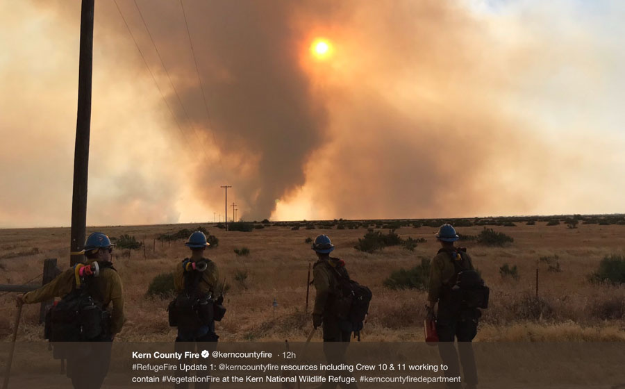
A wildfire in the Kern National Wildlife Refuge 36 miles northwest of Bakersfield, California had burned approximately 2,500 acres as of 10 p.m. PDT Tuesday night. The fire was reported at about 5 p.m. and at one point the Incident Commander said he had seen 100-foot flame lengths in the riparian area but by 10 p.m. firefighters were gaining some containment.

Wednesday morning the Kern County Fire Department announced that thanks to crews working throughout the night the fire was 100 percent contained and the size estimate remained at 2,500 acres.

map Refuge Fire
The red dot represents heat at the Refuge Fire detected by a satellite at 11:30 p.m. PDT May 7, 2019.

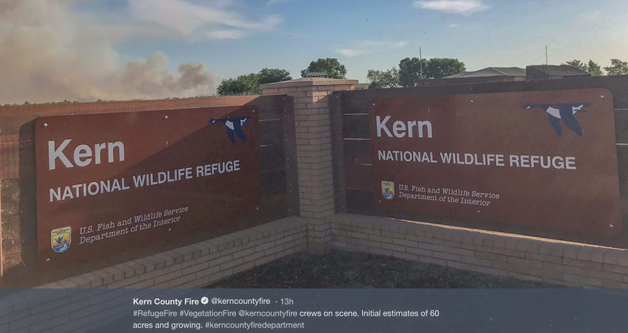
All of these photos and videos were taken by the Kern County Fire Department.

Refuge Fire

Refuge Fire