Guest post: Public information on the Las Conchas fire

Today we have a guest post written by Dan O’Brien, who has over 39 years of experience in wildland fire management. Dan was Chief of Fire and Aviation for three different regions in the National Park Service: the North Atlantic, Rocky Mountain, and Intermountain regions. Currently he is on the staff of Wildland Fire Associates.

==============================

Dan O'Obrien
Dan O’Brien

I have always thought fire information folks have one of the most difficult jobs in fire. They must get the information their different audiences are looking for and distribut it in a timely manner. Operations folks are charged with managing the “actual fire”, but the information staff must manage the “perceived fire” through the information they distribute. While different information outlets are aimed at different audiences it seems that there are often significant gaps, inconsistencies and timeliness issues in the information released.

With regard to information concerning the Las Conchas Fire today (7/1/11) NICC’s daily Situation Report references such current information as:

Active fire behavior. Numerous residences threatened. Evacuations in effect.

It would seem that “numerous residences threatened” might be a bit of an understatement considering there are 11,000 residents in Los Alamos, but it is not mine to split hairs.

Today’s InciWeb page concerning the Las Conchas Fire seems to target the locals and their concerns. Meeting places and times, shelters, closures, pet issues, number and type of resources, etc. are important issues that are adequately addressed. Additionally, there are descriptions of yesterday’s fire behavior, operational objectives and strategies. All this information is accurate, but what is the significance of making all this information available without interpreting it to the public? Reporting 4 dozers, 67 engines, 24 water tenders is pretty useless information in and of itself. Explaining that the engines and water tenders are being used to directly protect residences and other values would go much farther in helping the public understand the need for these and other resources and could go a long way in helping to correctly develop the public’s perception of the fire. I have never heard any information about the effect, positive or negative, of the 2000 Cerro Grande fire on the management of the Las Conchas Fire. Considering 400 families lost their home to the Cerro Grande Fire 11 years ago, I would think there would be an interpretive opportunity in there someplace.

This morning I see on a national news network that the residents of Los Alamos are going to be allowed to return to their homes on Sunday. Other information is reported such as the success or failure of firefighters in keeping a fire from crossing a road or drainage is the sort of information a large segment of the public wants to know and be kept current on. InciWeb is silent concerning these subjects and seems content to report only what has already happened.

Bottom line is that the fire information folks do an excellent job of gathering a lot of information, but then often refrain from doing even basic interpretation that could make the information meaningful to their publics. Just one man’s opinion………

============================

Note from Bill:

Last year we wrote about an outside-the-box method for providing fire information to the public. In that case an Information Officer Trainee, Leah Mitchell, wrote an article after she was embedded with a Wildland Fire Module while she was assigned to the Cow Creek fire in Rocky Mountain National Park. At the time, we said it was one of the best articles we had ever seen about what firefighters actually do out on the fireline — and we still think so. This is an excellent method for providing one aspect of information about a fire to the public. We hope Information Officers continue to keep this tool in their tool box, although this is the only time we have heard of an agency employee embedding with a fire crew in order to collect information for an article.

Fire-qualified and red-carded agency employees have access to remote firelines and background wildfire knowledge that reporters will never have. Allowing them to actually write articles about ongoing fires, rather than only expecting InciWeb or the dwindling number of newspaper reporters to get the agencies’ messages out to the public, is a smart strategy.

More photos from the early hours of the Las Conchas fire

Start of the Las Conchas fire
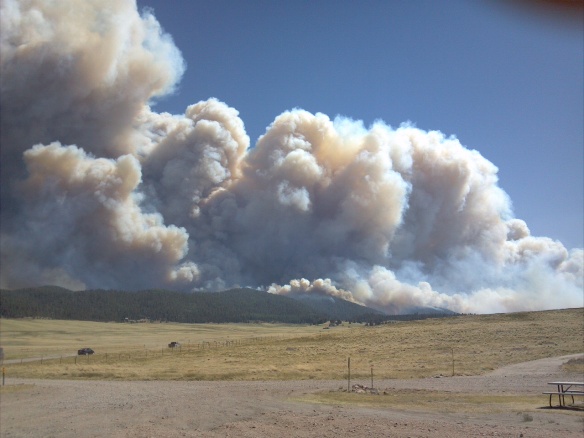
The Las Conchas fire, taken at 1:44 p.m. June 26, 2011. Photo: Michael Grady

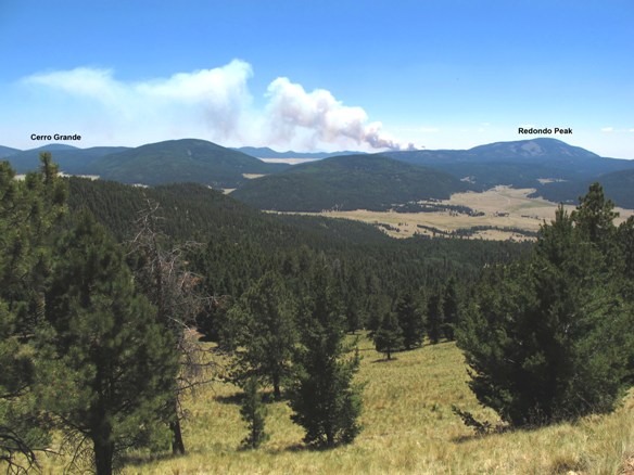
On July 2 we posted a photo of the Las Conchas fire in New Mexico that Michael Grady took soon after the fire started. Michael was hiking in the Valles Caldera National Preserve (VCNP) northwest of Santa Fe when a nearby smoke column pierced the sky and was kind enough to send us copies of his photos. Here are some of the others that he took, all within the first three hours after the fire started. According to InciWeb, the fire started at “approximately 1:00 p.m.”

Las Conchas fire photo
The Las Conchas fire as seen from the VCNP visitor center at 3:38 p.m., June 26, 2011. Photo: Michael Grady

Las Conchas fire from NM 4 looking west
The Las Conchas fire as seen from New Mexico Highway 4, looking west at 3:46 p.m., June 26, 2011. Photo: Michael Grady

Thanks again, Michael!

Las Conchas fire, photo from the early hours

Las Conchas fire, Rabbit Mtn & private
Click to enlarge. Las Conchas fire, Rabbit Mountain & private land. Taken from the north rim of the Valles Caldera National Preserve at 3:38 p.m., June 26, 2011. Photo by Michael Grady

Michael Grady was hiking in the Valles Caldera National Preserve northwest of Santa Fe, New Mexico when the Las Conchas fire started nearby. He took some pictures, and was kind enough to send them to Wildfire Today.

When he saw how close the fire was, he started hiking out, and he and some other hikers were picked up by a Preserve shuttle van which took them to safety.

We have been very busy recently, and when time permits, will post more of Michael’s photos.

Thanks Michael!

Las Conchas fire continues spreading towards the northeast

Las Conchas - Pacheco fire map 0325 7-1-2011
Map showing the Las Conchas and Pacheco fires near Santa Fe, NM. Data current at 3:25 a.m. July 1, 2011

Update at 12:40 p.m. MT, July 1, 2011:

The incident management team provided some updated information on the Las Conchas fire northwest of Santa Fe, NM, including:

  • Size: increased from 93,678 acres to 103,842, making it the largest fire in the history of New Mexico, surpassing the Dry Lakes fire which burned more than 94,000 acres of the Gila National Forest in 2003.
  • Equipment and aircraft: 4 dozers, 52 engines, 9 helicopters.
  • Personnel: 1,201
  • Containment: 3%

And this:

North Zone Fire Update

Winds will be lighter today and are projected to push the fire eastward. We expect the fire to become active with extreme fire behavior where winds and slope align. Precipitation from yesterday will only improve fuel moistures in the fine dead fuels until the afternoon when fuel moistures will return to conditions seen in previous days. Heavy fuels held the fire overnight; however, mop-up efforts are needed to prevent additional growth. The fire may become plume dominated, with the potential for erratic spreading and spotting in all directions.

North – The fire may continue to progress north and east beyond the 144 road and may align with terrain in the gap between the South Fork and Cerro Grande burn scars. The lighter fuels in these areas will reduce the fire’s intensity but remain receptive to spotting. Firefighters plan to conduct burnout operations in the area.

East – Firefighters will continue burnout operations along the Pajarito Ski Area to reduce the likelihood for spotting. Firefighters will be completing line around Los Alamos and looking for opportunities to check the fire’s spread in the old Cerro Grande burn.

South side of north zone – Firefighters will be monitoring the area, checking the fire’s spread as needed, and ensuring heavy fuels are well mopped-up to prevent embers blowing across the line.

West – Firefighters will work on a direct fire line from 4 Road to Valles Caldera 2 Road and prepare the Valles Caldera 4 Road for burnout to help confine the fire’s spread.

============================

9:00 a.m. MT, July 1, 2011

The Las Conchas fire in northern New Mexico continued marching toward the north and northeast on Thursday, coming to within one-half mile of New Mexico State Highway 565. The last size of the fire that was posted by the incident management team on Thursday listed it at 93,678 acres, but it is probably over 100,000 acres now, Friday morning.

We will post more information as it becomes available. Evacuation information can be found on InciWeb.

Scroll down to see more information and detailed maps of the fire.

Continue reading “Las Conchas fire continues spreading towards the northeast”

Las Conchas fire spreads 4 miles farther north

Update at 11:58 a.m. MT, June 30:

The incident management team provided some updated information, increasing the number of personnel assigned to the fire from 452 to 752, and also the number of acres, from 69,555 to “approximately 92,735”. There are no changes in the number of helicopters, dozers, or engines. They are still not specifying how many air tankers are being used or are available.

Sky crane helicopter at heli-well
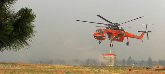
Air-Crane helicopter drafting water out of heli-well at Los Alamos National Laboratory. Photo: Los Alamos National Laboratory

Below is the “point” weather forecast for Los Alamos, NM, from 1:00 p.m. MT, June 30 until noon on Saturday, July 2. The 18-20 mph winds out of the southwest on Thursday afternoon will keep firefighters busy around Los Alamos and on the north end of the fire. However the 61% cloud cover may moderate the fire behavior a bit. The relative humidity, in the mid-teens on Thursday, will not be as extreme as it was earlier in the week when it was in the single digits. Friday calls for lower RH’s and decreasing winds.

Click the forecast below to enlarge it.

Wx Forecast Los Alamos 1200 6-30-2011
Clilck to enlarge. Weather forecast Los Alamos, current as of 12:01 p.m., 6-30-2011. The wind “barbs” point in the direction the wind will be FROM.

================================

Las Conchas fire vicinity fire map 0245 6-30-2011
Las Conchas fire map showing heat detected by satellites at 2:45 a.m. MT, 6-30-2011. The red areas were actively burning at that time, while the yellow was within the last 12 hours, and the black was within the last 24 hours. MODIS
Las Conchas fire map at Los Alamos 2330 6-29-2011
Click to enlarge. Zoomed in map of the Las Conchas fire in the Los Alamos area, 11:30 p.m., 6-29-2011. USFS/Google Earth

The Las Conchas fire near Los Alamos, New Mexico was very active Wednesday afternoon as you can see from the maps, spreading an additional four miles farther north, crossing from Sandoval County into Rio Arriba County. The fire moved toward the east becoming a little closer to the town of Los Alamos. It was also active on the southwest side.

Another map is below.

Continue reading “Las Conchas fire spreads 4 miles farther north”

Burning operation at Las Conchas fire

Firefighters at the Las Conchas fire in New Mexico did some black-lining or burning out along the border of the Los Alamos National Laboratory on Wednesday. On InciWeb it was described like this:

Firefighters were successful in holding the fire line along NM Hwy 4. Tomorrow firefighters will continue to work the fire line along the highway through Bandelier National Monument. Firefighters are working with the Los Alamos National Laboratory to prevent the fire from spreading on to the lab.

The Laboratory issued a news release about the burning operation:

LOS ALAMOS, New Mexico June 29, 2011 – Los Alamos County Fire Chief Doug Tucker said Wednesday that preventive burns just outside the western boundary of Los Alamos National Laboratory have been successful.

“In my professional opinion, there is a less than 10% chance of spot fires on Lab property this evening, diminishing tomorrow,” Tucker said during a briefing to emergency managers.

Firefighters began setting “back burns” on the west side of New Mexico State Route 501 around mid-morning. Those operations were declared complete by evening. The burns were intended to remove available fuel from the Las Conchas Fire, which has consumed more than 60,000 acres on two sides of the 37-square-mile LANL site but only one acre of the Lab itself.

“What I witnessed today was an incredibly professional job by men and women who are risking their lives to save our community and this Laboratory,” said LANL Director Charles McMillan. “I could feel the heat of the fire on my face as I watched from the roof of our Emergency Operations Center.”

The video below shows some of the burning operation.