McDannald Fire mapped at 22,000 acres

The fire is 13 miles west of Fort Davis, Texas.

Above: Map of the McDannald Fire showing the approximate perimeter early Thursday morning May 3, 2018.

(Originally published at 8:43 a.m. CDT May 3, 2018)

The McDannald Fire in western Texas slowed Wednesday and officials were able to lift the voluntary evacuations that were in effect for the Davis Mountain Resort area.

A mapping flight at about 2 a.m. Thursday estimated the fire had burned 22,053 acres.

Jeff Davis County released the following information Wednesday evening:

With the cooler temperatures and higher humidity today the McDannald Fire has shown minimal fire growth. The east side of Paradise Ridge has little fire activity at this time and the head of the fire appears to be north of the Davis Mountain Resort.

Given these conditions, the County Judge and County EMC will lift the voluntary evacuation order at 8:00 PM this evening. Residents will be allowed back in after that time.

We appreciate the cooperation of all residents. Your actions allowed the structure crews in the Davis Mountain Resort to perform their work with minimal trouble.
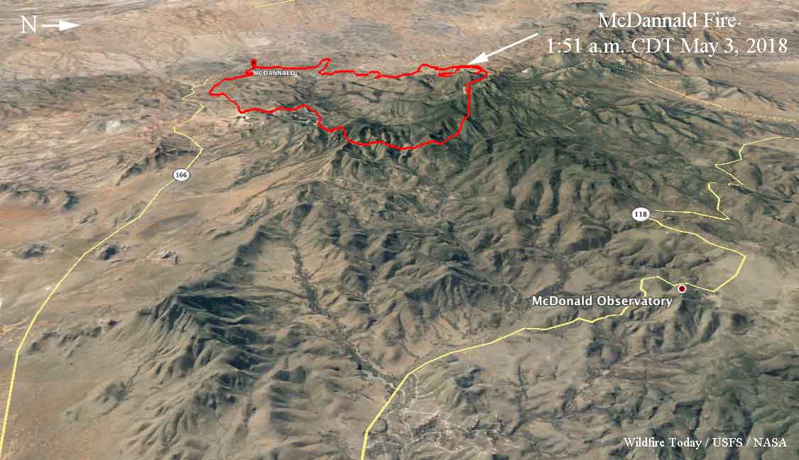
map of the McDannald Fire 3d wildfire
3D map of the McDannald Fire showing the approximate perimeter early Thursday morning May 3, 2018.

McDannald Fire is very active west of Fort Davis, Texas

Posted on Categories UncategorizedTags ,

Above: 3D map of the McDannald Fire showing the approximate perimeter at 4:23 a.m. CDT May 2, 2018.

(Originally published at 10:55 a.m. CDT May 2, 2018)

The McDannald Fire 13 miles west of Fort Davis, Texas was very active Tuesday and early Wednesday morning. Pushed by 10 to 20 mph winds out of the south and southwest it spread to within a mile west of Tomahawk Trail on the east side of the fire.

Our very unofficial estimate based on heat detections Wednesday morning by a satellite put it at about 18,000 acres. Most if not all of the fire is north of Highway 166.

Officials estimate that 400 homes are threatened. Evacuations are ongoing in the Davis Mountain Resort community.

The area is under a Red Flag Warning Wednesday for strong southwest winds of 16 to 30 mph gusting above 40 mph along with relative humidity in the mid-teens. These conditions could be conducive to the fire continuing to spread to the northeast toward Davis Mountain Resort. The McDonald Observatory is 8 miles northeast of the fire.

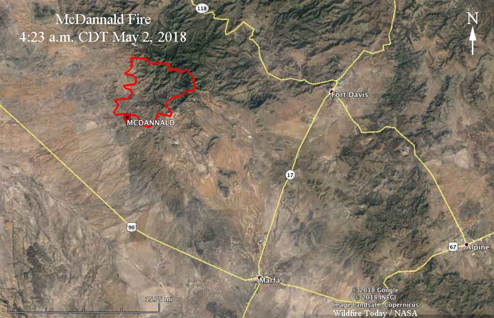
Map of the McDannald Fire
Map of the McDannald Fire showing the approximate perimeter at 4:23 a.m. CDT May 2, 2018.

The Texas Forest Service reports that lightning started the fire on Monday. A Type 1 Incident Management Team with Incident Commander Mike Dueitt is mobilizing.

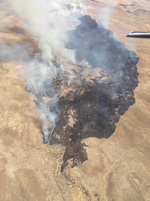
McDannald Fire, April 30, 2018
McDannald Fire, April 30, 2018. Texas Forest Service photo.