Smoke map and Red Flag Warnings, September 5, 2015

Wildfire
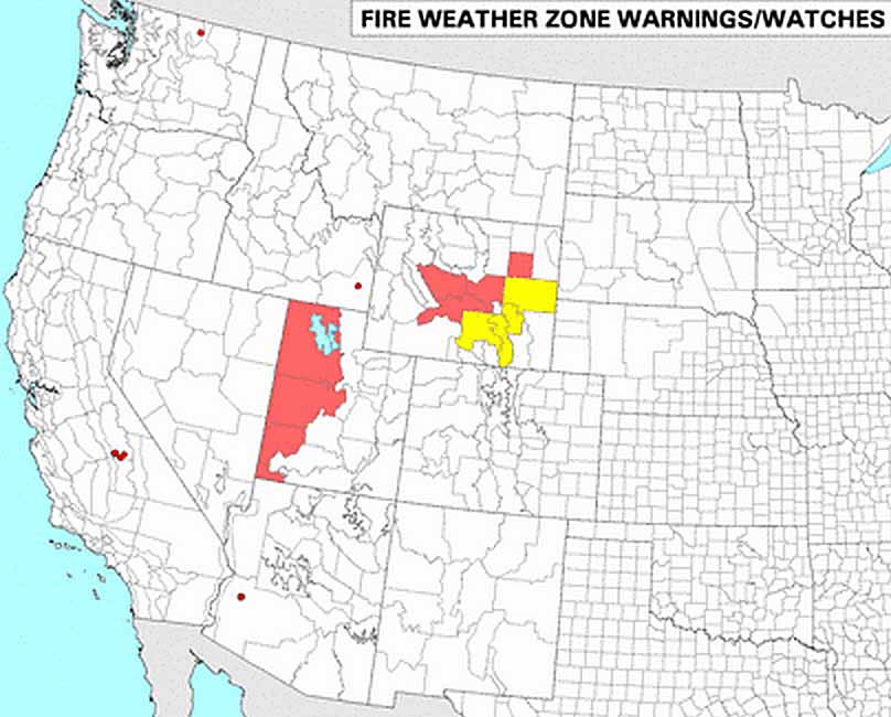
Wildfire smoke map, September 5, 2015. The circular brown icons represent the locations of wildfires.

The National Weather Service has issued Red Flag Warnings or Fire Weather Watches for areas in Utah and Wyoming.

wildfire Red Flag Warnings 9-5-2015

The Red Flag map was current as of 10:30 a.m. MDT on Saturday. Red Flag Warnings can change throughout the day as the National Weather Service offices around the country update and revise their forecasts and maps. For the most current data visit this NWS site or this NWS site.

To see the most current smoke reports, visit the articles tagged “smoke” at https://wildfiretoday.com/tag/smoke/

UPDATED: Red Flag Warning July 23, 2014

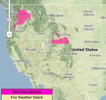
Red Flag Warning July 23, 2014

Warnings for elevated wildfire danger were issued Wednesday by the National Weather Service for areas in Oregon, Washington, Nevada, Utah, Wyoming and Idaho.

Fire weather watches were issued for areas in Wyoming and Montana.

The Red Flag Warning map was current as of 5 p.m. MDT on Wednesday. Red Flag Warnings can change throughout the day as the National Weather Service offices around the country update and revise their forecasts. For the most current data visit this site. 


Red Flag Warnings, June 2, 2014 — and, controlling the weather

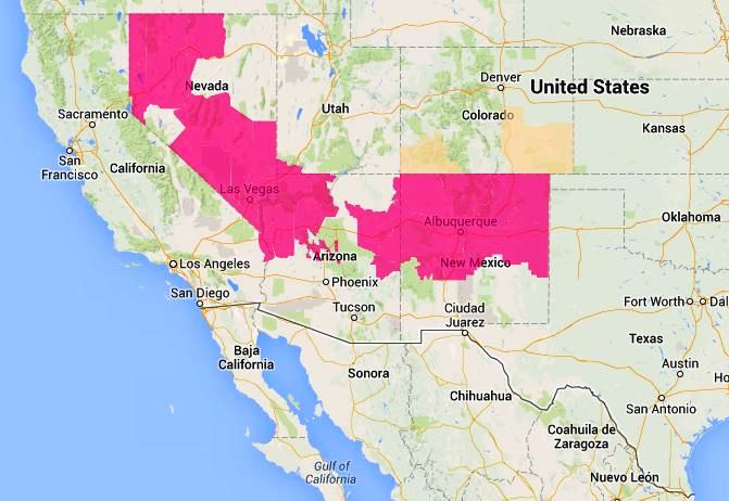
wildfire Red Flag Warnings - June 2, 2014

Warnings for elevated wildfire danger have been issued by the National Weather Service for areas in Nevada, Utah, Arizona, New Mexico, and Colorado.

We continue to be amazed at how weather and fire danger can respect and adhere to state boundaries. The Joint Fire Science Program should investigate this phenomenon. Maybe additional imaginary lines could be put on maps on an as-needed basis that would control the weather to protect our firefighters, forests, and communities. Could we even reverse droughts and prevent floods?

The Red Flag Warning map was current as of 11:23 a.m. MDT on Monday. Red Flag Warnings can change throughout the day as the National Weather Service offices around the country update and revise their forecasts. For the most current data, visit this NWS site.

Red Flag Warnings, April 25, 2014

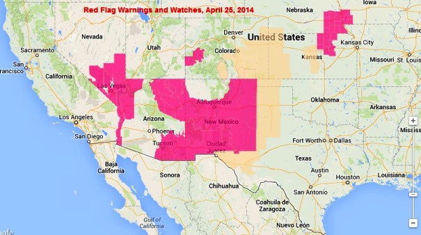
wildfire Red Flag Warnings, April 25, 2014

Warnings for elevated wildfire danger have been issued by the National Weather Service for areas in Iowa, Nebraska, Kansas, Colorado, Oklahoma, Colorado, New Mexico Arizona, Nevada, and California.

The weather forecasters in Utah frequently interpret fire danger differently than the NWS personnel in the neighboring states of Nevada, Arizona, and Colorado. Weather patterns and vegetation conditions rarely recognize state borders… except in Utah.

The Red Flag Warning map was current as of 9:40 a.m. MDT on Friday. Red Flag Warnings can change throughout the day as the National Weather Service offices around the country update and revise their forecasts. For the most current data, visit this NWS site.

Red Flag Warnings and smoke distribution, July 22, 2013

The map below shows the distribution of smoke from wildfires in the United States and Canada. For much more information about smoke and dust in the air today, visit NOAA’s text description, which is perhaps more than you want to know.

Wildfire smoke map
Map showing the distribution of wildfire smoke at 10:52 a.m. MDT, July 22, 2013
Red Flag Warnings wildfire
Red Flag Warnings, July 22, 2013

Red Flag Warnings and Fire Weather Watches for enhanced wildfire danger have been issued by the National Weather Service for areas in Washington, Oregon, and Wyoming.

****

The Red Flag Warning map above was current as of 11:35 a.m. MDT on Monday. Red Flag Warnings can change throughout the day as the National Weather Service offices around the country update and revise their forecasts. For the most current data, visit this NWS site.

Red Flag Warnings, June 9, 2013

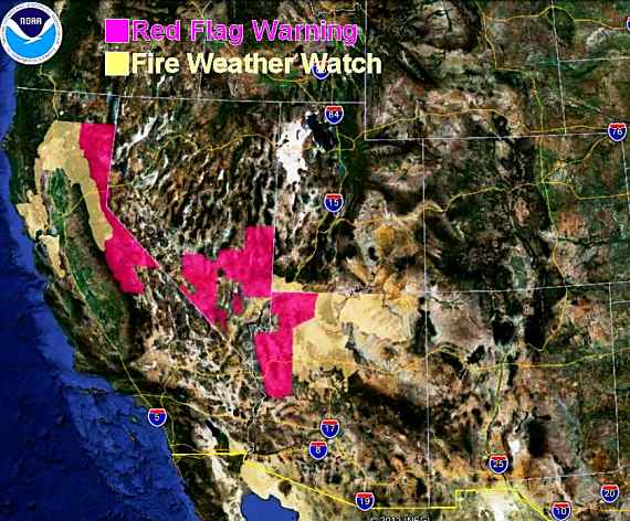
Wildfire Red Flag Warnings

Red Flag Warnings and Fire Weather Watches for enhanced wildfire danger have been issued by the National Weather Service for areas in California, Nevada, Utah, and Arizona.

Dry lightning and strong winds are in the forecast for Northern California, the Bay Area hills & the Sierras.

On the map above it is unusual to see a small part of Utah’s southwest corner marked as a Fire Weather Watch area. The weather forecasters in Utah rarely forecast Red Flag Warnings or Fire Weather Watches, even when their neighboring states do so right up to the imaginary line separating the two.

***

The Red Flag Warning map above was current as of 9:20 a.m. MT Sunday. Red Flag Warnings can change throughout the day as the National Weather Service offices around the country update and revise their forecasts. For the most current data, visit this NWS site.