The enemy below – why there are peatland fires in new places

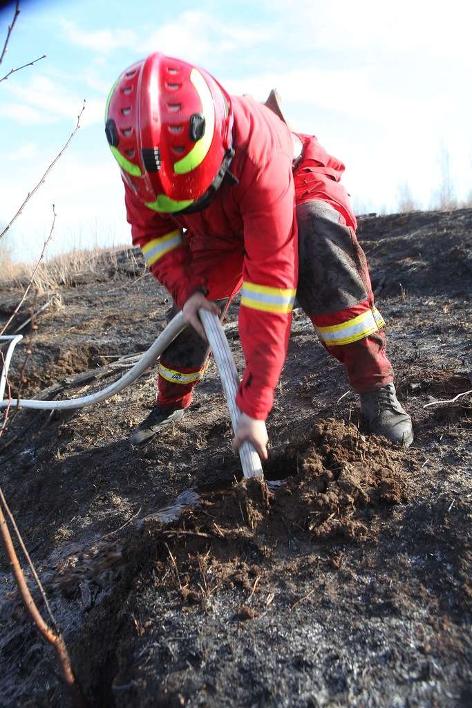
A Greenpeace Russia firefighter suppresses a reignition in a peatland in the Central Federal District in 2019. Photo: Greenpeace Russia.

By Anton Beneslavskiy

I fought my first peat fire in 2020 while working as a volunteer firefighter. We poured a lot of water onto it. Despite repeatedly spraying the blackened area, the peat continued to smoulder. That was my first encounter with the trickiest wildfire.

This article is first published in Wildfire Magazine – read the full edition.

Later, while working for Greenpeace Russia’s fire prevention programme, I fought peat fires in Siberia and the European part of Russia, from Buryatia in the east to the radioactive marshes of the Bryansk Oblast. In 2016, we launched a similar programme in Greenpeace Indonesia, where I tackled some of the most impressive peatlands I have ever seen.

What have I learned? Peat fires are tricky, hard to detect and suppress, and it’s difficult to be sure the work is done properly. Peat fires can pop up weeks after fire crews have left the scene, convinced that there is no burning in the soil.

Greenpeace Russia has now been banned, and I fled my country to settle in the United Kingdom. What I see now is so similar to what I saw previously.

Wildfires across Europe are breaking records. France, Spain, Greece, Germany, Austria, Belgium, the UK and Ireland are affected. Lives lost, nature destroyed, people evacuated, houses burned. The media is full of images of terrifying flames.

In the flood of fire information, we overlook a threat that is less spectacular but no less terrifying: many UK and Irish fires, including the biggest ever in Belgium, are burning in peatlands, creating a high risk of long-term smouldering peat fires.

The emissions

Peatlands are incredible wetland ecosystems that can accumulate up to 600 gigatons (Gt) of carbon in their soil, making them crucial for climate regulation; they can be found in the boreal zone and throughout the tropics. Peatlands are an integral part of Northern European natural landscapes and are critical to some of the world’s most important forest ecosystems. Peatlands are home to a wide variety of species. However, peatlands can present a significant challenge in the event of a wildfire.

Human activities are damaging peatlands through drainage, peat harvesting, and conversion into agricultural land and plantations; this leads to the emission of 1.3-1.9 Gt of carbon dioxide equivalent (CO₂e) each year. Peat fires also emit 0.2-1.5 Gt CO₂e annually. In the UK, peat fires have been responsible for 90 per cent of annual wildfire-related carbon emissions since 2001. Peat accumulation is a slow process, taking centuries, so even if burned peat could be restored, it would take far more than the time available for climate mitigation.

In addition to fuelling climate change, large-scale peat fires cause severe damage to public health by producing smoke haze. The peat fires in Indonesia in 2019 are estimated to have caused 87,000 excess deaths.

Today, more peatlands are at risk of burning, while the effectiveness of peat fire suppression is far beyond what is necessary.

After working on the issue of peat fires for more than 10 years, both as a firefighter and an environmentalist, I have concluded that a peat fire is the trickiest enemy a wildland firefighter can face: it is not the most terrifying or the most powerful, but it is undoubtedly the trickiest.

The fuel

What makes peat fires so special? The fuel. Peat is formed in specific conditions in peatlands from sphagnum moss and other species. Limited oxygen during formation slows decomposition, but its high carbon content makes it highly flammable.

Peat can smoulder underground without oxygen. Even with a 5:1 water-to-peat ratio, smouldering can continue. During smouldering, peat converts into a solid substance that prevents wetting. Suppression requires large amounts of water (at least one ton per 1 m2) and a high-pressure water jet to destroy smouldering peat conglomerates.

The relative flammability of peat depends on multiple factors. Long-term droughts, a lack of humidity and intensive surface fires altogether create ideal conditions for peat ignition. Therefore, we can expect an enormous number of smouldering peat spots in areas where the fire has passed through the peatland surface.

Once ignited, peat smoulders often without visible flames, and in the early stages of small-scale burning spots, it produces a very low amount of smoke, making it hard to detect without special technical devices such as portable thermal infra-red or special thermometers.

The challenge

Although peat fires spread slowly, they still present a serious challenge to firefighters because they’re difficult to detect, size up, control, and monitor post-fire. In addition, there are hot caves filled with smouldering peat and ash, toxic smoke, high carbon monoxide levels, and fires that can start again in random places. Fighting peat fires requires application of specific LACES protocols (lookouts, anchor points, communication, escape routes, safety zones).

Even a small particle that continues to smoulder can reignite a peat fire days or weeks after firefighters have left the scene. In the most basic terms, peatland firefighting is 90 per cent mop-up. It is dirty, hot and unglamourous work. While for most wildland firefighters mop up is only the last stage of battling flames and is definitely the least fancy one, the mop up is the main and sometimes the only way to put out a peat fire.

Climate change now ruins usual fire dynamics and assumptions, and this is true also for peat fires. For a long time, most peat fires occurred only in drier drained peatlands where the peat was exposed to surface vegetation fires; today even undrained peatlands in their natural state are catching fire.

When peat fires cease to be a rare, exotic phenomenon and become a regular occurrence – as has long been the case in Russia and Indonesia – they will become a real disaster for many countries in Northern Europe.

The situation

Ireland is an interesting study case in point: Peatlands in Ireland cover an area of around 1.66 million hectares (approximately 23 per cent of the country’s territory), and their depth varies considerably depending on the type of bog – raised bogs have an average depth of 7.5 metres (with maximum depths of up to 12 to 13 metres), while blanket bogs in mountainous and lowland areas have an average depth of between two and four to six metres.

By contrast, Peatlands in the United Kingdom cover around three million hectares (approximately 12 per cent of the country’s land area). The depth of the peat layer varies considerably: in mountainous blanket bogs it ranges from one to five metres, while in lowland raised bogs it reaches five to 10 metres or more.

Peatlands comprise an enormous amount of fuel that is potentially exposed for ignition due to climate change, and emissions from these fires become a climate change contributor in their own right. Again, Ireland becomes a useful study point – according to EFFIS (European Forest Fire Information System) between July 15 and Aug. 14, 2026, more than 2220 hectares of mainly peat-based wildfires produced almost 170,000 tonnes of carbon dioxide, that was previously sequestered within the peat fuels affected by these fires. This represents a significant increase on expected average annual levels of approximately 90,000 tonnes arising from wildfire activity.

Recent fires in Ireland also prove that the new reality has come: if fires of this scale are possible in the country with traditionally humid and cool weather, then what should we expect elsewhere? There are no large-scale wildfires in peatlands reported in Germany, Belgium, Netherlands and Scandinavian states, but we are still in the middle of the season, and drought conditions continue to climb daily.

So, we are dealing with fires that come to the new areas due to climate change, that are easy to start, hard to detect and size up, hard to suppress, and hard to control. At the same time these fires are out of the scope of many fire services. There is no significant experience of managing this type of wildfires outside of a very few countries, and even regions within these countries, and as a result there are no internationally standardised methods, no strategies, no guides and no special equipment.

We are a little more than halfway through the fire season, but the total area affected by wildfires on peatlands in Ireland in 2026 has already reached approximately 2950 hectares, of which 2200 hectares is the area affected by problematic peat fires – that is, fires that were thought to have been extinguished but have flared up again. A similar situation exists in Scotland.

The fire services carried out the operations in accordance with current standards. However, these standards do not consider the specific nature and suppression requirements of underground peat fires.

Reignition is caused by active and widespread underground peat burning. Small pockets of fire can survive initial extinguishing efforts, even when water is used, and cause the fire to reignite once the surface fire has been deemed extinguished. Detecting a peat fire at an early stage is difficult, but particularly so in recently burned areas while firefighting efforts are ongoing. Smouldering vegetation in the wake of the fire masks the peat fires, which emit relatively little smoke. However, even at an early stage, extinguishing a peat fire is difficult – it requires a large volume of water, delivered under pressure directly into the centre of the fire. Simply spraying the burning peat with a mist of water will certainly not be enough – after all, peat has evolved to absorb and hold water.

A special team of Greenpeace firefighters fights a peat fire in a radioactively contaminated marsh in Bryansk Oblast in 2019. Strategies used to fight peat fires in Russia and Indonesia could be implemented by firefighters in Northern Europe if and if a proper peatland firefighting culture can be developed and adapted.

The tools

My experience fighting peat fires in Russia and Indonesia shows we must adapt to deal with this threat. Greenpeace fire crews have developed technologies and skills for early detection, effective triage, proper use of resources and comprehensive post-fire control. This meant our small team could respond to and prevent multiple peat fires.

GIS systems and software allowed us to identify surface fires and prioritise potential fires. This enabled us to react quickly with small crews and provide on-ground reconnaissance with infrared-vision drones and portable infrared systems to identify all the burning spots. If this work was done in early spring, each burning spot required limited resources and time to be suppressed. Specialised thermometers and infrared devices allowed us to effectively control post-fire reignitions.

Our teams were small, mobile and properly equipped, and had relevant experience. This gave them serious advantages over regular fire units.

If the way we fought peat fires in Russia and Indonesia could be implemented by firefighters in Northern Europe, and if a proper peatland firefighting culture can be developed and adapted, we will be better prepared when peat fires became a regular occurrence in this part of the world.
Anton ‘Benny’ Beneslavskiy

Anton ‘Benny’ Beneslavskiy is a certified forest fire incident commander, author and educator.

Russia declares multiple states of emergency as wildfires threaten thousands, government inaction continues

Multiple wildfires across Russia have caused officials to issue multiple states of emergency and evacuate thousands, while government officials are accused of largely ignoring the problem.

The latest state of emergency was issued by Novorossiysk Mayor Andrei Kravchenko on July 14, according to the Kyiv Independent. The city in southern Russia was forced to evacuate around 500 people from the fire that burned at least 153 acres as of July 15. More than 300 people, including workers from the Emergency Situations Ministry, were fighting the fire.

Two other regions declared wildfire-driven states of emergency at the beginning of July,  a Reuters article reported. The Republic of Sakha, also known as Yakutia, declared a federal state of emergency for wildfires on July 1. The Russian Ministry of Emergency Situations reported more than 107 registered wildfires burned more than 331,000 hectares (~818,000 acres) in the region.

The governor of the remote Siberian region of Tuva made the declaration on the same day as Sakha after a wildfire burned around 1,700 hectares (4,200 acres) driven by intense heat, strong winds, and dry thunderstorms.

“At the moment, 23 forest fires have been registered on the territory of the republic,” said Vladislav Khovalyg, head of the Tuva region. “Most of them are in inaccessible mountainous areas. July as a whole promises to be the most difficult month in terms of the fire situation, and we have to fight for every hectare of forest.”

Experts warned that the nation was unprepared for an alarming wildfire season. The Moscow Times reported that limited state capacity for fire prevention and control, along with ongoing dry grass burning practices, worried experts of the potential for the season to turn into an annual crisis.

The “official indifference” was seen in real-time during the Siberia wildfires, which have burned an area the size of Normandy since the beginning of the year, French newspaper Le Monde reported. While the Russian government is preoccupied with its incursion into Ukraine, officials are neglecting necessary resources to fight wildfires burning throughout the nation.

“The problem is not just in the forest and its poor management,” an Irkutsk resident told Le Monde. “It’s largely in the heads of the people and the authorities, who don’t want to see it or fight it.”

The Russian Ministry of Emergency Situations reported more than 107 registered wildfires burned more than 331,000 hectares (~818,000 acres) in the region.

Russia’s wildfire problem is exacerbated by Earth’s changing climate. Recent research has shown wildfires will worsen in the coming years, even in areas where wildfires are currently rare, such as Russia’s alpine regions. Smoke from the worsening wildfires, e.g. in Siberia, is projected to cause thousands of deaths and billions in costs for East Asia.

RELATED: Climate change will make wildfires worse, even in areas that don’t have wildfires today

The colors on the Russian Hydrometeorological Center’s map below represent the number of days of predicted “high” and “extreme” fire danger in April, according to the Moscow Times. The purple indicates less than one day, the yellow between one and three days, pink between four and six days, red between seven and nine days, and dark red over ten days.

Russian fire map
Russian fire map

Unfinished USSR project had goal of a 50,000-gallon air tanker

USSR Rescuer
Before the USSR collapsed, the government was designing the “Rescuer” which could carry 200 tons of water. This is the unfinished project at the Central Design Bureau. Alekseeva.

Before the USSR collapsed, their government was attempting to develop an aircraft that could carry 500 to 700 tons of cargo or serve as a water-scooping air tanker carrying 50,000 gallons of water.

It is not clear if it is a ground effect vehicle that would be restricted to flying 10 to 20 feet above a surface, or if it could also fly high enough to drop water on wildfires. It is a little difficult to determine the details based on the very crudely machine-translated article from Aviation of Russia, which is below:


“The Central Design Bureau (TsKB) for hydrofoil ships named after Alekseev (Nizhny Novgorod) has good groundwork on heavy ekranoplans, which could be used to extinguish large forest fires with greater efficiency than airplanes, reported Chairman of the Board of Directors – General Designer of the Central Design Bureau Georgy Antsev.

“ ‘Speaking of fires, we have serious work on the development of the Spasatel ekranoplan, where we go into tonnages from 500 to 700 tons. We have a series of proposals for the construction of ekranoplanes, where we can already talk about the tasks of fire fighting,’ Antsev said.

“According to him, such an ekranoplan could take about 200 tons of water as a load and dump it in the same time that IL-76 aircraft dump only 40 tons. Antsev emphasized that the advantage of ekranoplanes is that water does not need to be pumped at airfields from fire tanks, as is now happening with the IL-76. It takes a lot of time and is technically difficult. WIG can take water in large rivers or large bodies of water.

“Such characteristics of an ekranoplan, such as excess weight, characteristic of high-strength machines, designed for good performance in conditions of frequent water hammer, are compensated by the economy when flying in screen mode. In addition, the ekranoplanes are unpretentious to the places of basing – they can stand on the water or go ashore with a slight slope (up to 5%).

“Antsev added that he does not consider the ekranoplanes a panacea for extinguishing forest fires, but noted their effectiveness in the fight against large foci.

” ‘In a disaster, there is no one means. For something you still have to get and put out by plane and helicopter, you have to get somewhere on foot. In high-intensity fires and the battle over the area, the ekranoplan gives a significant gain in the amount of water discharged by unit area in a shorter time. If we talk about intense fires, it helps to ‘crush’ the source,’ said the general designer.

“Wing Rescuer is the second instance of the project 903, the first was an impact Wing-rocket carrier ‘Lun’. The ‘rescue’ was also pledged as a missile carrier, but the collapse of the USSR led to the cessation of financing and the conservation of the vessel at the 95% readiness stage.”

Thanks and a tip of the hat go out to Isaac. Typos or errors, report them HERE.

Rare nesting stork hatches eggs as wildfire burns

Screengrab from the video below.

A surveillance camera overlooking an endangered oriental white stork nest in Russia’s Far East captured a scene of a wildfire spreading in a field on April 28. The fire went by without doing any harm to the birds. The camera was installed at a power pylon as a part of World Wildlife Fund Russia project to monitor the stork family online.

Satellite photos of wildfires in Siberia

ESA satellite photo wildfire siberia

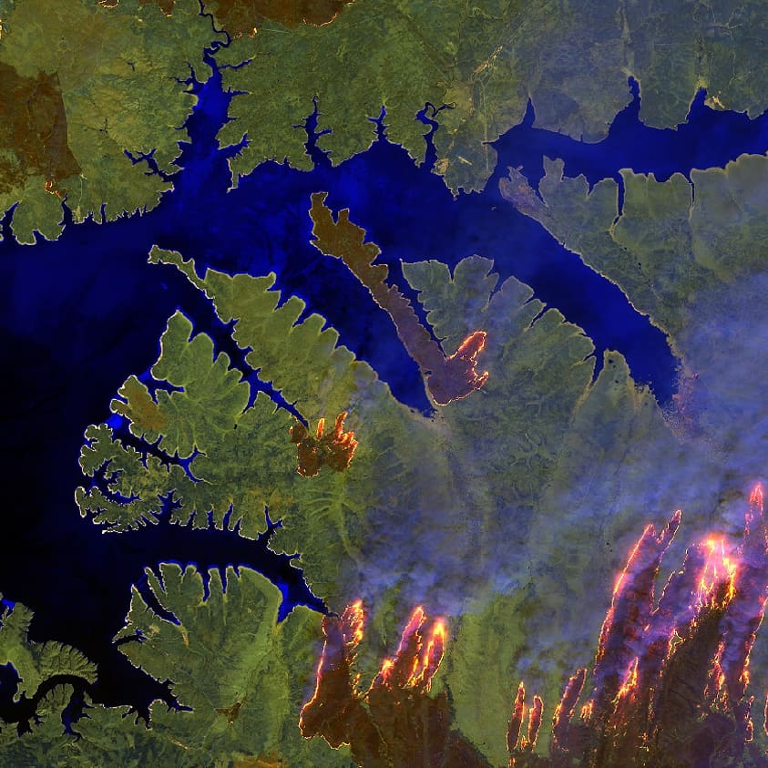
Two photos taken May 9 by the European Space Agency’s Sentinel 2 satellite of wildfires in Siberia highlight flames, and in the other, smoke. The sensors used were RGB-natural color and SWIR-enhanced infrared.

On that date wildfires blazed in Russia’s Far East around Komsomolsk-on-Amur, a city of nearly 264,000. The Siberian Times published images of the fires.

ESA satellite photo wildfire siberia

Numerous wildfires burning in Russia’s Amur province

wildfires russia

Above:  NASA’s Suomi NPP satellite captured this natural-color image of smoke streaming from wildfires on April 4, 2018. Recently charred areas appear black. Rivers, still ice-covered, are white. Heat at the fires is represented by red dots.

NASA reports on wildfires in Russia seen from space:


As is often the case in the spring, satellites detected dozens of fires burning in Russia’s far eastern Amur province in late-March 2018. Fires usually flare up around the time that the winter snow cover melts.

The fires were initially quite small. Most of them were probably lit by people, mainly to burn dried grasses and old crop debris from fields. People in the area routinely light fires in the spring to fertilize the soil, maintain pasturelands, and prevent forest encroachment.

Many of the fires near the Amur and Zeya rivers spread rapidly over the following week. By April, several were raging out of control—in some cases burning through forests. Dahurian larch dominates forests in Amur, though deciduous trees such as birch and aspen are also common.

The Visible Infrared Imaging Radiometer Suite (VIIRS) on the Suomi NPP satellite captured this natural-color image of smoke streaming from several fires on April 4, 2018. Recently charred areas appear black. Rivers, still ice-covered, are white.

Hundreds of firefighters are working in the region, according to news reports. However, the fires are proving difficult to control and have spread about 20,000 hectares (80 square miles) per day. On April 5, authorities reported extinguishing 15 fires, but 23 new fires emerged on the same day.

Massive helicopter used in wildfire on Russia/China border

Click on the photos to see larger versions.

The automatic translation from Bing about the Russian-made Mi-26 helicopter:

Cross-border forest fires occurred in Russia, driven by China in Mongolia Autonomous daeheung an Ridge North. Join the Wu troops in Mongolia and Heilongjiang total fire fighting!

And Google’s auto-translation:

Forest fires occurred in Russia crossed the border and spread to the northern part of Daixing Anrill in China ‘s Inner Mongolia Autonomous Region. Forest Takeshi Kaiuchi Mongolia · Heilongji Squadron participate in firefighting activities.

Fire monitoring helicopter crashes in Russia, reportedly killing three

A helicopter used for monitoring wildfires crashed May 4 in the Russian republic of Bashkortostan, according to TASS which received information from regional emergency services. Three people were on board when it went down 30 kilometers south of the community of Inzer in the Beloretsk district. The reports are that there were no survivors.

Below is an excerpt from TASS:

The helicopter belonged to the Lightair company. The news it went missing came at 14:20 Moscow time. The helicopter had left Bashkortostan’s capital Ufa for Beloretsk. The distress signal from its emergency beacon was picked up by a satellite rescue system. The local office of the Investigative Committee has launched a probe.

Our sincere condolences go out to the family, friends, and coworkers.

Photo of Russian firefighters mobilized for a fire in Siberia

По обращению Правительства Бурятии об оказании помощи в удержании под контролем лесопожарной обстановки, оперативный штаб Рослесхоза направил 50 авиапожарных ФБУ «Авиалесоохрана» на тушение лесных пожаров в регионе #ПДПС#парашютисты#десантники#пожарные#помощь#Бурятия#нацпарк#Тункинский#поджогисухойтравы#проблема#нарушение#Россия#Сибирь#мера#недопустить#лес#Авиалесоохрана#Avialesookhrana#Берегилес#smokejumpers#СМИ#ТВ

A post shared by Федеральная Авиалесоохрана (@avialesookhrana) on

About 50 wildland firefighter in Russia were mobilized to assist with a wildfire in Buryatia, a mountainous Russian republic in eastern Siberia.

Below is the Google translation of the image’s caption:

Avialesookhrana According to the appeal of the Government of Buryatia to assist in keeping the fire situation under control, the operational headquarters of the Federal Forestry Agency sent 50 air firefighters “Avialesoohrana” to extinguish forest fires in the region
# PAPC # paratroopers # paratroopers # firefighters # help # Buryatia # national park # Tunkinsky # arsons of dry grass # problem # violation # Russia # Siberia # measure # not # forest # Avialesookhrana # Avialesookhrana # Berehiles # smokejumpers # media # TV

And while we’re on the subject of airborne firefighters, back in America: