Smoke from Western wildfires spreads at high altitudes across the Southeast

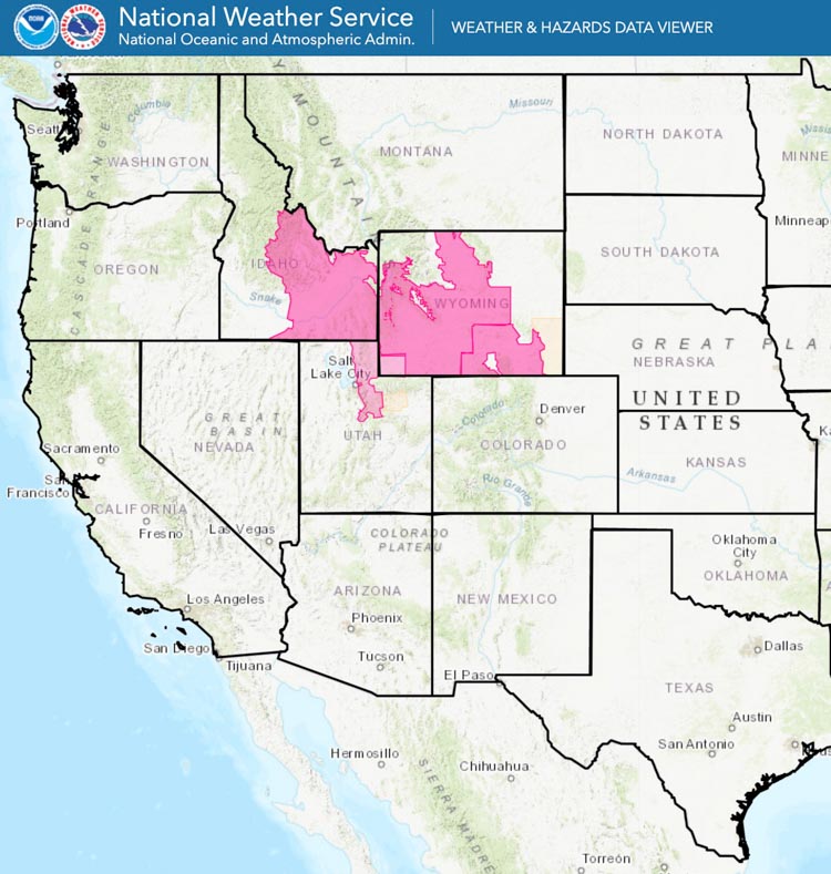
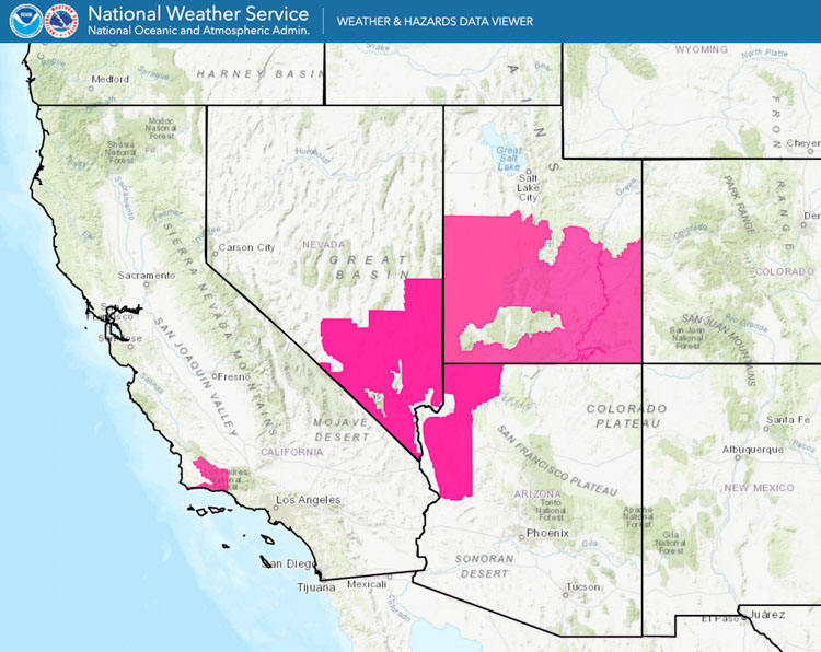
Red Flag Warnings in effect for areas of Utah, Nevada, Arizona, and California

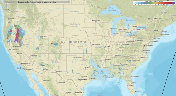
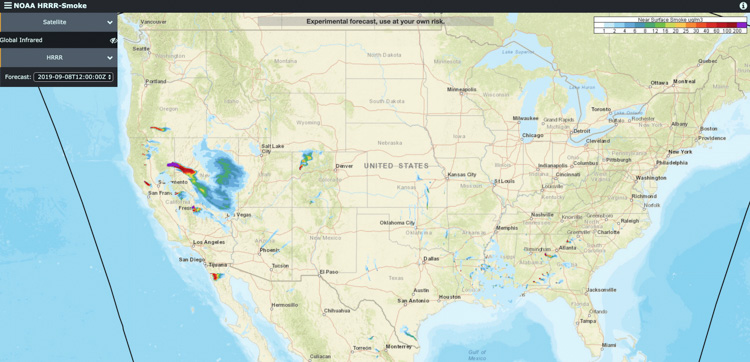
Near Surface vegetation fire smoke
Forecast for 6 p.m. MDT September 8, 2019. Near Surface vegetation fire smoke near the Earth’s surface.

These images represent the forecast for the distribution of smoke from vegetation fires at 6 p.m. MDT September 8, 2019. If the predictions are correct, smoke is going to be heavily affecting some areas in Nevada Saturday.

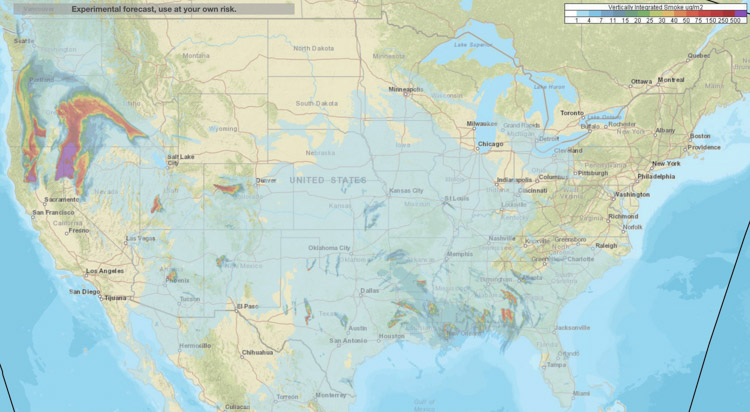
Near Surface Smoke (in the map above) is what affects people and animals in real time. Vertically integrated smoke higher in the atmosphere (in the map below) can have additional environmental effects and can contribute to interesting sunsets.
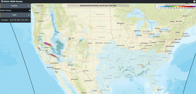
Vertically Integrated vegetation fire smoke
Forecast for 6 p.m. MDT September 8, 2019. Vertically Integrated vegetation fire smoke at high altitudes.
Red Flag Warnings
Red Flag Warnings in effect September 8, 2019.


Wildfire smoke forecast for Saturday evening

Posted on Categories UncategorizedTags

There could be significant effects Saturday in some areas of Northern California, Southern Oregon, and Northwest Nevada

Near Surface vegetation fire smoke
Forecast for 6 p.m. MDT September 7, 2019. Vegetation fire smoke near the Earth’s surface. NOAA.

These images represent the forecast for the distribution of smoke from vegetation fires at 6 p.m. MDT September 7, 2019. If the predictions are correct, smoke is going to be heavily affecting some areas in Northern California, Southern Oregon, and Northwest Nevada late in the day Saturday.

Near Surface Smoke (in the map above) is what affects people and animals in real time. Vertically integrated smoke higher in the atmosphere (in the map below) can have additional environmental effects and can contribute to interesting sunsets.

Vertically Integrated vegetation fire smoke
Forecast for 6 p.m. MDT September 7, 2019. Vertically Integrated vegetation fire smoke at high altitudes. NOAA.

Smoke from wildfires in the Northwest spreads to the east

Posted on Categories UncategorizedTags

Above: Near Surface Smoke that is remaining near the Earth’s surface, created by vegetation fires. Forecast for 9 p.m. MDT September 4, 2019. Red dots represent heat detected by a satellite.

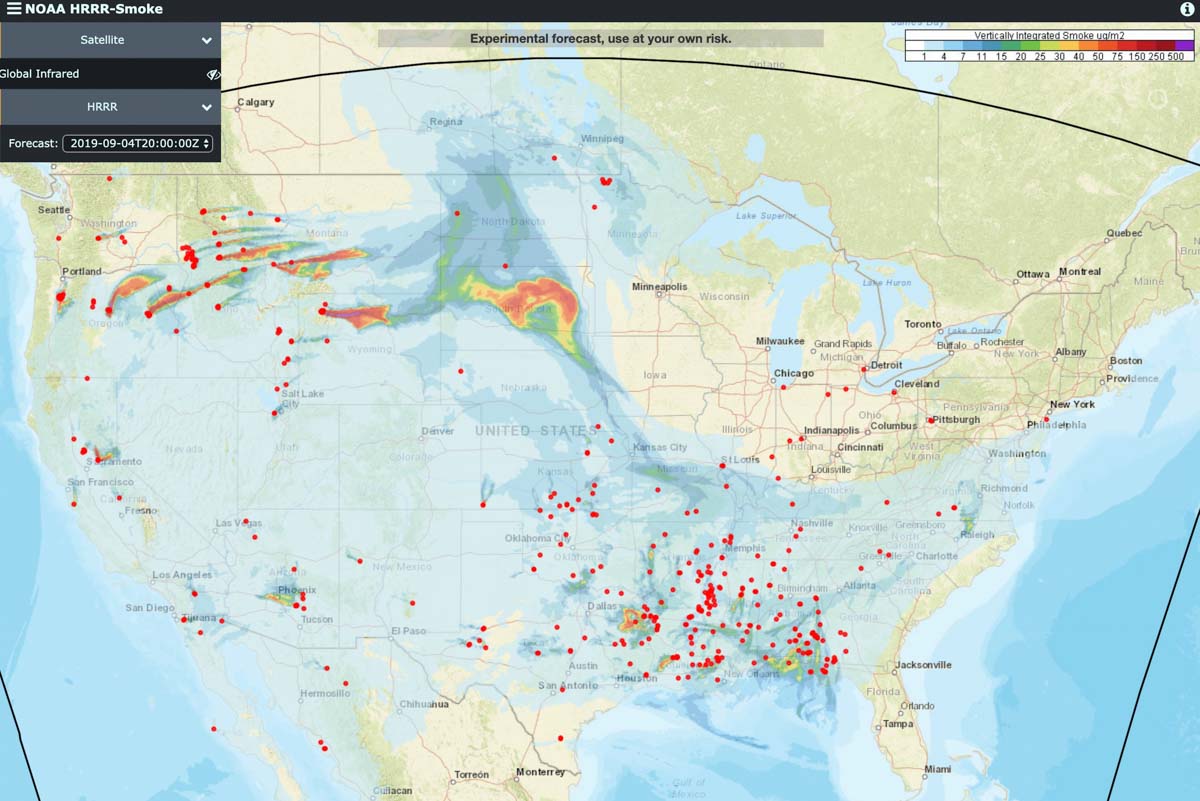
These images represent the forecast for the distribution of smoke from vegetation fires at 9 p.m. MDT September 4, 2019.

The red dots represent heat detected by a satellite.

Vertically Integrated Smoke, at high altitudes, created by vegetation fires. Forecast for 9 p.m. MDT September 4, 2019. Red dots represent heat detected by a satellite. Click to enlarge.


Lightning in the forecast for some western states

Wildfire smoke forecast

Red Flag Warnings wildfire Fire Weather Watches
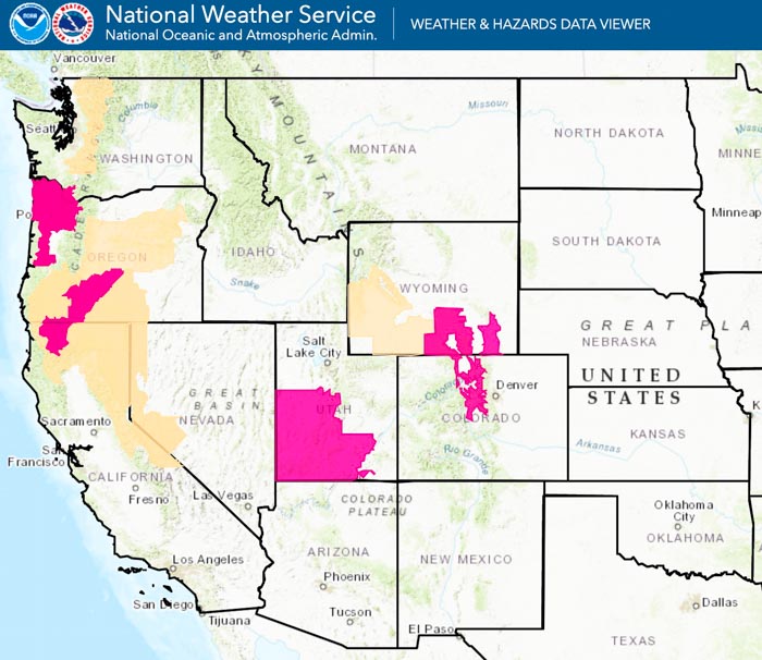
Red Flag Warnings for August 27 (in red) and Fire Weather Watches for August 28 (in brown). NOAA.

The forecast for areas with Red Flag Warnings in effect Tuesday include gusty winds and low humidities. The Warning area for southwest Utah could also experience dry lightning from noon to 9 p.m. MDT Wednesday. The Fire Weather Watch areas (brown on the map above) are for Wednesday. Some areas in Oregon could receive lighting Wednesday afternoon through Thursday afternoon with light rain.

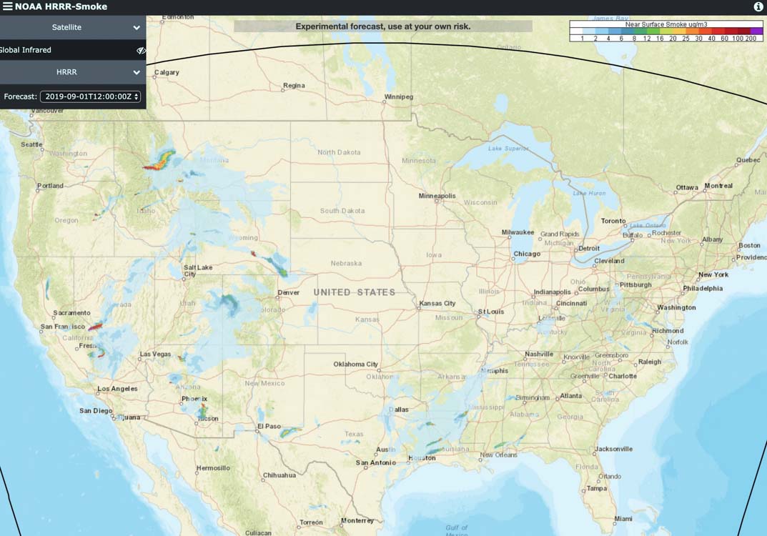
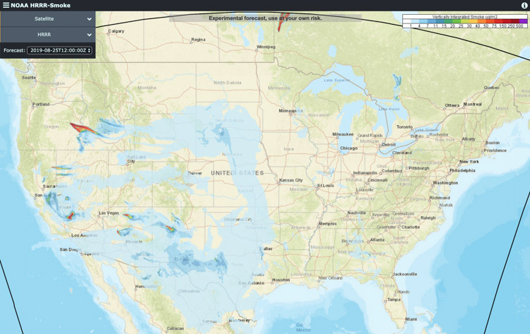
Below is the forecast for the distribution of smoke from wildfires at 5 p.m. MDT August 27, 2019.

wildfire smoke forecast map
The forecast for 5 p.m. MDT August 27 for wildfire smoke, vertically integrated and near surface.

(Red Flag Warnings can be modified throughout the day as NWS offices around the country update and revise their weather forecasts.)