
Smoke from wildfires in Arizona is spreading east into New Mexico, Texas, Colorado, Oklahoma, and Kansas.
News and opinion about wildland fire
States affected include Washington, Idaho, Utah, Colorado, New Mexico, Arizona, Alaska, and Texas
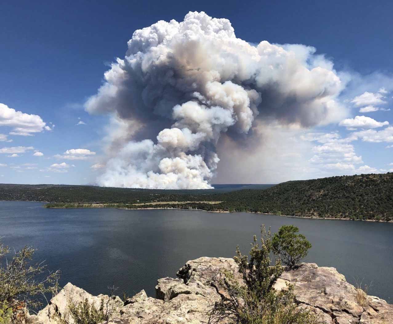
While currently there are not a great many active wildfires in the lower 48 states, the ones that are burning are creating a surprising amount of smoke.
Smoke from wildfires in Texas is expected to move into the Austin, Dallas, and Fort Worth areas Wednesday afternoon.
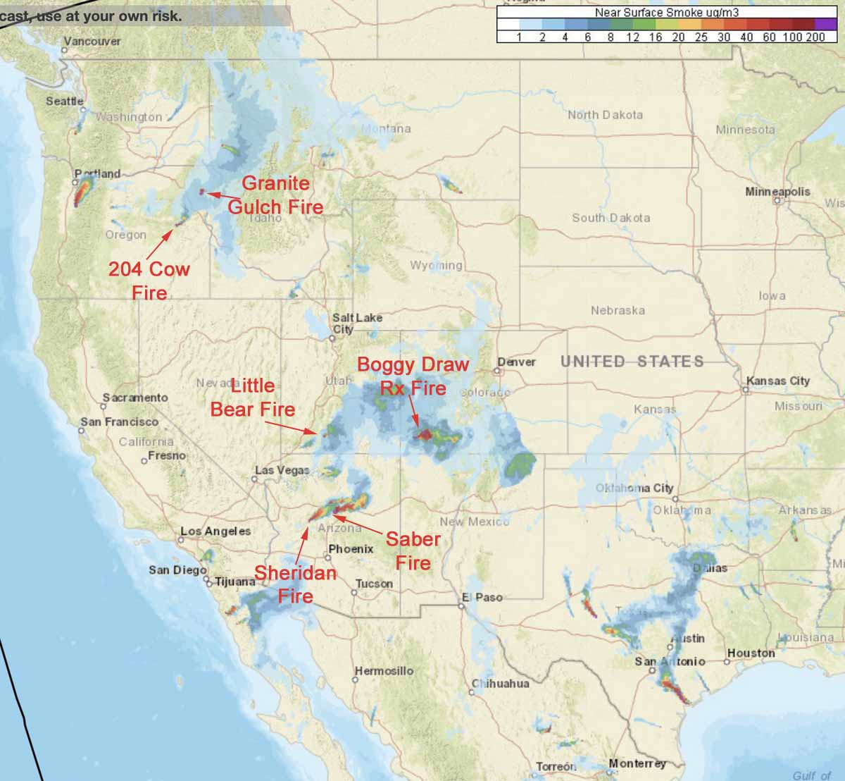
Ignition on the Boggy Draw prescribed fire in the San Juan National Forest north of Dolores, Colorado is complete, but the fire is still producing smoke. The Colorado Department of Public Health and Environment issued a statement Wednesday, saying, “Light-to-moderate impacts are expected in the immediate vicinity of the fire. No public health concerns are anticipated at this time.”
We don’t have a smoke map for Alaska but smoke from local fires is expected to plague residents of Anchorage until this weekend.

Smoke from hundreds of fires in the Amazon Basin combined with clouds Monday afternoon to plunge a major South American city into darkness.
Numerous fires in Bolivia and the Amazon Basin in Brazil have been creating smoke in recent days that got pushed hundreds of miles by a cold front to Sao Paulo, turning the sky dark.
Below is an excerpt from an article in the Washington Post:
“The smoke [Monday] didn’t come from fires in the state of Sao Paulo, but from very dense and wide fires that have been happening for several days in [the state of] Rondonia and Bolivia,” Josélia Pegorim, a meteorologist with Climatempo, said in an interview with Globo. “The cold front changed direction and its winds transported the smoke to Sao Paulo.”
The news highlighted the number of forest fires in Brazil, which rose by more than 80 percent this year, according to data released this week by the National Institute for Space Research (INPE).
“This central Brazil and south of the Amazon Rainforest region has been undergoing a prolonged drought,” Alberto Setzer, a researcher at INPE, said in an interview with local media outlets. “And there are some places where there has not fallen a drop of rain for three months.”
Most of the Amazon was once considered fireproof, but as climate change and deforestation remake the world, wildfires are increasing in frequency and intensity, recent research has shown.
In the Amazon region, according to NASA, fires are rare for much of the year because wet weather prevents them from starting and spreading. However, in July and August, activity typically increases due to the arrival of the dry season. Many people use fire to maintain farmland and pastures or to clear land for other purposes. Typically, activity peaks in early September and mostly stops by November.
The map above, showing heat and smoke in Brazil and Bolivia on August 14, is the best we could find. More recent satellite imagery has either clouds, or smoke so dense over very large areas that smoke from individual fires couldn’t be distinguished from smoke covering very large areas.
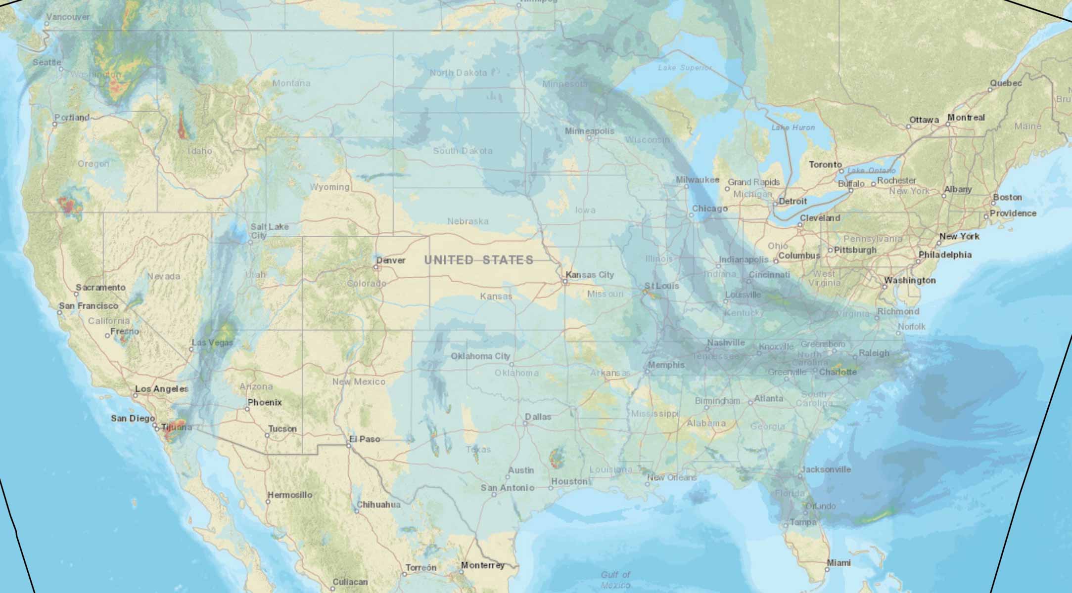
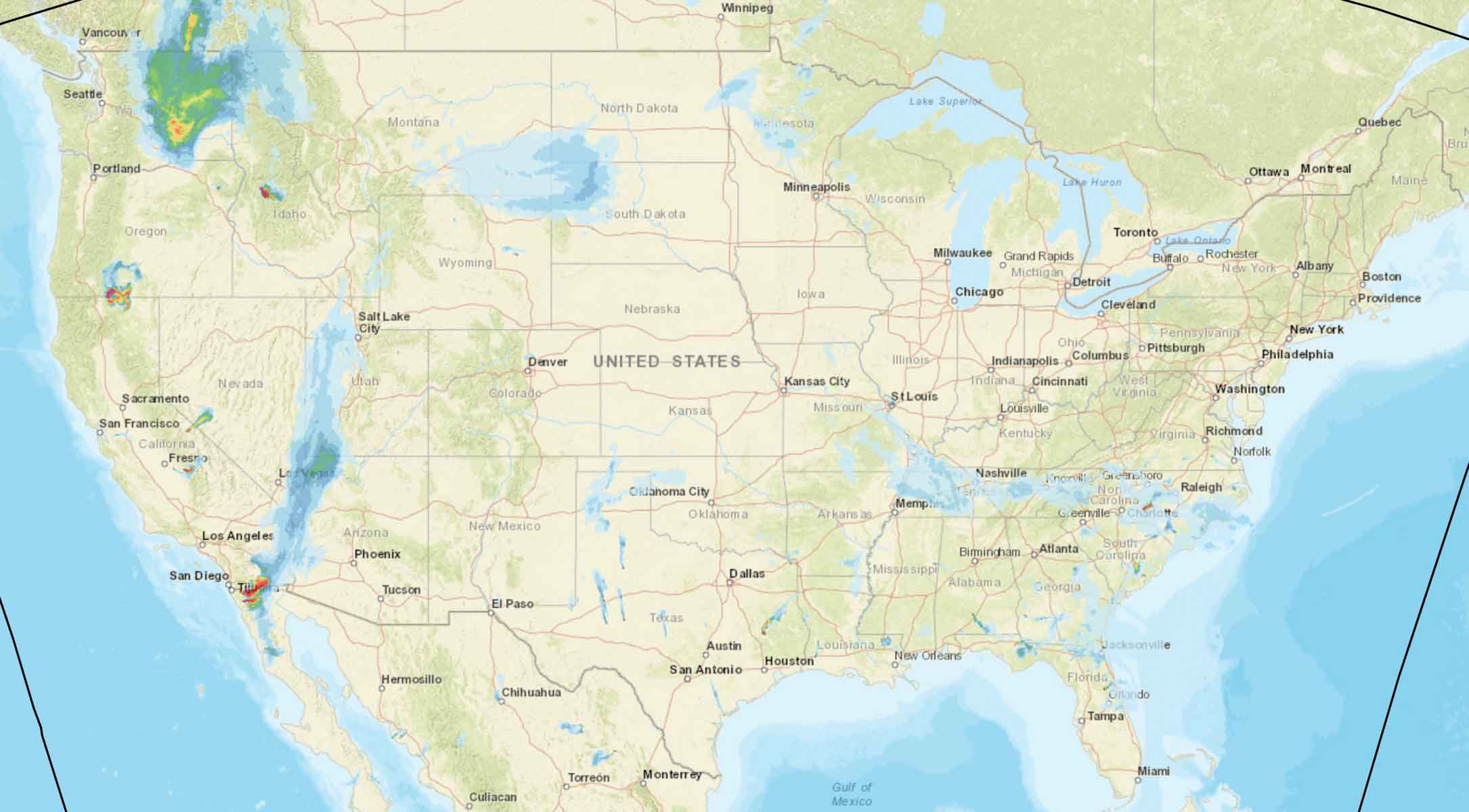
These maps predict the distribution of smoke from wildfires at 5 p.m. PDT August 10, 2019.
The first map is for vertically integrated smoke, depicting all of the smoke in a vertical column, including smoke high in Earth’s atmosphere. That is the smoke you see at sunrise and sunset.
The second map shows near surface smoke that will hover within 8 meters (26 feet) of the ground—the kind responsible for burning eyes and aggravating asthma.
#USFWS #StVincentNWR implemented a #rxfire yesterday. The operation went well and the burn is being monitored. @FFS_Leon @FFS_Chipola @NWSTallahassee @NFinFlorida Pic is during implementation. pic.twitter.com/AGszejaYwj
— USFWS Fire SE (@USFWSFireSE) August 9, 2019
The manager of the Twitter account for the U.S. Fish and Wildlife Service’s St. Vincent National Wildlife Refuge wanted to make it clear that the photo was taken during the implementation of the prescribed fire.
The refuge is in the Florida panhandle, southeast of Panama City. (map)
Which do you prefer?
These maps depict the prediction for wildfire smoke at 4 p.m. MDT August 7, 2019. As you can see, they are different. The first one is for near surface smoke — that is, smoke that is within 26 feet of the ground. The second one shows vertically integrated smoke, more than 26 feet above the ground ranging up to high in the atmosphere.
Below the maps are more details about the two different heights of smoke. Which map would you prefer to see on Wildfire Today?
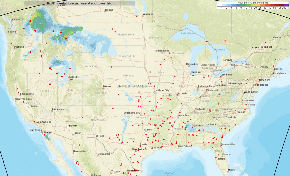

“Near-surface smoke” refers to the smoke that will hover within 8 meters (26 feet) of the ground—the kind responsible for burning eyes and aggravated asthma. “Vertically integrated smoke” depicts all of the smoke in a vertical column, including smoke high in Earth’s atmosphere. That is the smoke you see at sunrise and sunset. The animation below shows a 36-hour forecast of vertically integrated smoke on August 6, 2018.
“Near-surface smoke is one indicator of air pollution, but the smoke could also be at much higher altitudes,” said Ravan Ahmadov, the main developer of the HRRR-smoke model, and a research scientist at NOAA’s Earth Systems Research Laboratory and the Cooperative Institute for Research in Environmental Sciences. “That’s important to know, because the smoke could affect visibility for aviation.” High-altitude smoke can also block incoming sunlight, which can cool air temperatures and interfere with solar energy production.”