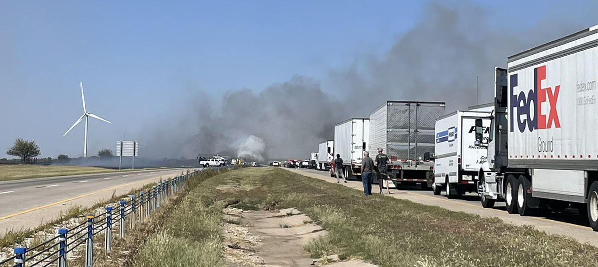
Crash and a grass fire close I-35 in Oklahoma, Sept. 27, 2022. Oklahoma Highway Patrol photo.
Interstate 35 in Noble County, Oklahoma Tuesday was closed for hours following a multiple vehicle crash in which at least one person died. Aerial footage showed fires in the rubble of mangled semi trucks and other vehicles. A nearby grass fire burned up to the Interstate and authorities suspect smoke from the fire reduced the visibility that led to the crash.
The Oklahoma Highway Patrol said the highway was completely shut down southbound at mile marker 211 and northbound at mile marker 203.
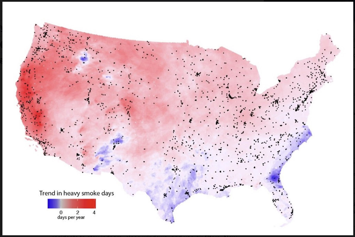
Measurements from satellites indicate rapidly growing exposure to heavy smoke plumes across much of the U.S. Map shows the estimated annual increase between 2011 and 2020 in the number of smoke plumes that NOAA analysts designate as “heavy,” their densest plume classification. Dots indicate EPA ground-based pollution monitors. Credit: Burke et al.
By Josie Garthwaite, Stanford University
When drifting wildfire smoke brings hazardous air pollution to cities and towns across the country, public health officials urge residents to stay indoors, close windows, and use air filters. New research from Stanford University shows Americans are getting the message, yet still rarely succeed at keeping smoke from entering their homes.
Researchers led by Marshall Burke, an associate professor of Earth system science, analyzed data from consumer-grade air pollution sensors in 1,520 single-family homes across the U.S., as well as nearby outdoor air pollution monitors, cell phones, social media posts, and Google searches in English and Spanish between 2016 and 2020.
They found internet searches for air quality information increased on heavy smoke days, regardless of income, while searches for air filters, smoke masks, and other protective measures recommended by health officials rose only in wealthy neighborhoods. Residents of wealthier neighborhoods are also more likely to shelter at home when wildfire smoke pollutes outside air. “People seem to know they’re being exposed. We see a lot of behaviors change even at pretty low levels of smoke exposure, although those responses differ by socioeconomic status,” said Burke.
The results, published July 7 in Nature Human Behaviour, show that better education and information about health hazards from wildfire smoke are not enough to protect people from the health harms of wildfire smoke exposure. The findings also bolster evidence for nascent efforts to take a more proactive and systematic approach to mitigating public health risks from wildfire smoke, predicted to be one of the most widely felt health impacts of climate change nationwide.
While most current government policies rely on a do-it-yourself approach to avoiding unhealthy air from wildfires, this tactic will have “modest and unequal benefits,” the authors write. Short-term solutions include establishing clean air shelters and providing public subsidies for lower-income households to filter indoor air. “If people can’t maintain good air quality in their homes, they need a place to go where they can breathe clean air,” said Burke, who is also deputy director of Stanford’s Center on Food Security and the Environment. “That’s a great place to start.”
Leaky homes
Overall, the authors found indoor concentrations of the deadliest type of particle pollution, known as PM 2.5, often remain three to four times higher than public health guidelines, and can vary by a factor of 20 between neighboring households during heavy smoke days. “Households that look exactly the same in terms of income, house price, and house size had enormously different indoor air for a given level of outdoor air quality,” said study co-author Sam Heft-Neal, a researcher at the Center on Food Security and the Environment. According to the authors, the most likely culprits are open doors and windows, leaky buildings, and a lack of filtration.
As the number of heavy smoke days in California and the West continue to climb, lawmakers from several western states have introduced bills that would allow the president to declare a “smoke emergency,” provide federal funding to establish clean air shelters and relocate vulnerable populations, and create a grant program for local community planning related to wildfire smoke. None have been enacted.
“To be able to intervene appropriately, we have to be able to measure things, including what people are exposed to in their home and how they’re behaving,” said Burke. That ability is rapidly expanding, thanks to the growing number of people buying relatively low-cost but reliable air quality monitors from PurpleAir, a private company, and agreeing to have the data put on a public website—although households who own the monitors, for now, are overwhelmingly Californian and higher income. “Our ability to precisely measure infiltration at the household level and then relate that to things we observe about the house or the community is new,” Burke said.
In the absence of systematic support at the federal level, a patchwork of local and state mitigation efforts has emerged. Oregon’s environmental agency, for example, has provided a grant for the city of Ashland to set up a free air purifier distribution program for vulnerable residents. In California, where more than half the population experienced a month of wildfire smoke levels in the range of unhealthy to hazardous during the 2020 fire season, the state has launched a $5 million pilot program providing grants for smoke shelters.
Still, most places are no better prepared for unhealthy air this year than they were in 2020 and, as large fires become more frequent, it will become increasingly onerous for people to protect themselves. “We’ve dug ourselves a huge hole in terms of the amount of accumulated dry fuel in our forests. It’s going to require unprecedented levels of investment over a sustained period to reduce fire risk and lower smoke exposures for everyone,” Heft-Neal said. “In the meantime, we have to be prepared for the large wildfires that, unfortunately, we’re going to get. And we have to be ready to deal with the downwind exposures that those wildfires generate.”
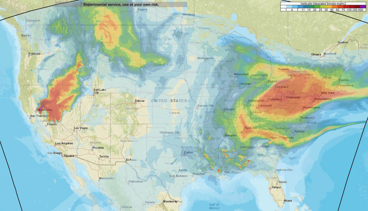
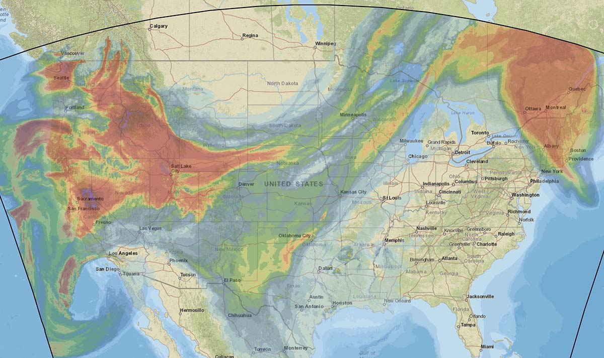
Forecast for distribution of smoke at 1 a.m. PDT Sept. 16, 2022. NOAA.
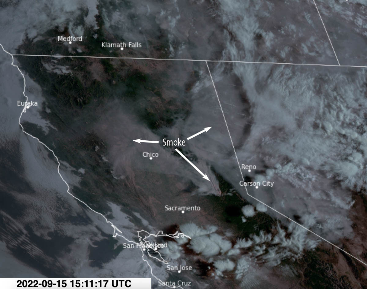
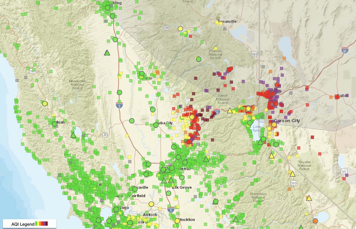
Wednesday afternoon most of the smoke from the Mosquito Fire 35 miles northeast of Sacramento was moving into Northern Nevada. But that changed overnight as it spread northwest toward Chico and Redding in north-central California.
A forecast produced by NOAA expects that by 1 a.m. Friday it will again be moving into Northern Nevada, Eastern Oregon, and Southern Idaho. And from there, most likely Montana.
Satellite photo showing smoke from the Mosquito Fire at 8:11 a.m. PDT Sept. 15, 2022.
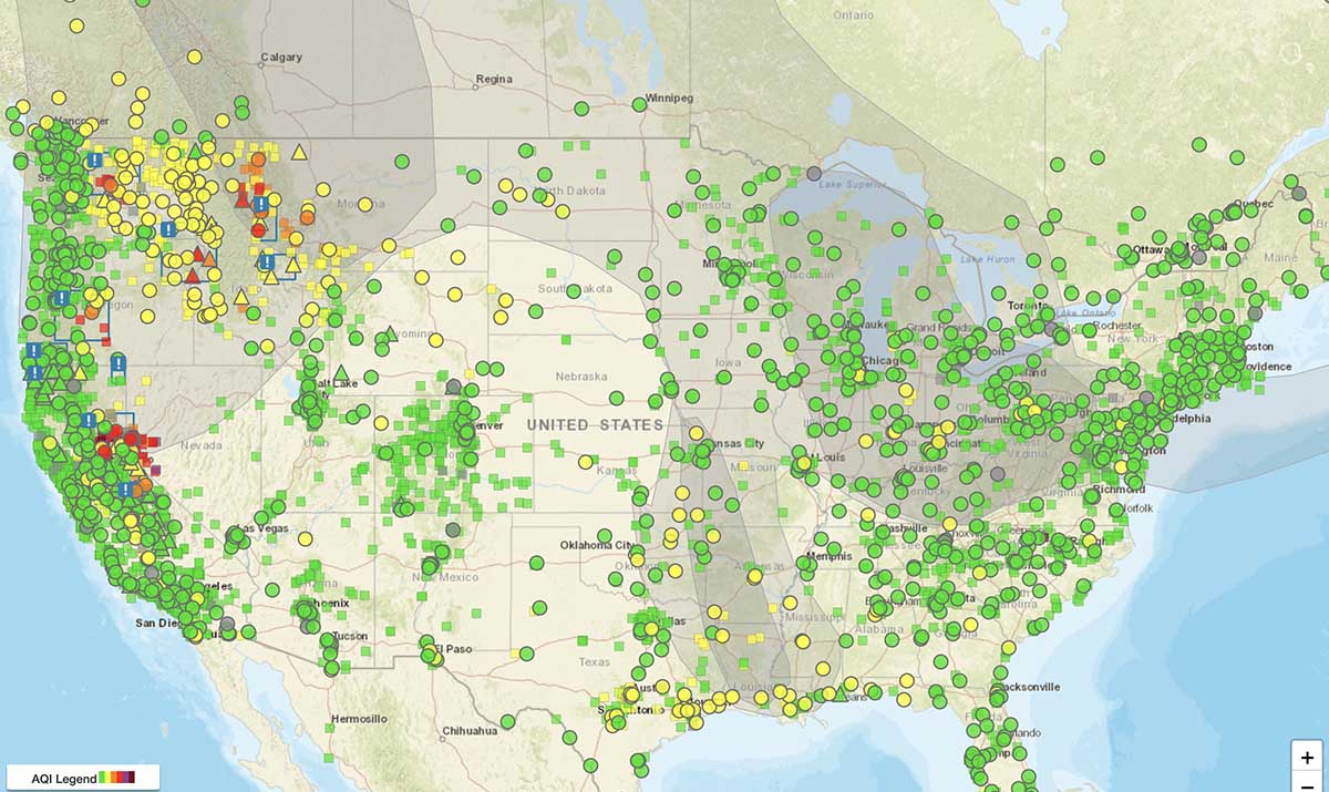
Below is the current air quality, produced by AirNow.
Air quality, from AirNow, at 8:54 a.m. PDT Sept 15, 2022.Air quality, vicinity of Mosquito Fire, from AirNow, at 8:54 a.m. PDT Sept 15, 2022.
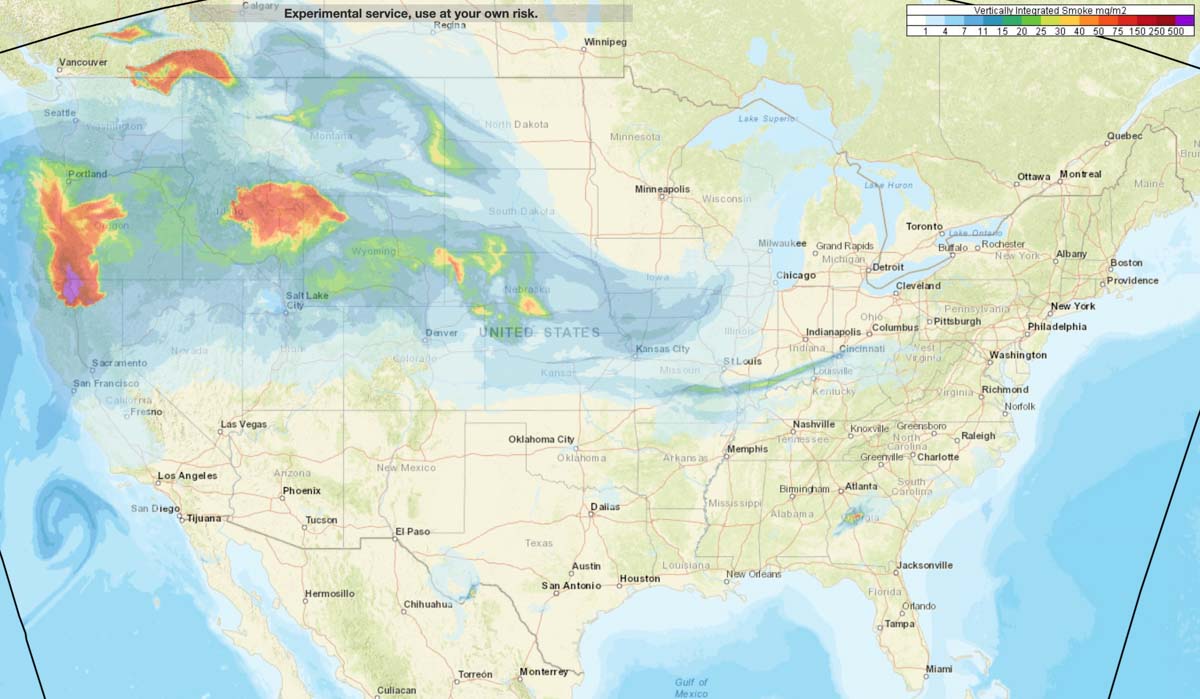
Wildfire smoke forecast for 11 p.m. MDT July 31, 2022.
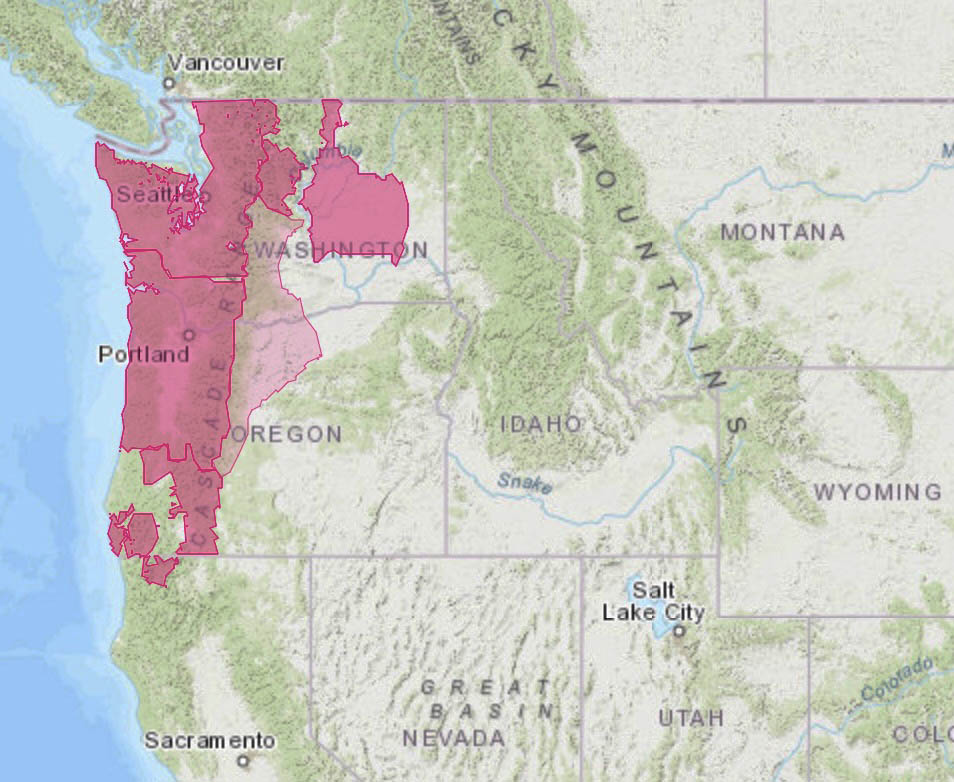
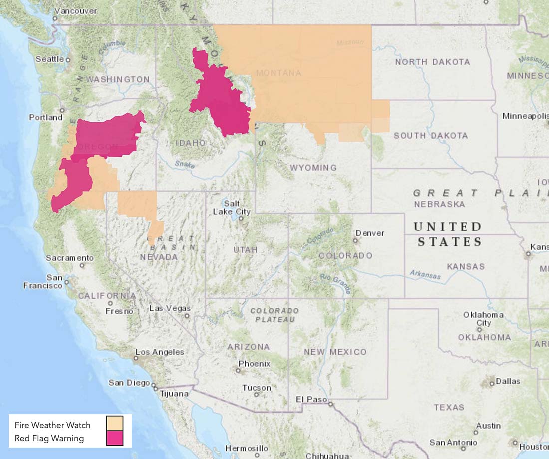
Smoke from wildfires may be noticeable Sunday in northern California and the northwest, including Oregon, Washington, Idaho, Montana, and Wyoming.
Red Flag Warnings are in effect Sunday for portions of California, Oregon, Idaho, and Montana. The Red Flag Watches on the map are for extreme fire danger on Monday.
Larger plumes send more smoke higher into the atmosphere where it can spread farther
Pyrocumulonimbus cloud over the Bootleg Fire in Oregon, July 14, 2021. InciWeb.
By Paul Gabrielsen Science writer, University of Utah
In recent years, the plumes of smoke crawling upward from Western wildfires have trended taller, with more smoke and aerosols lofted up where they can spread farther and impact air quality over a wider area. The likely cause is climate change, with decreased precipitation and increased aridity in the Western U.S. that intensifies wildfire activity.
“Should these trends persist into the future,” says Kai Wilmot, a postdoctoral researcher in the Department of Atmospheric Sciences at the University of Utah, “it would suggest that enhanced Western U.S. wildfire activity will likely correspond to increasingly frequent degradation of air quality at local to continental scales.”
The study is published in Scientific Reports and supported by the iNterdisciplinary EXchange for Utah Science, or NEXUS, at the University of Utah.
Smoke height
To assess trends in smoke plume height, Wilmot and University of Utah colleagues Derek Mallia, Gannet Haller and John Lin modeled plume activity for around 4.6 million smoke plumes within the Western U.S. and Canada between 2003 and 2020. Dividing the plume data according to EPA ecoregions (areas where ecosystems are similar, like the Great Basin, Colorado Plateau, and Wasatch and Uinta Mountains in Utah) the researchers looked for trends in the maximum smoke plume height measured during August and September in each region in each year.
In the Sierra Nevada ecoregion of California, the team found that the maximum plume height increased, on average, by 750 ft (230 m) per year. In four regions, maximum plume heights increased by an average of 320 ft (100 m) per year.
Why? Wilmot says that plume heights are a complex interaction between atmospheric conditions, fire size and the heat released by the fire.
“Given climate-driven trends towards increasing atmospheric aridity, declining snowpack, hotter temperatures, etc., we’re seeing larger and more intense wildfires throughout the Western U.S.,” he says. “And so this is giving us larger burn areas and more intense fires.”
The researchers also employed a smoke plume simulation model to estimate the mass of the plumes and approximate the trends in the amount of aerosols being thrown into the atmosphere by wildfires . . . which are also increasing.
The smoke simulation model also estimated the occurrence of pyrocumulonimbus clouds—a phenomenon where smoke plumes start creating thunderstorms and their own weather systems. Between 2017 and 2020, six ecoregions experienced their first known pyrocumulonimbus clouds and the trend suggests increasingly frequent pyrocumulonimbus activity on the Colorado Plateau.
Taller plumes send more smoke up into higher elevations where it can spread farther, says John Lin, professor of atmospheric sciences.
“When smoke is lofted to higher altitudes, it has the potential to be transported over longer distances, degrading air quality over a wider region,” he says. “So wildfire smoke can go from a more localized issue to a regional to even continental problem.”
Are the trends accelerating?
Some of the most extreme fire seasons have occurred in recent years. So does that mean that the pace of the worsening fire trend is accelerating? It’s too early to tell, Wilmot says. Additional years of data will be needed to tell if something significant has changed.
“Many of the most extreme data points fall within the years 2017 -2020, with some of the 2020 values absolutely towering over the rest of the time series,” he says. “Further, given what we know of the 2021 fire season, it appears likely that analysis of 2021 data would further support this finding.”
In Utah’s Wasatch and Uinta Mountains ecoregion, trends of plume height and aerosol amounts are rising but the trends are not as strong as those in Colorado or California. Smoke from neighboring states, however, often spills into Utah’s mountain basins.
“In terms of the plume trends themselves, it does not appear that Utah is the epicenter of this issue,” Wilmot says. “However, given our position as generally downwind of California, trends in plume top heights and wildfire emissions in California suggest a growing risk to Utah air quality as a result of wildfire activity in the West.”
Wilmot says that while there are some things that people can do to help the situation, like preventing human-caused wildfires, climate change is a much bigger and stronger force driving the trends of less precipitation, higher aridity and riper fire conditions across the West.
“The reality is that some of these [climate change] impacts are already baked in, even if we cut emissions right now,” Wilmot adds. “It seems like largely we’re along for the ride at the moment.”