Above average wildfire potential predicted for coastal areas of Central and Southern California

NIFC’s prediction for March and April

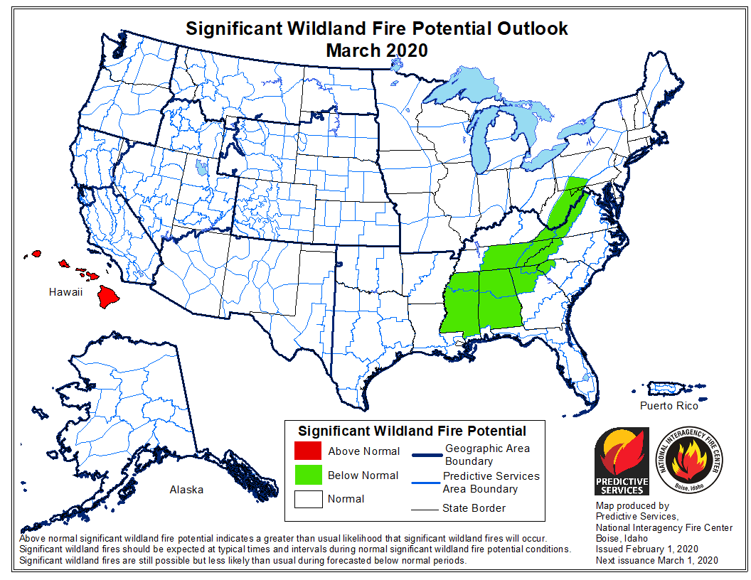
March wildfire outlook

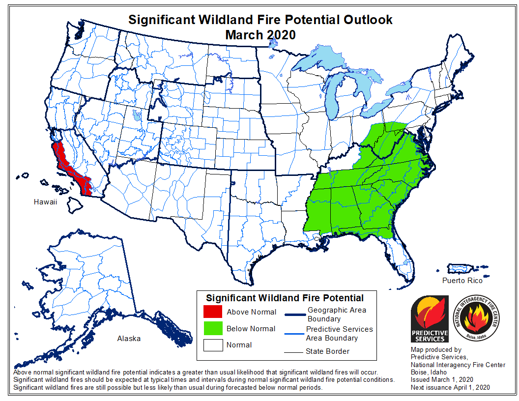
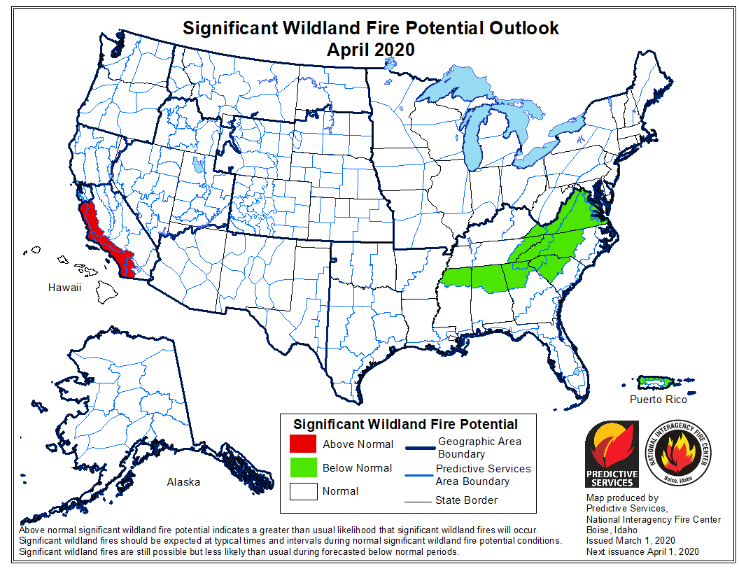
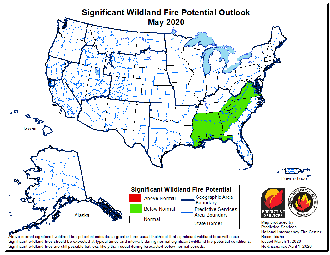
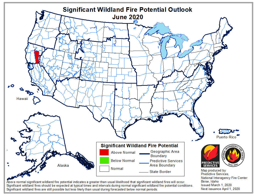
The Predictive Services section at the National Interagency Fire Center has issued their Wildland Fire Potential Outlook for March through June. The data represents the cumulative forecasts of the ten Geographic Area Predictive Services Units and the National Predictive Services Unit.

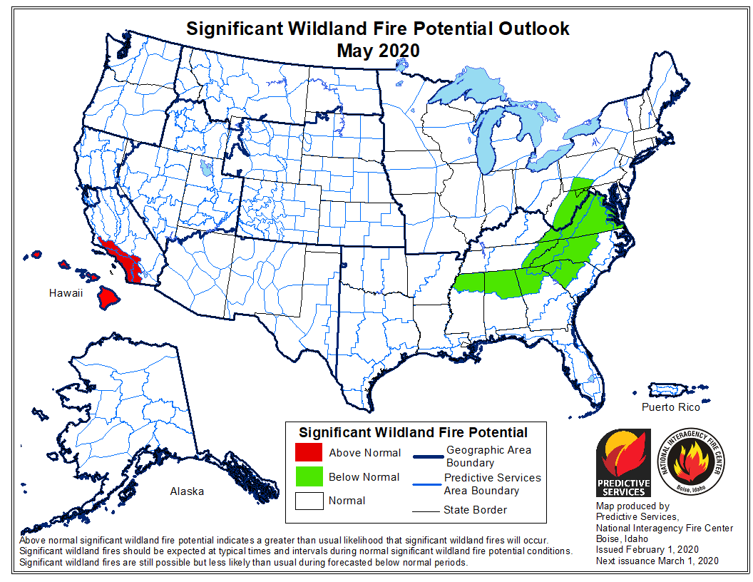
If NIFC’s analysis is correct the only area with above average potential for wildfires during March and April will be the coastal areas of Central and Southern California.

Below:

  • An excerpt from the NIFC narrative report for the next several months;
  • More of NIFC’s monthly graphical outlooks;
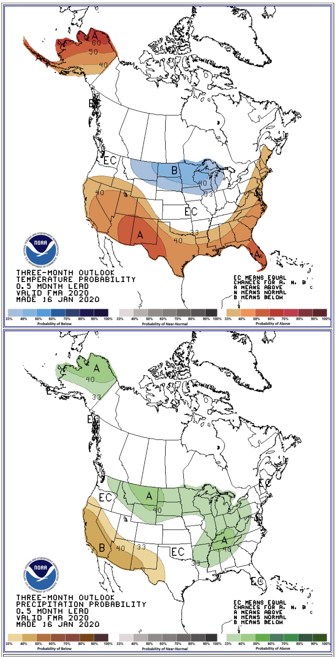
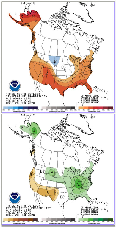
  • NOAA’s three-month temperature and precipitation forecasts;
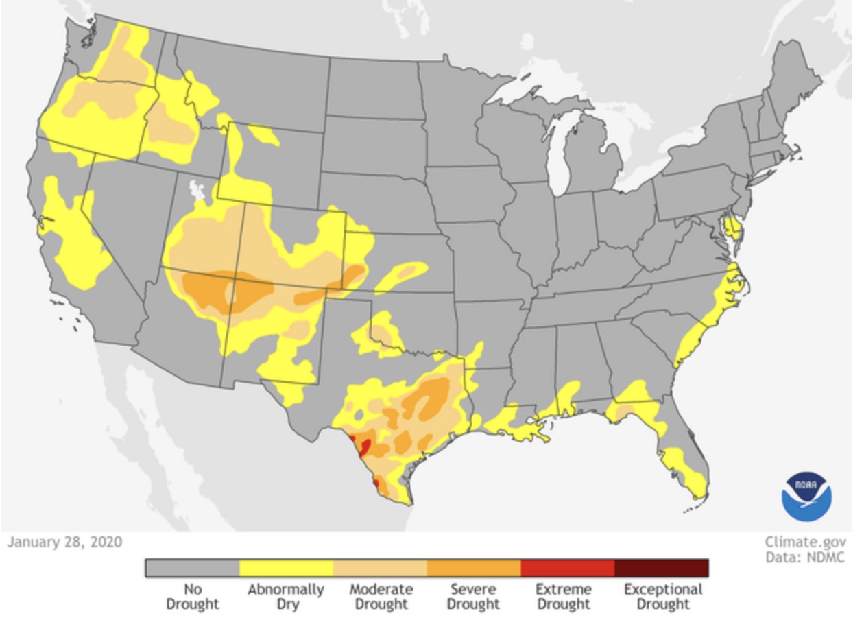
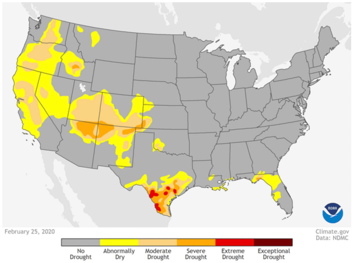
  • Drought Monitor;
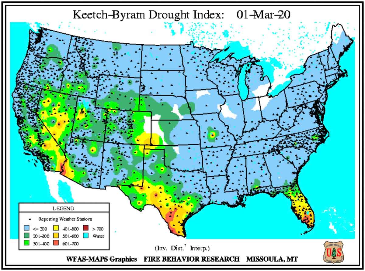
  • Keetch-Byram Drought Index.

Entering March and continuing through April, the prolonged periods of dry conditions across Southern California may lead to periods of elevated fire potential during days experiencing offshore winds. However, a muted greenup should initially limit activity. Normal to Below Normal significant large fire potential is expected along the Rocky Mountain Front during the pre-greenup period due to sufficiently wet or snowy conditions experienced during late winter.

Both the Southwest and Alaska will gradually transition into fire season in May with both regions peaking in activity by late June. Overall Normal significant large fire potential is expected during the period except possibly across northern and western portions of Arizona and across portions of South Central Alaska including the Kenai Peninsula where conditions were drier than average over the past winter.

[…]

[In Southern California] well below average rainfall and above average temperatures are expected to continue through April. Due to the lack of significant rainfall, fine fuels are curing rapidly across the lower elevations and will be completely cured by the middle or end of March. There will be an above average potential for large fires across the lower elevations of the Central Coast and Southern California due to the early curing of fine fuels. A near average amount of offshore wind events will most likely continue to occur through April. These winds will fan any new ignitions and rapid rates of spread and long range spotting will be likely in continuous dead fuel beds. The potential for large fire development will become Normal across all of Central and Southern California May and June as the interior warms up and the offshore wind season comes to an end.
April wildfire outlook May wildfire outlook June wildfire outlook

90-day Precipitation Temperature forecast
90-day Precipitation & Temperature forecasts for March, April, & May, 2020.
Drought Monitor
Drought Monitor

KBDI

February brought record low precipitation in parts of California

February Precipitation record low California map

From Daniel Swain of @WeatherWest:

“Well, it’s official: most of California just experienced driest February on record. Locations like Ukiah, Sacramento, Redding, & San Francisco recorded no rain *at all* during a month at peak of the rainy season. Wildfire concerns are elevated this week.”

Rain stops some of the bushfires in Australia

A number of locations have received 100 mm (almost four inches) of precipitation

Precip Observed
Observed precipitation observed during the seven-day period ending February 7. The darkest green color indicates 100 mm (almost 4 inches) of precipitation.

Many areas in New South Wales, Victoria, and Queensland have received multiple inches of rain over the last seven days with a number of locations recording about 100 mm (almost four inches).

A heavy rain could come close to putting out some fires but a light rain, depending on the fuel (vegetation), might just pause the spread for a while. And some regions have received little or no rain.

NSW Rural Fire Service commissioner Shane Fitzsimmons says the rain is “breaking the back” of the bushfire season. “The rain is good for business and farms as well as being really good for quenching some of these fires we’ve been dealing with for many, many months,” the commissioner told ABC TV on Friday.

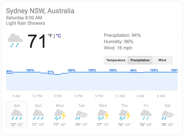
The forecast for Sydney, on the NSW coast, calls for nearly 100 percent chance of precipitation every day over the next eight days.

Precipitation forecast for Sydney, Australia
Precipitation forecast for Sydney, Australia. Generated Saturday February 8 local time.

Southern California could see elevated wildfire danger in April & May

NIFC issues updated report on wildfire potential

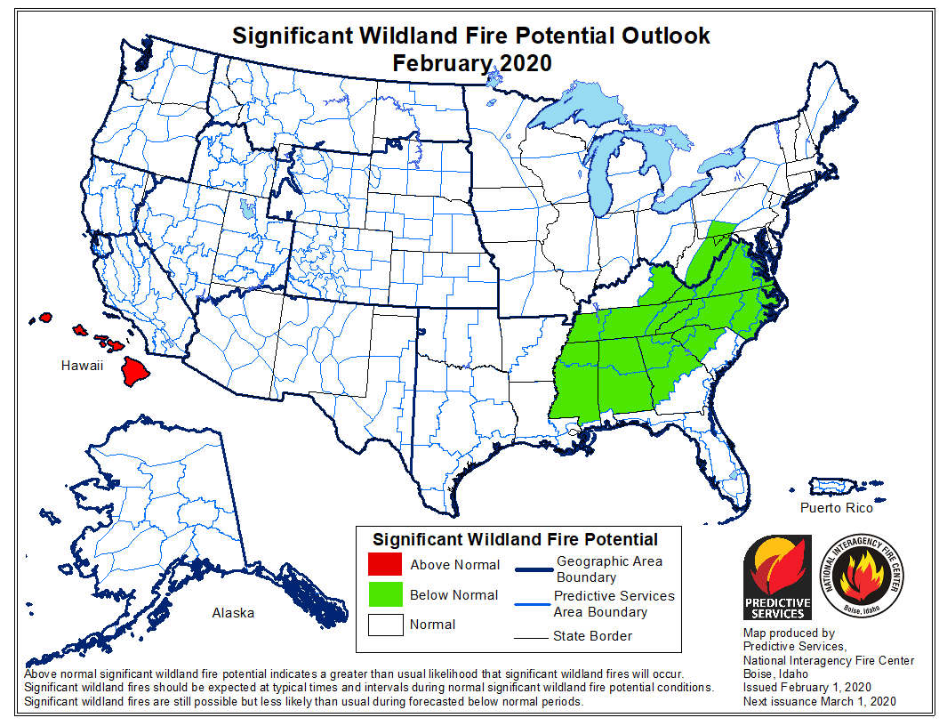
February wildfire potential

The Predictive Services section at the National Interagency Fire Center has issued their Wildland Fire Potential Outlook for February through May. The data represents the cumulative forecasts of the ten Geographic Area Predictive Services Units and the National Predictive Services Unit.

If NIFC’s analysis is correct the only area with above average potential for wildfires during February and March will be Hawaii. However the southern coastal area of California is expected to see above average wildfire potential in April and May.

Below:

  • An excerpt from the NIFC narrative report for the next several months;
  • More of NIFC’s monthly graphical outlooks;
  • NOAA’s three-month temperature and precipitation forecasts;
  • Drought Monitor;
  • Keetch-Byram Drought Index.

Here is an excerpt from a portion of the report that discusses the possibility of increasing fire potential in southern California in April and May.


“Due to a ridge replacing the trough, the weather has turned very dry since the start of 2020. Precipitation during the past 30 days has been, on average, 30-50% of normal across the Geographic Area. Some places in Southern CA are closer to the 10-25% range in comparison to normal since January 1st . Temperatures have been slightly above normal, especially near the coast, but offshore wind events have been infrequent and of light intensity.

“The drier weather coinciding with what is normally the wettest time of the year is concerning regarding the long term curing and drying cycle of seasonal grasses and other fine fuel types. Long range models are all depicting drier than normal conditions during the February through April timeframe, but some ensemble members point toward a wetter period returning in March. This may be too late to forestall an earlier than normal curing of grasses as subsoil moisture in the first few inches of topsoil will likely be depleted by then. Therefore, we are expecting large fire potential to climb to Above Normal levels due to an early onset of springtime “grassfire season.” Heavier, dead fuels may become involved by the time warmer temperatures arrive in May. Long range models also point toward a warmer than average temperature regime through May which may compound the problem.

“Resource demand will likely increase rapidly across Southern California by the end of March or in April. From there, large fire potential may climb to Above Average across central portions of the state by the late spring or early summer months. At this time, offshore wind events are expected to occur at a near normal rate, but even a quiet offshore pattern may not alleviate the effects of a dry late winter and spring.”


March wildfire potential April wildfire potential May wildfire potential

temperature and precipitation 90 day outlook
Temperature and precipitation outlook for February, March, and April, 2020. NOAA.
Drought Monitor
Drought Monitor


Rain could slow the fires in Australia

Areas of Victoria and New South Wales could receive zero to over two inches of precipitation this week

Precipitation over Victoria and New South Wales
Precipitation detected by radar over Victoria and New South Wales at 4:35 p.m. PST January 15, 2020. Fires are indicated by the flame icons.

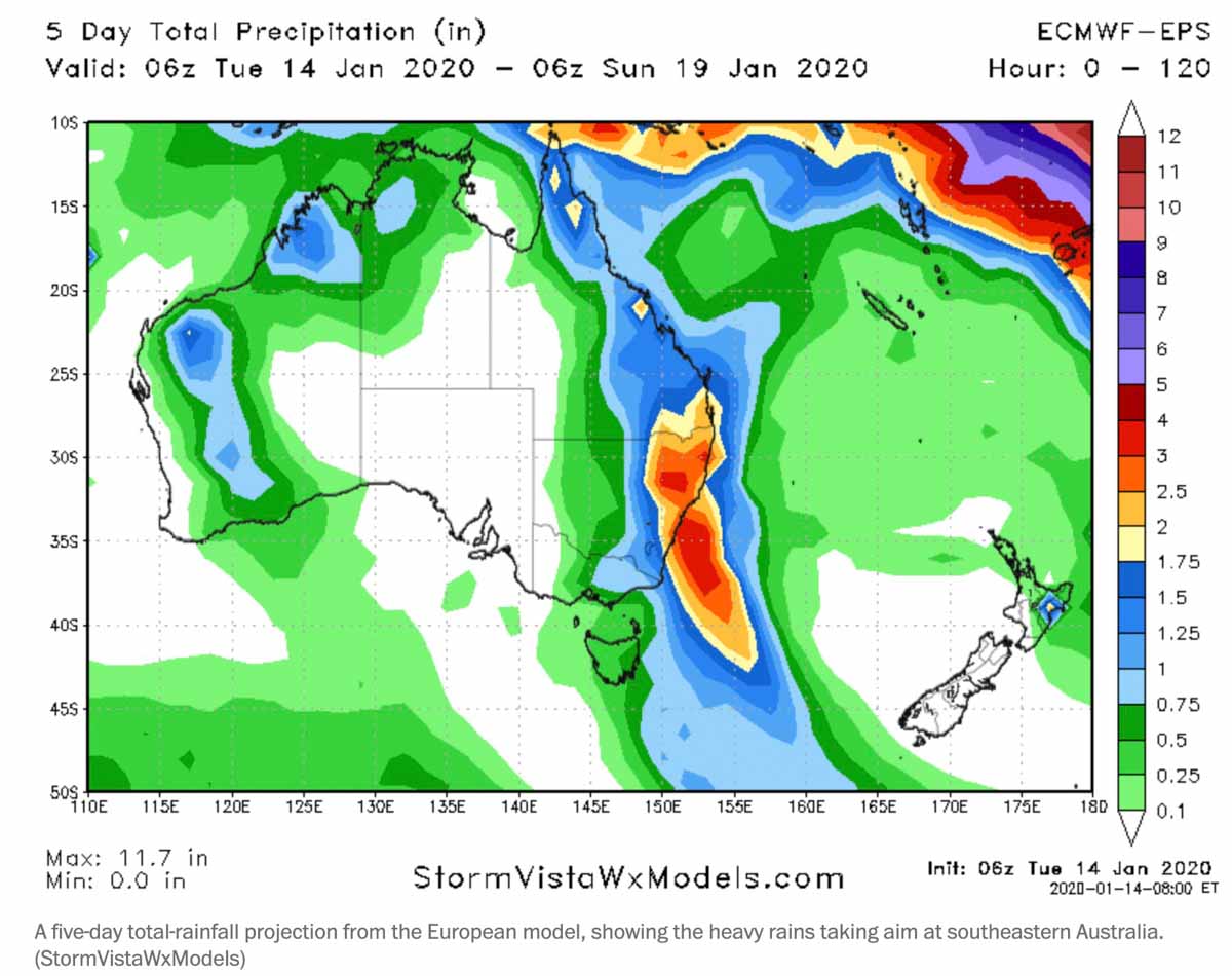
Predicted rain and cooler temperatures this week in Australia could slow the spread of the bushfires in Victoria and New South Wales. The heaviest rain will be on the east coast where some areas could receive over two inches while the forecast on the west side of the two states is for much less or perhaps none.

The rain is the product of a deep inland trough drawing humid air into the system.

Small amounts of rain will not put out the fires, but could make them partially dormant for a period of days, giving firefighters time to regroup and construct firelines on portions of the perimeters. But many of the fires are far too large to ever be completely encircled by firelines.

Some of the rain will come in the form of thunderstorms, leading to the possibility of flash flooding, landslides, and fallen trees.

The rain will be welcomed by residents and especially farmers in the drought-stricken communities.

predicted rain australia january 15 2020
Precipitation (in inches) predicted for Australia, January 14 through 19, 2020.

Meteorologist explains the weather that is driving the bushfires in Australia

Australia weather explained
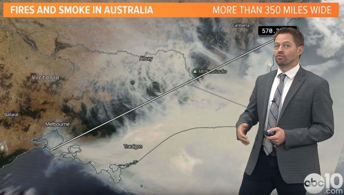
Screenshot from the ABC10 video below.

Rob Carlmark, a meteorologist at Sacramento TV station ABC10, explains the weather that has created the current unprecedented bushfire situation in Australia.

You can follow Mr. Carlmark on Twitter: @rcalrmark