The newest Landsat satellite has successfully achieved orbit and is being checked out by NASA for a few months before it is turned over to the U.S. Geological Survey and renamed Landsat 8. We were overdue to get a new Landsat — the last one was launched in 1999.
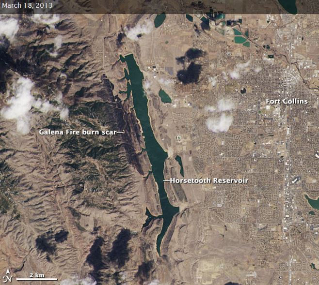
The image above is a test that was distributed by NASA before the instruments on the spacecraft had been fully checked out and calibrated. It was acquired on March 16, the day after the Galena Fire started. If you go to the NASA site and click on the button that says “VIEW IMAGE COMPARISON”, after a few seconds a slider will appear on the image which you can drag left and right to see data acquired by different sensors on the satellite. Very cool.
This spacecraft has additional sensors and technology new to the Landsat series. I may be the only one interested in this since I used to work closely with the US Forest Service Infrared aircraft used for mapping fires, but the older Landsats had a technology similar to the USFS Infrared planes, and used a scanning technique of reflecting the imagery off a rotating 3-sided mirror onto a sensor. A row of data was recorded with each pass of one side of the mirror. The excerpt below from NASA explains the new technology:
The Landsat Data Continuity Mission builds on this foundation and brings with it two advanced science instruments that will deliver more data — and clearer images — than ever before. The Operational Land Imager (OLI) is designed to measure visible, near infrared, and short wave infrared wavelengths, while the Thermal Infrared Sensor (TIRS) monitors temperatures on the Earth’s surface. Using what scientists call a “push-broom” approach, these detectors will record a constant stream of data as the spacecraft passes 438 miles overhead in a near-circular, near-polar orbit.
“All earlier Landsat sensors, on Landsats 1 through 7, were called ‘whisk-broom sensors.’ Each one of these sensors used a mirror that oscillated back and forth,” Irons said.
“In contrast, both of the sensors on the Landsat Data Continuity Mission, OLI and TIRS, instead of using an oscillating mirror, they will use long arrays of detectors across the focal plane of each instrument.”
During each satellite pass, OLI and TIRS will observe and collect image data for a 185-kilometer-wide swath of land. As Earth rotates beneath the satellite’s orbit, subsequent seams of land will come into view, providing a complete picture of the planet’s surface every 16 days.
I’m thinking that the new thermal infrared sensor will enable Landsat 8 to obtain better images of active vegetation fires than we have previously seen from satellites. By the time the spacecraft acquired the test image on the second day of the Galena Fire, there was probably not a great deal of heat left on the fire, which burned mostly in light fuels, so it looks more like a burn scar than an active fire.
Thanks go out to Daniel


Satellite imagery of active fires in the TIR bands was hampered not so much by the scanners or detectors as by the signal preamps that overloaded with the high emission values of raging wildfires. The instrument preamps have to be designed with enough dynamic range to process the lower emission values of earth surface features in daylight and dark and then not saturate with the much higher values of wildfire and volcanic eruptions. The common FLIR cameras have the same problem- fine for the most common targets day or night, but not able to handle the higher emission sources like fires. Solutions include inserting a neutral density filter in front of the detector and switching in a lower gain preamp.
The fact that these newer instruments are 12-bit means that they have the potential to handle the necessary dynamic range; whether the rest of the system can match that remains to be seen.