After the discussions on Wildfire Today about the use of prescribed fire in the Flint Hills of Kansas here and here, we, along with some of our readers, have been paying more attention to the use of fire in the state. Over the last 24 hours the weather in Kansas and Oklahoma must have been perfect for burning, because satellite images and the MODIS heat-detecting satellite have picked up a great deal of heat and smoke in the area.
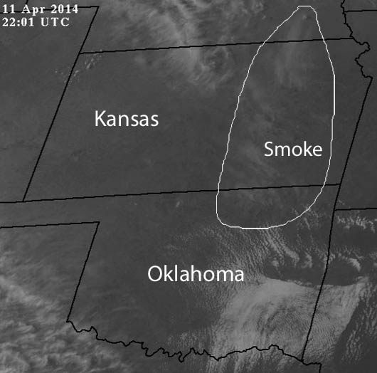
The visual satellite image above shows smoke in northeastern Oklahoma and eastern Kansas at 5:01 CDT, April 11, 2013.
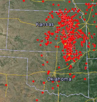
The map above shows heat detected by the MODIS satellite during the 24 hours previous to 7 p.m. CDT, April 11, 2014.
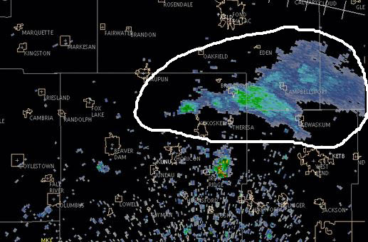
And speaking of smoke, the image below shows smoke detected by radar today from a fire in Horican Marsh, midway between the towns of Horicon and Waupun in Wisconsin. Click here to see an animation of the smoke as the fire increased in size.
Thanks and a hat tip go out to Darren.


You are correct, the weather has been not perfect, but the best in quite some time – after several years of either drought or rain that precluded much of the normal burning. Those maps outline the Flint Hills pretty nicely. Visibility 4/11 was below a mile at times due to the smoke. Folks are increasingly spreading burns out to other times of year, but for many, the first two weeks of April is so ingrained in them you’d get them to change churches or political parties faster than you’d get them to burn at other times. For now.
Air Quality Index in Lincoln, NE hit a “unhealthy” 154 over night.
We can’t get a burn permit here unless AQI is less than 50.
We have also been doing allot of RX fire in Nebraska. 🙂