(UPDATED at 8:30 a.m. PDT, July 31, 2014)

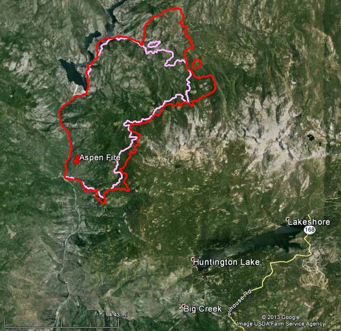
The map above shows the perimeters of the French Fire (south of the Mammoth Pool Reservoir) on Tuesday night and Wednesday night, as well as the 2013 Aspen Fire that was just across the San Joaquin River. Scroll down to see a map that shows a larger area.
The French Fire burned intensely well into the night on Wednesday, adding another 1,402 acres, bringing the total to 7,024 acres. Most of the growth was on the northwest and southeast sides.
Firefighters are planning a burning operation on the southern end of the fire to reinforce the hand and dozer lines that were constructed from the San Joaquin River up to Forest Road 4S81. This anchor point will support structure defense in the Hogue Ranch and Kinsmans Flat areas, which are currently the highest priorities.
Several Forest Service and private campgrounds were evacuated, as well as some summer homes in the Hogue Apple Ranch and Wagner’s Resort.
****
(UPDATED at 7:25 p.m. PDT, July 30, 2014)

We dug up the data for the July, 2013 Aspen Fire that was just across the drainage from where the French Fire is burning now — and put both fire perimeters on the above map.
Below is the 3-D version of the map.

****
(UPDATED at 6:40 a.m. PDT, July 30, 2014)

The latest map of the French Fire revealed that it has burned about 5,600 acres in California’s Sierra National Forest south of the Mammoth Pool Reservoir.
French Fire at Mt. Tom thank you Marta for the amazing picture! #FrenchFire #sierranationalforest pic.twitter.com/AUkE9xK7M0
— Sierra Ntl. Forest (@Sierra_NF) July 30, 2014
A Type 2 Incident Management Team under the direction of Incident Commander David Cooper has been assigned. One of their priorities is to anchor the west flank in order to protect the residential areas at the Hogue Ranch and the Kinsman Flat area.
****

A fire that was reported early Monday morning in California had already burned 3,600 acres as of Tuesday night. The French Fire is 15 miles east of Oakhurst, 5 miles west of Huntington Lake, and 36 miles northeast of Fresno. It is just across the drainage from last year’s Aspen Fire that blackened at 22,748 acres south of Mammoth Pool Reservoir about this same time last year.
Several summer homes and 12 Forest Service and private campgrounds have been evacuated and closed. Structures are being defended in the Hogue Ranch and Kinsman Flat areas.

The 2013 Aspen Fire (shown in the map below) was just east of where the French Fire is burning now (seen in the map above). Some of the same firelines that were used last year are being opened up and used again.

