(UPDATED at 8:41 a.m. PDT, August 21, 2014)

Firefighters are beginning to get a handle on the Way Fire near Wofford Heights, California, but there is still some fireline that has not yet been constructed in very steep terrain. The remaining fire activity is on the east and northwest sides, but those areas are being kept mostly in check with aircraft.
At the public meeting Wednesday night the Operations Section Chief said that for safety reasons, they may not commit firefighters to those rugged areas; they will continue to treat them with water and retardant drops from helicopters and hope that does the trick. The team is bringing in a portable fire retardant plant that will supply the helicopters. Long Term Retardant is more effective than water when dropped from a helicopter or an air tanker. Fire Aviation has photos of a retardant plant being used on the Beaver Fire in northern California on August 13.
The latest size estimate is 4,031 acres. The incident management team is calling it 48 percent contained as of 8:41 a.m. PDT, August 21, 2014.
****
(UPDATED at 8:25 p.m. PDT, August 20, 2014)
At 8 p.m. today the incident management team issued an update on the Way Fire near Wofford Heights and Kernville, reporting that the fire had burned 3,858 acres and they are calling it 48 percent contained. There is still some active fire on the north side.
All evacuation orders and road closures have been lifted.
A public meeting was held at 6 p.m. which was live-streamed on YouTube. The meeting was very well organized and informative for the locals who attended and the others who watched it on the internet. It was recorded and is available on YouTube.
****
(UPDATED at 9 a.m. PDT, August 20, 2014)
The Way Fire near Wofford Heights and Kernville in southern California grew very little on Tuesday under more moderate weather conditions. Very little information is being distributed by the Type 1 Incident Management Team that assumed command at 6 p.m. Tuesday, but the latest reported size is 3,367 acres and they are calling it 15 percent contained.
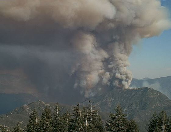
According to the Situation Report eight homes have burned. KBAK television reported that at the peak of fire activity 14 air tankers and 8 helicopters were working to assist firefighters on the ground. Approximately 900 personnel are assigned, along with 26 hand crews and 56 engines. The fire is burning in Bureau of Land Management jurisdiction, and is organized under a unified command with Kern County Fire Department and the U.S. Forest Service.
BakersfieldNow has an impressive slide show with more than 50 photos of the fire.
****
(UPDATED at 6:05 p.m. PDT August 19, 2014)
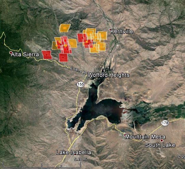
The map of the Way Fire near Kernville shows data collected at 2:26 p.m. PDT, August 19, 2014.

The weather in the fire area on Tuesday has been less conducive to rapid fire spread than it was late on Monday when the fire started. Comparing the conditions at 5 p.m. each day, on Tuesday the temperature was 8 degrees lower, the relative humidity was 10 percent higher, the wind was about the same, and the prediction for the humidity at midnight Tuesday night (the humidity recovery) is 17 percent higher than it was 24 hours before.
The Type 1 Incident Management Team is arriving at the fire today. It is likely that information about the fire will be distributed more slowly during the transition and after they assume command.

****
(Originally published at 10:34 a.m. PDT August 19, 2014)

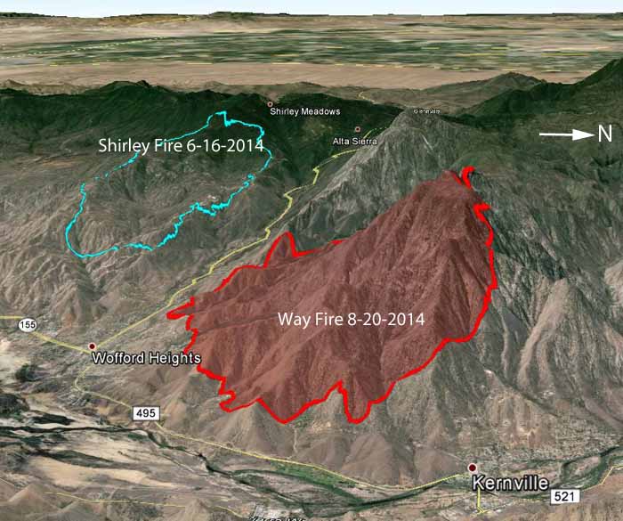
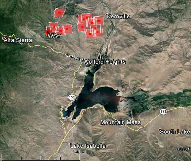
The Way Fire was reported at 3 p.m. on August 18 north of Highway 155 west of Isabella Lake in southern California and by midnight had spread to within about a mile of Kernville, as you can see in the map below. Wednesday morning the Incident Management Team (IMT) reported it had grown to 3,195 acres.

According to the IMT, “Recommended evacuations in Kernville are Burlando Road, Frontier Lane, and Plater Road.”
Some structures are reported to have burned, but the exact number is not known; other structures are threatened, including in the Wofford Heights area.
The fire has been spreading rapidly and has large growth potential.
In June the Shirley Fire burned more than 2,600 acres on the other side of Highway 155.
Amazing shot @Jeff_Frost MT “#Wildfire #WayFire threatens #Kernville as the #milkyway blazes overhead pic.twitter.com/C54pgyvC2j”
— Ed Sherman (@fireimages) August 19, 2014
