(UPDATED at 5:47 a.m. PT, August 19, 2015)

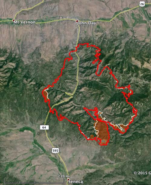
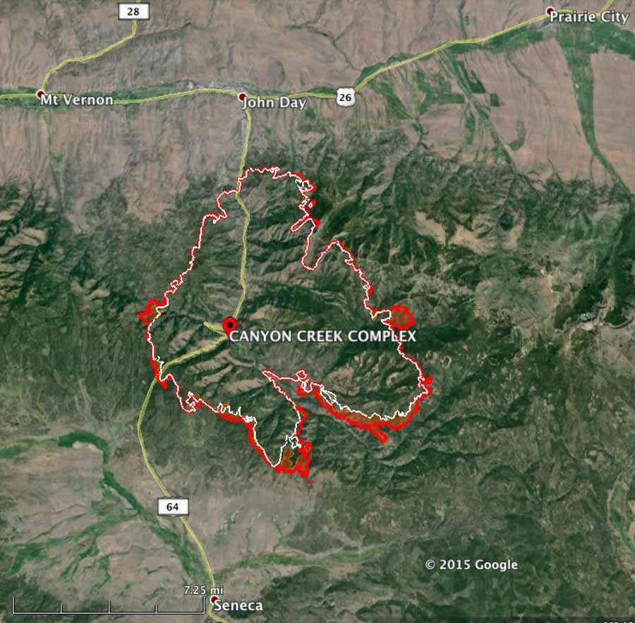
On Tuesday the Canyon Creek Complex of fires grew by over 4,000 acres and has now burned 48,200 acres (see the map below). Most of the growth was on the south side, but it also expanded west of Highway 385.
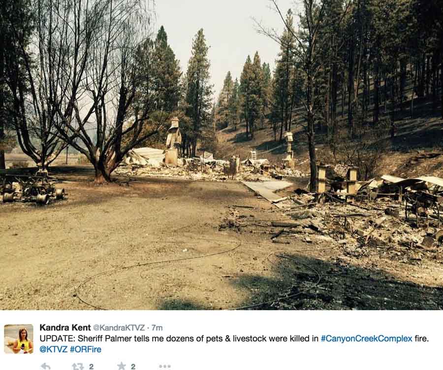
The Grant County Sheriff’s office reports that 36 residences have burned and 50 structures have been damaged.
The firefighting resources battling the fire include 826 personnel, 18 hand crews, 7 helicopters, 46 fire engines, 14 dozers, 5 skidgines, and 16 water tenders.
The fire is being managed by the Great Basin Incident Management Team (Incident Commander Lund) and the Oregon State Fire Marshal Red Team (Incident Commander Walker).
The south and southwest sides of the fire were very active Tuesday. Fire crews and dozers worked in the area, while heavy air tankers dropped fire retardant. The fire has burned south of the Dry Soda Lookout, along the 3925 Road and across Thompson Gulch on the Forest.

****
(Originally published at 6:24 p.m. PT, August 18, 2015)

Since the Canyon Creek Complex of fires started in central Oregon on August 12 it has burned 36 structures and over 43,738 acres. Currently it is one mile south of Canyon City and 2.5 miles south of John Day, Oregon. (see the map below)


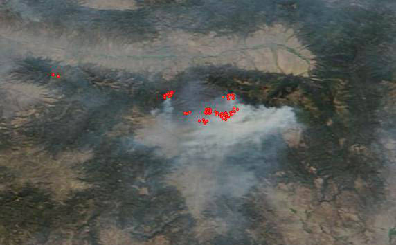
On Monday the south half of the fire was actively spreading, with intense heat detected on the southeast side during a 10 p.m. aerial mapping mission.
The Canyon Creek Complex of fires is the number one priority nationally for allocation of firefighting resources. Approximately 561 firefighters are assigned to the incident and more will be arriving Tuesday.
On Monday firefighters constructed and improved fireline on the north and south sides. Structural firefighting crews worked directly around homes, air resources dropped retardant, and bulldozers cut fireline to slow the spread of the fire. Several homes were saved due to the direct action of fire crews.
On Tuesday the Fall Mountain weather station west of the fire recorded a 3:30 p.m temperature of 78 degrees, 19 percent relative humidity, and an 8 mph wind gusting to 21 out of the northwest. The forecast for Wednesday for the fire area predicts 90 degrees, 12 percent RH, and 5 to 9 mph winds out of the southeast, switching to be out of the northwest in the afternoon — and no chance of rain on Wednesday, the NWS says. The warmer and drier conditions on Wednesday could portend a more active fire.


This fire is near John Day and Canyon City…Grant Co. That’s eastern Oregon. Bend would be central Oregon.
I considered that before writing the article. We can agree to disagree. Yes, it is east of the exact center of Oregon. But saying it’s in central Oregon is not incorrect…. at least for this person who does not live there and is just looking at a map. Maybe the locals have decided that certain areas are in the “east”, “central”, or “west” parts of the state.
First of all, Bill. KUDOS!! For your never-ending dedication to the wildfire community and for Wildfire Today. I’m quite certain many of your dedicated readers applaud you, too. So much for the strokes ….. get back to it! Anyway …
A question about establishing priorities for allocation of firefighting resources. Who/what determines that? NIFC? And what puts the Canyon Creek Complex at the top of the list at this time?
At this point in time in a fairly recent very active fire season, I’d guess that it’s not the natural and human resources at risk but rather, simply put, firefighting resources were probably stretching thin in advance of this aggressive wildfire.
Any thoughts, Bill or anyone?
Lone Ranger
Thanks Lone-
The Multi-Agency Coordination System (MACS) provides the framework to support coordination for incident prioritization, critical resource allocation, communication systems integration, and information coordination.