New law allows temporary federal firefighters to apply for permanent jobs

One of the many challenges federal land management agencies face when recruiting to fill wildland firefighter positions, in addition to low pay, is the difficulty in filling seasonal or “temporary” positions. A law recently signed by President Obama, the Land Management Workforce Flexibility Act, P.L. 114-47, puts a different perspective on that issue. Temporary firefighters can now apply for permanent positions if a few conditions are met:

1)   the employee was initially appointed under competitive procedures;
2)   the employee has served under one or more time-limited appointments in a land management agency for a period or periods totaling more than 24 months without a break of 2 or more years;
3)   the employee’s performance was at an acceptable level throughout the service period/s; and
4)   the employee’s most recent separation was for reasons other than misconduct or performance.

While the law is official, it can’t be implemented until new rules are issued by the Office of Personnel Management and the six agencies — Forest Service, Bureau of Land Management, National Park Service, Fish and Wildlife Service, Bureau of Indian Affairs, and Bureau of Reclamation.

Nearly 29,000 firefighters battling fires in western U.S.

Fire resources - 8-19-2015

(The above data is from the National Interagency Fire Center. We added the descriptions on the right in order to decode the acronyms for the Geographic Area Coordination Centers. Click the image above to see a larger version.)

An update of the wildfire situation in the western United States reveals that almost 29,000 personnel are currently working on active fires. The numbers from the National Interagency Coordination Center’s Incident Management Situation Report for August 19 show 573 hand crews, 1,811 fire engines, and 194 helicopters assigned to fires.

In addition, 46 incident management teams are deployed:

  • 2 Area Command Teams
  • 16 Type 1 IMTs
  • 27 Type 2 IMTs
  • 1 National Incident Management Organization team

There were 4 new large fires reported on Friday, to bring the total of uncontained large fires to 96.

Almost all of these numbers are higher than we last reported on August 15.

Red Flag Warnings and smoke, August 19, 2015

wildfire Red Flag Warnings Aug 19, 2015

The National Weather Service has issued Red Flag Warnings or Fire Weather Watches for areas in Washington, Oregon, Idaho, Wyoming, and Colorado.

The map was current as of 5:30 a.m. MDT on Wednesday. Red Flag Warnings can change throughout the day as the National Weather Service offices around the country update and revise their forecasts and maps. For the most current data visit this NWS site or this NWS site.

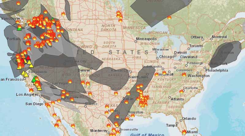
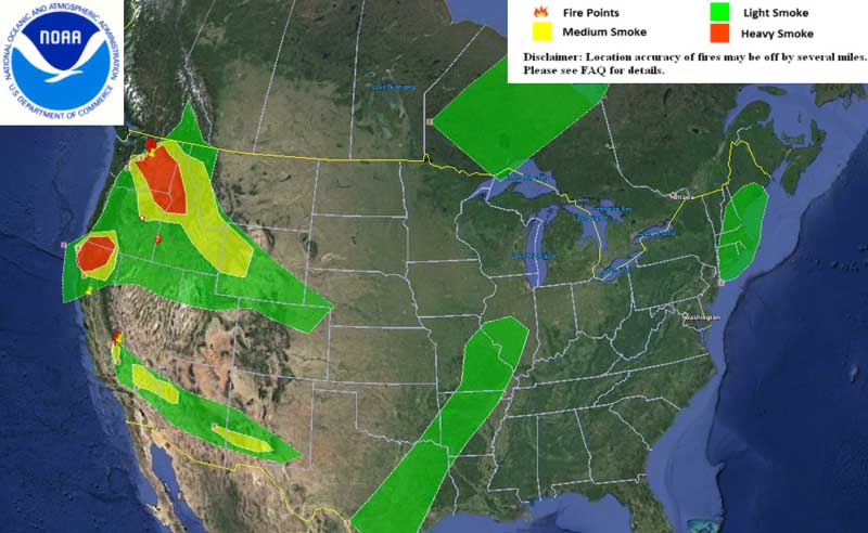
The map below shows the locations of wildfires and the smoke from those fires.

Wildfires and smoke map
Wildfires, and smoke produced by them, August 19, 2015.

Rough Fire, east of Fresno, CA, continues to spread near Hume Lake

(This article is no longer being updated, but there was an update on Wildfire Today on September 3, 2015.)

****

(UPDATE at 6:45 a.m. PT, August 24, 2015)

Rough Fire
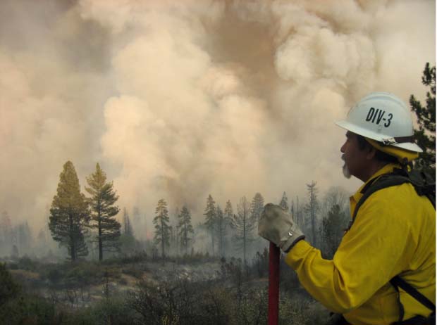
Undated InciWeb photo from the Rough Fire.

The Rough Fire just east of Hume Lake, California was fairly active again Sunday afternoon in multiple areas. As a result of fire activity and firing operations, the burned area increased approximately 2,000 acres to a total of 49,440 acres or 77 square miles.

Direct fire suppression continued southwest of Hume Lake near Landslide Campground. The objective of this operation is to stop the southern spread south of Hume Lake and east of  the Kennedy Grove area. Aircraft continue to be used for  these direct suppression operations.

Crews conducted hand firing near Balch Camp on Sunday. The fire made a run up canyon and burned laterally across the slope approximately ¾ miles from Balch Camp. Retardant is being dropped from helicopters to build a retardant line from the river up slope to check the fire spread.

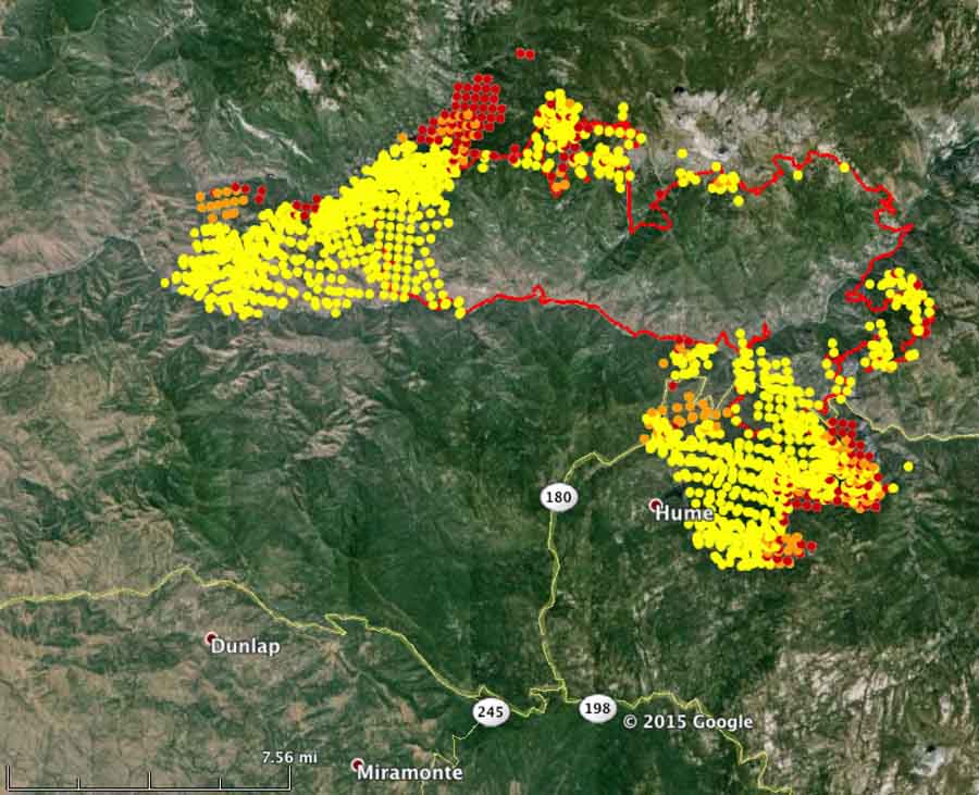
Map of the Rough Fire
Map of the Rough Fire. The red dots represent heat detected at 1:47 a.m. PT August 24, 2015.

The Grant Grove and Wilsonia areas of Kings Canyon National  Park will reopen in stages Monday and Tuesday. At noon on Monday the General Grant Tree,  Panoramic Point, park trails, John Muir Lodge, Grant Grove  Cabins, restaurant, market, and gift shop will open. On Tuesday at 8 a.m., the Kings Canyon Visitor  Center will reopen, and at noon Tuesday Sunset Campground will open.

****

(UPDATE at 11:15 a.m. PT, August 22, 2015)

Rough Fire
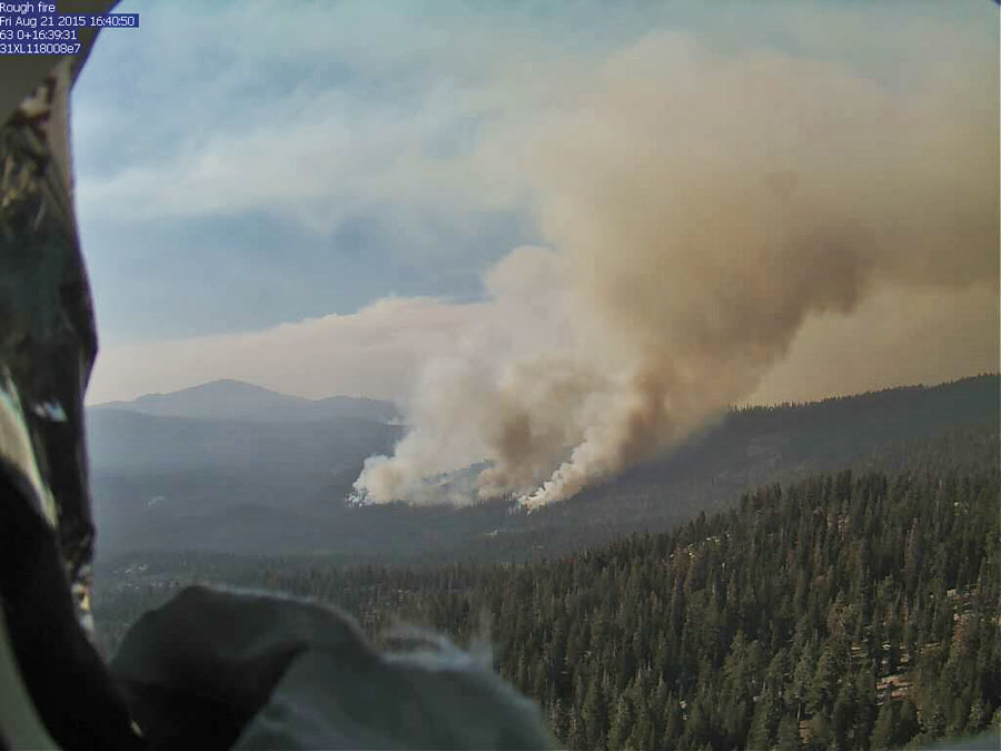
Rough Fire as seen from the Buck Rock cam at 4:41 p.m. PT, Aug 21, 2015.

The Rough Fire at Hume Lake, California, 36 miles east of Fresno, has spread south of Hume Lake and continues to grow on the west side north of Kings River and Highway 180. The incident Management Team is calling it 47,079 acres. Approximately 1,484 personnel are assigned to the incident.

Continue reading “Rough Fire, east of Fresno, CA, continues to spread near Hume Lake”

Canyon Creek Complex of fires in central Oregon

(UPDATED at 5:47 a.m. PT, August 19, 2015)

removing hazardous tree highway
Oregon Department of Transportation workers remove a hazardous tree on the Canyon Creek Complex of fires near US Highway 395.

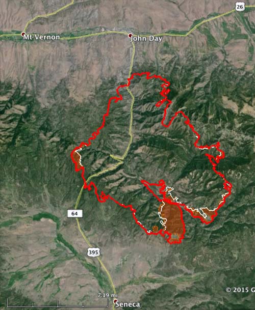
On Tuesday the Canyon Creek Complex of fires grew by over 4,000 acres and has now burned 48,200 acres (see the map below). Most of the growth was on the south side, but it also expanded west of Highway 385.

The Grant County Sheriff’s office reports that 36 residences have burned and 50 structures have been damaged.

The firefighting resources battling the fire include 826 personnel,  18 hand crews, 7 helicopters, 46 fire engines, 14 dozers, 5 skidgines, and 16 water tenders.

The fire is being managed by the Great Basin Incident Management Team (Incident Commander Lund) and the Oregon State Fire Marshal Red Team (Incident Commander Walker).

The south and southwest sides of the fire were very active Tuesday. Fire crews and dozers worked in the area, while heavy air tankers dropped fire retardant. The fire has burned south of the Dry Soda Lookout, along the 3925 Road and across Thompson Gulch on the Forest.

Canyon Creek Fire map
The red line was the perimeter of the Canyon Creek Fire at 11 p.m. PT, Aug 18, 2015. The white line was from about 24 hours before.

****

(Originally published at 6:24 p.m. PT, August 18, 2015)

Canyon Creek Complex of fires.
A crew works along a road on the west side of the Canyon Creek Complex of fires. Undated photo from InciWeb.

Since the Canyon Creek Complex of fires started in central Oregon on August 12 it has burned 36 structures and over 43,738 acres. Currently it is one mile south of Canyon City and 2.5 miles south of John Day, Oregon. (see the map below)

Continue reading “Canyon Creek Complex of fires in central Oregon”