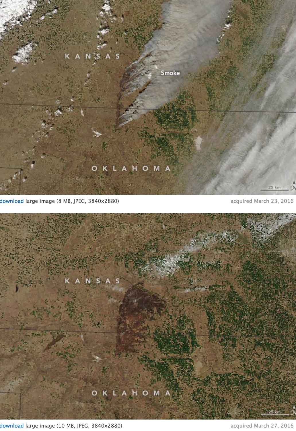
Here is the description from NASA of the images below of the Anderson Creek Fire that burned almost 400,000 acres in Oklahoma and Kansas last month:
“In late March 2016, wildfire raged across rural areas of Kansas and Oklahoma. Local authorities and media outlets are calling it the largest grass fire in Kansas history. The Anderson Creek fire started in northern Oklahoma on March 22 and proceeded to burn more than 620 square miles (1600 square kilometers) of prairie and cattle grazing land. No human deaths have been reported, though 600 cattle were killed by the fires. At least 16 homes and 25 structures were lost, as were countless miles of fencing.
The Moderate Resolution Imaging Spectroradiometer (MODIS) on NASA’s Aqua satellite acquired these two natural-color images of the fire. The first shows the extensive smoke plumes as winds whipped the fires on March 23, 2016. The second image shows the scarred land as it appeared on March 27. Turn on the image comparison tool to see the change.
The wildfire spread quickly due to dry conditions in the region; rainfall has been below normal this spring. By March 31, the fire was close to 90 percent contained, thanks to work by fire crews, the National Guard, and a few inches of snow. Click here to view drone footage of the fire at its peak.”

