Above: A burnout operation near Lowman, Idaho on the Pioneer Fire, August 5, 2016. USFS photo.
(UPDATED at 11 a.m. MDT August 6, 2016)
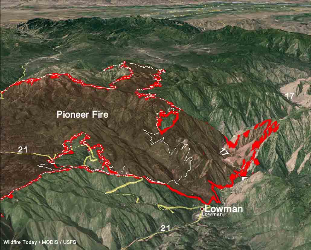
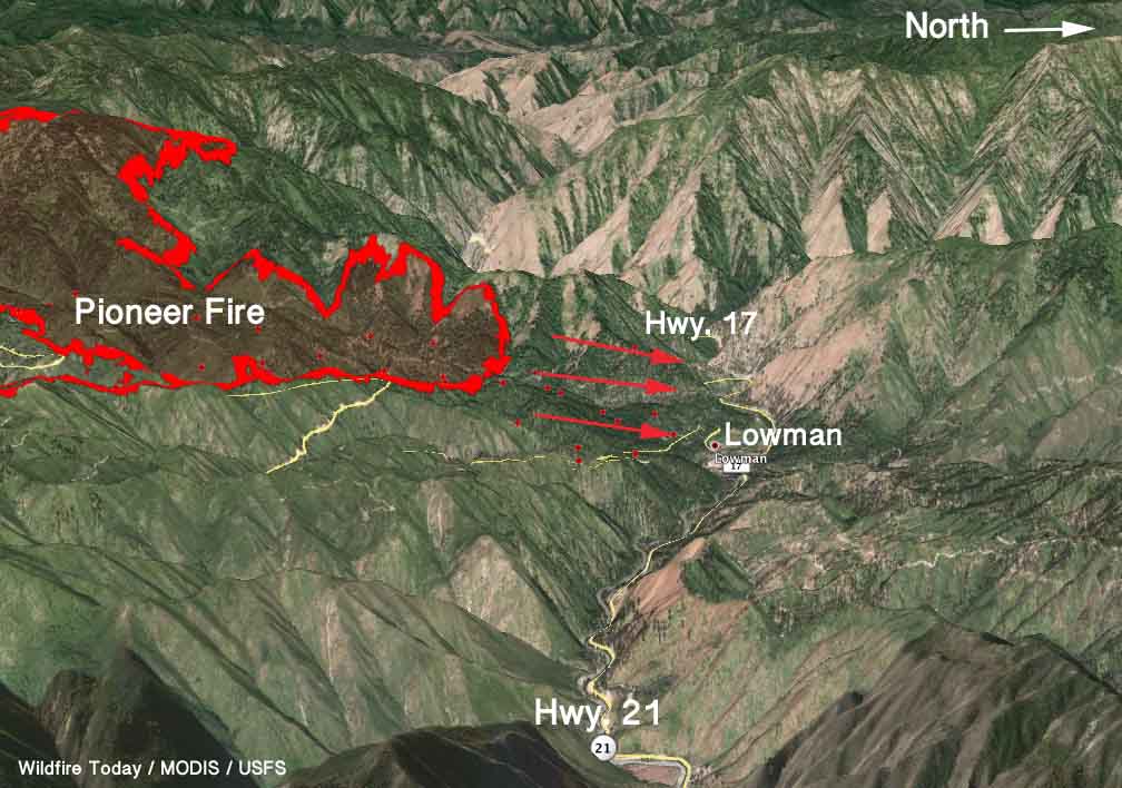
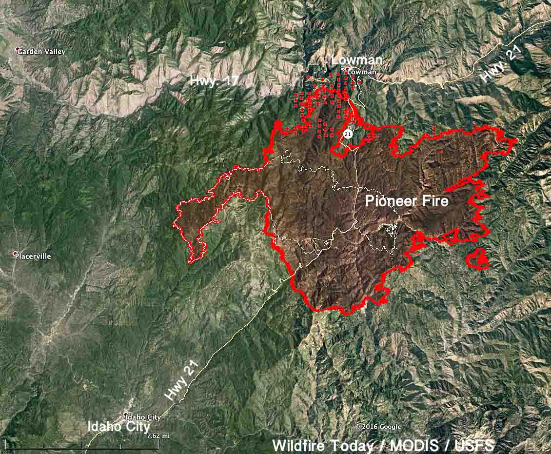
The Pioneer Fire at Lowman, Idaho, 32 air miles northeast of Boise, Idaho, continued to spread up the steep slopes after it crossed highway 17 Friday afternoon pushed by thunderstorm-generated winds gusting up to 35 mph. Spot fires initially occurred over the roadway west of the burnout firefighters were conducting near Lowman to protect the community. By 2 a.m. aerial mapping showed the fire had spread about 1.2 miles north of the highway and consumed an additional 1,200 acres.
On Friday the fire grew by about 6,700 acres, to 58,136 acres.
The video below of firefighters working along Highway 21 was posted by the incident management team on August 5.

The incident management team’s plans for Saturday, in part:
Crews will look for opportunities to bring dozer line north from Burns Ridge down to the river west of the fire in an effort to create a new containment line. North of the river the fire is established in steep slopes with light grassy fuels. Aircraft this morning will survey the fire west and north of Lowman looking for suitable places to build containment lines. The possibility of another thunderstorm today or tomorrow brings potential for stronger wind gusts, which could create more extreme fire behavior.
****
Originally published at 9:02 p.m. MDT August 5, 2016
A strong south wind added to the complexity of the burnout being carried out since Thursday by firefighters in an effort to stop the Pioneer Fire from impacting the community of Lowman, Idaho and crossing Highway 21. Sustained winds at 20 mph with gusts of 28 to 40 mph pushed the blaze across the highway Friday, significantly increasing the workload now laid out before the incident management team.

Evacuations have been ordered by the Boise County Sheriff’s Office for some areas near the Payette River, and Highway 17 is closed. The fire is 32 air miles northeast of Boise, Idaho.
The 52,000-acre fire is being fought by 1,489 personnel, 43 hand crews, 52 engines, and 10 helicopters. Five structures have been destroyed.

The incident management team running the fire led by Beth Lund is about to time out, so a replacement has been ordered which will inbrief at 9 a.m. on August 8.
#PioneerFire pic.twitter.com/uSqgdLQ3ji
— Jeff Platt KBOI (@JeffPlattKBOI) August 6, 2016
Double burnout planned to protect Lowman from #PioneerFire: https://t.co/A9c63DSU8X pic.twitter.com/aLypSZZDGw
— KBOI 2News (@KBOITV) August 4, 2016


Is the Pioneer fire close to the Grandjean campground?
Is Centerville or placerville in trouble with fire do we need to come up and get out stuff out of our cabins ?
Conditions for large wildfires is assisted by preservation instead of management.