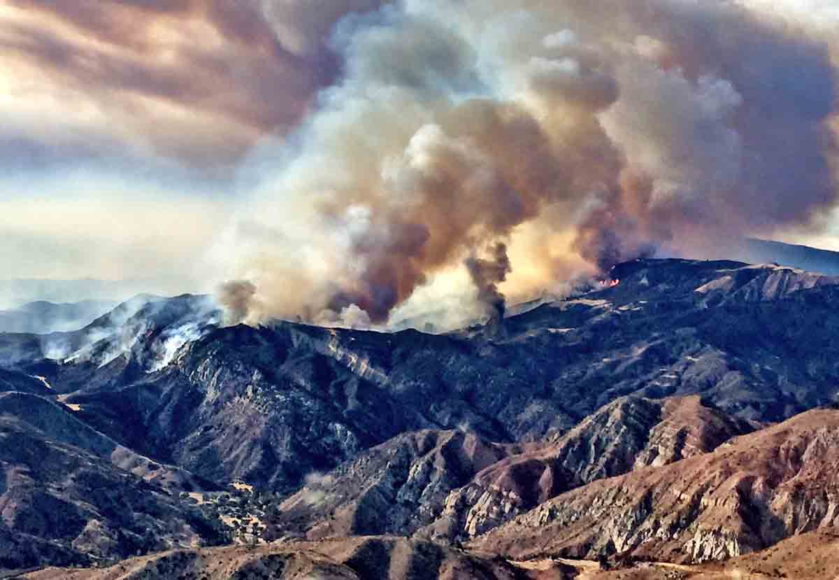
Above: The Rey Fire. Photo by Jeff Zimmerman.
(We published an updated article about the Rey Fire August 24, 2016)
(UPDATED at 8:22 a.m. August 22, 2016)
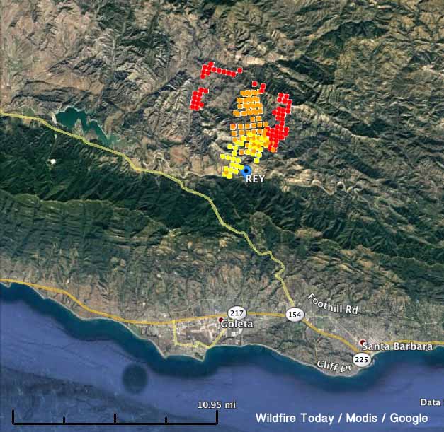
The Rey Fire continued to spread to the east on Sunday, growing by more than 4,000 acres to a total of 23,546. Almost all of the growth was on the east side where it spread for more than 2 miles but it was also active on the northeast perimeter.
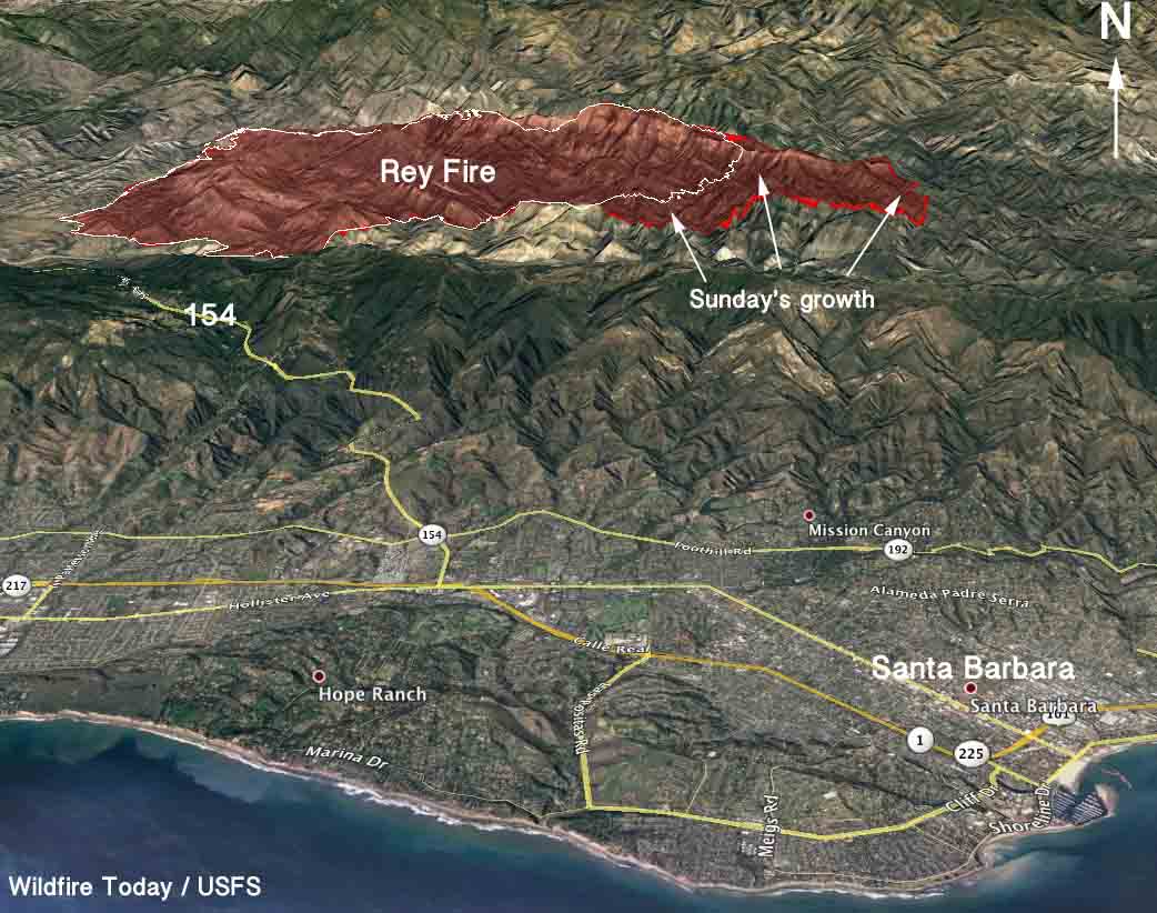
The weather conditions at the fire area should be rather mild Monday, for southern California anyway. The temperature will be in the mid-80s under a mostly clear sky and the relative humidity will bottom out in the mid-20s, but the wind could be a concern. It will increase in the afternoon to 10 to 13 mph out of the northwest gusting at 16-20.
The fire is being fought by 1,260 personnel, 28 crews, 48 engines, and 2 helicopters. There are no reports of any structures that burned.
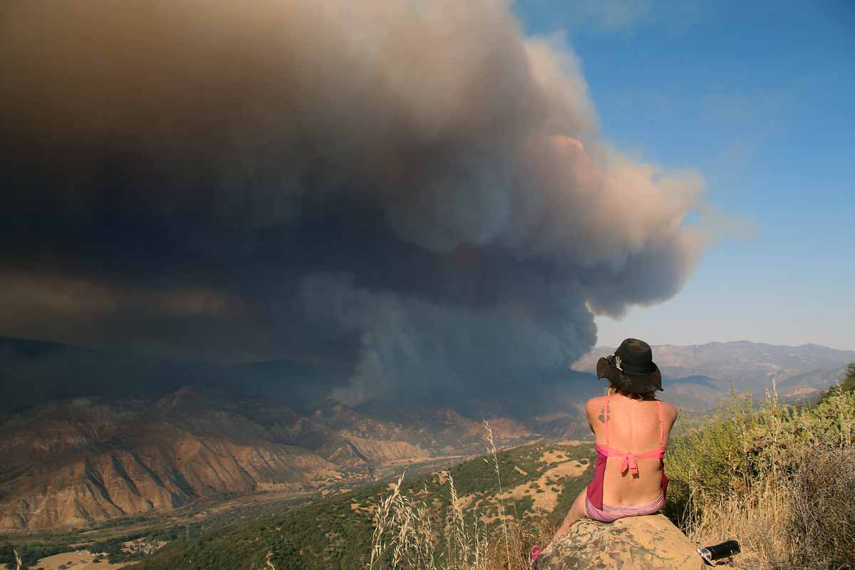
The time lapse video below of the Rey Fire is mesmerizing. It’s a case study in wildland fire behavior and fire meteorology, featuring wind shear and pyrocumulus clouds. It was shot on August 20 by Jesse Rockwell.
#ReyFire – A C-130 makes a retardant drop Sunday near Camuesa Peak in the Los Padres Nat. Forest pic.twitter.com/v9KJm4YtUK
— SBCFireInfo (@EliasonMike) August 22, 2016
#ReyFire – A C-130 makes a retardant drop Sunday near Camuesa Peak in the Los Padres Nat. Forest pic.twitter.com/4kd3aRUJE4
— SBCFireInfo (@EliasonMike) August 22, 2016
****
(UPDATED at 4:05 p.m. PDT August 21, 2016)
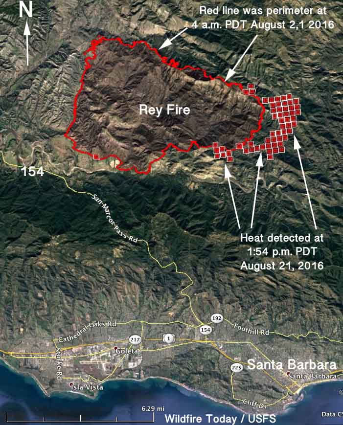
The Rey Fire north of Santa Barbara, California is very active again Sunday afternoon, even after fog moved in last night bringing the humidity up to 80 percent. Heat detected by a satellite at 1:54 p.m. PDT today indicated that at that time it had spread approximately 1.5 miles to the east since 4 a.m. this morning.
There is a great deal of energy in the pyrocumulus cloud below.
Just In – #ReyFire north of Santa Barbara (Santa Barbara County) is now 18,839 acres & 10% contained. pic.twitter.com/chJSe93weq
— CAL FIRE PIO Berlant (@CALFIRE_PIO) August 21, 2016
#reyfire flared back up. Getting kind of toasty. #fire #wildfire #santabarbara pic.twitter.com/i2kJlsmj9o
— Tyson Blades (@tysonblades) August 21, 2016
At the Los Prietos weather station near the fire at 3:35 p.m. PDT this afternoon it was 95 degrees, 15 percent relative humidity, and there was a wind from the west at 6 mph gusting to 15 mph.
****
(UPDATED at 10:18 a.m. PDT August 21, 2016)
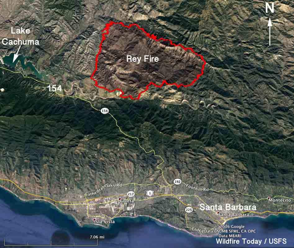
The Rey Fire 10 miles north of Santa Barbara, California was very active Saturday, burning about 8,000 more acres bringing the total to 18,839 acres. It is about 1 mile from San Marcos Pass Road (Highway 154).
A burning operation conducted by firefighters created a great deal of smoke on Saturday. The fire was influenced all day Saturday by a wind out of the west at 3 to 6 mph with gusts to 12 mph. During the night and early morning hours on Sunday fog moved in and considerably slowed fire activity as the relative humidity at Los Prietos increased from a low of 17 percent in the afternoon to 80 percent by 2 a.m.
The South Central Sierra Incident Management assumed command of the Rey Fire Saturday at 6 a.m. They are working in Unified Command on behalf of the U.S. Forest Service with Santa Barbara County Fire and CAL FIRE.
****
(Originally published at 12:27 p.m. PDT August 20, 2016)
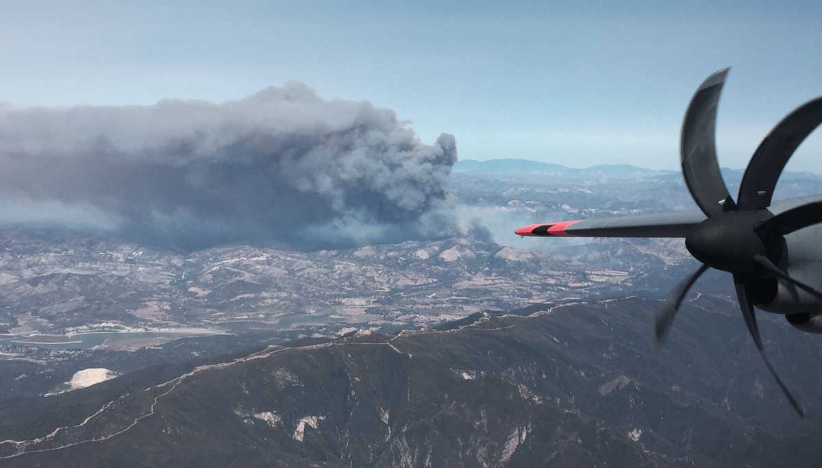
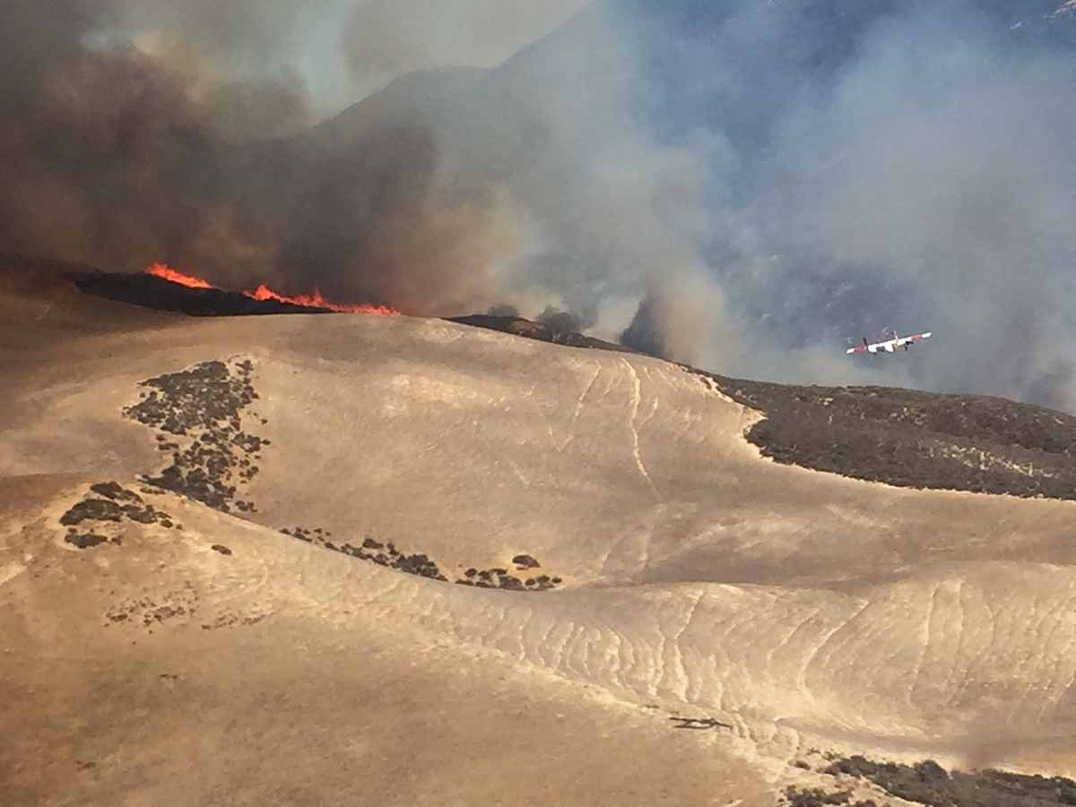
Flight crews staffing the C-130 Modular Airborne FireFighting Systems (MAFFS) aircraft out of the 146 Airlift Wing at Channel Islands, California shot these fascinating photographs of the Rey Fire which has burned 10,732 acres 10 miles northwest of Santa Barbara, California. The pictures are undated, but may have been shot Friday, August 20, 2016.
The fire is burning in the Los Padres National Forest and state protected lands. A statement on InciWeb provided some comforting information:
Firefighters will continue to utilize all available resources to slow the growth of the fire.
MAFFS 4 and 6 dropped 19,000 gallons of retardant on the Rey Fire Friday.
The Governor’s office activated the two Air National Guard aircraft August 17 in light of the heavy wildfire activity in California. The National Interagency Fire Center activated two other MAFFS on August 2, 2016. At that time it was one each from Cheyenne and Colorado Springs.


Your time lapse video does not appear for me over here in Europe.
I remember fires like this in the 1950s and 1960s. We would sit at the beach in Santa Barbara and watch the smoke roll in like a fog dusting ashes all over everything. In the 1950s fire, it looked as if all the hills behind Santa Barbara were filled with active fire lines. One could see the flames from town at night. The Santa Ana’s were blowing, of course.