Lawsuit filed against Southern California Edison for allegedly causing the Rey Fire

The fire burned over 32,000 acres north of Santa Barbara in 2016

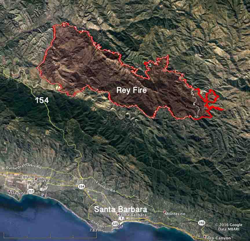
Map Rey Fire August 25 2016
Map of the Rey Fire. The red line was the perimeter at 10 p.m. PDT Aug. 25, 2016. The white line was the perimeter at 10 p.m. PDT Aug. 23.

The federal government has filed a lawsuit against Southern California Edison and two other companies for allegedly allowing the Rey Fire to ignite north of Santa Barbara, California on August 18, 2016. The complaint that was filed in U.S. District Court August 17, 2019 contends that of the 32,606 acres that burned in the fire, 19,752 acres were within the Los Padres National Forest. Also named in the lawsuit were Frontier Communications (a telecommunications company) and Utility Tree Service (a tree trimming company).

The fire started when a tree fell on power and communications lines. The court document states, “SCE and UTS were informed of the potential danger the tree that fell on the subject lines posed, were aware of the danger that said tree might fall on the subject lines before it fell, and failed to take any action to prevent it from falling on the subject lines.”

The filing says Frontier failed to, “…maintain proper vegetation clearance around and below its communication lines, and using a device, including its communication lines and equipment, which may cause a fire and failure to take reasonable precautions to avoid starting and spreading a fire.”

The Government alleges SCE violated the terms of its Special Use Permit for the powerlines by “…failure to prevent damage to the land and property of the United States; to take reasonable precautions to prevent and suppress fires; to construct, maintain and operate its equipment and power lines in a safe and effective working order; and to properly and safely maintain, operate, use and occupy the premises of National Forest System lands.”

On the date the suit was filed, SCE had not paid any of the suppression or rehabilitation costs which amounted to more than $26 million.

In addition to those costs, the Government hopes to recover costs of “wrongful injury to [National Forest] trees, loss of timber and vegetation, loss of habitat and environmental damages, damage to the soil, loss of use, scenic views, and aesthetic values”, in an amount to be determined at a trial by jury.
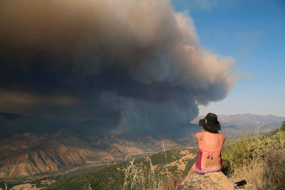
Rey Fire.
Rey Fire, August 21, 2016. Photo by Jeff Zimmerman.


Updates on three California fires, Soberanes, Chimney, and Rey

Above: A firing operation on the Soberanes Fire by the Arroyo Grande Hotshots. Inciweb photo.

Soberanes Fire

This fire has been eating through the brush, grass, timber, and poison oak in the coastal mountains south of Monterey since July 22. In that time it has spread mostly to the south blackening over 91,000 acres.

Map Soberanes Fire
Map of the Soberanes Fire. The red line was the perimeter at 11 p.m. PDT Aug. 25. The white line was the perimeter at 1 a.m. PDT Aug. 7. Click to enlarge.

The only large heat sources a satellite 200 miles overhead was able to detect in the last 24 hours were near the perimeter on the south and southeast sides. The Soberanes Fire is being fought by 1,4913 personnel including 21 hand crews; 65 engines; 12 helicopters; 21 dozers; and 14 water tenders.

The fire was caused by an illegal, unattended campfire on the Soberanes Canyon trail in the Garrapata State Park. The suppression costs to date are $160 million.

Poison oak is very prevalent in the area and some firefighters are saying it is the worst they have even seen. Five hundred have reported to the fire’s medical units for poison oak related ailments, with 200 cases in the past three days.

Rey Fire

The Rey Fire north of Santa Barbara has been working its way east over the last several days but that growth has slowed as firefighters make progress by constructing direct firelines on the fire’s edge and completing contingency lines out ahead of the fire.

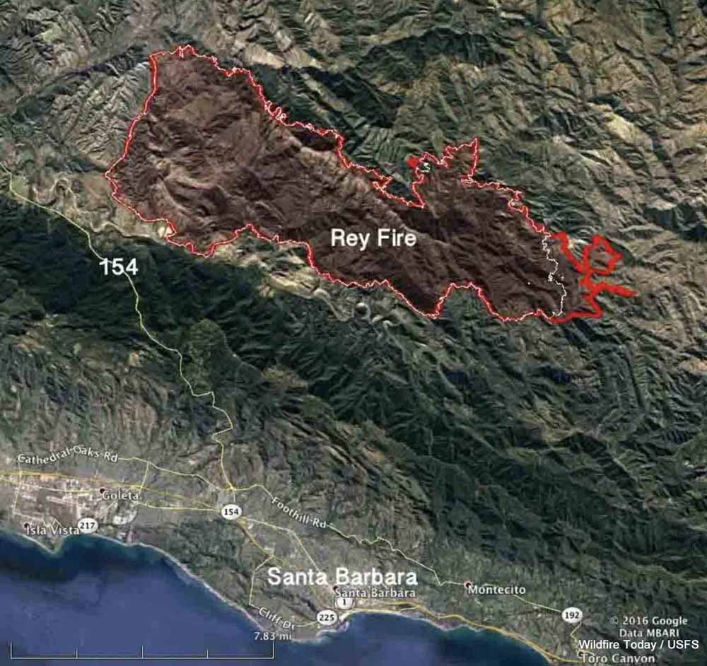
Map Rey Fire
Map of the Rey Fire. The red line was the perimeter at 10 p.m. PDT Aug. 25. The white line was the perimeter at 10 p.m. PDT Aug. 23. Click to enlarge.

The Rey Fire typically slows to a crawl late at night when the marine layer moves in, then the activity increases in the afternoon. The incident management team is calling it 33,006 acres. Approximately 1,976 personnel are assigned to the fire, including 57 hand crews, 99 engines, and 18 helicopters.

Chimney Fire

The Chimney Fire near the central California coast has continued to spread to the north over the last few days through very rough and remote country east of the Hearst Castle.

Map Chimney Fire
Map of the Chimney Fire. The red line was the perimeter at 9 p.m. PDT Aug. 25. The white line was the perimeter at 10 p.m. PDT Aug. 23. Click to enlarge.

CAL FIRE reports that 49 residences and 21 other structures have been destroyed, while 1,898 remain threatened. Some evacuation orders have been lifted but others are still in place.

The 45,000-acre Chimney Fire is being fought by 4,028 personnel, including 328 engines, 106 hand crews, 16 helicopters, 46 dozers, and 69 water tenders.

Rey Fire continues to spread to the east

Above: The Rey Fire. Photo by Jeff Zimmerman.

(We published an updated article about the Rey Fire August 24, 2016)

(UPDATED at 8:22 a.m. August 22, 2016)

The Rey Fire continued to spread to the east on Sunday, growing by more than 4,000 acres to a total of 23,546. Almost all of the growth was on the east side where it spread for more than 2 miles but it was also active on the northeast perimeter.

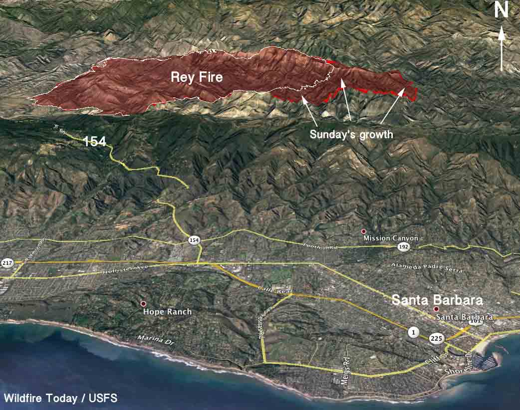
3-D Map of the Rey Fire
3-D Map of the Rey Fire. The red line was the perimeter at 10 p.m. PDT Aug 21, 2016. The white line was from about 24 hours before.

The weather conditions at the fire area should be rather mild Monday, for southern California anyway. The temperature will be in the mid-80s under a mostly clear sky and the relative humidity will bottom out in the mid-20s, but the wind could be a concern. It will increase in the afternoon to 10 to 13 mph out of the northwest gusting at 16-20.

The fire is being fought by 1,260 personnel, 28 crews, 48 engines, and 2 helicopters. There are no reports of any structures that burned.

Rey Fire.
Rey Fire. Photo by Jeff Zimmerman.

The time lapse video below of the Rey Fire is mesmerizing. It’s a case study in wildland fire behavior and fire meteorology, featuring wind shear and pyrocumulus clouds. It was shot on August 20 by Jesse Rockwell.

Continue reading “Rey Fire continues to spread to the east”