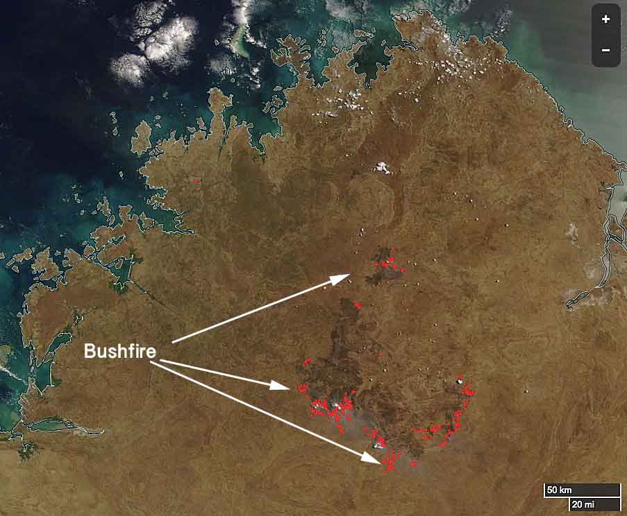
A huge bushfire in the Kimberley region of Western Australia has burned approximately 2.4 million acres (1 million hectares). Since it started from lightning two weeks ago it has been spreading across cattle stations on both sides of Gibb River Road and recently began approaching Aboriginal communities. Not all fires in sparsely populated areas of Western Australia are aggressively suppressed but firefighters have been working around the clock this week to put in a fireline on the north side near Gibb River Road station.

Below is an excerpt from an article at ABC.NET in Australia:
Indigenous ranger groups from across the region have converged on the area to help, some travelling hundreds of kilometres. There is concern about the impact the bushfire will have on the landscape, which covers both prime grazing country and biodiversity hotspots.
The fire is now heading towards properties managed by the Australian Wildlife Conservancy. The group’s national operations manager Tim Allard said it would have a harsh impact on native species.
“It’s a significant fire and a significant chunk of land has been burnt in one event,” he said.
“It’s decimated the habitat for so many animals … [and] the other issue is it destroys all of the refuge for native animals to hide from feral cats.”

