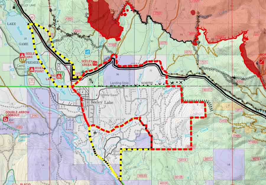
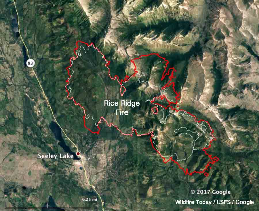
Above: A 3-D map of the Rice Ridge Fire, looking northeast. The red line was the perimeter at 10:30 p.m. MDT August 28, 2017. The white line was the perimeter two days earlier
(Originally published at 9:37 a.m. MDT August 29, 2017)
The Rice Ridge Fire made an unexpected southerly surge Monday evening toward the community of Seeley Lake after the wind direction shifted from the south and southwest to come out of the north and northwest. At about 7 p.m. Monday fire officials issued a mandatory evacuation order and three hours later expanded the area to include much of the community.

When the fire was mapped by a fixed wing aircraft at 10:30 p.m. Monday the Rice Ridge Fire had approached to within 1.5 miles of the Seeley Lake Community after a large finger of fire spread from the western flank. Sunday evening the incident management team had written in their evening update:
Containment is up to 22% as crews completed fire line along the west flank of the fire. Firefighters successfully completed small firing operations along the west and southwest edge of the fire that will aid in securing fire line.
The term “contain” or containment percentage means a fire line has been established along a portion of the perimeter. It does not mean the fire is “controlled” or “out”. A 2-foot wide or 100-foot wide fireline is not guaranteed to stop the fire at that point. Strong winds have been known to blow burning embers and start new spot fires more than a mile away. The incident management team appears to be computing the containment percentage the way it should be done — showing the percentage of the fire perimeter where a fireline is completed and the spread is at least temporarily halted. The fire could continue to spread across the fireline, but it is not thought likely. The unexpected wind shift may have been the unlikely occurrence in this case. The definition of these and hundreds of other fire management terms are in the National Wildfire Coordinating Group Glossary.

An incursion into the air space over the fire by a drone shut down all firefighting aircraft Sunday evening.
Seeley Lake is closed so that firefighting aircraft can safely access the lake to refill their water buckets or tanks.
The incident management team is not releasing a great deal of information about the fire. It has been almost two weeks since photos were posted on their Inciweb page.


East Fork fire south of Havre, MT has now burned over 15,000 acres. Why aren’t you covering this????
Is it true that the rice ridge fire in Seeley lake Montana was increased by the Forest service when they set some type of back fire plan and then the wind changed and started the terrible evacuation . Or is the fire service action a rumour?