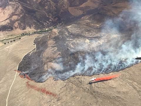
Above: screenshot from the video of the Martin Fire.
(UPDATED at 8:58 a.m. MDT July 9, 2018)
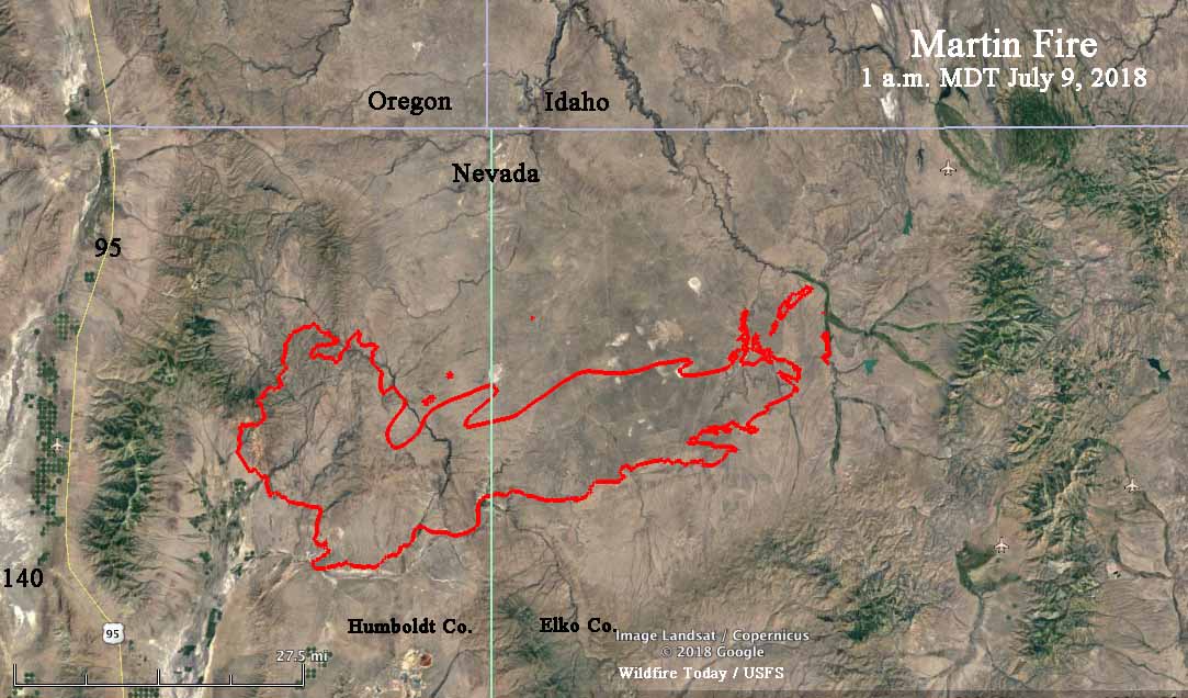
A new map of the rapidly growing Martin Fire in Northern Nevada reveals that it has exploded to 399,429 acres, according to the Incident Management Team. During an overnight fixed wing mapping flight some areas of light vegetation burned and then cooled, again making it difficult to fill in some of the holes where no heat was detected by the sensors.
The Martin Fire is 57 miles long, west to east.


(UPDATED at 6:30 a.m. MDT July 9, 2018)
The incident management team has posted an updated map of the Martin Fire on InciWeb.
(UPDATED at 6:50 p.m. MDT July 8, 2018)
According to satellite data acquired at 1:54 p.m. MDT Sunday the Martin Fire in Northern Nevada was extremely active at that time. It may have progressed over 20 miles during the previous 24 hours, reaching a total length of approximately 54 miles, west to east. At 1:54 p.m. it was 13 miles west of highway 11/226. Our very, very unofficial guestimate of the size at that time was about 380,000 acres. This is difficult to determine, because much of the vegetation that is burning is light, and can burn and then cool before the next infrared-sensing satellite overflight, occurring about every 12 hours. Our guess involved assuming some of the “unburned” holes had actually burned, but were undetectable by the satellite.
The map below shows approximately the same area as the one farther down dated July 7.

(UPDATED at 2:21 MDT July 8, 2018)
InciWeb is saying the Martin Fire has burned 164,000 acres but this map puts it at over 239,000 acres.
7/8 Sunday #MartinFire, north Nevada. This July 8 briefing map says 239,289 acres.. 3.0MB PDF file: https://t.co/FaVM8KUklu#GeoSpatialpic.twitter.com/fuXPlTFNb4
— Joseph Elfelt (@MappingSupport) July 8, 2018
(Originally published at 1:45 p.m MDT July 8, 2018)
The robotic cameras operated by the Nevada Seismological Lab have scored again, capturing some great time-lapse video of the Martin Fire in Northern Nevada as pyrocumulus clouds are being created. The video was shot from 6 to 7 p.m. on July 7, 2018.
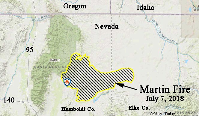
The Martin Fire has burned 164,000 acres according to InciWeb, and on Saturday it spread from Humboldt County into Elko County.
 Fire perimeter produced by the Incident Management Team. Text notations by Wildfire Today.

I wish they’d put names of cities/towns on these maps.
Which cities would you like to see on this map?
It’s over 340,000 acres per wildcad and local media
I just found a map dated today that puts it at 239,289 acres.