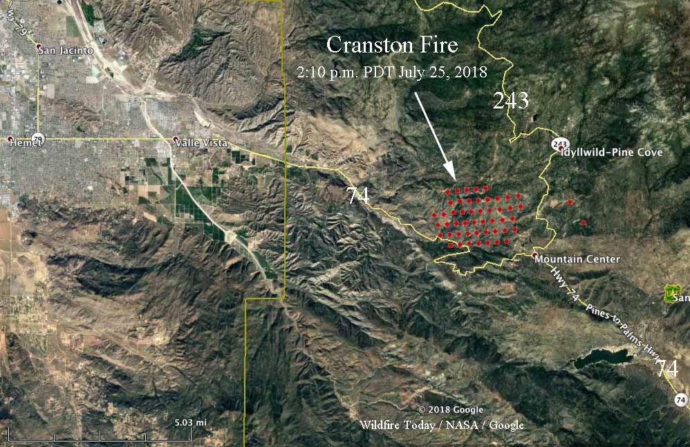
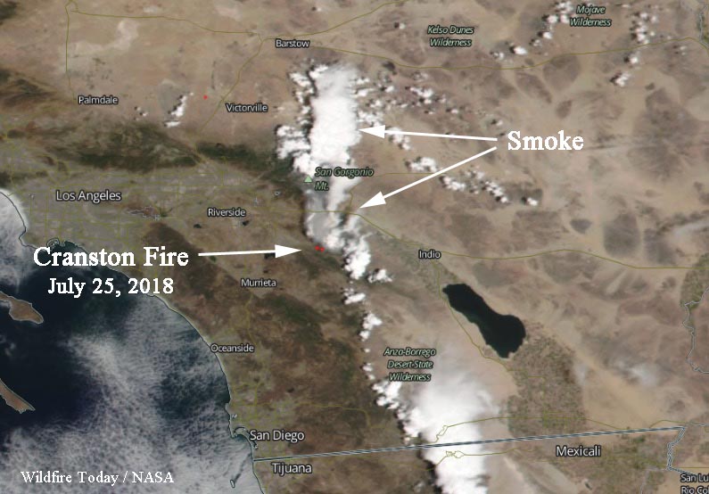
Above: 3-D map view of the Cranston Fire. The red dots represent heat detected by a satellite at 2:10 p.m. PDT July 25, 2018.
(Originally published at 7 p.m. PDT July 25, 2018)
Within of about two hours of the Cranston Fire starting at noon today 8 miles east of Hemet, California, it had already burned two thousand acres and had developed a huge smoke column topped by a pyrocumulus cloud.
The fire is burning close to the mountain community of Idyllwild, which has been ordered to evacuate along with Pine Grove, Fern Valley, and portions of Mountain Center.
Highway 74 is closed from the city of Hemet to Lake Hemet.
At 6:30 PDT fire officials estimated it had burned approximately 3,000 acres, but getting a good estimate is difficult with the rapid spread of the fire and the enormous amount of smoke being generated.

There are reports that multiple fires were set today in this general area. One arson suspect was apprehended in Hemet.

An insane plume of smoke from the #CranstonFire. I’m in the evacuated community of Idyllwild. Live on @KDOCTV at 7:30pm. pic.twitter.com/4tUX3QKgOh
— Veronica Miracle (@ABC7Veronica) July 26, 2018
According to KSOX radar the #CranstonFire‘s pyrocumulus cloud has been fluctuating between 30-48 thousand feet producing dozens of lightning strikes and extremely dangerous firefighting conditions for those battling the fire @EPN473 @Weather_West @engineco16 #CAwx #CAwildfires pic.twitter.com/fhBSi4x9Qh
— US StormWatch (@GreatWinter2017) July 26, 2018
#CranstonFire: Aircraft order from Air Attack for tomorrow’s operations JUL 26. pic.twitter.com/s4W1SrFKbw
— RVC Fires (@RVCFires) July 26, 2018
The smoke and pyrocumulonimbus cloud formation are visible from Temecula, but I don’t think the smoke has reached here yet. #CranstonFire #CAwx pic.twitter.com/97O6HrAvYt
— Wendy (@geococcyxcal) July 26, 2018

I thought this fire was really going to crank much more than it has. I would guess that the footprint of the 2013 Mountain Fire helped prevent it from building a greater momentum. The Cranston’s southern flank east of Hwy. 74 pretty much follows the northern flank of the old burn scar. That has afforded resources the opportunity to throw even more on the northern flank protecting the communities and hopefully driving the fire eastward into the western flank of the old burn scar.