
During his visit he wants “…to see the firefighters. Nobody’s ever seen what’s going on over there.”
Continue readingSatellite imagery of Camp Fire seven hours after it started
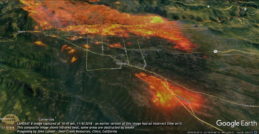
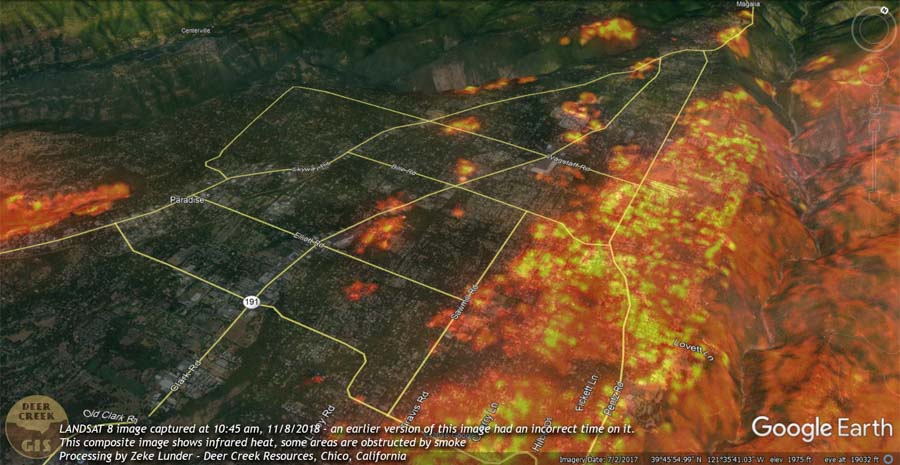
Deer Creek Resources of Chico, California has produced five images that show the Camp Fire about four and a half hours after it started near Pulga, California on November 8, 2018. Zeke Lunder used data from LANDSAT 8 with the infrared heat layer to map the location of the fire at 10:45 p.m. PST. By that time it was burning thousands of homes in Paradise.
(The images below show the corrected time stamp of 10:45 a.m. on November 8, 2018.)

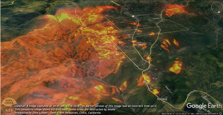
To help get oriented take note of the north indicator that is at the top-right on four of the four photos. Presumably north is at the top in the other photo (above).

To see all articles on Wildfire Today about the Camp Fire, including the most recent, click HERE.
Smoke obscures some areas, as Mr. Lunder wrote, but it appears that significant spotting was occurring. During that seven-hour period the wind was out of the northeast at 8 to 15 mph gusting at 21 to 35 mph. At noon the relative humidity was 13 percent. A few hours before the fire started the wind was from the northeast at 32 gusting up to 52.
Here is more information about the fuels that the fire was burning through in the first few hours.
The was a lot of timberland logged after 2008 fires in Concow Basin the initial path of the fire, and most of Paradise had major pondo pine component.
— Deer Creek Resources (@DeerCreekGIS) November 15, 2018
CAL FIRE has not released the cause of the fire but Pacific Gas & Electric disclosed to the Public Utilities Commission that one of their high voltage power lines had a disruption in service on Pulga Road near the Camp Fire at 6:15 a.m. the day it started, November 8. The burn pattern along with the wind direction would lead one to believe that it is likely that the point of origin of the fire was in the general vicinity of Pulga Road and the small community of Pulga, but this is not confirmed. The fire was reported at 6:29 a.m.
A fourth large air tanker arrives in Australia
This will be the first time a 737 air tanker has been used on a wildfire
Continue readingReport released for injuries to several smokejumpers on wildfire in Utah
Three of the seven jumpers were injured and evacuated by two helicopters
Continue readingReport released for multiple smokejumper injuries on wildfire in Utah
Three of the seven jumpers were injured and evacuated by two helicopters
Continue readingThe Camp and Woolsey Fires have burned more than 10,000 structures
The death toll increased Thursday evening to a total of 66 for the two fires in California.
Continue readingLakeview Crew 7 earns Hotshot status
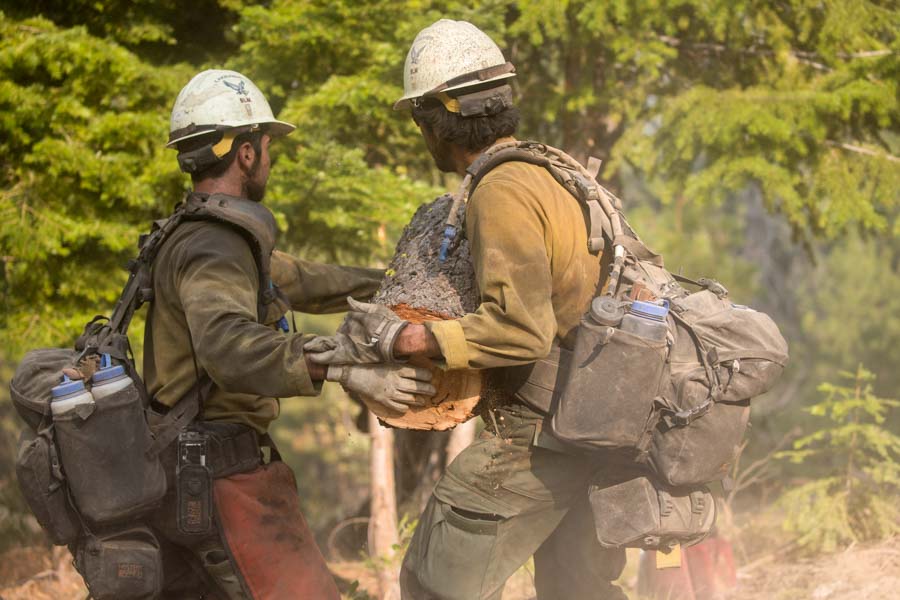
Congratulations to Lakeview Crew 7, an interagency hotshot firefighter crew comprised almost entirely of U.S. military veterans.
The crew was formed in 2000 and reorganized in 2011 to help military veterans transition to productive civilian careers. Crew 7 has been funded under the BLM Veterans Crew Program since 2012.
In March of 2016, Crew 7 began the process to be certified as a hotshot crew. They went through the review process in 2017 and received the recommendation for certification this year.
During the 2018 wildfire season, Lakeview Crew 7 battled fires across the West, including the large Cougar Creek Fire in central Washington.
“Our time spent in the military is a key ingredient to our achievements,” said Levi VanderMolen, a member of Crew 7.
“It’s what separates us from other crews and inspires us to work harder and become the best.”
Learn more about BLM career opportunities for veterans:
https://www.blm.gov/

Firefighters battled the Sierra Fire under harrowing conditions
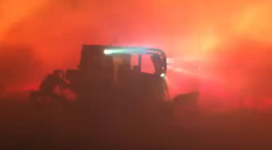
With large, devastating wildfires burning at both ends of California it is refreshing to hear about a fire that appears to be a success story.
Tuesday night at about 10 p.m. the Sierra Fire started in Fontana, California near Interstate 15 at Sierra and Riverside Avenues. At that time the weather station in Devore recorded sustained north-northwest winds at 25 mph gusting to 45 along with 10 percent relative humidity.
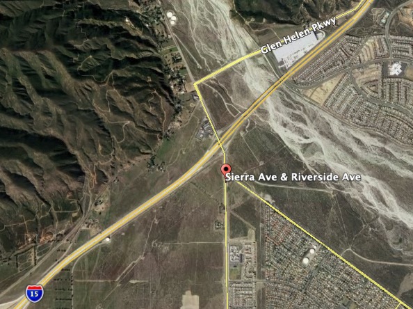
In spite of these horrendous conditions, by 4:30 a.m. on Wednesday the 26 engines, 7 hand crews, and 3 dozers were able to stop the spread at 147 acres. Kudos to these badass firefighters.
You can get a taste of the conditions they were dealing with in this very impressive video.
#SierraFire: Footage from earlier this evening. In #SantaAnaWinds, Dozers can often engage where it’s too dangerous for handcrews. A decisive force multiplier in tonight’s firefight. ^eas pic.twitter.com/gtqmJB5pk6
— SB County Fire (@SBCOUNTYFIRE) November 14, 2018
@FirePhotoGirl also shot video at the fire.
Update: #SierraFire now 25-30 acres very Rapid ROS, wind driven, erratic Fire behavior. #Devore #Breaking pic.twitter.com/ZiXCGLF0Wf
— Bernie Deyo? (@BDP473) November 14, 2018
Wildfire smoke and air quality maps, November 13, 2018
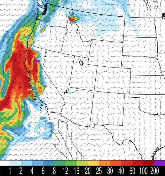
Above is NOAA’s forecast for the distribution of wildfire smoke at 6 p.m. PST November 13, 2018. Much of Central and Northern California has severely compromised air quality and is in the “unhealthy” category.
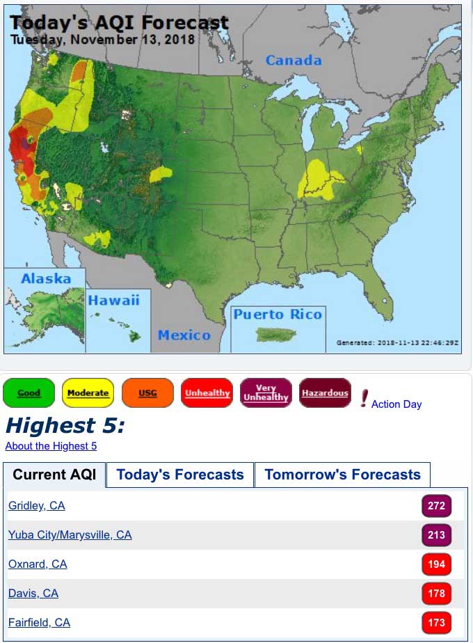
Below is air quality data from AirNow.gov for Tuesday November 13, 2018:
Strong winds on Tuesday make Woolsey Fire difficult to contain

The spread of the Woolsey Fire in the Santa Monica Mountains slowed considerably Monday, adding very few burned acres. However on Tuesday a flareup put a large smoke column into the atmosphere near Lake Sherwood, but it was attacked aggressively by firefighters in the air and on the ground after devouring about 50 acres.
To see all articles on Wildfire Today about the Woolsey Fire, including the most recent, click HERE.
Strong winds Tuesday are keeping residents and firefighters on edge. A sampling of weather stations with high wind speeds showed gusts up to 50 mph at Warm Springs.

The fire area will remain under a Red Flag Warning through Wednesday for 20 to 30 mph winds gusting at 45 to 55, with relative humidities in the single digits.

The number of structures that have been destroyed in the fire has increased from 370 to 435. It is believed that most of them are homes, but the figures have not been broken out. Officials are still conducting surveys and the number may not remain at that level. There has been no change in fatalities, with that number remaining at two.
Even though President Trump made a vague statement on November 10 saying “no more Fed payments!” for wildfires in California, on November 12 he tweeted that he “…just approved an expedited request for a Major Disaster Declaration for the State of California.” California Governor Jerry Brown requested it on November 11.
“I had shared one video, of an area where there was nothing left on that street. And that was the best way I could describe what the city is enduring. And it’s a horrible feeling.” @FirePhotoGirl https://t.co/upxlSfNc3M
— CBCEarlyEdition (@CBCEarlyEdition) November 13, 2018
The resources assigned to the Woolsey Fire include 619 fire engines, 57 hand crews, 22 helicopters, 23 dozers, and 48 water tenders, for a total of 3,592 personnel.
Putting in a wet line. #WoolseyFire https://t.co/YqtwY361G0
— Wildfire Today ? (@wildfiretoday) November 13, 2018