
More than 6,000 homes destroyed
Continue readingWoolsey Fire burns to the ocean as 200,000 evacuate
Scores of homes have been destroyed
Continue readingWildfires near Thousand Oaks, California put over 100,000 homes under evacuation orders
The Hill and Woosley Fires started Thursday evening.
Continue readingWildfire smoke mapsmok
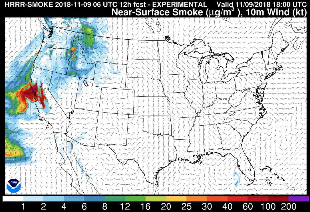
The map above shows the prediction for the distribution of wildfire smoke at noon PST November 9. Click on the map to see a larger version.
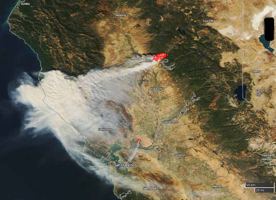
Below is a satellite photo taken Thursday, November 8 showing heat from the Camp Fire in red and the smoke being blown to the southwest, mostly north of San Francisco.
Camp Fire burns hundreds of homes in Northern California
Severe damage in Paradise, California
Continue readingWildfire burns into Paradise, California, forcing evacuations
Hundreds of structures have burned
Continue readingMajor damage to an engine on a prescribed fire in California
An engine that was working on a prescribed fire near Covelo, California was burned over and appears to be destroyed.
Below is the summary from a “Green Sheet” report released by the California Department of Forestry and Fire Protection.
On October 22, 2018, a CAL FIRE fire engine staffed with one Fire Apparatus Engineer and two firefighters were participating in a Vegetation Management Program (VMP) hazardous fuel reduction burn near Covelo, CA. While the crew was away from the engine assisting with containment of several spot fires, the parked, unattended engine was impacted by spot fires burning outside of containment lines, and sustained major damage. No personnel were injured during the incident.

Burning tumbleweeds flew forty feet above the ground
The Texas/Oklahoma/Kansas fire storm of March, 2017
Continue readingPrescribed fire at Tallgrass Prairie
Firefighters from the National Park Service and the US Fish and Wildlife Service conducted prescribed fires last week on two units of the Tallgrass Prairie National Preserve in Kansas.
The treatments with fire maintain the ecological integrity, promote forage for cattle, and sustain the cultural history of the preserve.


Report released on burnover of two fire engines
The incident occurred on the North Eden Fire which burned in Utah, Idaho, and Wyoming. No firefighters were injured.
Continue reading