(UPDATE at 2:39 p.m. MDT May 20, 2019)
Mandatory evacuation order issued for an area near High Level, Alberta, due to the Chuckegg Creek Fire. At 11:40 a.m. May 20 Mackenzie County declared a State of Local Emergency and issued the order for residents living south and southeast of the Town of High Level, Alberta. All evacuees must register at the High Level Arena (10101 105 Ave). Crews will be going door to door to notify affected residents. Manned barricades will be set up on all roads to prevent unauthorized entry into the evacuated areas.
(To see all of the articles on Wildfire Today about the Chuckegg Fire, including the most recent, click here.)
(UPDATED at 11:31 a.m. MDT May 20, 2019)
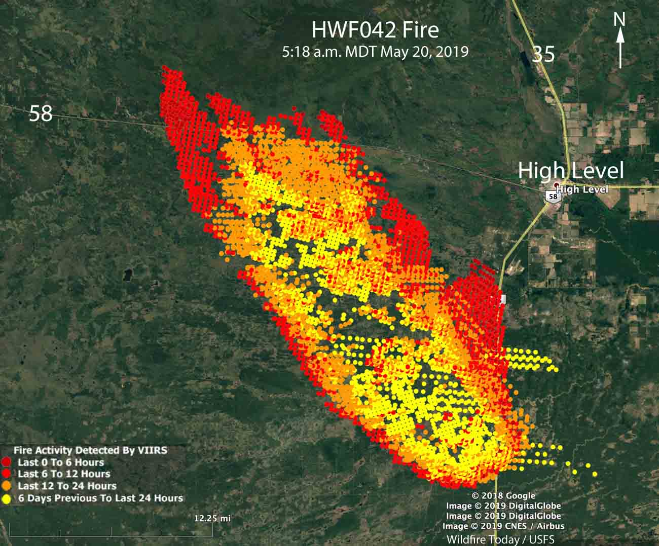
The Chuckegg Creek Fire southwest of High Level, Alberta continued to spread rapidly to the north Sunday afternoon and into the night, running across and becoming well established north of Highway 58.
The Town of High Creek advised their residents Monday morning:
As of 9:00 a.m. May 20, 2019, the town remains in no immediate danger, but residents are recommended to remain vigilant and be prepared to evacuate if conditions change. The eastern flank of the fire had slow growth over night. The HLFD will begin Sprinkler protection operations today May 20, 2019, in town and at the Tolko mill.
Our very unofficial estimate of the size, based on satellite imagery at 5:18 a.m. May 20, is that the Chuckegg Creek Fire has burned approximately 150,000 acres (60,700 ha). (UPDATE at 11:26 a.m. MDT May 20: Alberta Wildfire said the fire has burned 69,000 ha (170,500 acres).
Strong gusty winds are in the forecast again for Monday, which should produce continued growth of the fire.
Alberta Wildfire has 64 firefighters, heavy equipment, and helicopters and air tankers working to contain the fire. Additional resources have been requested.
(Originally published at 3:44 p.m. MDT May 19, 2019)
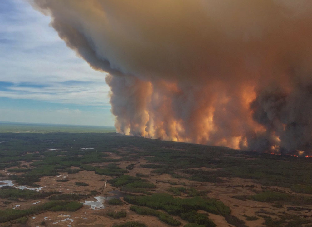
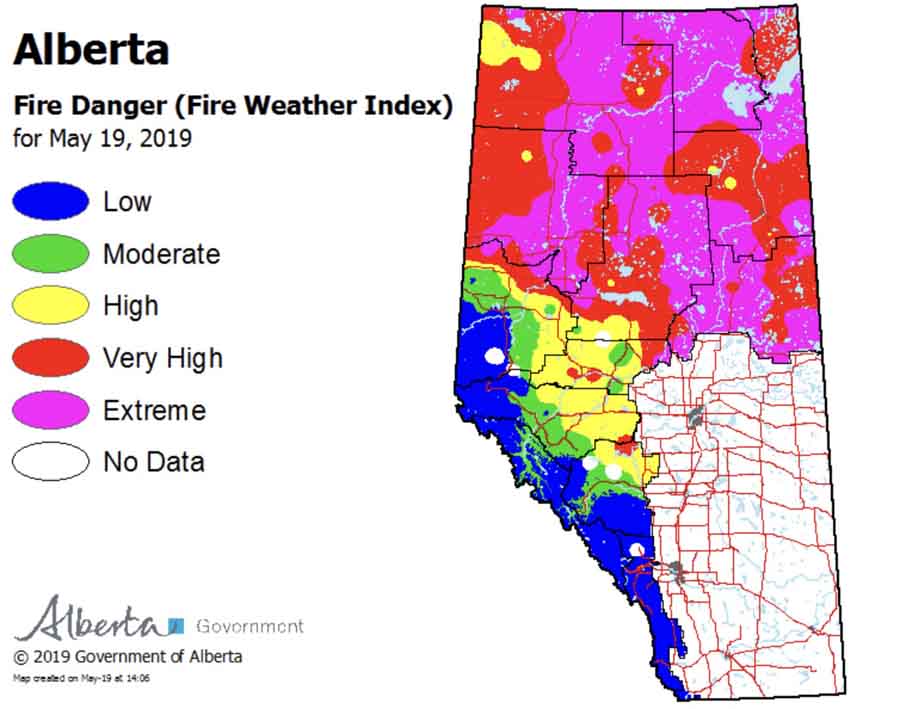
A very large wildfire in northern Alberta almost doubled in size Sunday due to low humidity and 20 km/h southeast winds gusting to 40. The strong winds are expected to continue until dark Sunday but will become lighter Sunday night through Tuesday.
The fire is approximately seven miles southeast of High Level and is spreading toward the northwest.
The most of the fire is west of Highway 35 and south of Highway 35, but there is active fire east of 35. On Sunday it crossed Highway 58, 17 miles west of High Level.
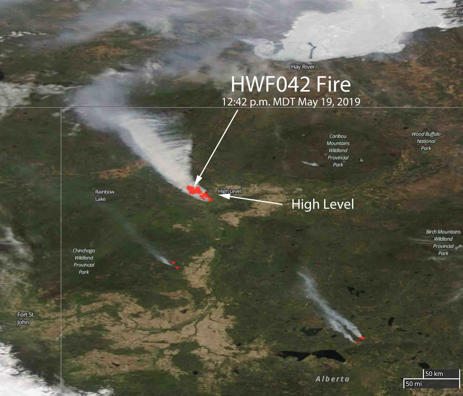
Officials said Sunday that neither the Town of High Level or Norbord Plant are under immediate threat. There was no Evacuation Alert in effect Sunday at noon, but residents were advised to remain vigilant.
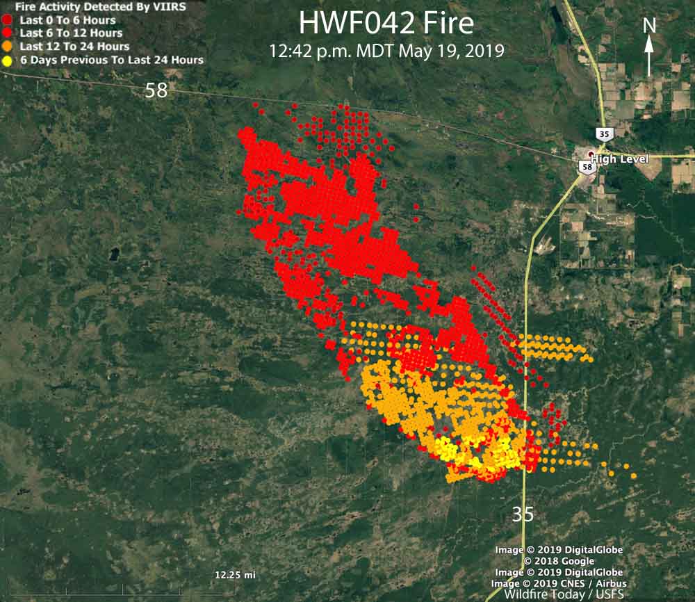
On Sunday morning May 19 Alberta Wildfire reported the fire, named Chuckegg Creek HWF042, was 25,334 ha (62,600 acres). Our very unofficial estimate of the size when it was overflown by a satellite at 12:14 p.m. MDT May 19 is 40,000 ha (99,000 acres). This measurement was based on heat detected by the satellite. Generally a fire can be described as a “megafire” when it reaches 100,000 acres.
The fire is being fought with heavy equipment and 53 firefighters, along with air support from helicopters and air tankers.

Global warming and the previous protocol of suppressing forest fires have fueled these mega fires.
Are these close to the location of the tar sands?
https://www.youtube.com/watch?v=NMK_IREGZdk
The YouTube link take you to an 11-minute 60 Minutes piece on megafires, uploaded by the National Interagency Fire Center in 2013.
This is a forestry area. There are no large scale Tar Sands operations except in Fort McMurray, completely different area of the province. However, to the north and west of High Level there are oil patch development and natural gas collection in Rainbow Lake and Zama. To the east is rural/agriculture development. The fire is headed toward the northwest, Zama area, unless it is stopped. The main area of concern is the town of High Level, the residences, hospital, Tolko Saw Mill with its huge log piles, and the Norbord OSB plant south of town with its sawdust piles and log piles as well, all key employers for the town but also key fuel sources for an OC fire. Surrounding native reserves to the east, west, north and south are evacuated mostly due to smoke and inconvenience as High Level provides services (food, gas, medical) for miles around. Most people will evacuate because it becomes inconvenient to breathe the smoke and not have access to services. Well prepared persons could remain in vicinity so long as they have gas to travel the 100 – 200 km to nearby hamlets who have services they might need. Ergo, it’s not just the town but all the surrounding hamlets and reserves that suffer. Also mail is disrupted creating a problem for everyone who is trying to conduct business. Overall, it’s a “worst case scenario” is a town that often said it was at “low risk” with regard to disaster.
LOL global warming, time to wake up
Be safe people
Exactly
Global warming? Should of hung out with us this past winter when we had 3 weeks of colder than minus 20. Weather patterns cycle. Yes to the past practice of supressing fires but we have had people living and earning a living in these areas for over a hundred years. Should we just let it burn ? Tar Sands is a large area … maybe check a map to see if it is what you define as close. My definition .. not even close.
It was over 220,000 acres yesterday.
Smoke stretches over Canada and the USA east coast including Washington DC and out into the Atlantic Ocean.
As a Wildland Firefighter myself; Keep ahead of it and please keep an Escape Route. Don’t get trapped above it. Good Luck,
Richard Pierson
Nighthawk, Colorado
Grateful for the water
Prayers the weather turns so the firefighters can safely make headway
Our prayers are with all of you be careful and please remember life is more important than material stuff.
We need work call region 3 fire fighters to help surpress fire