By Diane Banegas, Research and Development, U.S. Forest Service
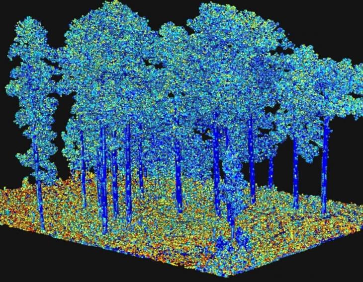
Land managers have a new tool in their firefighting arsenals that models forest fuels in three dimensions. These 3D fuel models have the potential to make firefighting and the management of controlled burns safer and less costly while helping to protect valuable natural resources.
The 3D fuels modeling technique will benefit land managers by allowing firefighters to develop better strategies and helping predict future fire behavior. It was recently tested at Eglin Air Force Base in Florida.

Managers will be able to input 3D fuels from this research into next-generation fire behavior models. This will allow them to test different ignition patterns for a prescribed burn to see how the resulting fire behaves in 3D.
Running 3D simulations can help firefighting teams develop strategies to manage or extinguish future fires as safely and economically as possible.
“These fire models can output various scenarios of fire behavior that help inform quick management decision making,” said Louise Loudermilk, a research ecologist at the USDA Forest Service’s Southern Research Station. The model can also give “burn bosses” choices on selecting the safest approach to meet management and ecological controlled burning objectives while better predicting smoke conditions.
“This work represents a new era in fuels research because it links fuel ecology with fire behavior. In fire behavior models, fuels traditionally are overgeneralized and have been unable to represent how fuels predict fire behavior. Now fuels can be represented dynamically in three dimensions,” Loudermilk said. “This advancement, which has taken over 10 years to achieve, is like going from a board game to a realistic video game.”

The modeling technique combines aerial and terrestrial LIDAR data with new 3D field sampling, historical data about when an area last burned and simulation modeling to provide 3D fuel characterization at multiple scales. Data collected from a landscape of interest includes vegetation type, fuel mass and fuel volume, all represented in 3D.
Loudermilk co-authored a research paper about a new method of field sampling used for this modeling technique. “The method works equally well across small or large landscapes,” she said. “Our goal is to provide big data collections that will one day be downloadable for anyone to use.” She also contributed to a book chapter about the 3D modeling technique and the importance of fuels research. A related paper in Forest Ecology and Management explains how the status and trends of plant diversity can be monitored at a landscape-scale, information valuable for 3D fuels monitoring.
Ultimately, extensive 3D data collected on fuels will be available for landscapes across the United States. Any land manager will be able to select the data for their area and run 3D fire simulations for educational or fire management purposes.
The success of these projects has been dependent on Loudermilk’s extensive network of federal, state and private organization collaborator

