Award granted to develop system to detect and forecast the spread of all wildland fires in U.S.

Pyregence fire forecasting tool
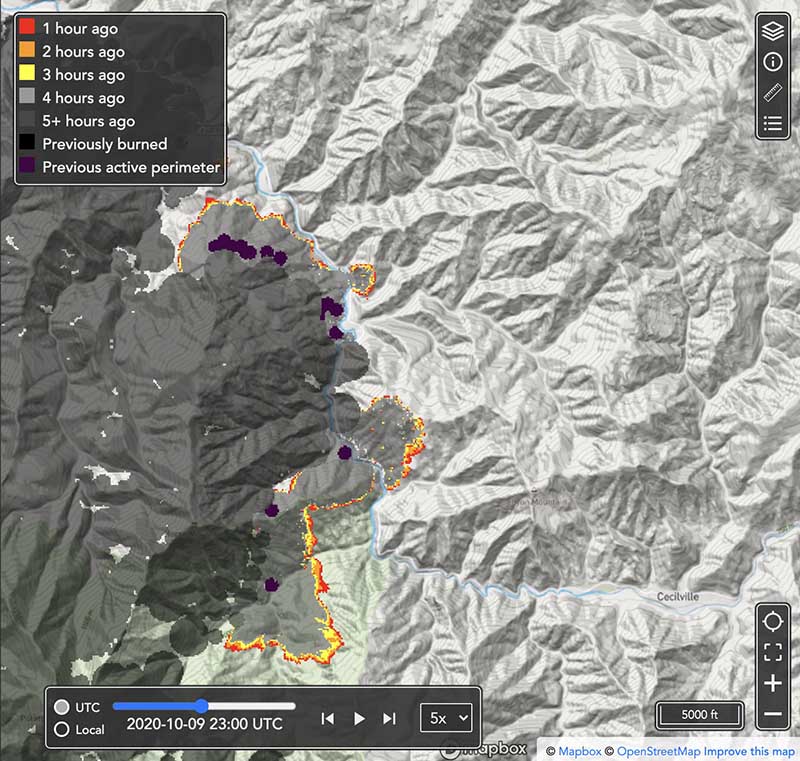
Pyregence fire forecasting tool, beta version. Forecast for the northeast side of the Red Salmon Complex of fires in Northern California at 4 p.m. PDT October 9, 2020.

The U.S. Department of Commerce’s National Institute of Standards and Technology (NIST) has awarded 19 small businesses in 12 states a total of more than $4.4 million in grants to support innovative technology development. One of those grants, for $100,000, is to help build a system for automatically detecting and forecasting the spread of every wildfire in the continental United States and updating the forecasts as conditions change.

Reax Engineering Inc. of Berkeley, California, the company that received the grant, has a beta version of the forecasting tool online now just for the state of California. It is a work in progress and will eventually include data for fires in other  states.

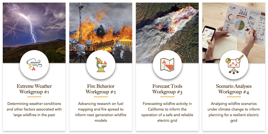
Wildfire forecasting is one of the four primary goals of Pyregence, a group of fire-science labs and researchers collaborating about wildland fire, where the forecasting tool now resides. The organization brings together initiatives and leading researchers from 18 institutions representing industry, academia, and government in an effort to transform how wildfire mitigation and adaptation measures are implemented. In addition to forecasting wildfire activity, wildfire scenario analyses will be produced to inform future wildfire risk and California’s 5th Climate Change Assessment, using open science and technology principles.
Pyregence working groups
Pyregence working groups.

In order to predict the spread of wildfires, fire behavior models are run on computers. The versions that have been used for decades are not accurate for dealing with heavy dead and down fuels or fires spreading through the crowns of trees under extreme weather conditions. The goal of one of the four Pyregence workgroups, the Fire Behavior Workgroup, is to improve existing models or develop new ones. That effort is being led by Scott Stephens, Professor of Fire Science, and director of the University of California Center for Fire Research and Outreach.
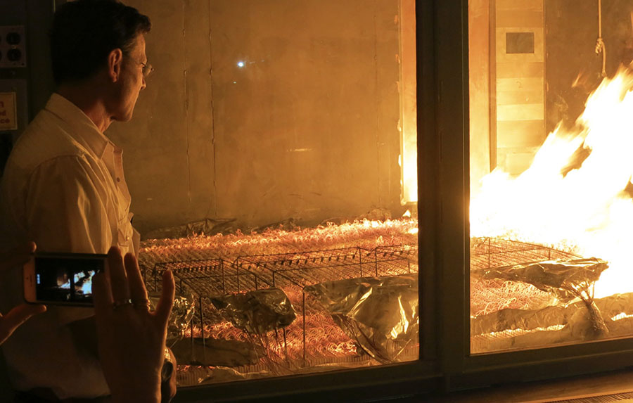
Missoula Fire Lab burn chamber
U.S. Forest Service Missoula Fire Lab burn chamber, May 21, 2014. Photo by Bill Gabbert.

Mark Finney, a researcher at the U.S. Forest Service Missoula Fire Sciences Laboratory, is part of the Fire Behavior Workgroup and will soon have access to a burn chamber much larger than the one in the photo above. It will reportedly be the size of a grain silo. These wind tunnel/combustion chambers are used to conduct burning experiments in a controlled environment under varying fuel, temperature, humidity, and wind conditions. It can lead to a better understanding of how vegetation burns, leading to improvements in predicting fire spread.

An article at Wired describes the planned burn chamber:

Once complete, that chamber will let him replicate wildfire fuel beds by piling logs and other material as much as a few feet deep. He will then ignite them, hit them with wind and moisture, and quantify their burn rate and energy-­release rate—what he calls the “heat-engine part of mass fires.”

“Really what we’re looking for,” Finney says, “is how these things transition to flaming. Instead of just smoldering on the forest floor, how do they become actively involved in these large fires?”

If all goes well, Finney’s working group will eventually code three-dimensional digital simulations of various wildland fuel beds—digital cubes, in essence, not unlike Minecraft voxels—that can be stacked and arranged in infinite variation across landscapes generated by GIS mapping data.

New 3D fuel modeling helps predict fire behavior

Combining aerial and terrestrial LIDAR data with new 3D field sampling

By Diane Banegas, Research and Development, U.S. Forest Service

Land managers have a new tool in their firefighting arsenals that models forest fuels in three dimensions. These 3D fuel models have the potential to make firefighting and the management of controlled burns safer and less costly while helping to protect valuable natural resources.

The 3D fuels modeling technique will benefit land managers by allowing firefighters to develop better strategies and helping predict future fire behavior. It was recently tested at Eglin Air Force Base in Florida.

3-d fuels vegetation wildfire
New 3D fuel modeling techniques help land managers predict future fire behavior. Here, Louise Loudermilk (right) and Christie Hawley (left) collect 3D fuels in the field. Photo courtesy: Susan Prichard, University of Washington.

Managers will be able to input 3D fuels from this research into next-generation fire behavior models. This will allow them to test different ignition patterns for a prescribed burn to see how the resulting fire behaves in 3D.

Running 3D simulations can help firefighting teams develop strategies to manage or extinguish future fires as safely and economically as possible.

“These fire models can output various scenarios of fire behavior that help inform quick management decision making,” said Louise Loudermilk, a research ecologist at the USDA Forest Service’s Southern Research Station. The model can also give “burn bosses” choices on selecting the safest approach to meet management and ecological controlled burning objectives while better predicting smoke conditions.

“This work represents a new era in fuels research because it links fuel ecology with fire behavior. In fire behavior models, fuels traditionally are overgeneralized and have been unable to represent how fuels predict fire behavior. Now fuels can be represented dynamically in three dimensions,” Loudermilk said. “This advancement, which has taken over 10 years to achieve, is like going from a board game to a realistic video game.”

3-d fuels vegetation wildfire
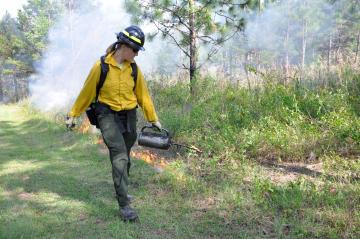
Louise Loudermilk ignited a prescribed fire with a drip torch for management and ecological objectives. A new 3D fuel model can help make the management of controlled burns safer and less costly. USDA Forest Service photo by Christie Hawley.

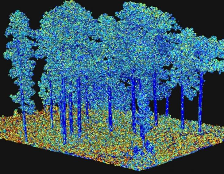
The modeling technique combines aerial and terrestrial LIDAR data with new 3D field sampling, historical data about when an area last burned and simulation modeling to provide 3D fuel characterization at multiple scales. Data collected from a landscape of interest includes vegetation type, fuel mass and fuel volume, all represented in 3D.

Loudermilk co-authored a research paper about a new method of field sampling used for this modeling technique. “The method works equally well across small or large landscapes,” she said. “Our goal is to provide big data collections that will one day be downloadable for anyone to use.” She also contributed to a book chapter about the 3D modeling technique and the importance of fuels research. A related paper in Forest Ecology and Management explains how the status and trends of plant diversity can be monitored at a landscape-scale, information valuable for 3D fuels monitoring.

Ultimately, extensive 3D data collected on fuels will be available for landscapes across the United States. Any land manager will be able to select the data for their area and run 3D fire simulations for educational or fire management purposes.

The success of these projects has been dependent on Loudermilk’s extensive network of federal, state and private organization collaborator

3-d model wildfire fuels
Output from processing of terrestrial laser scanning data, representing an important fuel characteristic “surface area” as illustrated by the different colors. This is input to next-generation fire behavior models. Image courtesy Eric Rowell, Tall Timbers Research Station.