(UPDATE at 6:24 a.m. MDT July 23, 2019)
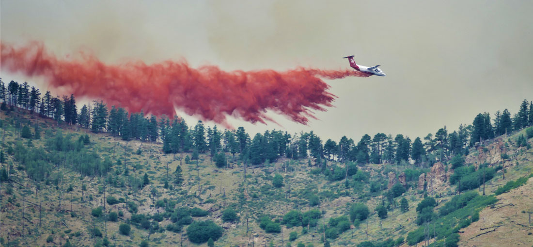
Fire officials say the Museum Fire north of Flagstaff, Arizona has burned 1,800 acres. (UPDATE at 11:33 a.m. MDT July 23, 2019: the size estimate by the Incident Management Team was reduced to 1,000 acres Tuesday morning.) Part of that increase may be from back-burning out ahead of the fire in the area of Mount Elden Lookout Road.
Monday afternoon the Coconino County Sheriff issued an evacuation order effective at 6 p.m. until further notice for all persons living, working and accessing a home from Mount Elden Lookout Road. All residents east of Weatherford Road with access on Mount Elden Lookout Road were included. The evacuation is to support burnout operations and to prevent the fire from coming into these neighborhoods.
At about 4 p.m. the weather station near the Flagstaff airport south of town recorded 0.03 inch of rain. Monday night the relative humidity reached 70 percent, a level that would retard the spread of a wildfire. The weather forecast for the fire area calls for a 70 percent chance of rain and thunderstorms in the afternoons on Tuesday and Wednesday, with an estimated total of approximately half an inch. Rain could continue off and on through the rest of this week.
Moisture has increased overnight and we are expecting an active day of thunderstorms. Hail, gusty winds, and localized heavy rain/flooding are all possible with the stronger storms. #azwx pic.twitter.com/uKaWrsHKty
— NWS Flagstaff (@NWSFlagstaff) July 23, 2019
A fixed wing mapping flight scheduled for Monday night had to be cancelled due to cloud cover.
The Type 1 Southwest Area Incident Management Team 2 assumed command of the fire at 6 p.m. Monday. The Incident Command Post is located at Ft. Tuthill, just south of Flagstaff.
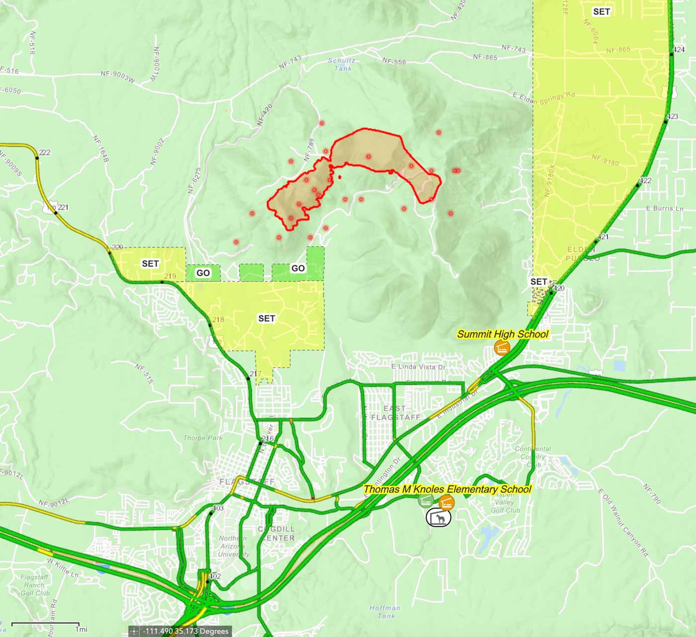
It’s already burned over 400 acres! #MuseumFire @CorruptedPOD @Gatekeeper5150 @kenfoulmouths pic.twitter.com/wUTy9XZKtq
— Chizhiiknees (@Chizhiiknees) July 23, 2019
(UPDATED at 10:14 am MDT July 22, 2019)
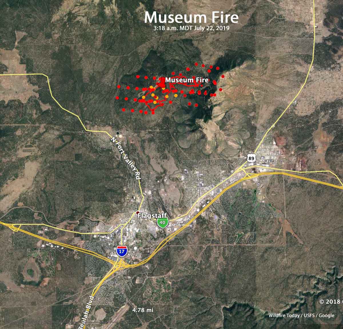
The Coconino National Forest is saying the Museum Fire north of Flagstaff has burned 1,000 acres, which is consistent with the data from a satellite overflight of the fire at 3:18 a.m. MDT July 22, 2019.
(UPDATED at 7:46 a.m. MDT July 22, 2019)
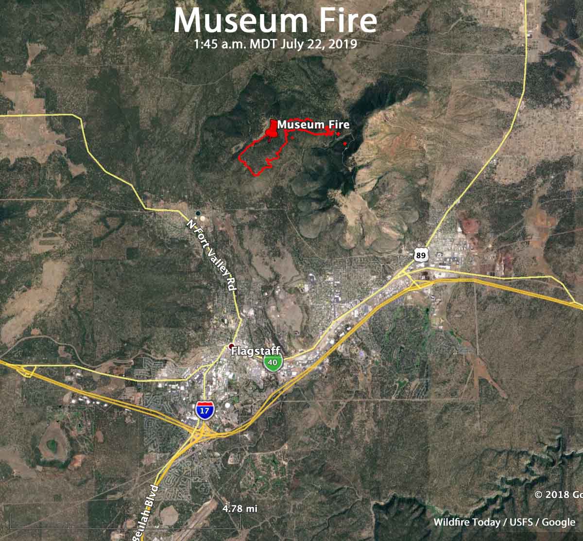
Firefighters continue to battle the Museum Fire just north of Flagstaff, Arizona.
Coconino County has issued a pre-evacuation notice for several neighborhoods, including Mt. Elden Lookout Estates, north and west of Highway 89 and Silver Saddle, Hutcheson Acres, McCann Estates, and all of the Timberline communities (Black Bill Park, Wupatki Trails and Pine Mountain Estates.) Residents in these areas are advised to be ready to evacuate if it becomes necessary.
Data from an overnight fixed wing mapping flight indicates that the fire has burned 415 acres. Satellite imagery collected about half an hour later appears to show that the fire is significantly larger, but the fixed wing flight should be much more accurate.
We will update this article as more information becomes available.
(Originally published at 7:05 p.m. MDT July 21, 2019)
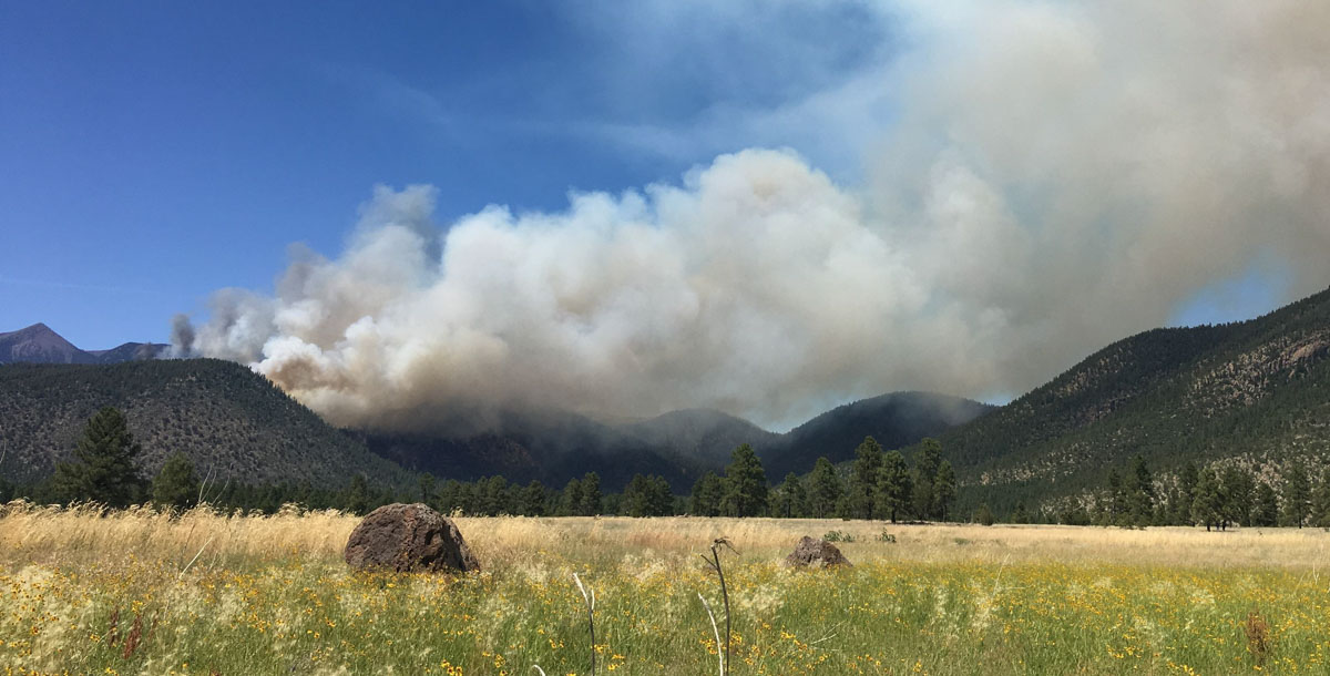
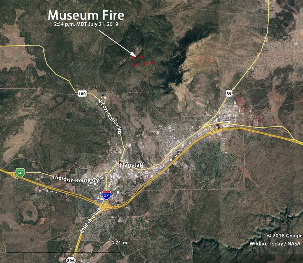
A fire named “Museum” is causing evacuations on the north side of Flagstaff, Arizona. It was reported at 10:53 a.m. Sunday and had burned approximately 400 acres by 6:22 Sunday afternoon, coming to within a mile of the outskirts of the city (see the map below).
Due to the complexity, a Type 1 Incident Management Team has been ordered and should arrive on Monday.
Evacuation information is being handled by Coconino County Emergency Management and conducted by the Sheriff’s Office. The Emergency Management Call Center can be reached at (928) 213-2990.
Firefighting resources assigned to fire Sunday afternoon included:
- 7 Fire Engines
- 2 Hot Shot crews
- 4 other Hand Crews
- 2 Dozers
- 2 Water Tenders
- 4 Large Air Tankers
- 4 Single Engine Air Tankers
- 1 Very Large Air Tanker (DC-10)
- 3 Type 1 Helicopters
A weather station at the Flagstaff Airport Sunday afternoon recorded a temperature of 87 degrees, 14 percent humidity, and 6 to 9 mph winds out of the west and southwest gusting to 20. For Monday the forecast is for 83 degrees, 18 percent RH, and variable winds of 6 to 9 mph.
The #MuseumFire, north of Flagstaff, has burned 400 acres and continues to grow.
Are you near the fire? Message us with sights/updates, and please stay safe.
Photos courtesy of Jeremy Perez, Taylor McKinnon, Nishan Campbell and Christina Cantu https://t.co/ax2l9loipK pic.twitter.com/JUIDthU2KN
— azcentral (@azcentral) July 22, 2019
#museumfire update: An evacuation notice has been issued for recreational areas of Forest Rd. 420 to Hwy 89 (Mount Elden Lookout) and Schultz Pass Rd. to private land. A pre-evacuation notice has also been issued for the area of Forest Rd. 420 to Friedlein Prairie. pic.twitter.com/4pHSAjVxhJ
— Coconino County (@CoconinoCounty) July 21, 2019
Thanks and a tip of the hat go out to Tom. Typos or errors, report them HERE.
