(UPDATED at 3:56 p.m. PDT July 27, 2019)
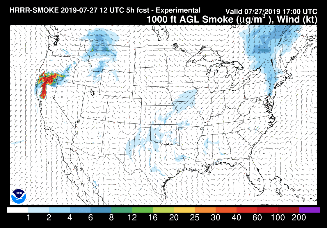
Below is an updated forecast for the distribution of smoke from the Milepost 97 Fire in Southwest Oregon. One difference from the previous version further down in this article is that not only is it proceeding further south approaching the San Francisco Bay Area, but some of the smoke will be spreading into southern Idaho. The forecast is for 6 p.m. PDT July 27, 2019.

(Originally published at 7:15 a.m. PDT July 27, 2019)

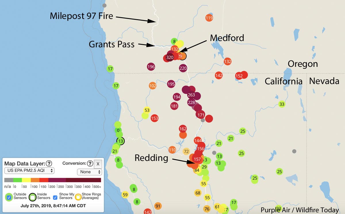
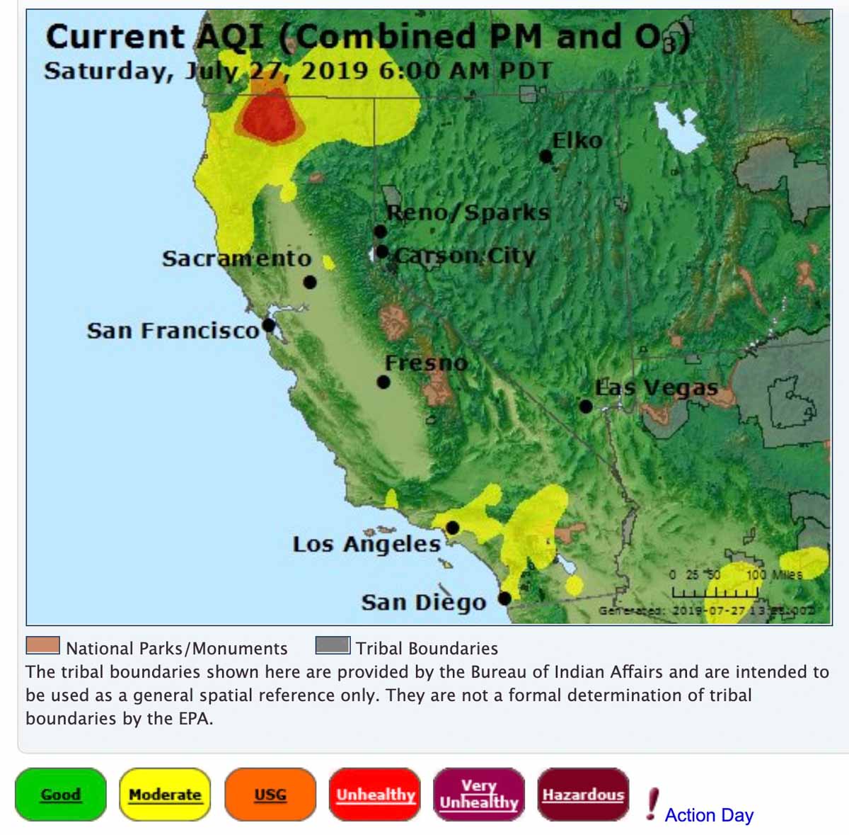
Smoke from the 8,878-acre Milepost 97 fire near Canyonville, Oregon is affecting the air quality in Southern Oregon and Northern California.
Some of the cities in Oregon affected are Grants Pass, Medford, and Ashland. And in California, Yreka, Weed, Mt. Shasta, and Redding.
Click here for more information about the Milepost 97 Fire near Canyonville, Oregon.


Today is the 31st , can anyone tell me what the wind will be doing with the smoke over the next couple of days in the area of Weed, Mt Shasta, etc?
Tons of smoke in little valley, east of Redding on the 299. ?
What’s it like in Ashland? We will be in Ashland for two weeks starting on 8/5/19.
Last year we where there during the Smokey time.
I live in Canyonville, one mile north of where the fire started and we have had little to NO smoke whatsoever. I feel so bad for everyone being affected by this smoke! Cheers to all fighting this fire!
And then the smoke came back Sunday morning.
What happened ? – to clear the air so thoroughly Saturday late afternoon.
White City, yesterday morning and this morning hazy smoke around the edges of the Rogue Valley. Unfortunately afternoon winds yesterday brought the smoke back filling the Valley again. We always have afternoon winds here, so enjoying the somewhat clear morning while we can.
At times heavy smoke in Grants Pass.
The 2002? Biscuit fire near Cave Junction sent heavy smoke down into the Bay area. I was doing a job at a school in Danville and the smoke at times was so heavy l could barely see a small hill a mile away.
We drove right through it while it was happening and you can see the Smokey red sky and heavy smoke leading up to the mountains and foothills while it was spreading.. I couldn’t drive through that area without choking.,, I hope everyone is ok in the areas affected by it.. it made our drive from California to Washington pretty scary because I had children in the car and when the fire was burning, you could see how fast it was spreading.. :-/
Is Sunny Valley in danger from the fire?
I’m near Grants Pass & the Mile 55 exit Highway 5.
We had the smoke lift almost completely in late afternoon, on Saturday.
It was smokey as late as 2 or 3 PM, when the air conditioning kicked on and I turned it off because it was bringing in smoke.
So as of 6 PM, the skies are blue etc.
The Accuweather for Canyonville says the wind is still blowing from the North.
If I am interpreting that right, the rate of smoke production has dropped off one heck of a lot, because the wind is still blowing from the North, to the South, from Mile 97 to Mile 55.
“8 North” and “5 NNW” are 2 of the hourly readings. The one time I looked it up, it said that means, from North to South (or NNW to SSE).
https://www.accuweather.com/en/us/canyonville-or/97417/hourly-weather-forecast/335294
The first time since the first smoke arrived, that we can use the A/C & house fan.
Pretty hazy in Yreka, yesterday and today… flashbacks to our previous two summers:(I
Keep an eye on the air quality, especially if you have a higher risk of heart disease.
Good resource: cleanairresources.com/tools/aqi_lookup
Here in Mccloud, it’s thick and heavy! Scary, haven’t seen mt Shasta I. Two days. God bless all fire fighters.
Yes we can Alturas is starting to fill up also thank you for asking
we see smoke in the Kneeland/Eureka area this morning
The smoke has polluted Rogue River OR horribly. I can’t see the mountain across the street.
I’m seeing smoke in the air down here in Arcata, I’m surprised it’s coming so far southwest.
We are seeing the smoke in Anderson as well
smoke in the air in Lakehead, CA on Saturday morning, 7/27/19 (clear Friday)
We live in Lake Shastina (Weed) we can’t even see Mount Shasta from our windows..which is, as a rule beautifully looming large. Matter of fact we can’t see any of the lesser mountain ranges around us, the air quality is poor and it smells strong of smoke!
I am your neighbor. The air quality is hazardous today. Stay indoors if you can…
The sky has become hazy with smoke in Lakeview, OR.
I live inEagle Point and I woke up this morning to clear sky’s. God bless the fire fighters.
I live by keswick dam and it’s hazy with drift smoke and low smoke near by, I thought there was a fire close by but it doesn’t smell strong. The sun light is filtering through the smoke.
We can see the smoke from our patio in west Redding.
Hi John. Can you see the actual column or drift smoke?
We can see the smoke in French Gulch Ca
I’m in shasta lake city and the smoke is extremely thick and water planes are flying over head
Thick, oily smelling smoke here in Fall River Mills, east of Redding.
I guess its drift smoke in Lake County California. Freaks us out after losing house to the Valley Fire.