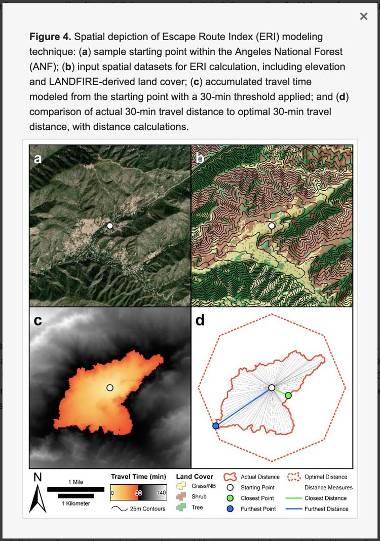
Above: a figure from the research
Previously we covered research that is underway to help wildland firefighters determine the best escape routes from a dangerous fire. A paper published in 2017 looked at the use of LiDAR to analyze the effects of slope, vegetation density, and ground surface roughness on travel rates for wildland firefighters’ escape routes. And earlier this year we reported on research that studied crowd-sourced fitness data to estimate rates of foot travel on slopes and how it could be integrated into recommendations for escape routes.
Below are excerpts from a research paper that was published July 8, 2019, written by Michael J. Campbell, Wesley G. Page, Philip E. Dennison, and Bret W. Butler. It is titled, Escape Route Index: A Spatially-Explicit Measure of Wildland Firefighter Egress Capacity. Link to the entire document.
From the Abstract
A previously published, crowd-sourced relationship between slope and travel rate was used to account for terrain, while vegetation was accounted for by using land cover to adjust travel rates based on factors from the Wildland Fire Decision Support System (WFDSS). Land cover was found to have a stronger impact on ERI values than slope. We also modeled Escape Route Index (ERI) values for several recent wildland firefighter entrapments to assess the degree to which landscape conditions may have contributed to these events, finding that ERI values were generally low from the crews’ evacuation starting points.
From the Conclusions
In this paper, we have introduced a new metric for assessing and mapping egress capacity, or the degree to which one can evacuate from a given location, on a broad, spatial scale based on existing landscape conditions. ERI is not a single metric, but a suite of four spatially-explicit metrics that define the relative travel impedance caused by terrain and land cover faced by a fire crew, should that fire crew need to evacuate. The intent is that this modeling technique will be employed to aid in wildland firefighter safety operations prior to engaging a fire, acting as a decision support tool. Given that the metric relies on US nationwide, publicly-available datasets, the goal is that ERI metrics would be mapped in advance of fire suppression and used to direct fire crews toward potential control locations with higher capacity for evacuation, thus reducing the potential for injurious or even fatal entrapments.
ERI does not map escape routes, per se, it highlights areas that have a greater or lesser capacity for providing efficient escape routes. Areas with high ERI values will likely have an abundance of open, easily-traversable terrain, through which many potential escape routes may exist requiring little alteration of the land cover. Conversely, areas with low ERI values possess some combination of rugged terrain and dense vegetation, thus making the designation of suitable escape routes difficult or even impossible.


ERI values, topo mapping with expected seasonal weather/ wind direction may be offered to vulnerable civilian communities prior to wildfire hazard.
Easy, step into the black.