(UPDATED at 8:01 p.m. CDT March 8, 2020)
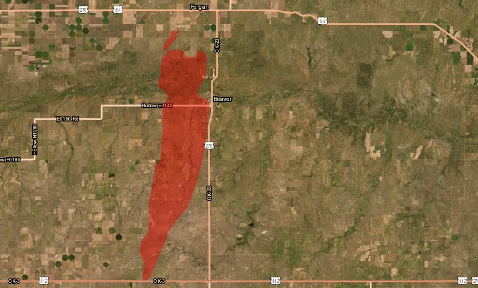
After more accurate mapping the Oklahoma Forestry Services reported Sunday afternoon that the Beaver Fire in Beaver County has burned 29,120 acres and is 50 percent contained. Crews continue to improve fireline and mopup hot spots.
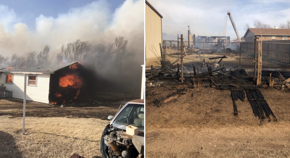
On Saturday Cody Rehder of the Oklahoma Highway Patrol wrote on Twitter, “The town of Beaver is being evacuated at this time. The fire has reached the SW edge of town. Structures are on fire and the HS football field as burned.”
(UPDATED at 12:55 p.m.CST March 8, 2020)
The Beaver fire in the panhandle of Oklahoma is still estimated to be 13,000 acres, but that could change after more accurate mapping is complete. Saturday the Oklahoma Forestry Services responded to 30 new wildfires.
In a Sunday morning update the OFS said, “OFS are over the fire in an [Oklahoma Highway Patrol] aircraft mapping the fire and coordinating with ground resources. Rain chances do enter the southwestern part of the state this afternoon and gradually move east through the state, but going fires from yesterday will remain active.”
(Originally published at 9:37 p.m. CST March 7, 2020)
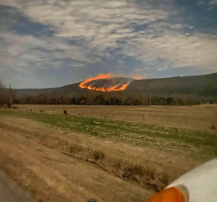
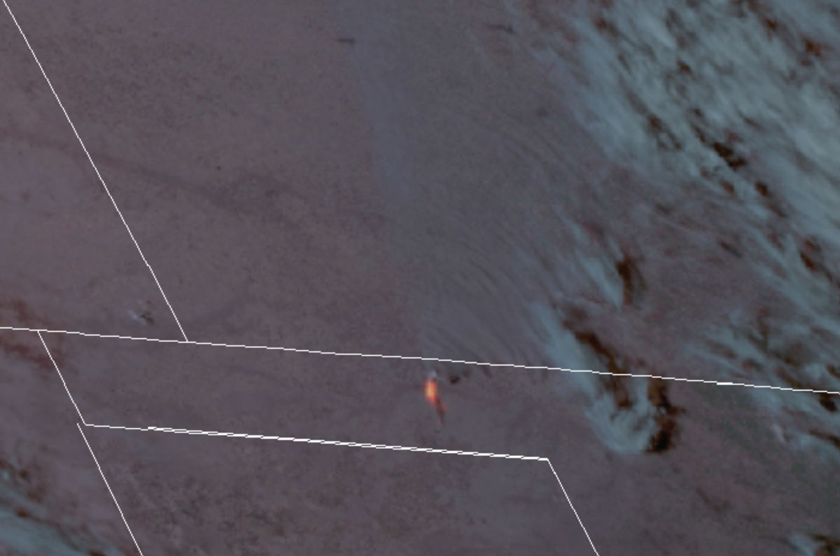
The 412 Fire in the Oklahoma panhandle has destroyed structures and burned approximately 13,000 acres, the Oklahoma Forestry Services (OFS) announced in an update at about 8 p.m. CST Saturday. At about 7:30 p.m. Saturday the OFS said fire had been at least temporarily stopped at the EW 100 road three miles north of Beaver.
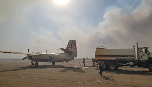
The communities of Beaver and Forgan are under evacuation orders. Firefighters from Oklahoma, Texas, and Kansas are battling the fire along with Air Tanker 95, a privately owned S-2 aircraft formerly operated by the California Department of Forestry and Fire Protection. The air tanker is under a call when needed arrangement in Kansas, operated by Ag Air Service out of Nikerson, Kansas. The aircraft can carry up to 800 gallons and still has the radial engines, unlike the S-2s operated by CAL FIRE today that have been converted to turbine engines.
There are no details available as to the number of structures that have been destroyed or the locations. Damage assessments are underway.
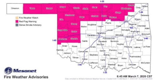
The area was under a Red Flag Warning on Saturday. Strong winds pushed the fire approximately 14 miles across plains.
The 412 Fire occurs one day after the three-year anniversary of the huge Starbuck Fire that burned half a million acres across Oklahoma and Kansas. State and county officials estimated the fire caused at least $50 million in damages.
The 412 Fire near Beaver was one of 19 wildfires the OFS responded to across the state Saturday.

Thanks and a tip of the hat go out to Matt. Typos or errors, report them HERE.
