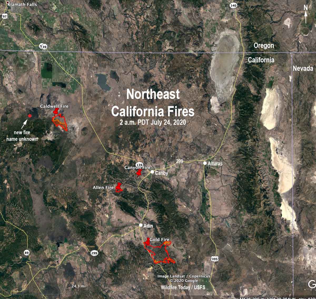
Lightning earlier this week ignited numerous wildfires in northeast California. Most of them were suppressed while still small, but several are resisting the efforts of firefighters.
(To see all articles on Wildfire Today about the Gold Fire including the most recent, CLICK HERE. To see all articles on Wildfire Today about the Caldwell Fire, including the most recent, CLICK HERE.)
In addition, the Gold Fire southeast of Adin that started July 20 (cause undetermined) prompted more evacuations Thursday when fire intensity increased during the afternoon. An overnight mapping flight found that it grew by 4,876 acres to bring the total up to 19,642 acres. It is burning in areas with private residences, ranches, and commercial operations including agriculture, livestock, and timber. Seven structures have been destroyed. The Willow Creek Campground is threatened and Highway 139 is closed at Susanville Road (A-2) south to Termo Grasshopper. Resources assigned include 20 hand crews, 132 engines, and 12 helicopters for a total of 1,214 personnel.
@FirePhotoGirl is on the job at the Gold Fire:
#goldfire several different spot fires have gotten well eatablished. pic.twitter.com/BOwY71pP1W
— FirePhotoGirl (@FirePhotoGirl) July 24, 2020
Very little current information is available about the lightning-caused fires on the Modoc National Forest:
The Caldwell Fire on the Modoc/Siskiyou county line southeast of Lava Beds National Monument has burned approximately 7,000 acres. It was very active again Thursday spreading to the south. Around 11 p.m. Thursday a weather station on Timber Mountain five miles to the southeast recorded 0.06″ of rain. The maximum relative humidity overnight was 59 percent. There is another fire, name unknown, burning five miles west-northwest of the Caldwell Fire northwest of Cinder Butte.
The Allen Fire near Allen Butte 11 miles southwest of Canby was last reported at 800 acres. It was partially obscured by clouds during an attempt to map it from a fixed wind aircraft Thursday night. Smoke jumpers and other crews are working to keep it south of County Road 85.
The Canyon Fire four miles southwest of Canby was also unable to be mapped due to clouds. During the last two days satellites have only been able to detect a small amount of heat on this fire.

Thank you for details/updates