Caldwell Fire burns through Lava Beds National Monument in northern California

UPDATED at 1:25 p.m. PDT July 29, 2020
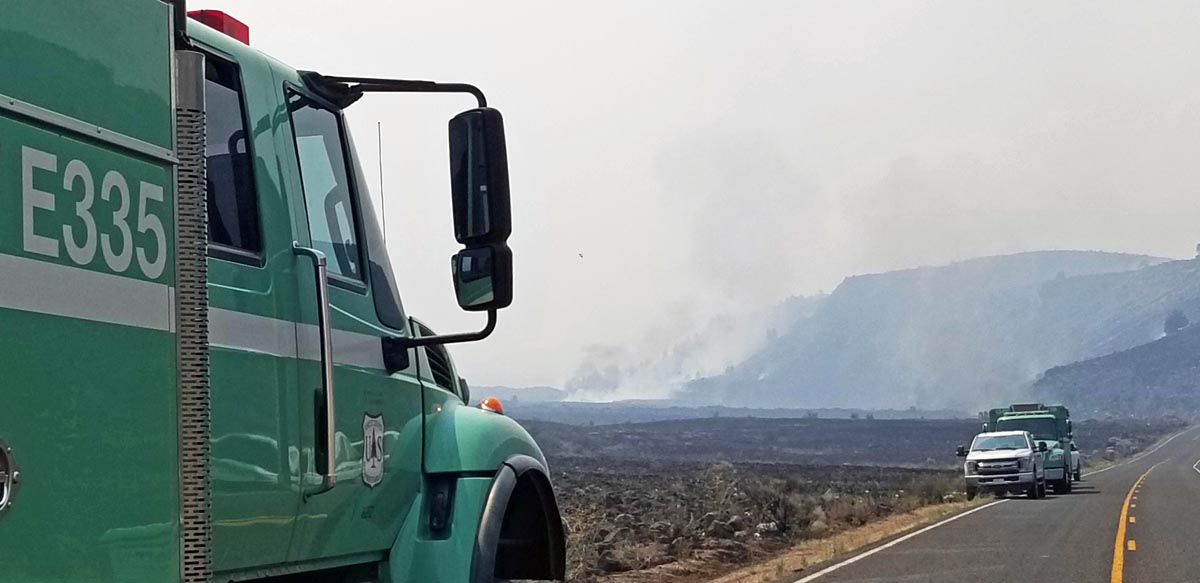
Caldwell Fire Lassen Volcanic Highway
Caldwell Fire, on Lassen Volcanic Highway July 28, 2020. Inciweb photo.

The Caldwell Fire in northeast California was not as active Tuesday as it had been in recent days. It added an additional 1,508 acres which brought the total up to 69,297. Most of the growth was on the northwest side within or west of Lava Beds National Monument.

The area is under a Red Flag Warning Wednesday from 2 p.m. until 8 p.m.

From the Incident Management Team, July 29, 2020:

“[Tuesday] crews conducted burning operations to even out the fire’s edge and fill in unburned areas. On the west side of the fire, the 49 road is holding well. Firefighters were able to begin direct control line construction on the south side of the fire, working from the 49 road eastward. Additionally, crews are still creating secondary control lines south of the fire perimeter.

“On the southeast corner, dozers and firefighters succeeded in creating solid control line, and this allowed the residents of Tionesta to return to their homes. On the east side, fire held well along the 120 road, and fire crews built control line all around the fire area that had crossed over the railroad tracks. On the north, fire flanked into the marsh and the tule is receptive to burning, however, fire is holding well at the 120 road.”


UPDATED at 7:49 a.m. PDT July 28, 2020

Caldwell Fire wildfire Lava Beds National Monument
Caldwell Fire. USFS photo.

The Caldwell Fire in northeast California burned across Lava Beds National Monument Monday, adding another 24,040 acres to bring the total up to 67,789 acres. This is 26 percent of the 259,823 acres burned in California wildfires in 2019.
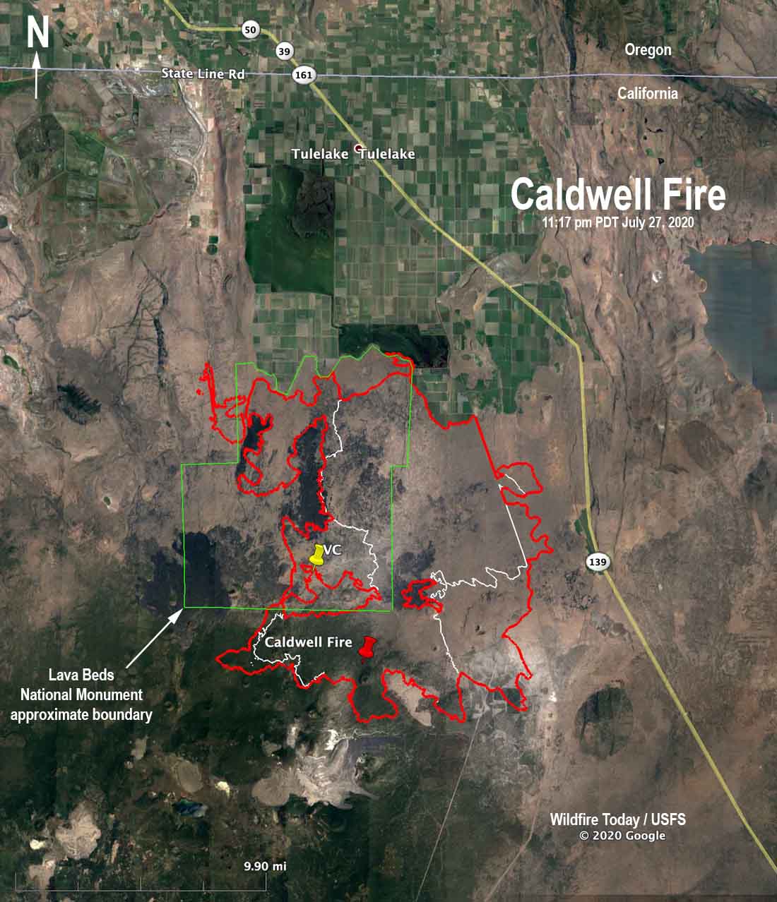
Map of the Caldwell Fire wildfire California Lava Beds
Map of the Caldwell Fire. The red line was the perimeter at 11:17 p.m. PDT July 27, 2020. The white line was the perimeter about 24 hours before. “VC” is the location of the Visitors Center at Lava Beds National Monument.

As of Monday evening the mandatory evacuation of Tionesta ordered by the Modoc County Sheriff’s Office was still in effect.

There is no Red Flag Warning in effect for the fire area. The forecast for Tuesday calls for 87 degrees, 19 percent relative humidity, and 2 to 7 mph winds out of the southeast in the morning and west in the afternoon. On Wednesday the winds will be out of the south and stronger, 7 to 13 mph gusting up to 20 with 12 percent relative humidity.


Originally published at 2:39 p.m. PDT July 27, 2020
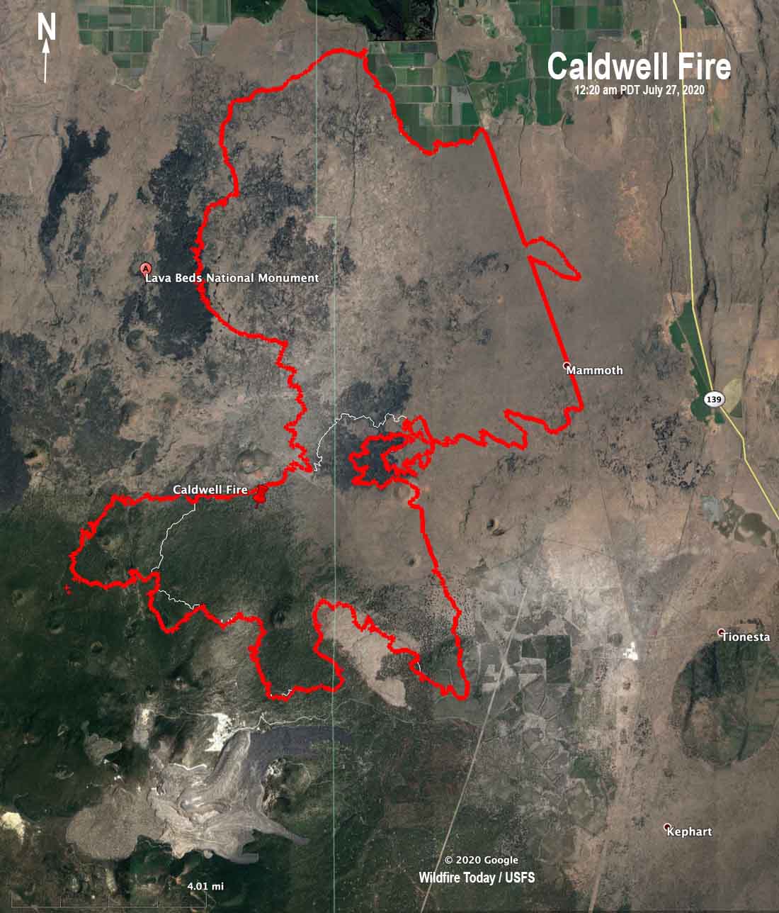
Map Caldwell Fire 12:24 am PDT July 27, 2020
Map of the Caldwell Fire. The red line was the perimeter at 12:24 am PDT July 27, 2020. The white line was the perimeter about 24 hours before.

Outflow winds from a thunderstorm Sunday caused the Caldwell Fire to spread seven miles to the north, more than doubling in size. Early Sunday morning the fire was 13,125 acres, but at 12:20 a.m. Monday a fixed wing aircraft mapped it at 43,749 acres, an increase of 30,624.

(To see all articles on Wildfire Today about the Caldwell Fire, including the most recent, click here.)

As of 6:45 a.m. Monday one structure and three outbuildings were confirmed as destroyed. The fire threatened the community of Tulelake, prompting evacuations in that area. The fire has spread to approximately one mile south of County Road 120. Firefighting resources attacking the new growth included 20 engines, 5 water tenders, and 3 20-person hand crews. On the east side firefighters stopped the fire along 6 miles of a railroad, however there was one slop-over.
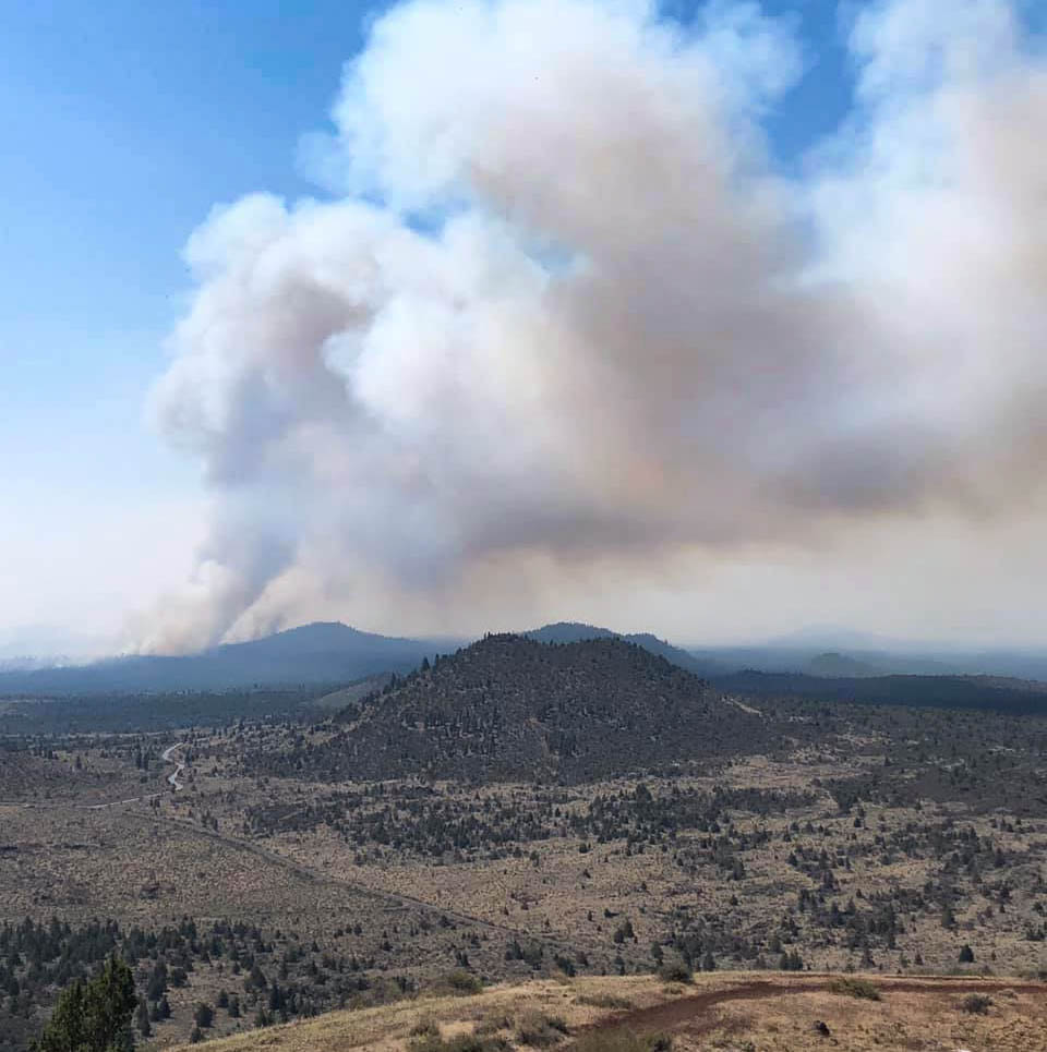
Caldwell Fire
Caldwell Fire. NPS photo by fire lookout Ranger Wendy from Schonchin Butte July 26, 2020.

Firefighters conducted burn-out operations around the Lava Beds National Monument Visitor Center and around some residences in order to protect the facilities.
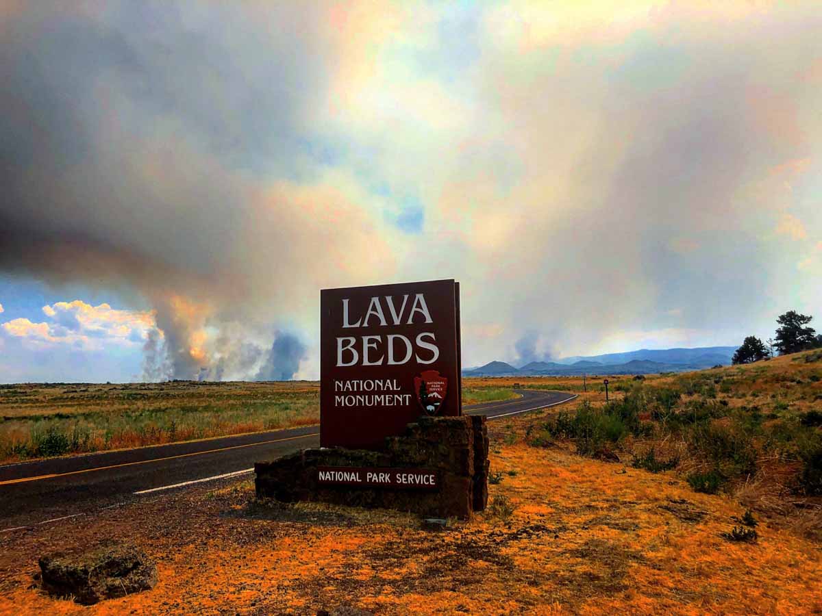
Caldwell Fire
Caldwell Fire, NPS photo by Ranger C. Orland, as seen from the park’s north entrance July 26 2020.

Additional evacuations were ordered by the Modoc County Sheriff’s Office.

The area is under a Red Flag Warning Monday for gusty winds and low humidity.

On Monday firefighters on the north side of the fire will prioritize protecting structures in the Tulelake area and construct both direct and indirect containment line. Crews west of the fire will continue work on the secondary containment lines between the fire and the Medicine Lake area. There are 16 helicopters available to assist with suppression efforts Monday.

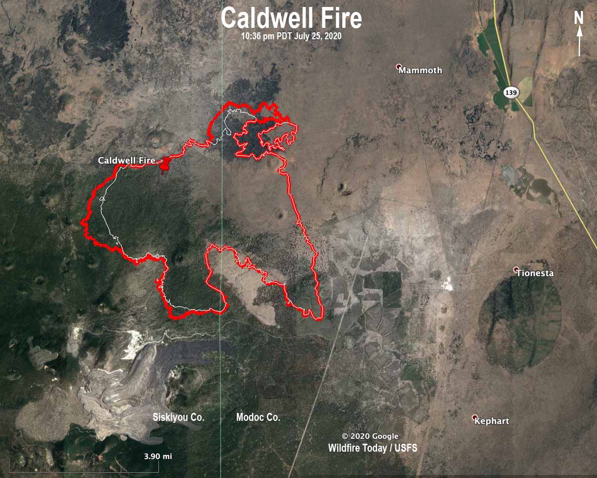
Caldwell Fire is very active in northeast California

UPDATED at 5:46 a.m. PDT July 26, 2020

map Caldwell Fire California wildfire
Map showing the perimeter (in red) of the Caldwell Fire at 10:36 p.m. PDT July 26, 2020. The white line was the perimeter about 24 hours before.

A mapping flight Saturday night showed that most of the growth of the Caldwell Fire Saturday was on the northeast and west sides. It expanded by 1,265 acres to bring the total to 13,125 acres.

The forecast for Sunday is for 91 degrees, 14 percent relative humidity, and 5 to 8 mph west winds in the afternoon along with isolated showers and thunderstorms.

(To see all articles on Wildfire Today about the Caldwell Fire, including the most recent, click here.)

A Red Flag Warning is in effect for the fire area Monday for abundant lightning and dry fuels.


Originally published at 8:47 p.m. PDT July 25, 2020

Caldwell Fire heat smoke satellite imagery
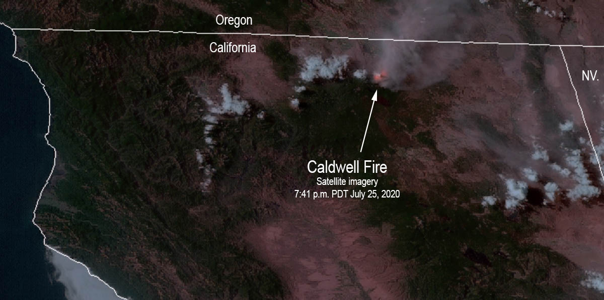
Satellite imagery showing heat and smoke on the Caldwell Fire at 7:41 p.m. PDT July 25, 2020.

The Caldwell Fire in northeast California has been very active for the last two days, growing to 11,860 acres by Saturday morning and was particularly active on the northeast side Saturday. Firefighters are constructing both direct and indirect control lines to limit fire spread using existing road and trail systems. They will work from the Lava Beds National Monument Visitor Center southwest and from the 10 Road going back west toward the lava fields.

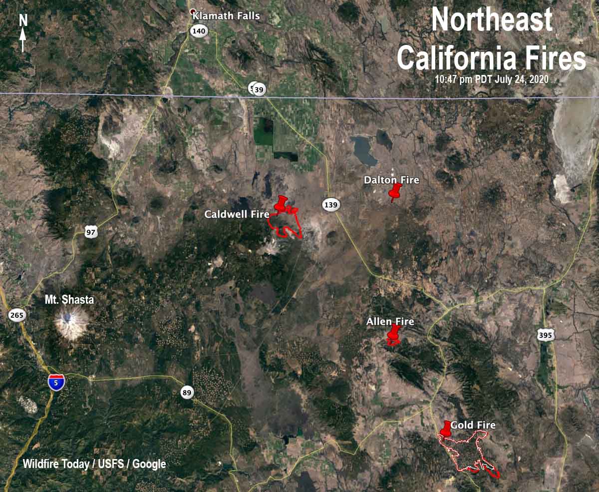
The Caldwell Fire is on the Modoc/Siskiyou county line southeast of Lava Beds National Monument and 37 miles southeast of Klamath Falls, Oregon.

Click here for information about the Gold Fire.

Map wildfires in northeast California
Map showing the location of wildfires in northeast California at 10:47 p.m. PDT July 24, 2020.
Wildfire smoke forecast 6 am MDT July 25, 2020
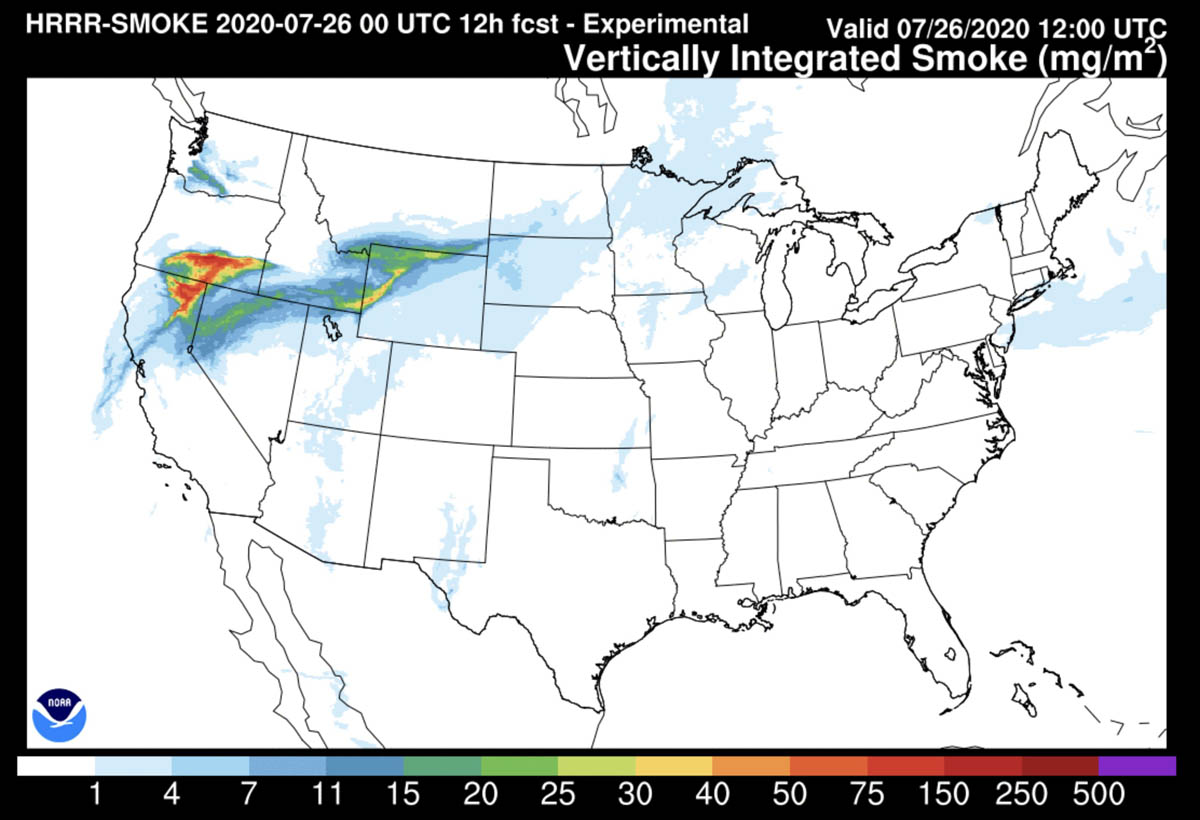
Wildfire smoke forecast for 6 a.m. MDT July 25, 2020. NOAA.

Update on wildfires in northeast California

Evacuations are in effect on the Gold Fire south of Adin

map Wildfires in northeast California
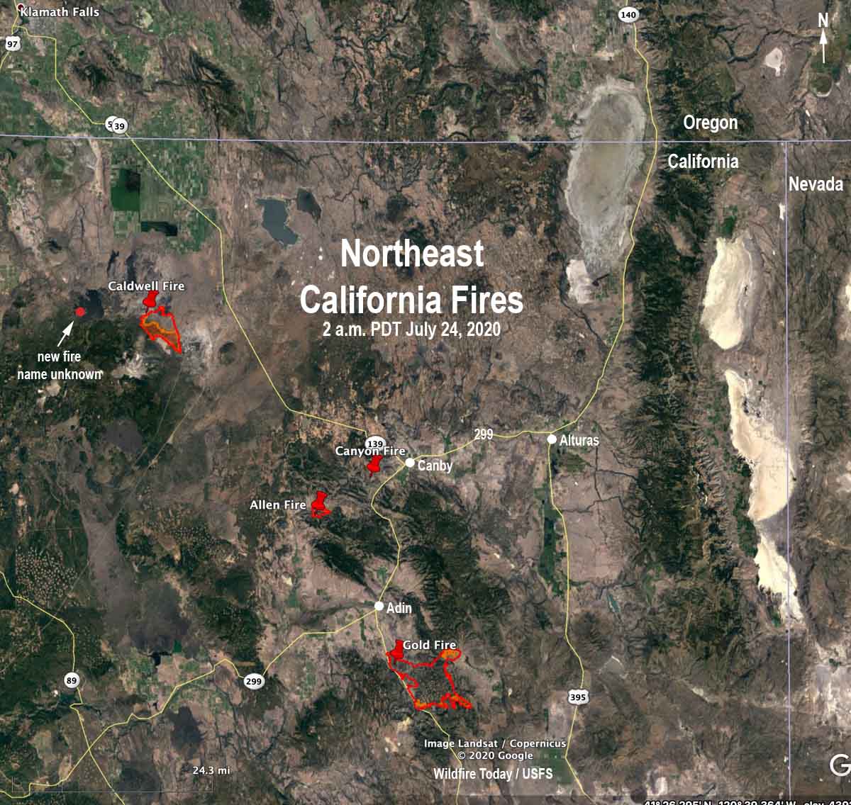
Wildfires in northeast California at 2 a.m. PDT July 24, 2020.

Lightning earlier this week ignited numerous wildfires in northeast California. Most of them were suppressed while still small, but several are resisting the efforts of firefighters.

(To see all articles on Wildfire Today about the Gold Fire including the most recent, CLICK HERE. To see all articles on Wildfire Today about the Caldwell Fire, including the most recent, CLICK HERE.)

In addition, the Gold Fire southeast of Adin that started July 20 (cause undetermined) prompted more evacuations Thursday when fire intensity increased during the afternoon. An overnight mapping flight found that it grew by 4,876 acres to bring the total up to 19,642 acres. It is burning in areas with private residences, ranches, and commercial operations including agriculture, livestock, and timber. Seven structures have been destroyed. The Willow Creek Campground is threatened and Highway 139 is closed at Susanville Road (A-2) south to Termo Grasshopper. Resources assigned include 20 hand crews, 132 engines, and 12 helicopters for a total of 1,214 personnel.

@FirePhotoGirl is on the job at the Gold Fire:

Very little current information is available about the lightning-caused fires on the Modoc National Forest:

The Caldwell Fire on the Modoc/Siskiyou county line southeast of Lava Beds National Monument has burned approximately 7,000 acres. It was very active again Thursday spreading to the south. Around 11 p.m. Thursday a weather station on Timber Mountain five miles to the southeast recorded 0.06″ of rain. The maximum relative humidity overnight was 59 percent. There is another fire, name unknown, burning five miles west-northwest of the Caldwell Fire northwest of Cinder Butte.

The Allen Fire near Allen Butte 11 miles southwest of Canby was last reported at 800 acres. It was partially obscured by clouds during an attempt to map it from a fixed wind aircraft Thursday night. Smoke jumpers and other crews are working to keep it south of County Road 85.

The Canyon Fire four miles southwest of Canby was also unable to be mapped due to clouds. During the last two days satellites have only been able to detect a small amount of heat on this fire.