August 19, 2020 | 7:35 p.m. PDT
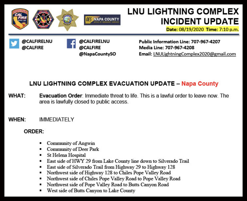
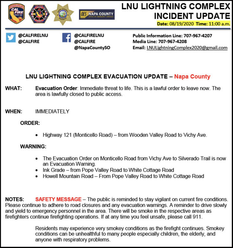
More evacuations have been ordered for the Hennessey and LNU Complex in northern California, this time in Napa County, including the St Helena Hospital and the communities of Angwin and Deer Park.
August 19, 2020 | 6:36 p.m. PDT
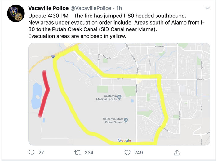
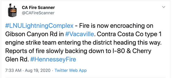
The Hennessey Fire has crossed Interstate 80 near Vacaville, California, prompting more evacuations. At about 5:15 p.m. @CAFireScanner reported that ground units said they had about 80 acres south of the Interstate and they would not be able to catch it without support from aviation.
August 19, 2020 | 12:58 p.m. PDT
Official evacuation information for the LNU Complex of fires north of Vacaville is provided by @CALFIRELNU. Follow them on Twitter.

The map above of the fires in the LNU Complex in northern California is from a fixed wing mapping flight at 11:45 p.m. MDT August 18. After the flight the fires spread substantially to the south and southeast. The red arrows were added by Wildfire Today indicating the direction of additional spread after the flight. This is considered accurate data, much better than information collected by an orbiting satellite passing by hundreds of miles above the Earth. The limitation is that it is just a snapshot of one moment in time while the fires are spreading very rapidly, in some cases, into populated areas. This data is usually only available once a day in the middle of the night.
The mapping flight determined that at 11:45 p.m. Tuesday the size of the multiple fires in the Complex combined (Gamble, 15-10, Hennessey, and others) was 51,223 acres.
Firefighters and other emergency services personnel, including law enforcement, need continuous real-time, 24/7 situational awareness of the location of dangerous wildfires. Current, accurate, real-time fire location data can aid firefighters and law enforcement who are planning and administering evacuations. It can be a life and death issue.
The technology exists for real-time fire location information. The federal agencies are dragging their feet in getting it implemented.
August 19, 2020 | 7:05 a.m. PDT
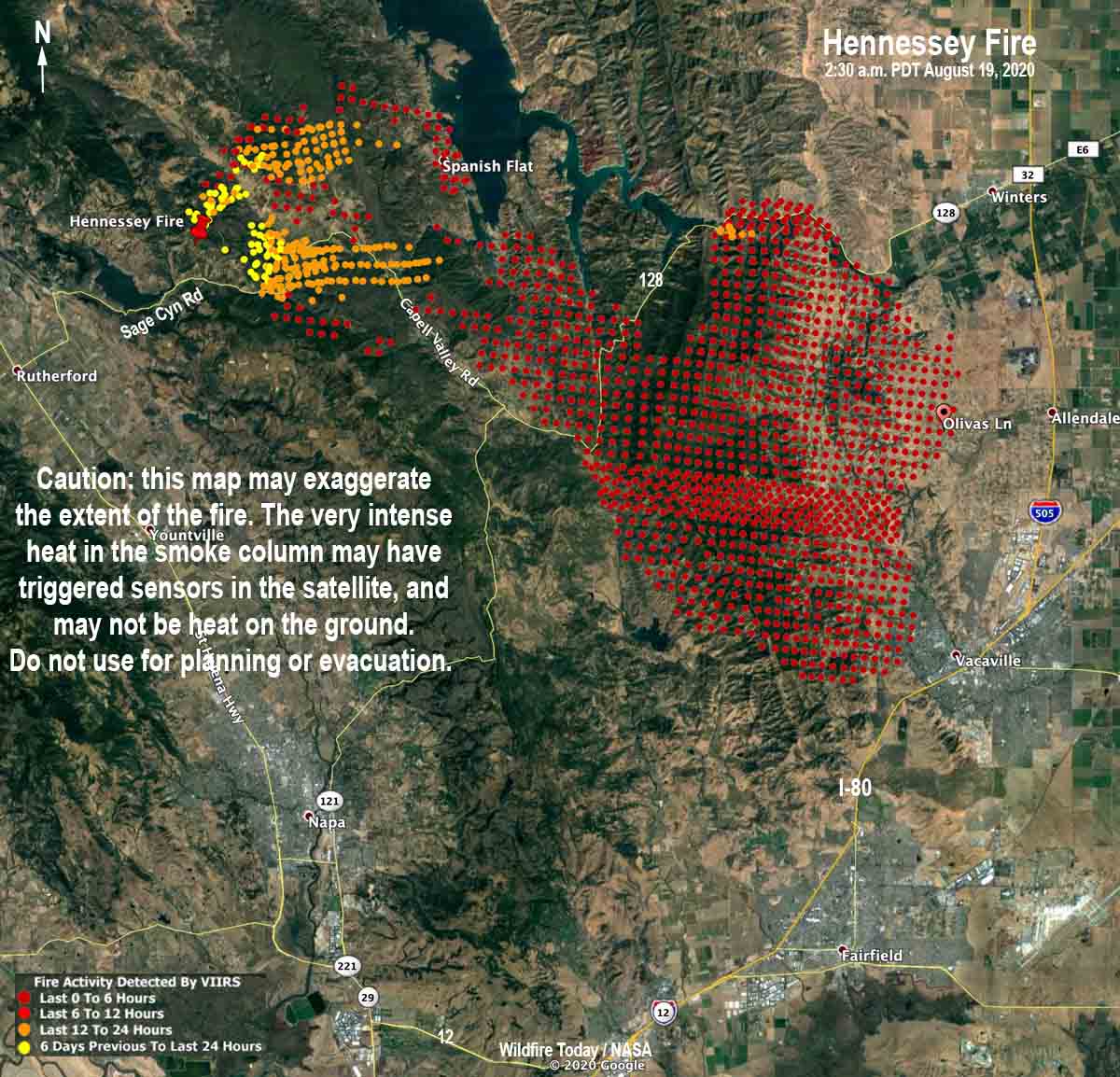
The Hennessey Fire north and northeast of Napa, California made a strong push to the southeast late in the day on Tuesday and well into the early morning hours on Wednesday and spread toward Vacaville.
The fire spread south across Highway 128 and prompted evacuations in Solano County.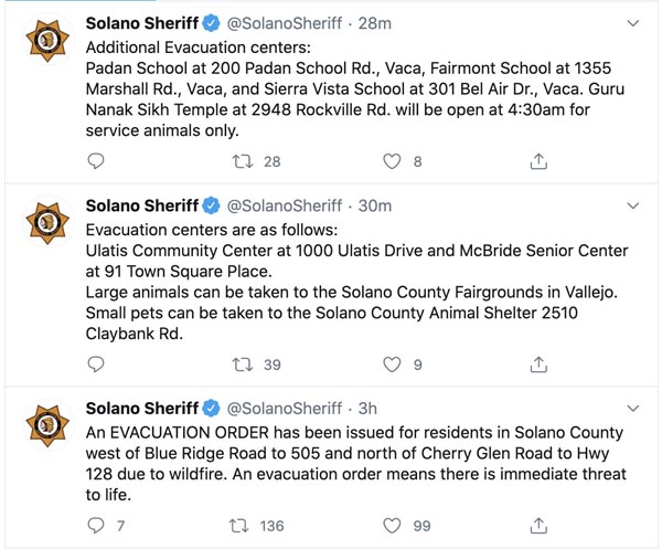
On Twitter, @CAFireScanner, a person who regularly and closely monitors radio traffic on wildland fires, said at 5:33 a.m. Wednesday the fire was near Gibson Road north of Vacaville and was approaching Interstate 80 and Cherry Glen Road southwest of Vacaville.
When I saw the red dots on the map above which represent heat detected by a satellite at 2:30 a.m. MDT Wednesday, it was hard to believe that the fire spread that quickly and for that distance, and that it accurately reflected where the fire was. When a fire is burning very intensely and creating a large convection column of smoke, heat sensors on aircraft and satellites used for mapping fires can mistake heat in smoke for heat on the ground. The map may exaggerate the extent of the fire, but radio traffic indicates the Hennessey Fire spread about 15 miles to the southeast in the last 24 hours. But, the map above is not official, and should not be used for planning or evacuation.
Here is a link to a map produced by the Incident Management Team based on a mapping flight at 11:45 p.m. PDT August 18, 2020. It is for all of the fires in the LNU Lightning Complex including the Hennessey, Gamble, and 15-10 fires.
I estimate, conservatively, that the Hennessey Fire has burned at least 40,000 acres. That is a very unofficial estimate, and separate from the other two fires in the Complex.

Why aren’t the VLAT being used? Yesterday very little use. Is the “system” that overloaded? New starts framing in the fire with retardant until ground forces can start suppression.
I don’t understand why they even had a fire in this vicinity. Radar at the beginning of the week showed some heavy thunderstorms moving through the North Bay area indicating heavy rain. Did the rain miss this particular area?
Regards,
Fred M. Cain
Yes, at least it seems so, while Davis did get some but not a lot. My mom lives very close the evac zone, but it was dry over there. The rain seems to have missed us, as far as I can see.
Bill: the Hennessey Fire had burned into Vacaville by 6am today when I awoke and
Began checking for updates on lightning-caused fires the ought the San Francisco Bay Counties. Firefighters in the South Bay are pulling a second shift due to lack of available personnel due to the many fires that have emerged from the unusual thunderstorms at the beginning of this week.
Steve Beck
Sebastopol, Sonoma County, CA