Updated October 1, 2020 | 10:26 a.m. PDT
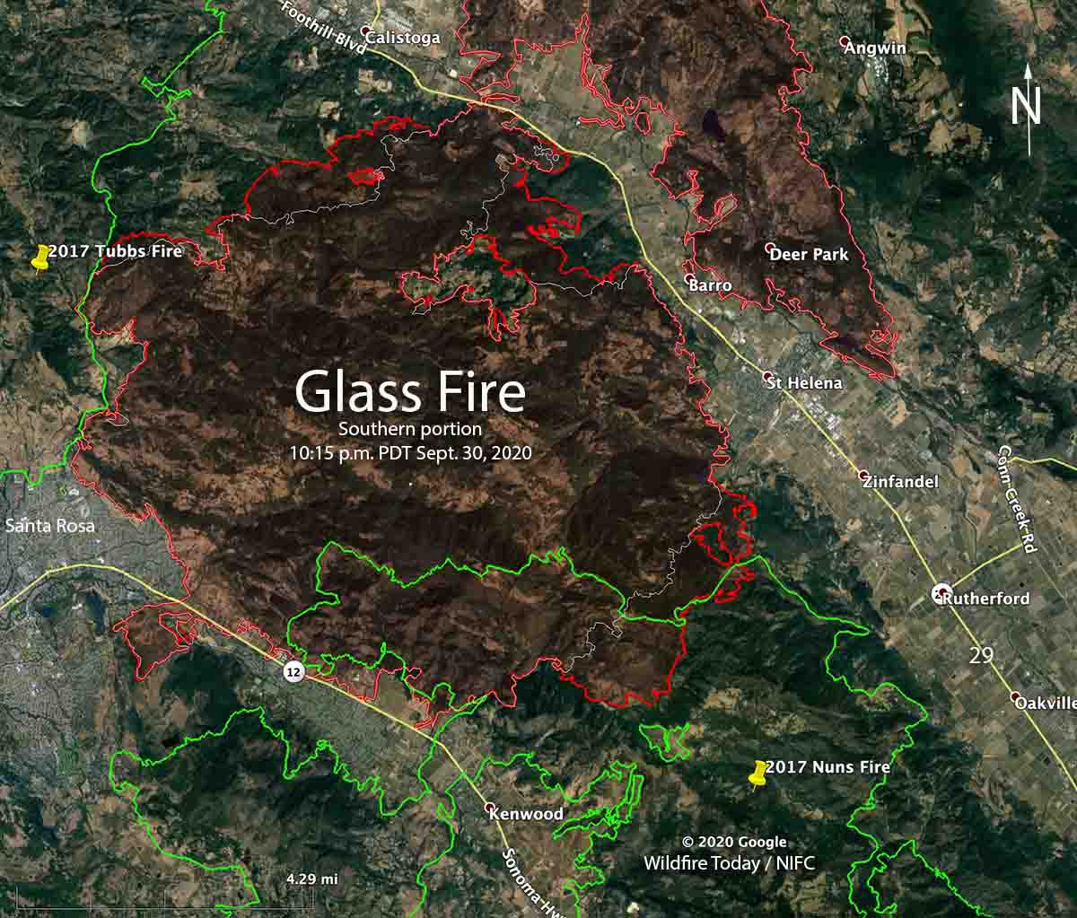
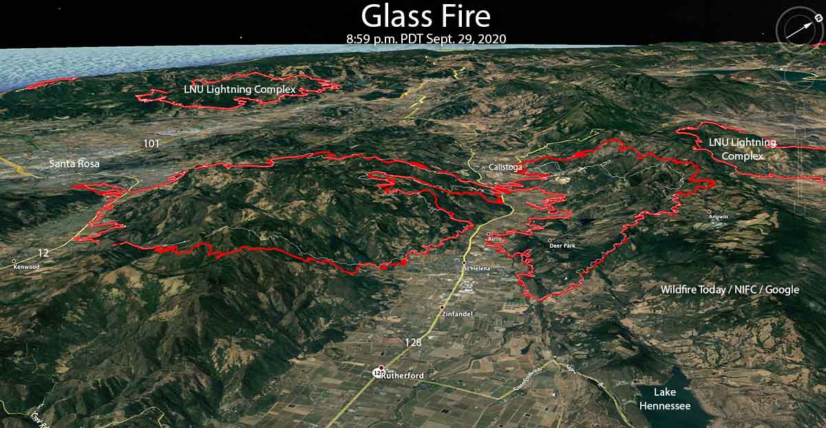
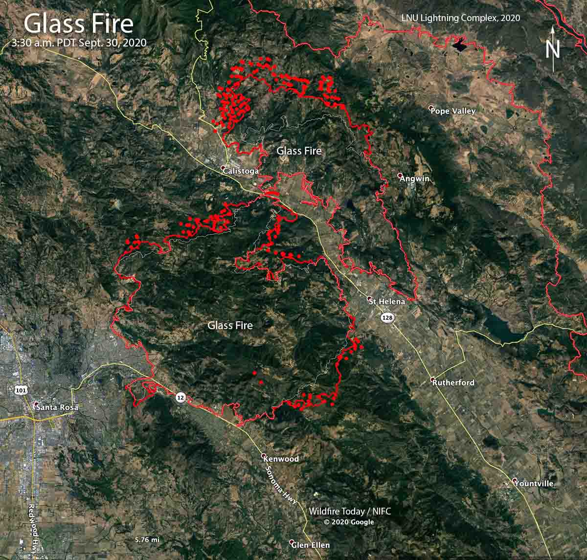
The Glass Fire near California’s Napa Valley was very active again Wednesday, adding about 8,000 acres to bring the size up to 56,781 acres according to CAL FIRE Thursday morning. The agency reported that 143 residences and 105 other structures have been destroyed since the blaze started September 27.
The growth Wednesday was primarily in four areas:
- The north end, north of Calistoga where it has burned across a narrow finger of the Robert Louis Stevenson State Park. In this area it has come close to burning into the LNU Complex which was last active several weeks ago.
- The west side, one to four miles south of Calistoga and Highway 29. South of the highway the fire is a couple of miles away from the 2017 Tubbs Fire. Firefighters have stopped it along a portion of that two-year-old fire scar.
- West of Highway 29 and one to two miles northwest of Barro. This could be considered a large unburned island before Wednesday, but it is burning very actively today, Thursday. Multiple structures have been destroyed and more are threatened near Spring mountain Road.
- The southeast side, three to five miles west of Rutherford. It has already burned into the 2017 Nuns Fire, but firefighters have not yet had success in stopping it in this two-year-old fire scar.

The area is under a Red Flag Warning through Friday. Gusty north to northwest winds, very low humidity, and extremely dry fuels have produced critical fire weather conditions Thursday afternoon through Friday night. Northwest winds will increase Thursday night into Friday morning with gusts of 25 to 30 mph with little or no humidity recovery overnight. Breezy northerly winds will continue through the Friday burn period with continued hot temperatures. The relative humidity Thursday will be generally in the teens, with a high temperature at Santa Rosa of 96 degrees.
September 30, 2020 | 4:23 p.m. PDT
CAL FIRE revealed September 29 that two firefighters deployed fire shelters at the Glass Fire September 27, 2020. The individuals were not injured, but several transport support vehicles were damaged.
To see all articles on Wildfire Today about the Glass Fire, including the most recent, click here.
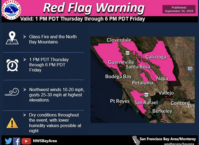 The weather Thursday and Friday could increase activity on the blaze. Strong winds and a Red Flag Warning are predicted for 1 p.m. Thursday through 6 p.m. Friday for 10-20 mph northwest winds with 25-30 mph gusts in the higher elevations.
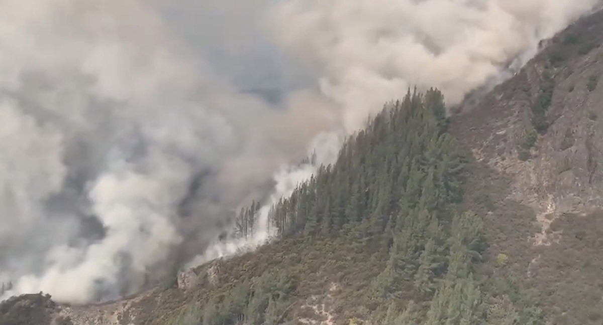
The north end of the fire north of Calistoga has moved into much more rugged terrain — the southeast side of Robert Louis Stevenson State Park. The last time that area burned was 56 years ago during the C. Hanly Fire of 1964. In 2017 the Tubbs Fire, west of the Glass Fire, burned exceedingly well in the footprint of that 55,000-acre fire. Most of the rest of the Glass fire is burning in areas with no recorded history of fires in the last 70 years.
At last count 80 residences and 33 other structures have been destroyed, with over 21,000 still threatened.
CAL FIRE reports the Glass Fire has burned 48,440 acres near Santa Rosa and Calistoga, California. Data from a Tuesday night mapping flight could bump that figure up another 5,000 acres.
Resources assigned to the fire include 25 hand crews, 261 fire engines, and 16 helicopters for a total of 2,099 personnel.
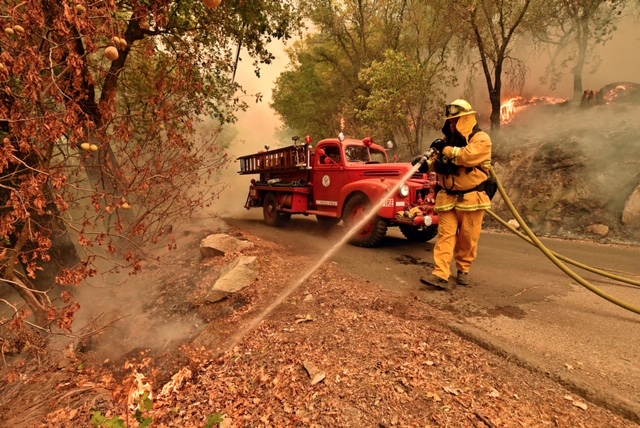
Eagle Field Fire Department firefighter Jeff Knobbe & Mark Jones extinguish hot spots using a restored 1942 firetruck during the Glass Fire in St. Helena, Calif., on Monday, Sept. 28, 2020. #glassfire #wildfire #napavalley #firefighters #wildlandfire pic.twitter.com/BX7Pq44Tof
— Jose Carlos Fajardo (@jcfphotog) September 29, 2020
#GlassFire in Deer Park, Napa Valley CA, fire damage on Mund Rd, the Mund Trailer Park is devastated with complete loss. Mutual aid fire crew from Pasadena CA monitoring 1/ pic.twitter.com/GgdtHggTjI
— craig philpott (@CphilpottCraig) September 30, 2020

Did the trees near the houses ignite the houses or did the houses ignite the trees? Looks like a ground fire, judging by the trees in the background of the devastation video.