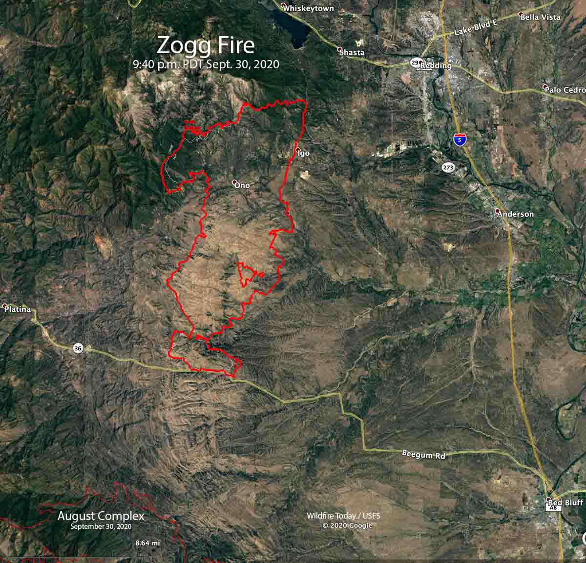
Four people have died and 74 residences plus 73 other structures have been destroyed in the Zogg Fire southwest of Redding, California. The fourth fatality was announced by fire officials Wednesday. A person was found badly burned and was pronounced dead after being transported to a hospital.
CAL FIRE said Thursday morning the blaze has burned 55,303 acres.
The fire was not as active Wednesday has it had been in recent days. Most of the spread was on the northwest and southeast sides. Crews completed firing operations along critical sections of the fireline. Live fuel moistures in the area are at a very low critical level, about 60 percent, and the 1000-hour time lag dead fuel moistures are 7 percent. The lower the fuel moisture, the faster a fire spreads. Kiln-dried lumber is usually at about 12 percent.
To see all articles on Wildfire Today about the Zogg Fire, including the most recent, click here.
The weather forecast for the Zogg Fire Thursday calls for 100 degrees, 6 to 9 mph winds out of the northwest in the morning switching to northeast in the afternoon, with 7 percent relative humidity.
The dry fuels with the hot and dry forecast has led to a fire behavior forecast if there is a slopover or spot fire, for rates of spread of around 1 mph and a spotting distance of up to half a mile.
Resources assigned include 133 fire engines, 52 water tenders, 13 helicopters, 31 hand crews, and 37 dozers for a total of 1,538 personnel.
