The fire has burned well over 48,000 acres near the Napa Valley of northern California
Continue readingFirefighters deploy fire shelters at the Glass Fire
September 30, 2020 | 3:34 p.m. PDT

CAL FIRE reports that two firefighters deployed fire shelters at the Glass Fire September 27, 2020. The individuals were not injured, but several transport support vehicles were damaged.
The fire has burned over 50,000 acres in California’s North Bay near Santa Rosa and Calistoga.
To see all articles on Wildfire Today about the Glass Fire, including the most recent, click here.
NWCG recommends standardization of call numbers for Air Attack platforms
 File photo of an Aero Commander
The National Wildfire Coordination Group is pushing for a standard method of designating call signs of “Air Attack aircraft”. It is believed they are referring to aircraft used to coordinate aerial firefighting aircraft over wildland fires, rather than using a generic term for any aircraft that attacks fires.
Here is an excerpt from a memo the group sent, dated September 21, 2020:
NWCG requests assistance with the adoption of the call sign standard for Exclusive Use (EU) Air Attack platforms. The initial year implementation of the standard would be considered a beta test, with permanent updates planned for sequential years. Updates would include all appropriate documents and applications at the National Interagency Coordination Center (NICC), Geographic Area Coordination Centers (GACC), and local dispatch centers. Implementation of the proposal will include updating Automated Flight Following (AFF) to display call signs. Additional points include:
- Total Mobility (see National Interagency Mobilization Guide, Chapter 10) is supported through this proposal. The call sign standard provides information pertinent to resource movement and prioritization, and it distinguishes between EU and Call When Needed (CWN) platforms.
- AFF will be updated with the new resource identifier call signs. For EU aircraft, the call sign stays with the platform while under contract.
- CWN platforms will continue to use the last three characters of their registration number (N#).
- Operationally, Air Attack platforms will continue to use incident call signs when assuming incident air attack (for example, AA-402 becomes Ranch Air Attack).
Below is description of the call sign standard for all interagency EU Air Attack call signs:
- First Number: The Forest Service regional identification number where the platform is hosted (e.g., 1, 2, etc.).
- Numbers Two and Three: Forest Service will use the two-digit number of the Forest that hosts the platform:
- USFS: 0-29 Cooperating agencies will use the two-digit number assigned to the agency:
- BLM: 30-39
- BIA: 40-49
- States, NPS, FWS: 50-99
Three found dead at Zogg Fire in northern California
Over 100 structures destroyed
Continue readingWildfire smoke forecast, September 28, 2020
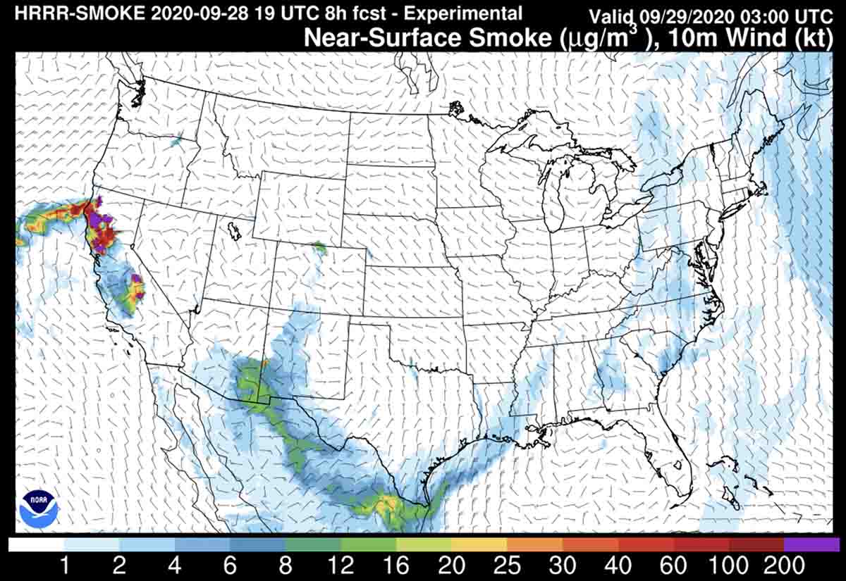
Above is the forecast for wildfire smoke at 8 p.m. PDT September 28, 2020. Most of the smoke from the California fires is being transported out over the Pacific. Some of the smoke from the Wyoming and Colorado fires has blown south into New Mexico and Arizona.
Company issues statement about the drop gate on the air tanker that crashed in Idaho
The company that manufactures the gate that allows the retardant to be dropped from the Single Engine Air Tanker that crashed in Idaho September 22, 2020 said the FAA and the National Transportation Safety Board to their knowledge have not released preliminary findings regarding the cause of the crash.
Ricky Fulton was killed while flying the Air Tractor 802A when it crashed while attempting to drop retardant on a wildfire southeast of Emmett, Idaho.
On September 24, 2020 KWTV – NEWS9 reported that Mr. Fulton’s family said, “The preliminary finding from the FAA is saying that the dump gate malfunctioned and didn’t open to dump the fire retardant, so he wasn’t able to pull up over the ridge,”
Victor Trotter, President/CTO of Trotter Controls that made the gate, said, “Neither FAA or the NTSB has made any preliminary statements or findings regarding the cause or possible causes of the crash. We have not been notified that a gate malfunction contributed to the incident. …Air Tractor and our company is fully cooperating with the NTSB. Documentation related to the FAA approved documents including the operation instructions (AFM), ICA (maintenance instructions), and Installation Instructions have been forwarded to the NTSB.”
The Single Engine Air Tanker that crashed was manufactured this year and was registered for the first time July 10, 2020. It was an Air Tractor 802A, N836MM, SN 802A-0836, owned by Aero S.E.A.T. Inc. of Sterling, Colorado, and was working on a call when needed contract with the Department of the Interior.
Glass Fire destroys structures in California’s North Bay
Structures have burned north of St. Helena and on the east side of Santa Rosa
Continue readingZogg Fire grows rapidly southwest of Redding, California
Updated September 28, 2020 | 8:27 a.m. PDT
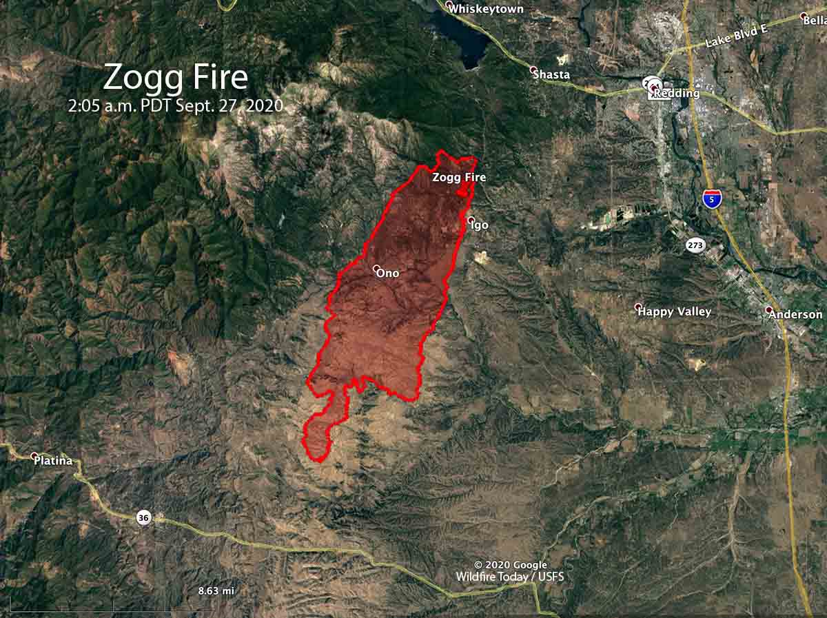
A 2 a.m. mapping flight on Monday by a fixed wing aircraft determined that the Zogg Fire had spread south-southwest for about 14 miles and east for about one mile. It had come to within three miles of reaching Highway 36 the south end. The fire was very active at that time. It was first reported near Zogg Mine Road and Jenny Bird Lane, north of Igo.
The overnight flight mapped it at about 27,000 acres.
To see all articles on Wildfire Today about the Zogg Fire, including the most recent, click here.
Evacuations are in effect, including an area west of Redding, according to KRCRTV:
Update as of 7 a.m.: Areas west of Redding are under a mandatory evacuation order for the Zogg Fire. This includes Muletown Road from Placer Road north to Kanaka Lane. Diggins Way from Placer to the North is being evacuated, as well as all roads off Diggins Way and Muletown Road.
Around 4 a.m., the Redding Police Department posted on Facebook that the fire was no immediate threat to Redding.

The weather forecast predicts for Monday 14 to 16 mph winds out of the north gusting to 24, with relative humidity of 12 percent in the afternoon.
#ZoggFire currently burning over 7,000 acres in Igo, CA pic.twitter.com/esC6lRUwwJ
— KRCR PHOTOG (@krcrphoto) September 28, 2020
Updated September 27, 2020 | 7:46 p.m. PDT
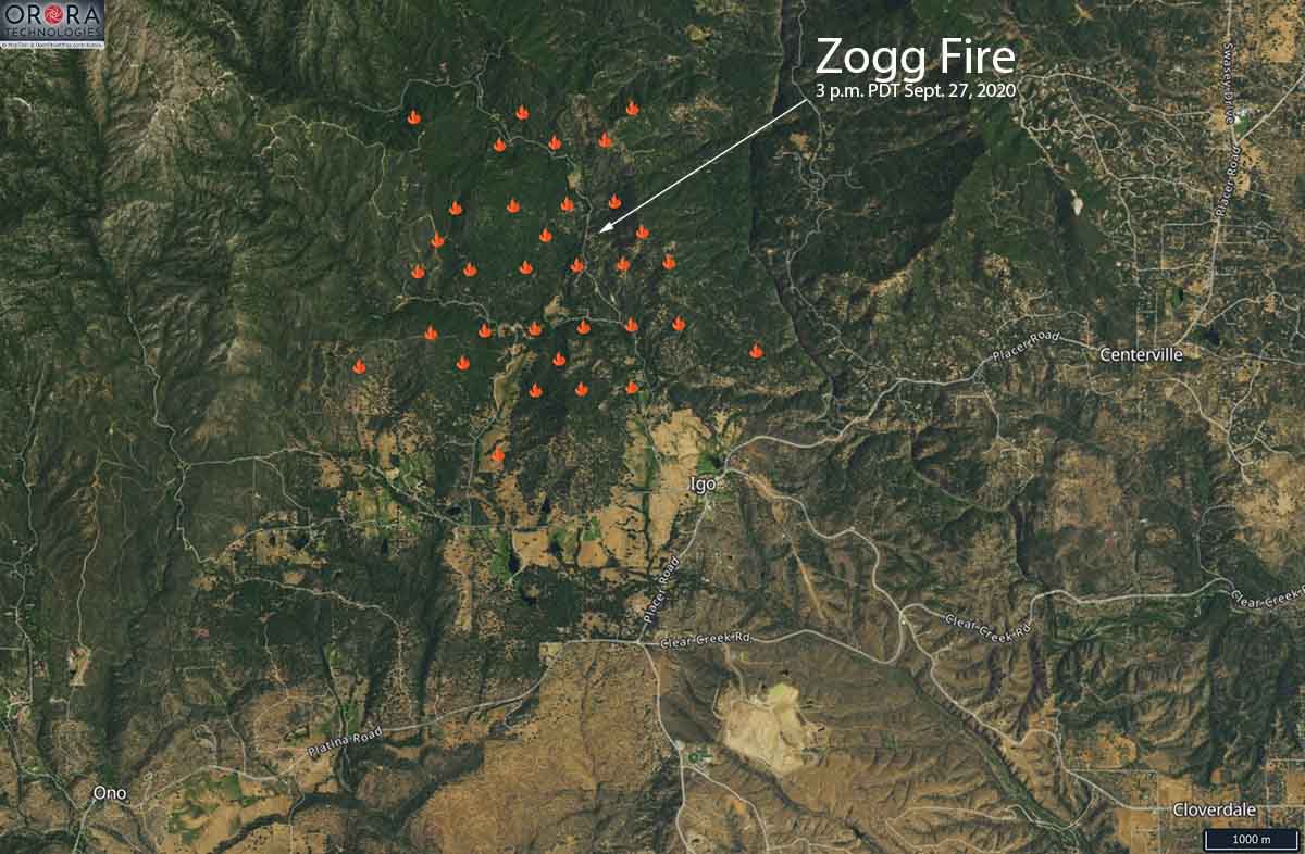
The map above shows heat on the Zogg Fire detected by a satellite at 3 p.m. PDT September 27, 2020. Since then the fire has spread significantly to the south or southwest across Platina Road.
CAL FIRE reported at about 7:35 p.m. Sunday that the Zogg Fire southwest of Redding, California had burned about 7,000 acres.
Updated September 27, 2020 | 7:03 p.m. PDT
Air tankers currently working on the Zogg Fire southwest of Redding, California include four S-2s, three large air tankers, four military C-130 MAFFS, and two super scoopers.
Initiation and rapid development of #ZoggFire shown in 24 fps time-lapse video from #WestPeak1 camera. Time shown from 2:40 pm to 4 pm PDT. Ridge is about 3.8 km WSW from the camera, just north of Igo, California. Smoke first appears on camera at 2:43 pm. Via @jamesinho. pic.twitter.com/y7T74gqKZq
— ALERTWildfire (@AlertWildfire) September 28, 2020
Updated September 27, 2020 | 5:32 p.m. PDT
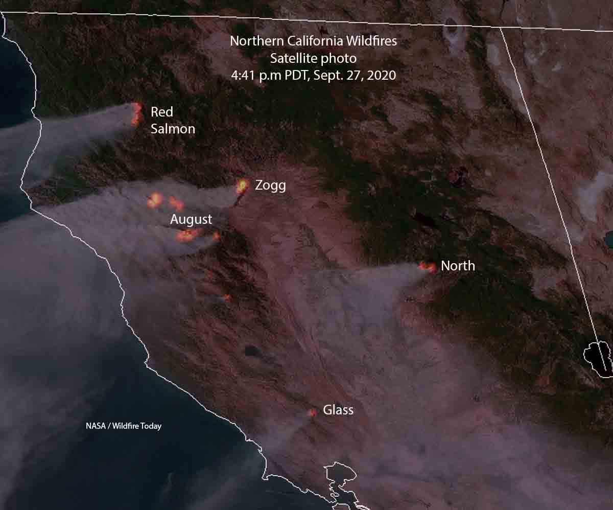
The Zogg Fire showed up on satellite photos soon after it started September 27, 2020.
#ZoggFire pic.twitter.com/nDXK4Fg0at
— CAL FIRE SHU (@CALFIRESHU) September 28, 2020
September 27, 2020 | 5:15 p.m. PDT

The Zogg Fire that started southwest of Redding, California at about 2:40 p.m PDT Sunday September 27 spread rapidly to the southwest Sunday afternoon. It was reported about a mile north of Igo, 8 miles west of Highway 273, and five miles south of Whiskeytown Lake.
At 4 p.m. a spot fire was observed near Platina Road and Newscott Lane, about three miles southwest of where the fire was first reported.
By 5:10 p.m. it had burned 1,000 acres, according to CAL FIRE.

Evacuations are in effect.
#ZoggFire Mandatory Evacuation Orders (update) all areas south of South Fork Rd & Zogg Mine Rd. South along Gas Point corridor including all residents along Gas Point Rd. to Foster Dr. @ShastaSheriff @211Norcal @CHP_Northern pic.twitter.com/oqu6RYPBvj
— CAL FIRE SHU (@CALFIRESHU) September 27, 2020
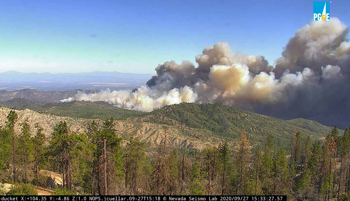
The National Weather Service has issued a wind warning for the area, for 15 to 25 mph northeast winds gusting to 40 mph, or up to 60 mph in isolated locations.
Report released for fatal crash of C-130 air tanker in Australia
September 25, 2020 | 5:23 p.m. MDT
This article was first published at Fire Aviation September 24, 2020
The Australian Transport Safety Bureau (ATSB) has released an interim report about the January 23, 2020 crash of a C-130, Air Tanker 134, that killed the three crewmembers on board. This follows the preliminary report the agency issued in February, 2020. The aircraft was known as Bomber 134 (B134) in Australia.
“The interim report does not contain findings nor identify safety issues, which will be contained in the final report. However, it does detail the extensive evidence gathered to date, which has helped ATSB investigators develop a detailed picture of this tragic accident’s sequence of events,” said ATSB Chief Commissioner Greg Hood.
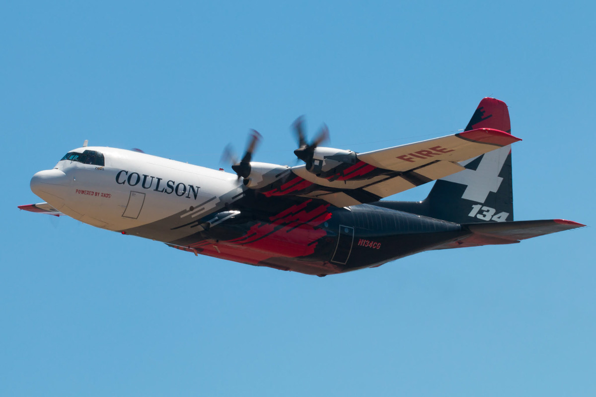 Tanker 134 (B134) at Medford, Oregon July 27, 2019. Photo by Tim Crippin.
It was very windy on January 23, with a forecast for the possibility of mountain waves. Before the incident a birddog, similar to a lead plane, and Bomber 137 (B137), formerly Tanker 138, a Boeing 737 that Coulson sold to New South Wales, was tasked to drop on a fire in the Adaminaby area. Based on the weather the birddog pilot declined the assignment. After B137 made a drop on the fire, the crew reported having experienced uncommanded aircraft rolls up to 45° angle of bank (due to wind) and a windshear warning from the aircraft on‑board systems.
After completing the drop, the B137 crew sent a text message to the birddog pilot indicating that the conditions were “horrible down there. Don’t send anybody and we’re not going back.” They also reported to the Cooma FCC that the conditions were unsuitable for firebombing operations. During B137’s return flight to Richmond, the Richmond air base manager requested that they reload the aircraft in Canberra and return to Adaminaby. The Pilot in Command (PIC) replied that they would not be returning to Adaminaby due to the weather conditions.
B134 was dispatched to the fire at Adaminaby. While they were in route, the PIC of B137 called to inform them of the actual conditions, and that B137 would not be returning to Adaminaby.
After arriving at Adaminaby the PIC of B134 contacted the air operations officer at the Cooma FCC by radio and advised them that it was too smoky and windy to complete a retardant drop at that location. The Cooma air operations officer then provided the crew with the location of the Good Good Fire, about 58 km to the east of Adaminaby, with the objective of conducting structure and property protection near Peak View. Again, there was no birddog operating with the air tanker.
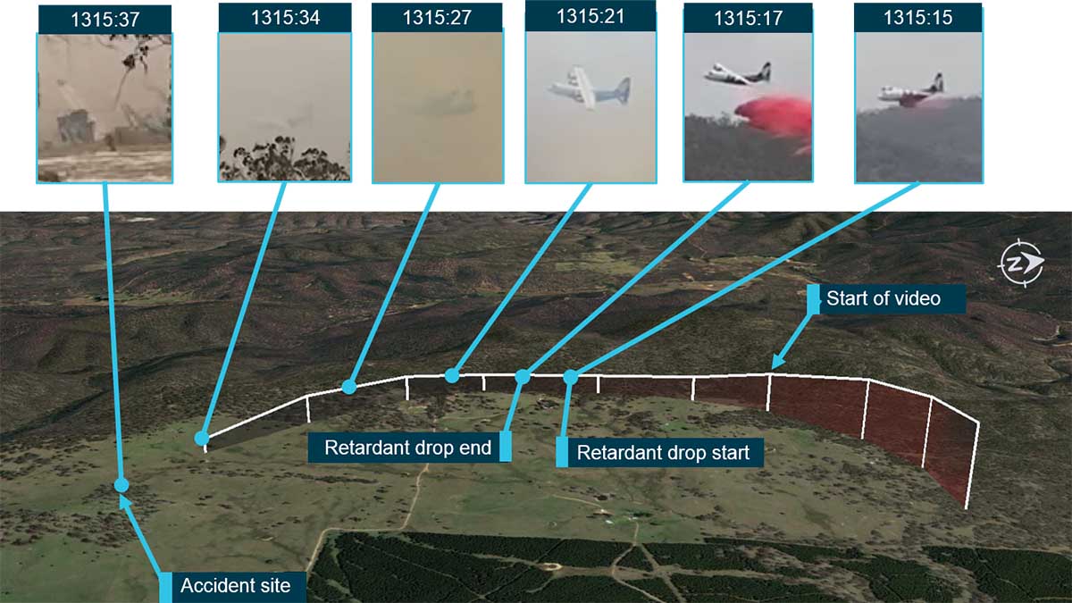
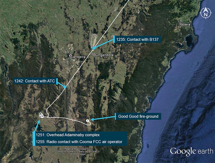 Flight path overview (in white), including the times and locations of where the crew of B134 was in communication with others. From the report.
Analysis of a witness video confirmed that the aircraft initially established a positive rate of climb and was banking to the left following the retardant drop, the report details.Continue reading
Wildfire smoke forecast, Sept. 26 – 27
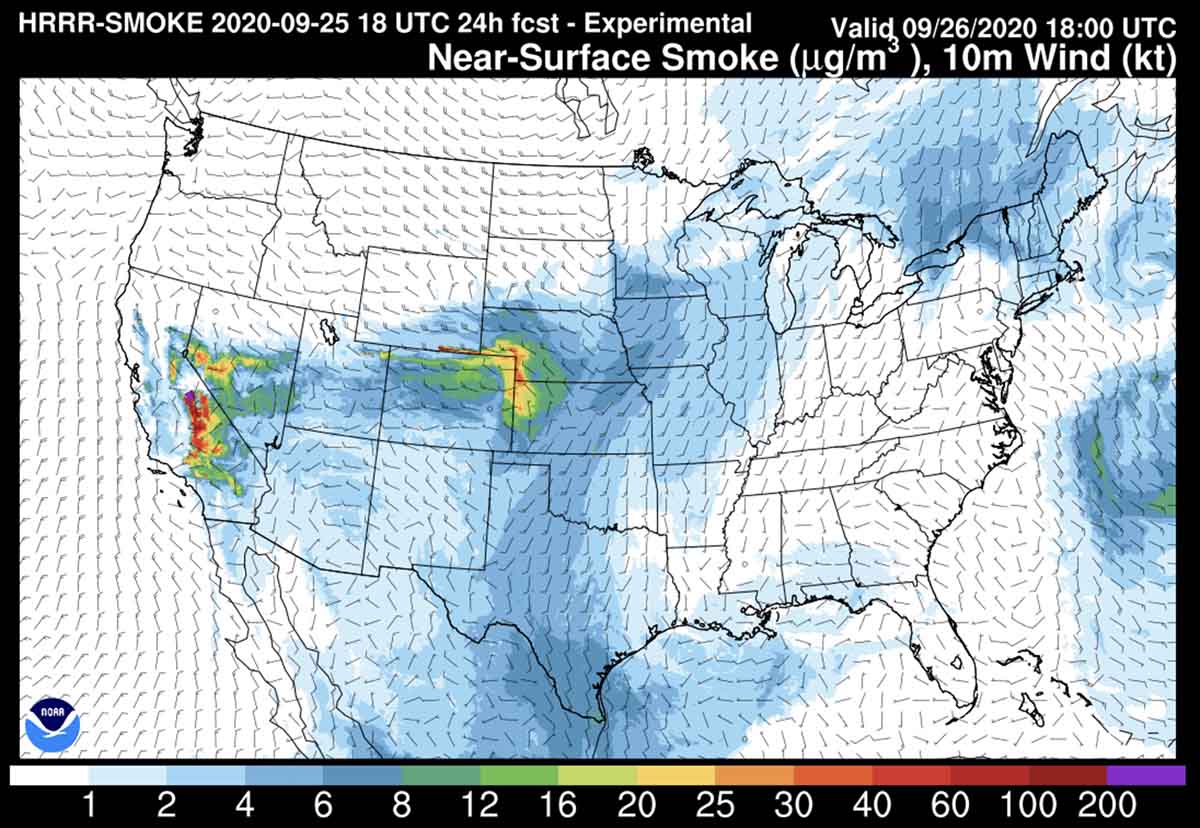
The map above is the forecast for smoke at noon MDT Saturday, September 26, 2020.
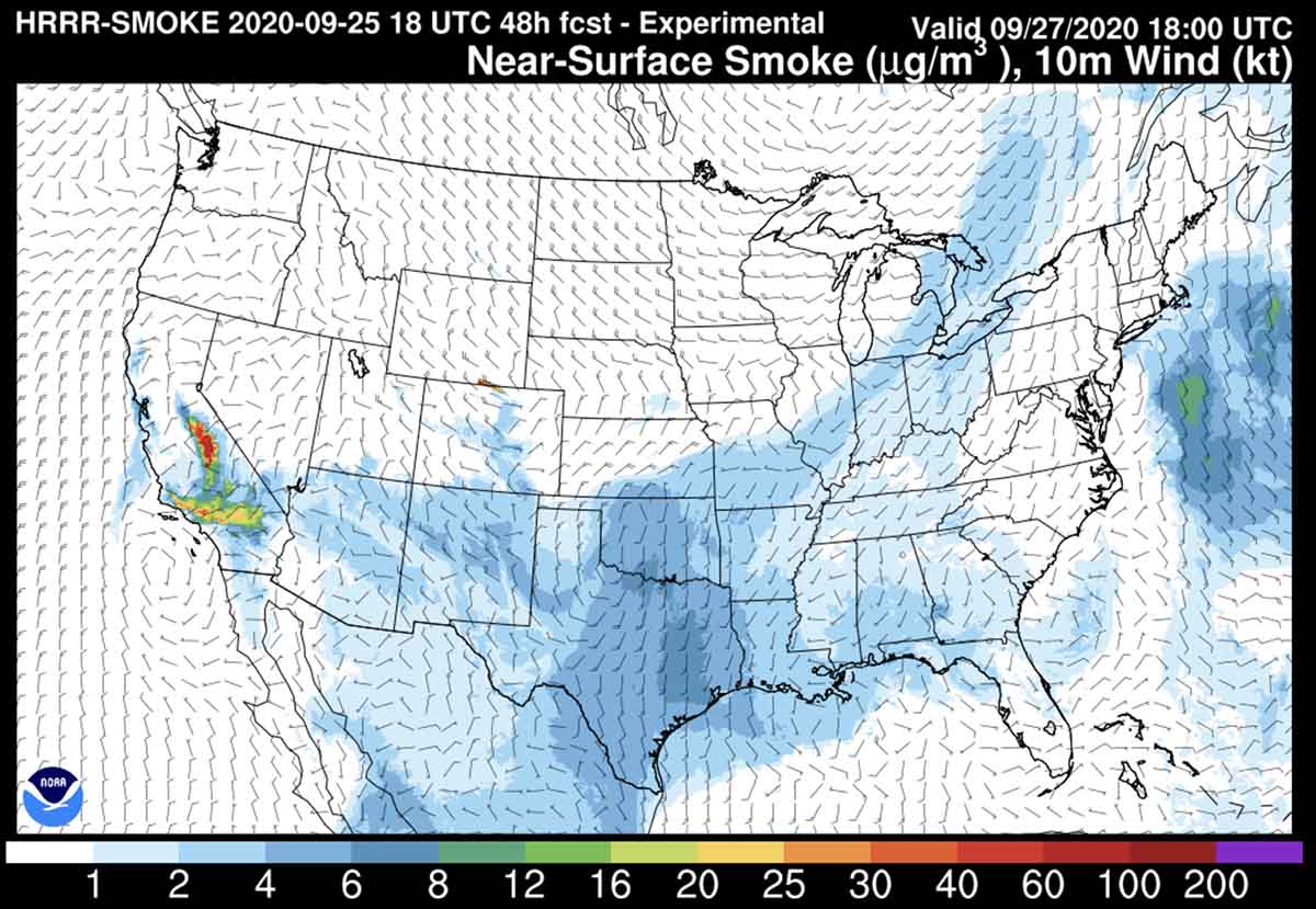
Below is the forecast for noon MDT Sunday, September 27, 2020.