Updated October 21, 2020 | 9:26 p.m. MDT

The East Troublesome Fire made a big push to the east Wednesday afternoon and crossed Highway 125 at Cabin Creek (County Road 21) reaching a point just south of Little Gravel Mountain. It also crossed northwest of Willow Creek Reservoir. The incident management team estimated Wednesday evening it had grown to almost 30,400 acres, an increase of 11,000 acres from Tuesday night’s mapping flight.
To see all articles on Wildfire Today about the East Troublesome Fire, including the most recent, click here.
Additional evacuations have been ordered. At 4:15 p.m. the Sheriff issued an evacuation notice for Area E; east of Highway 125 from milepost 5 to Highway 40. Highway 40 is open. Highway 125 remains closed.
More information about evacuations.
When the fire spotted across Highway 125 there was nothing firefighters could do to contain it at that location. The smoke from the main fire made it impossible for aircraft to work in the area and the fire behavior was too extreme for firefighters to work safely on the ground.
Aircraft on the southeast portion of the fire had to be shut down in the afternoon due to very strong winds.
Wednesday afternoon a weather station west of the fire recorded sustained 26 mph winds out of the west-southwest gusting at 32 to 40 mph with relative humidity of 11 percent. The Wednesday night forecast for the fire east of highway 125 calls for west-southwest winds of 16 gusting to 25 continuing into Thursday. The wind will decrease substantially Thursday night then increase again on Friday.
Five to seven inches of snow is expected beginning Saturday evening.

Updated October 21, 2020 | 8:33 a.m. MDT

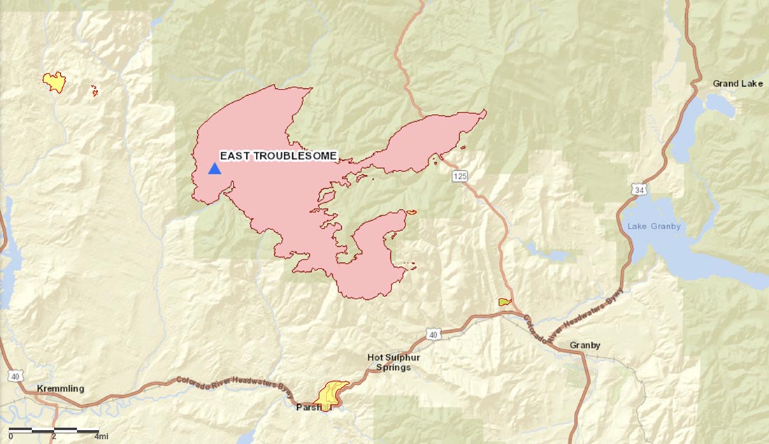
The East Troublesome Fire 11 miles northeast of Kremmling, Colorado was mapped Tuesday night as having grown to within about 2 miles of Highway 40 on the southeast side and approximately 1/2 mile from Highway 125 on the east side.
The mapping flight Tuesday night estimated the fire had burned about 19,000 acres.
Evacuation orders and pre-evacuation notices are in effect. Current evacuation information can be found at gcemergency.com. Colorado Department of Transportation has closed Highway 125 north of Granby from milepost 5 to 27.
October 20, 2020 | 3:30 p.m. MDT

Mostly sunny skies will dominate Tuesday on the East Troublesome fire 43 miles west of Boulder, Colorado. Low relative humidity indices and warm temperatures are producing near red flag conditions. Winds from the southwest will transition to the northwest in the afternoon at 15-20 mph with gusts to 30 mph.
Poor humidity recovery and strong winds continued to push the fire to the north and east to the Ethel Creek and East Troublesome Creek drainages Monday night. The fire is estimated at 15,546 acres with 293 personnel currently assigned.
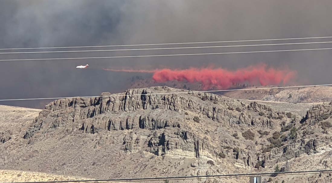
On Tuesday aircraft will continue water and retardant drops on active areas in the north and southeast parts of the fire. Helicopters will engage in bucket work on the eastern side of the active fire front near Kinney Creek, Sawmill Creek, and the Highway 125 corridor protecting values at risk. A helibase is being established in Kremmling to support air operations.
Ground crews are tying lines together on the north side of the fire. Some resources have shifted to the southeast section of the fire to assist in containing spot fires and increasing structure protection efforts. A second structure protection group has been created specifically to install hose lays and sprinklers around structures along the Highway 125 and Highway 40 corridors. Crews are working to reinforce fire lines around Grouse Mountain using multiple strategies which could include tactical firing operations as conditions allow.
(The above is adapted from an update by the incident management team October 20, 2020.)
The fire is 11 air miles northeast of Kremmling. On Monday night it was active on the north and east sides, but was most active on the southeast side 4 miles north of Hot Sulphur Springs. It was about a mile west of Highway 125.
Fires are usually named after a nearby landmark. In this case it was East Troublesome Creek.

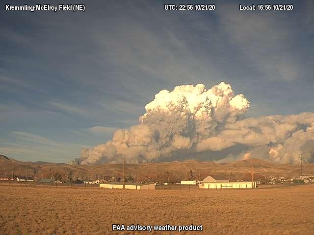
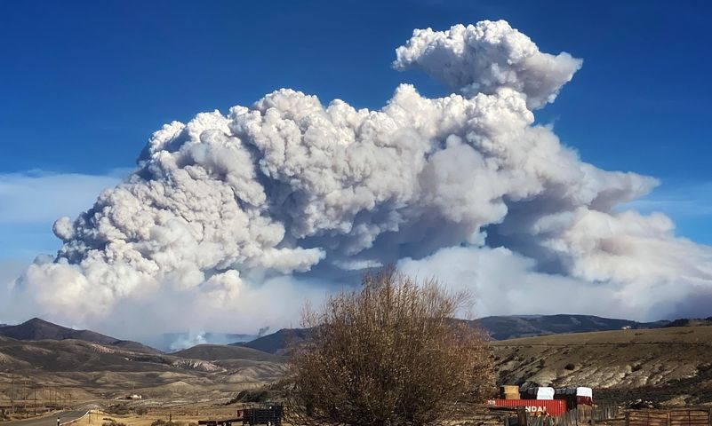
Looks like it made a big run today. NwS Denver has a time lapse on their facebook page of the smoke column.