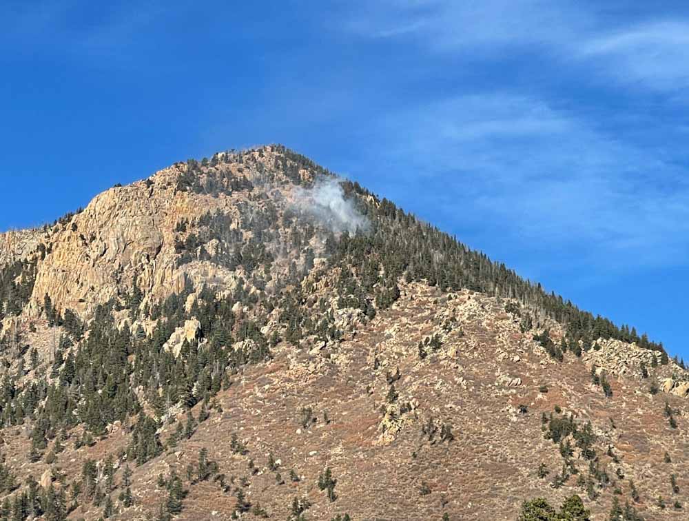
The last entry on the Pike & San Isabel National Forests blog was on October 13, about a 13-acre fire northeast of Gardner, Colorado — until yesterday, Dec. 22, when a fire was reported at 5:22 a.m. about two miles southwest of the Air Force Academy northwest of Colorado Springs. It was near the top of Blodgett Peak, 9,400 feet above sea level.
A person would think that three days before Christmas there would be snow in Colorado at that elevation, but none was visible in photos posted by the Colorado Springs Fire Department. And not only was there no snow, but two large air tankers were on duty and assisted firefighters.
The fire is 0.9 mile inside the National Forest boundary. It was mapped by the state’s multi-mission aircraft Wednesday at 0.3 acre.

The area was under a Red Flag Warning Wednesday for predicted winds gusting over 40 mph and very low humidity. Firefighters did not reach the fire Wednesday due to concerns about the wind. The area was patrolled by personnel from the Colorado Springs Fire Department that night, and the incident was turned over at 9 a.m. Thursday to the US Forest Service with a Type 2 hand crew and a Type 3 helicopter.
Ten years ago a slow moving fire on Colorado’s front range, especially in December, would not always have been aggressively attacked. But gradually since the 2012 Waldo Canyon Fire destroyed 344 homes, killed two people, and burned 18,000 acres on the west side of Colorado Springs, federal and local fire agencies have been improving their initial attack strategies.
#BlodgettPeakFire Air tanker drops on the fire successful this afternoon. CSFD brush patrols will be in the area overnight. Active flames may be visible throughout the night, please don’t call 911, we have crews on scene monitoring. Please avoid the area. pic.twitter.com/6swXr0CqxG
— CSFD PIO (@CSFDPIO) December 23, 2021

The US Forest Service now says the fire on Blodgett Peak was started by an abandoned illegal campfire.
A spokesperson for the US Forest Service tells KRDO Saturday that campfires are not allowed in this area, which was previously impacted by the Waldo Canyon Fire in 2012.
Still very dry here in the front country Bill. Man’s getting some snow but almost nothing here. Something had better change or we will have another terrible summer in 2022.
Merry Christmas Bill, keep up the Great reporting!
Jim
I live in Colorado Springs and we haven’t had any rain/lightning in awhile. We had a haboo (a wall of dirt caused by high winds) last week and it’s pretty windy today. It’s more likely that a homeless person left a fire unattended. I’m not saying anything bad about the homeless (I’ll probably be out there with them in a month), but there is a large encampment in that area. I’d also look in to the military, they’ve been doing night mission training. I’m not blaming them either (I don’t need an MP at my door!) I just think people are nervous because this is the same location as the 2012 fire. Stay safe! Merry Christmas!
The question I have is just how tf did it start? I’m thinking there has to be a trail near the origin, but I did not notice one on Google Earth. Maybe someone was up there stalking game? Just seems odd.
“The cause of the fire is under investigation. Unofficially, lightning from a month ago is suspected as the cause, Bellah said. ”
From the Colorado Springs Gazette.