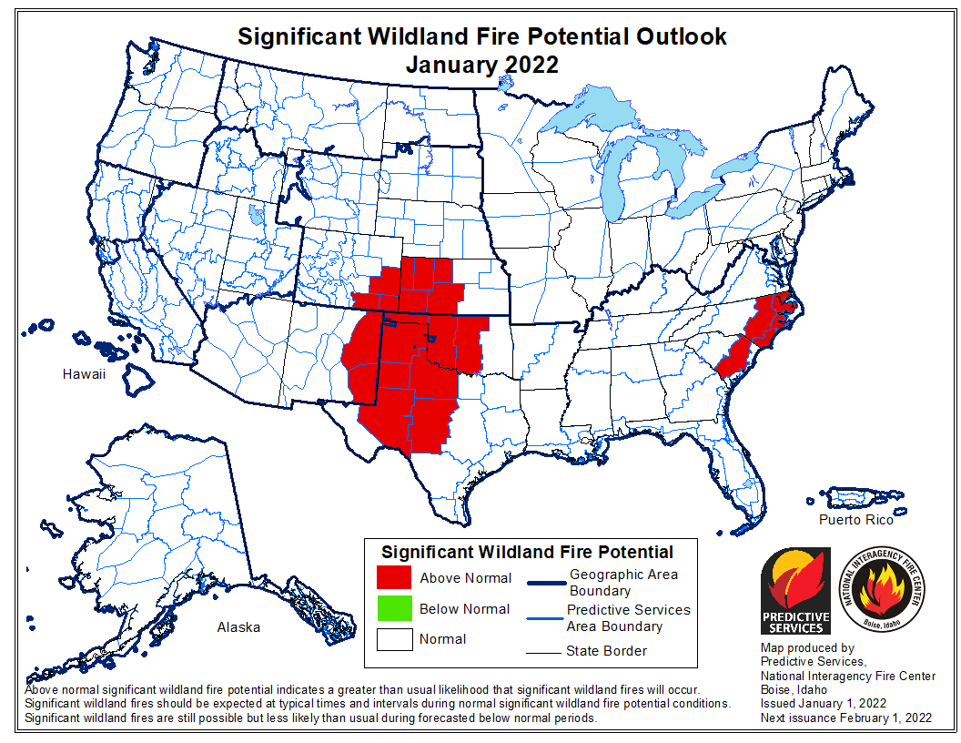
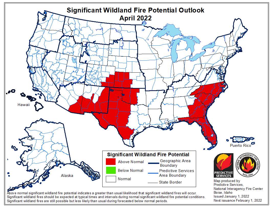
 The forecast for wildland fire potential issued January 1 by the National Interagency Fire Center predicts that for the next four months the potential for wildfires will be higher than average in the Carolinas, Georgia, Florida, and the central and southern plains.
The data from NIFC shown here represents the cumulative forecasts of the ten Geographic Area Predictive Services Units and the National Predictive Services Unit.
Below:
- An excerpt from the NIFC narrative report for the next four months;
- Additional NIFC monthly graphical outlooks;
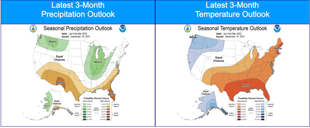
- NOAA’s three-month temperature and precipitation forecasts;
- Drought Monitor;
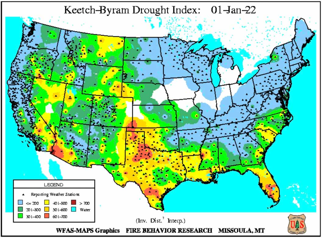
- Keetch-Byram Drought Index.
“Nearly 90% of the West remains in drought, with a third of the West in the highest two categories of drought…. Most of the eastern two-thirds of the CONUS observed below normal precipitation with portions of the central and southern Plains receiving no precipitation during December. Above normal precipitation was observed across much of the West into portions of the northern Plains and northern Great Lakes. Temperatures were above normal for most of the CONUS except along portions of the West Coast and Montana. Abnormally dry and drought conditions expanded across the southern Plains due to the prevalence of much above normal temperatures and little to no precipitation in December.
“Climate outlooks for winter into early spring indicate above normal temperatures are likely along the southern tier of the CONUS, with the highest probabilities likely in the South. Below normal temperatures and above normal precipitation are expected across the Pacific Northwest into portions of the northern Rockies and northern Plains. The Great Lakes and Mid-Mississippi Valley are also likely to experience above normal precipitation through March. Below normal precipitation will likely accompany above normal temperatures across the southern third of the western US, through much of Texas, along the Gulf Coast, and into the Carolinas.
“Above normal significant fire potential is forecast for much of the central and southern Plains January through April with several periods of critical conditions possible due to wind events. Above normal potential is forecast to expand into portions of south Texas in February then westward across far West Texas, southern New Mexico, and southeast Arizona March into April.
“Above normal significant fire potential is expected to expand from the eastern Carolinas in January into the remainder of the Carolinas and much of Florida and Georgia February through April. Above normal potential is also forecast for portions of Virginia in February that will expand into eastern West Virginia and the Mid-Atlantic for March.”

(March is at the top of the article)
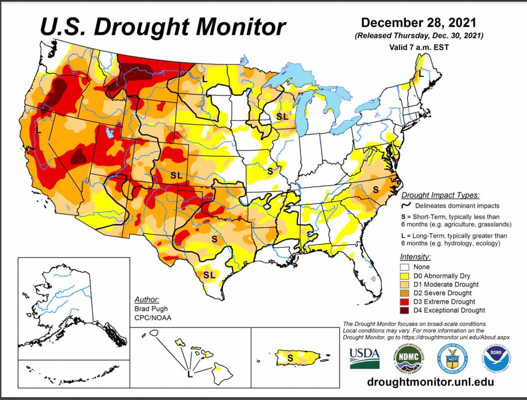

The Southeast might have a less dire looking drought map next week. Since December 18 we have had three significant systems move through, true soakers. It continues to rain steady tonite after it dumped 2-4 inches just before New Year’s.
But things change quick here. We had a pair of “flash droughts” in the Georgia/Carolina region in 2019, with green fields turning brown in a week and Pine needlecast so heavy it cast a red tinge across the landscape.