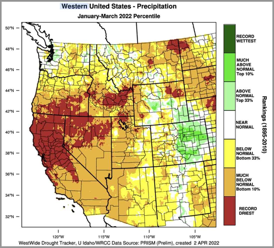
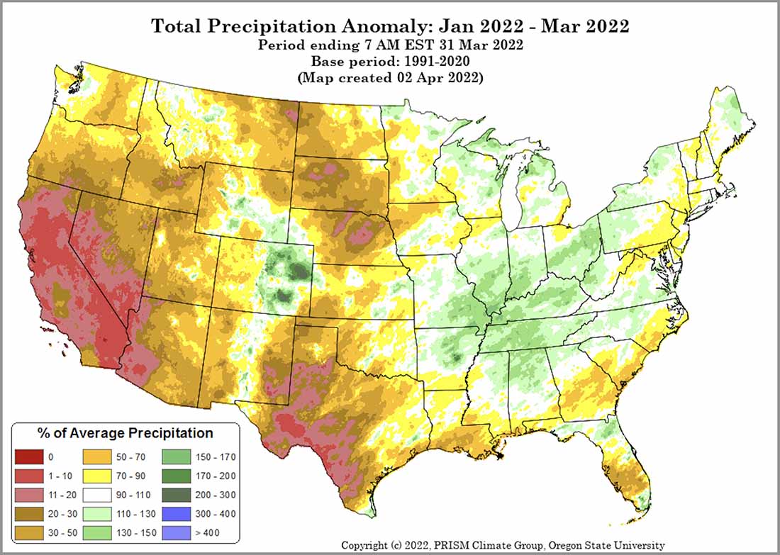
Precipitation from January through March in the 11 Western states was below normal in many locations, but record driest amounts were recorded in areas of Northern California, Southern Oregon, Central Idaho, Northern Nevada, and scattered sections of Montana, Colorado, and Utah. This is based on more than 100 years of data from the WestWide Drought Tracker at the University of Idaho.
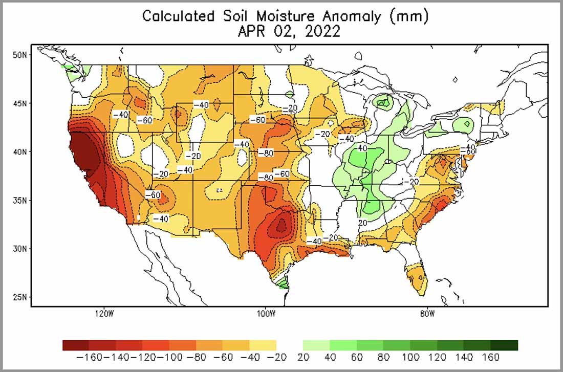
The dry weather is already affecting live fuel moisture of the brush in the Santa Cruz Mountains south of San Francisco. On April 1 it was near the lowest ever measured on that date, about 30 percent below average.

Of course there is a temptation to conclude that extremely dry soils and vegetation in April will lead to more acres burned than average, but the reality is that the weather in the summer has veto power. If conditions during the peak of the western wildfire season are cooler, wetter, more humid, and less windy than typical, it will not necessarily be a busier than average fire season.
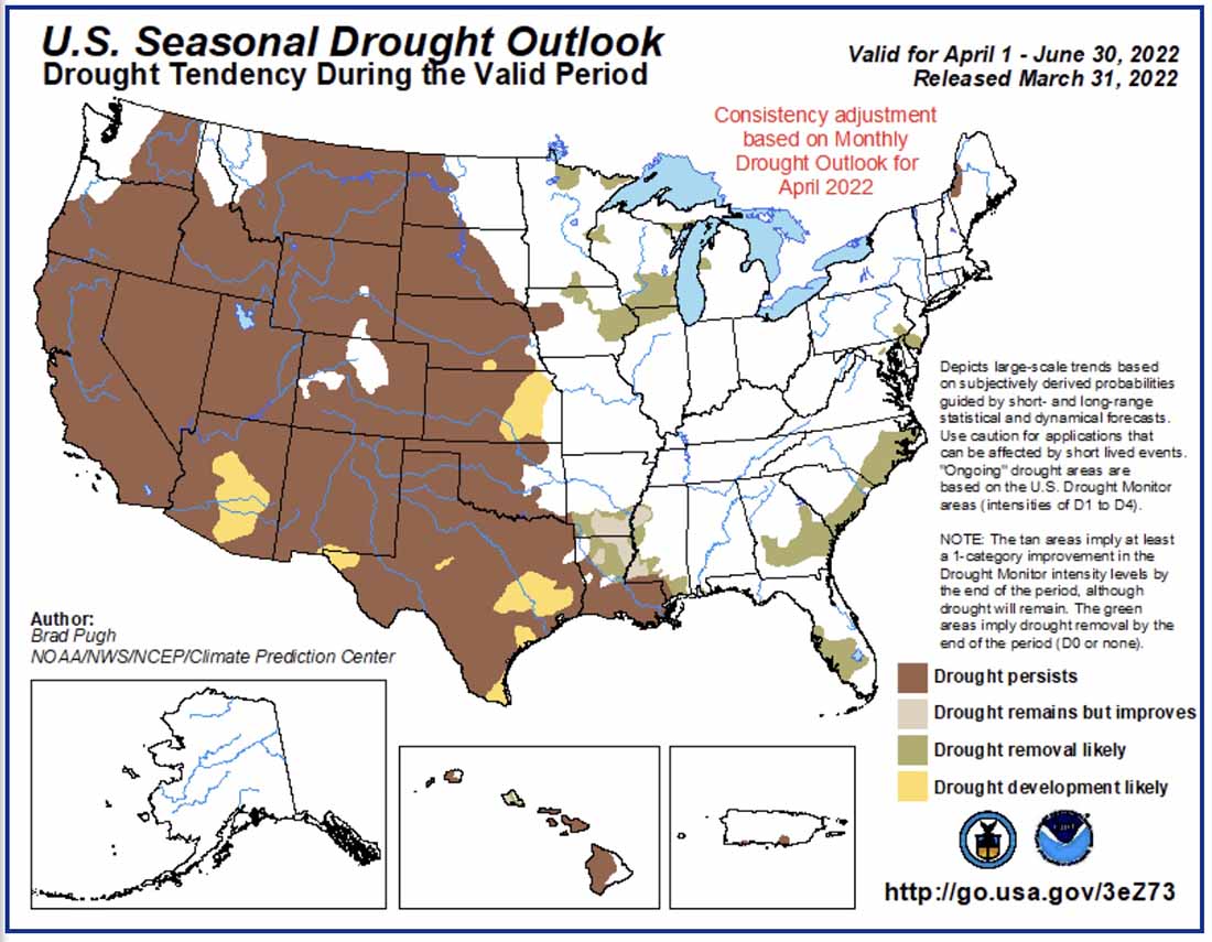
However (there is always a “however”) if this dry trend continues through June, and if the weather in the following three months is close to normal, the effects of the current shortages of wildland firefighters are going to be even more noticeable and far-reaching than we saw during the last two years.
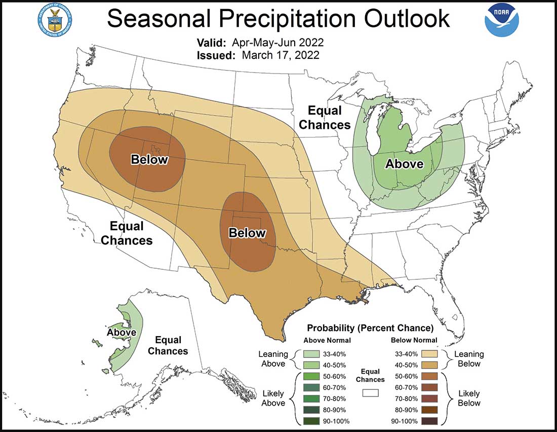
And the three-month forecast for much of the West predicts below normal precipitation.
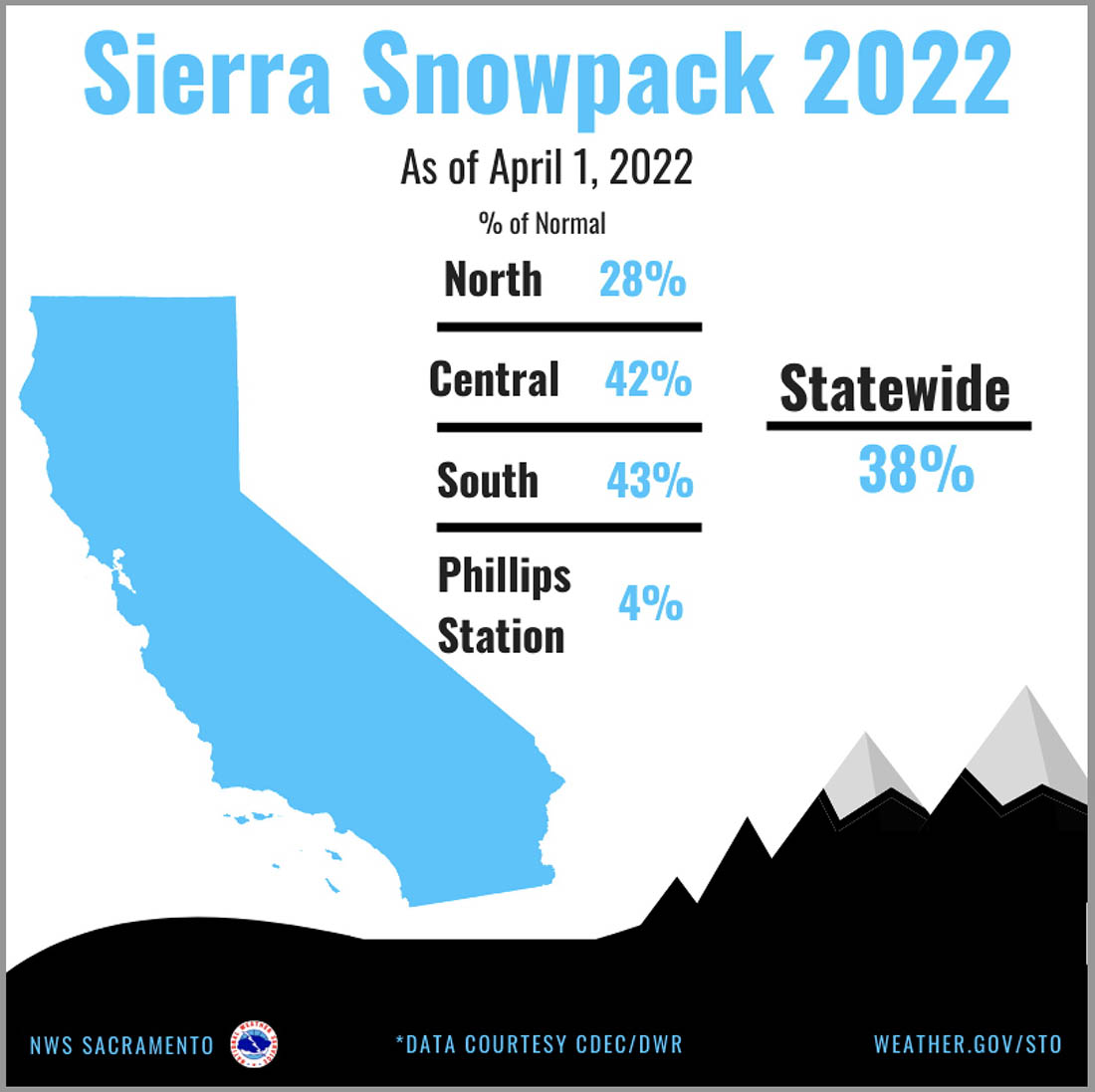
In Northern California the snowpack on April 1 was 28 percent of normal for the date; statewide it was 38 percent.
