

The Cooks Peak Fire in Northeast New Mexico 16 miles south of Cimarron has been very active Thursday afternoon, with reports of pyrocumulus clouds topping the large smoke plume blowing off to the east-northeast.
Click to see all articles on Wildfire Today, including the most recent, about the Calf Canyon, Hermits Peak, and Cooks Peak fires.
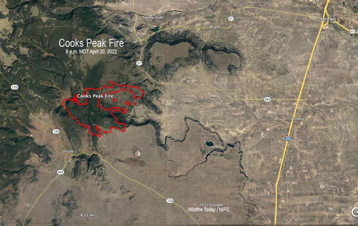
The blaze was reported at 4:15 p.m on April 17, 2022. Several ranches are under evacuation orders. The Type 3 Incident Management Team said on Thursday that the fire has burned 21,200 acres.

Resources assigned include 6 hand crews, 11 fire engines, and no helicopters for a total of 198 personnel.
There are no reports of structures burning.
Based on reports of the fire activity on Thursday and the satellite photo of the large smoke plume, the perimeter is most likely significantly different from the one below, mapped Wednesday evening. It likely spread further to the east-northeast.
Almost all of New Mexico is under a Red Flag Warning Thursday, with a prediction for 20 to 25 mph winds gusting out of the southwest to 60 mph, with 5 to 10 percent relative humidity. The forecast for Friday calls for stronger winds, from the southwest at 40 mph gusting to 57 mph. It will also be very windy on Saturday.
Column over the #CooksPeakFire #aerialfirefighting #nmfire pic.twitter.com/91xy4sClMZ
— Emilee (@littleemilee6) April 21, 2022
